
Mount Margaret Trail
View Photos
Mount Margaret Trail
Difficulty Rating:
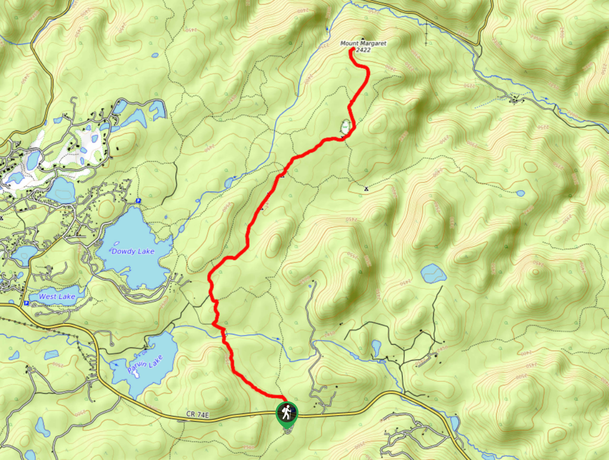
Take the Mount Margaret Trail to the low summit. Travel through stunning scenery and share the well-marked path with equestrians and bikers. This scenic trail will guide you through forestlands, past overlooks of the Red Feather Lakes and through impressive rock outcroppings. This trail is a wonderful nature outing for the whole family.
Getting there
The Mount Margaret Trailhead is off the Red Feather Lakes Road.

About
| Backcountry Campground | Several Dispersed Campsites along the trail |
| When to do | Year-round |
| Pets allowed | Yes - On Leash |
| Family friendly | Yes |
| Route Signage | Good |
| Crowd Levels | High |
| Route Type | Out and back |
Mount Margaret Trail
Elevation Graph
Weather
Mount Margaret Hike Description
The stimulating hike along the Mount Margaret trail is sure to impress the whole family. This easy to follow, well-maintained trail is a perfect beginner’s hike through the Colorado wilderness. Shared with horseback riders and bikers, make sure to keep an ear out for speedy passer-bys. Keep your eyes peeled for wildlife as you walk this forested path. Note this route does get a bit soggy in the springtime and after heavy rain, but there are well-marked detours to avoid getting your feet wet.
Beginning from the trailhead, track northwest on the Mount Margaret Trail. Hike along the path and you will intersect with South Lone Pine Creek. Travel over the bridge and take a right at the intersection. Maintain along the Mount Margaret Trail as you encounter another junction. Ignore the merging paths and hike along the wooded route. Notice sights on the Red Feather Lakes on your left. Trek along the Mount Margaret Trail, past several dispersed campsites and off-shooting paths. As you hike through the rock outcropping, you will eventually begin to descend towards Mount Margaret.
There are a few rocks you will have to scramble down to the summit, but they are manageable and easy to navigate. Hike down to the summit of Mount Margaret and explore the rocky peak. When you are ready to return, retrace your steps along the Mount Margaret Trail all the way back to the parking lot.
Similar hikes to the Mount Margaret Trail hike

Miller Gulch Loop Trail
The Miller Gulch Loop Trail is a scenic meadowland adventure in the Pike National Forest. Hike through grassy meadows laden…

The Castle Hike
The Castle Hike is an exciting adventure up the steep, forested terrain to The Castle Rock. From atop the summit,…

Rutherford Trail
The Rutherford Hike is a charming nature walk in Georgetown Colorado. This secluded trail is a wonderful adventure the whole…
Comments