
Helms Lake via Abyss Trail
View Photos
Helms Lake via Abyss Trail
Difficulty Rating:
Hike through vibrant aspens up to the picturesque Helms Lake. The Helms Lake via Abyss Trail adventure is one for the books. Challenge yourself as you ascend steep grades up to the alpine lakes. Ideal for those hoping to climb a Colorado 14er, the Helms Lake via Abyss Trail is the perfect introductory hike.
Getting there
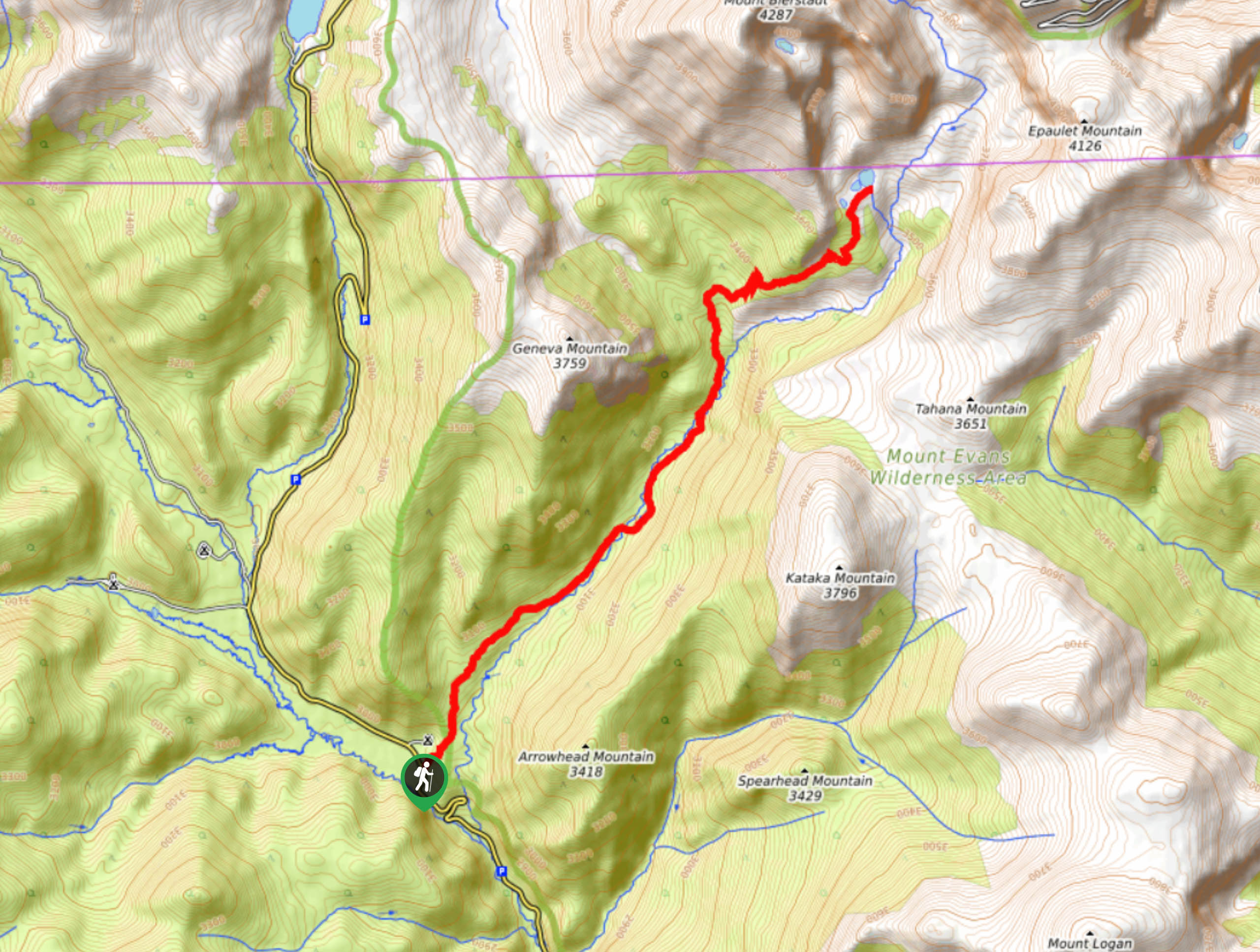
The Helms Lake via Abyss Trail is accessed from the Abyss Trailhead off Geneva Road.

About
| Backcountry Campground | Dispersed Backcountry Camping, restrictions apply. |
| When to do | June-October |
| Pets allowed | Yes - On Leash |
| Family friendly | No |
| Route Signage | Average |
| Crowd Levels | High |
| Route Type | Out and back |
Helms Lake via Abyss Trail
Elevation Graph
Weather
Helms Lake via Abyss Hike Description
Hike up steep but scenic terrain to Helms Lake. Track the Abyss Trail up through the aspen forests before opening to the alpine tundra. The Helms Lake via Abyss Trail is one for the books. This adventure is long, so if you are planning it as a day-hike then we would recommend setting out in the early morning to beat dusk. Furthermore, you will be trekking up to an exposed alpine tundra of high elevation. Check the weather forecast prior to your hike to mitigate any chances of getting caught in an afternoon storm. Pack plenty of water and bring a camera because you are going to want to snap some photos along this scenic trail.
Begin your adventure up Helms Lake via Abyss Trail from the Abyss Trailhead. This route follows a wide, well-marked logging road for the first few miles. Hike up the gravel trail through the vibrant aspens. Peeking through the tree coverage, you may be able to spot Arrowhead Mountain in the northeast. Continue climbing up the forested mountain valley as the path merges with the Scott Gomer Creek. Travel along the creek’s edge and enjoy the ambiance of the babbling waters. Eventually, you will encounter an intersection. At this junction, keep straight and continue tracking northeast on the Abyss Lake Trail. Shortly after the fork, you will have to navigate a short rocky scree up the ridge of the lakes. Climb up the switchbacks and you will see Helms Lake on your left.
Explore the shoreline of Helms Lake and the smaller surrounding pools. Dip your tired feet in the waters prior to beginning your descent. If you still have some gas left in the tank, consider continuing along the Abyss Lake Trail to the glacial cirque and alpine lake. If you are already exhausted, no worries, retrace your steps along the path back to the trailhead.
Similar hikes to the Helms Lake via Abyss Trail hike

Hankins Pass Hike
The Hankins Pass Hike is a quintessential adventure across the Lost Creek Wilderness. The hike demonstrates the diversity of the…

Miller Gulch Loop Trail
The Miller Gulch Loop Trail is a scenic meadowland adventure in the Pike National Forest. Hike through grassy meadows laden…

The Castle Hike
The Castle Hike is an exciting adventure up the steep, forested terrain to The Castle Rock. From atop the summit,…
Comments