
Scoutline Trail
View Photos
Scoutline Trail
Difficulty Rating:
The Scoutline Trail is a wonderful excursion through the Staunton State Park that the whole family can enjoy. The Scoutline Hike exhibits the diversity of the Colorado typographies as you travel through several terrains on this short adventure. Trek rocky ridges, through grassy plains, and through aspen groves all in one hike!
Getting there
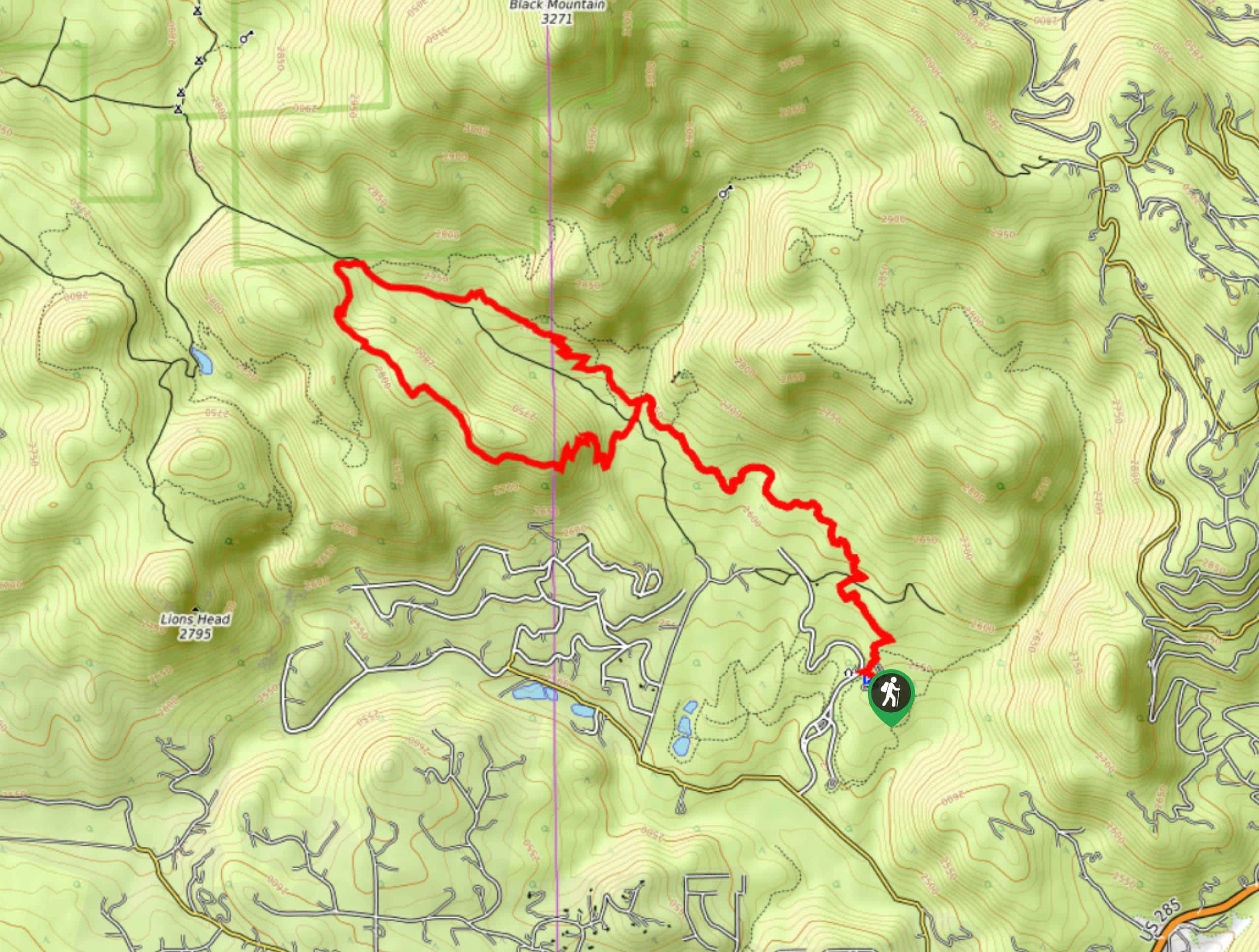
The Scoutline Hike is in the Staunton State Park off S Elk Creek Road.

About
| Backcountry Campground | No |
| When to do | Year-round |
| Pets allowed | Yes - On Leash |
| Family friendly | Yes |
| Route Signage | Good |
| Crowd Levels | High |
| Route Type | Lollipop |
Scoutline Trail
Elevation Graph
Weather
Scoutline Hike Description
Immerse yourself in nature as you trek the Scoutline Hike. Adventure the mildly undulating trail through the undeniably scenic terrain of the Staunton State Park. This new State Park has yet to lose its charm and that is made evident by the crowds that flock to the area on the weekend. This Park is a popular weekend adventure for Denver locals, so if you are seeking a more secluded hike, you may want to consider a weekday excursion. Whether you walk or bike this trail, there is no doubt in our minds that it will impress you. Enjoy sights of the encompassing mountainous landscape as you trek the Scoutline Hike. Note that visitors are required to purchase a $10USD day pass to utilize the trails.
Begin your Scoutline Hike from the Staunton Ranch Trailhead. From the trailhead, hike northwest. Shortly after your departure, you will confront a junction, turn left and you will be diverted up the Scoutline Trail. Ascend the rocky ridge and navigate a set of switchbacks. Hike along the forested terrain and enjoy sights of the Front Range summits peeking through the trees. The path will eventually merge onto the Marmot Passage Trail, travel this route until the next intersection.
At the next junction, veer right and you will be guided along a service road. Trek along the service road and through the aspen grove, noticing intrepid rock climbers on your left. Soon the path will merge onto the Staunton Ranch Trail. Follow this trail, retracing your steps, all the way back to the trailhead.
Similar hikes to the Scoutline Trail hike

Miller Gulch Loop Trail
The Miller Gulch Loop Trail is a scenic meadowland adventure in the Pike National Forest. Hike through grassy meadows laden…

The Castle Hike
The Castle Hike is an exciting adventure up the steep, forested terrain to The Castle Rock. From atop the summit,…

Rutherford Trail
The Rutherford Hike is a charming nature walk in Georgetown Colorado. This secluded trail is a wonderful adventure the whole…
Comments