
Gateway Natural Area Overlook Trail
View Photos
Gateway Natural Area Overlook Trail
Difficulty Rating:
The Gateway Natural Area Overlook Trail is a short but sweet walk to a scenic overlook of the Cache La Poudre River and Canyon. Revel in the vertiginous cliffs that line the river valley and enjoy the views of the mountainous landscape.
Getting there
The Gateway Natural Area Overlook Trail is located off the Poudre Canyon Highway.

About
| Backcountry Campground | No |
| When to do | April-October |
| Pets allowed | Yes - On Leash |
| Family friendly | Yes |
| Route Signage | Good |
| Crowd Levels | Moderate |
| Route Type | Lollipop |
Gateway Natural Area Overlook Trail
Elevation Graph
Weather
Gateway Natural Area Overlook Hike Description
The Gateway Natural Area Overlook Hike is a quick walk up to a stunning lookout. Enjoy the vistas of the Front Range peaks in the distance and the impressive Poudre Canyon that sits below. This hike is a great pit stop to get out into nature and stretch your legs. Located in the Gateway Natural Area, visitors must purchase a $7USD permit.
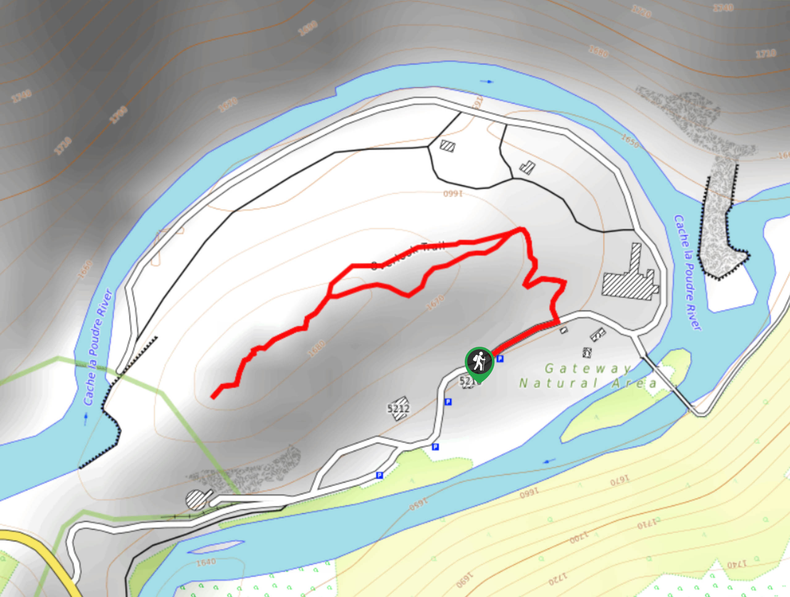
Begin your adventure up the Gateway Natural Area Overlook Trail from the parking lot. This loop can be hiked in either direction, but we went counter clockwise. Take the Overlook Trail north. The terrain is a bit steep, but children should still be able to navigate the terrain. Climb up the trail and notice the bristlecone pines. Soon you will meet a junction, veer right around the overlook. This loop offers panoramic views of the Poudre Canyon and surrounding wilderness.
Track around the loop and enjoy the mountain views. When you complete the loop, simply go down the trail back to the car park.
Similar hikes to the Gateway Natural Area Overlook Trail hike

Rutherford Trail
The Rutherford Hike is a charming nature walk in Georgetown Colorado. This secluded trail is a wonderful adventure the whole…
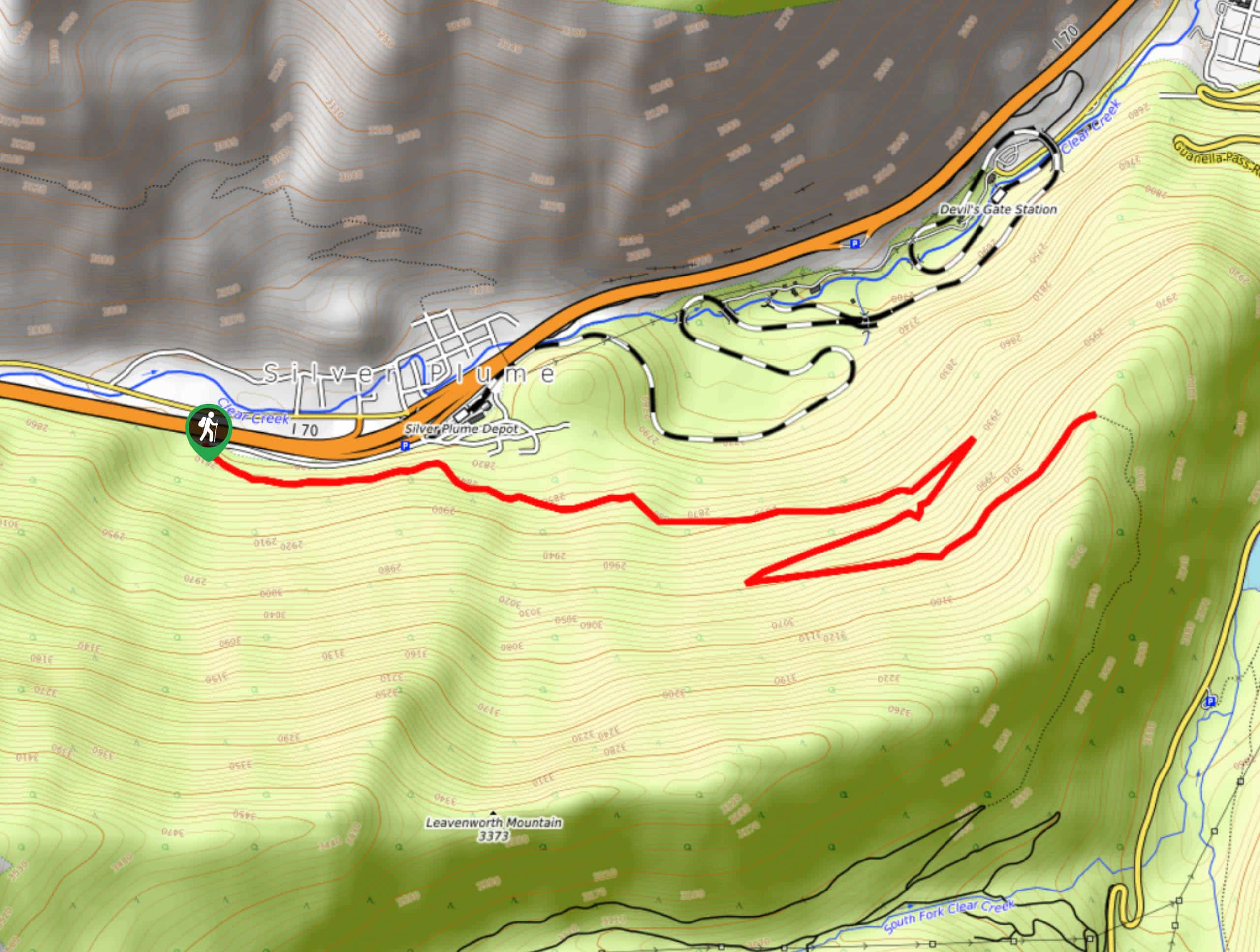
Pavilion Point Hike
The Pavilion Point Hike is an awesome adventure that the whole family can enjoy. Near Silver Plume Train Depot, kids…
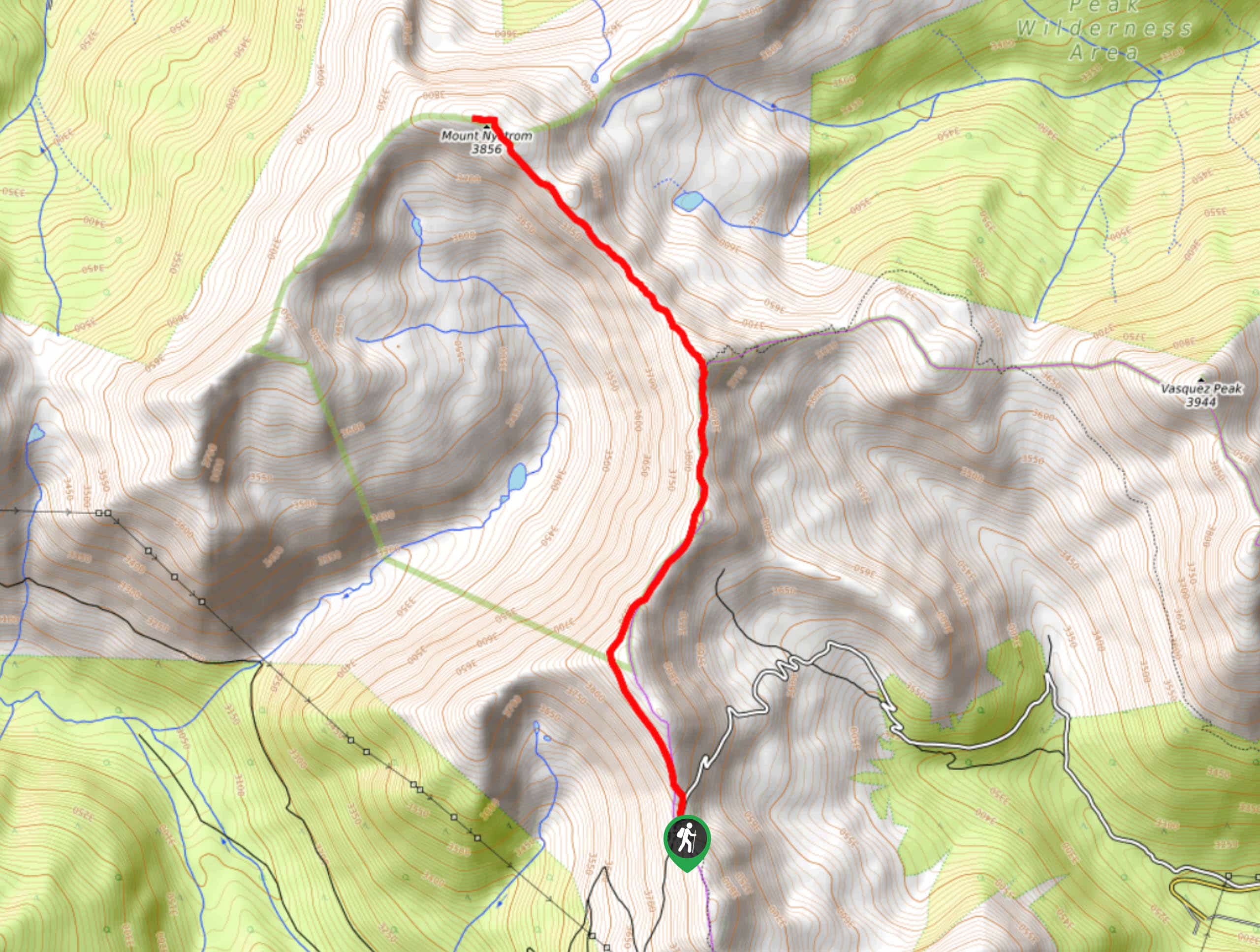
Mount Nystrom Trail
The Mount Nystrom Trail is an exciting adventure above the clouds. Hike the exposed path to the summit and enjoy…
Comments