
B-17 Plane Crash Site
View Photos
B-17 Plane Crash Site
Difficulty Rating:
Hike the woodland path to the B-17 Plane Crash Site. The World War II Bomber went down on June 13, 1944. Killing 4 of the 10 onboard, the haunting remains of the crash remain etched in the mountain side. Now hidden among the towering trees in the Colorado wilderness, this primitive hike is a popular historic destination.
Getting there
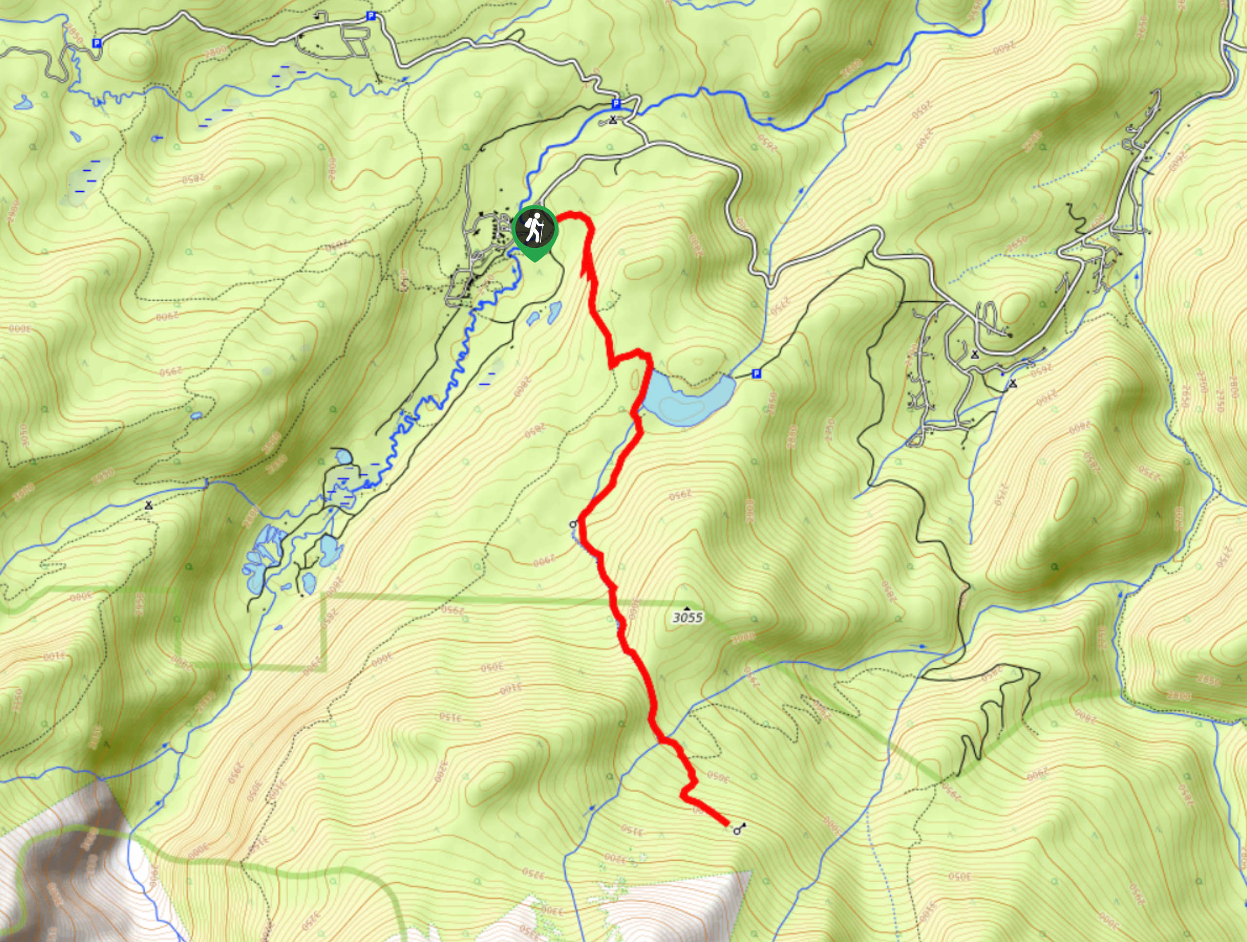
The hike to the B-17 Plane Crash Site begins at the Stormy Peaks Trailhead at the end of the Pingree Park Road.

About
| Backcountry Campground | Dispersed Camping Permitted |
| When to do | May-October |
| Pets allowed | Yes - On Leash |
| Family friendly | Older Children only |
| Route Signage | Poor |
| Crowd Levels | Moderate |
| Route Type | Out and back |
B-17 Plane Crash Site
Elevation Graph
Weather
B-17 Plane Crash Site Hike Description
Hike up the primitive path to the B-17 Plane Crash Site. This stunning forested nature trail will guide hikers up to the jagged metal remains of the 1944 plane crash. The initial segment of this hike is explicit and well-marked, but as you near the plane crash site it becomes a treasure hunt. We recommend having the trail GPS handy to help you navigate the unmarked route.
Embark on your hunt for the B-17 Plane Crash Site from the Stormy Peaks Trailhead. From the trailhead, track the Stormy Peaks Trail southeast. Hike along the path and you will confront an intersection. Veer left onto the Twin Lakes Reservoir Trail. Hike along the shore’s edge and the path will morph into the Old Sawmill Trail. Trek up to the Old Sawmill and along the Twin Lakes Creek. Climb up this path as another trail merges. Ignore the merging route and continue hiking. Continue southeast up the forested trail and you will eventually enter the clearing filled with the B-17 Plane Crash wreckage.
Explore the eerie remains of the World War II Bomber. This sobering sight is unforgettable, see the engine and the wings that litter the granite slope. When you are done exploring, simply backtrack along the route all the way back to the trailhead and parking lot.
Similar hikes to the B-17 Plane Crash Site hike

Hankins Pass Hike
The Hankins Pass Hike is a quintessential adventure across the Lost Creek Wilderness. The hike demonstrates the diversity of the…

Miller Gulch Loop Trail
The Miller Gulch Loop Trail is a scenic meadowland adventure in the Pike National Forest. Hike through grassy meadows laden…

The Castle Hike
The Castle Hike is an exciting adventure up the steep, forested terrain to The Castle Rock. From atop the summit,…
Comments