
Gill Trail
View Photos
Gill Trail
Difficulty Rating:
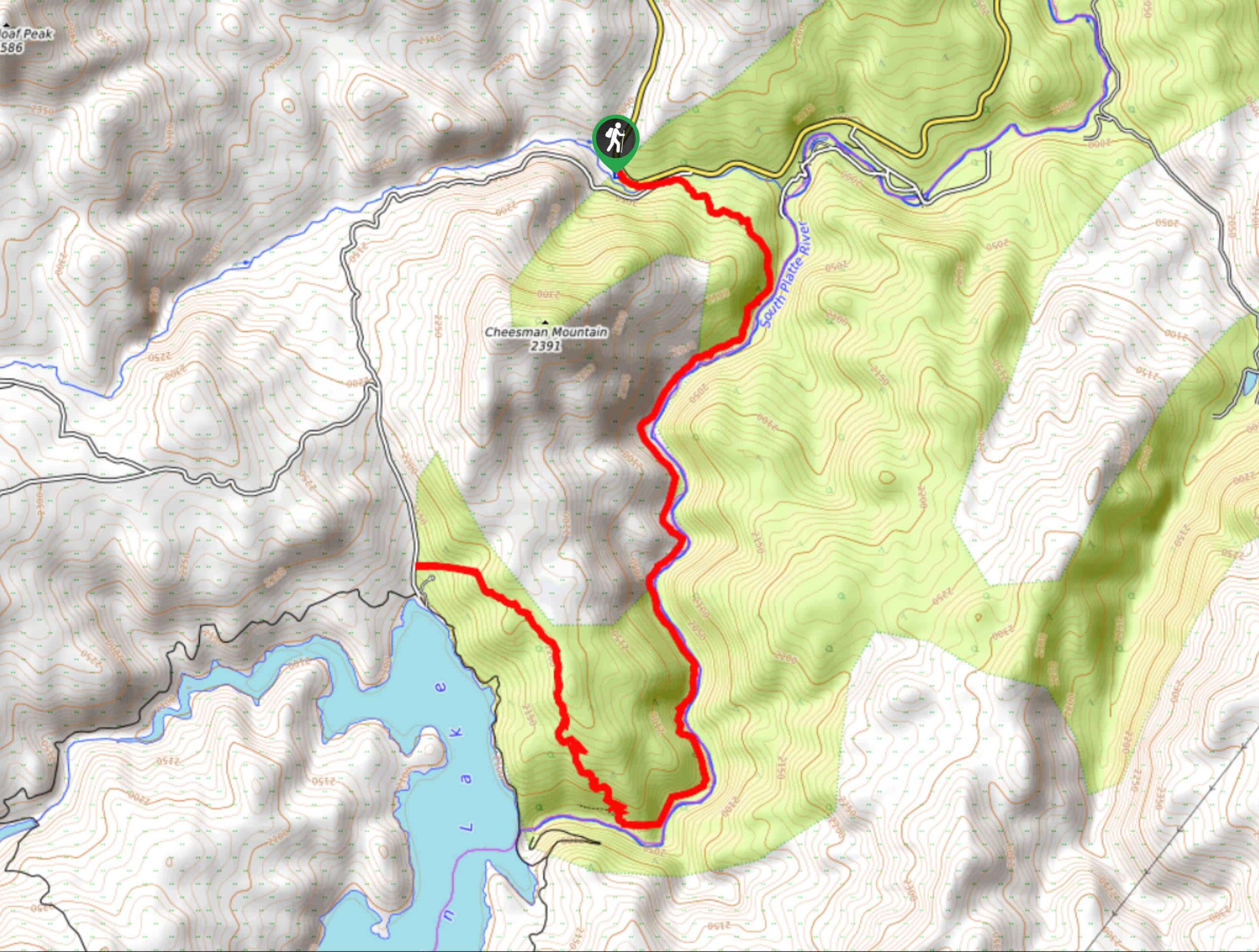
Intrepid adventurers will appreciate the escapade up the Gill Trail. Hike along the South Platte River, a popular fly-fishing destination up through the Cheesman Canyon. This exciting excursion doesn’t stop at the top of the canyon, challenge yourself and scramble up a rocky ridge to a stunning overlook of the Cheesman Reservoir and dam.
Getting there
The Gill Trailhead is found off County Road 126.

About
| Backcountry Campground | Dispersed backcountry camping, restrictions apply. |
| When to do | March-October |
| Pets allowed | Yes - On Leash |
| Family friendly | Older Children only |
| Route Signage | Poor |
| Crowd Levels | Moderate |
| Route Type | Out and back |
Gill Trail
Elevation Graph
Weather
Gill Hike Description
Hike amongst dozens of anglers as you ascend the Gill Trail. This scenic hike exhibits the stunning Colorado wilderness and reveals the mediative sights of anglers fishing the South Platte River. Hike along the river’s edge, through aspen groves and towering pines up to the dam and ascend a rocky ridge. This trail is not for the faint of heart; make sure you are wearing sturdy footwear as you will have to scramble up the path. Furthermore, sections of this hike are more primitive than others; we suggest downloading the trail GPS to help navigate the overgrown terrain. Note this trail is challenging, but the picturesque scenery makes it well worth the effort.
Embark on your adventure up the Gill Trail from the Cheesman Canyon Trailhead. From the trailhead, track southeast on the Cheesman Canyon Trail. This path will guide you over Wigwam Creek before heading to the forested gulch. The route will curve south to the canyon and along the South Platte River. Hike the primitive trail as it weaves you between the tree shade and exposed shoreline. Ascend the river canyon and be mindful of the peaceful anglers fishing the waters. Soon the marked Cheesman Canyon Trail will come to its end. From here, use the trail GPS to help you navigate the unmarked Gill Trail.
Ascend the primitive, woodland trail north. Scramble up the steep rocky terrain to an impressive overlook of the Cheesman Reservoir and dam. Enjoy the expansive views from atop the ridge before descending the path down to the Wigwam Creek Road. From here, turnaround and retrace your steps back to the trailhead. If you are already exhausted, you can walk along the shoulder of the Wigwam Creek Road back to the trailhead, but it is not nearly as scenic as the walk along the Gill Trail.
Similar hikes to the Gill Trail hike

Hankins Pass Hike
The Hankins Pass Hike is a quintessential adventure across the Lost Creek Wilderness. The hike demonstrates the diversity of the…

Miller Gulch Loop Trail
The Miller Gulch Loop Trail is a scenic meadowland adventure in the Pike National Forest. Hike through grassy meadows laden…

The Castle Hike
The Castle Hike is an exciting adventure up the steep, forested terrain to The Castle Rock. From atop the summit,…
Comments