
Mount Bailey Hike
View Photos
Mount Bailey Hike
Difficulty Rating:
The Mount Bailey Hike is a wonderful adventure that the whole family will enjoy. Hike up the short woodland path to the summit of Mount Bailey. Explore the rocky mountain and revel in the overwhelming views that this small mountain offers.
Getting there
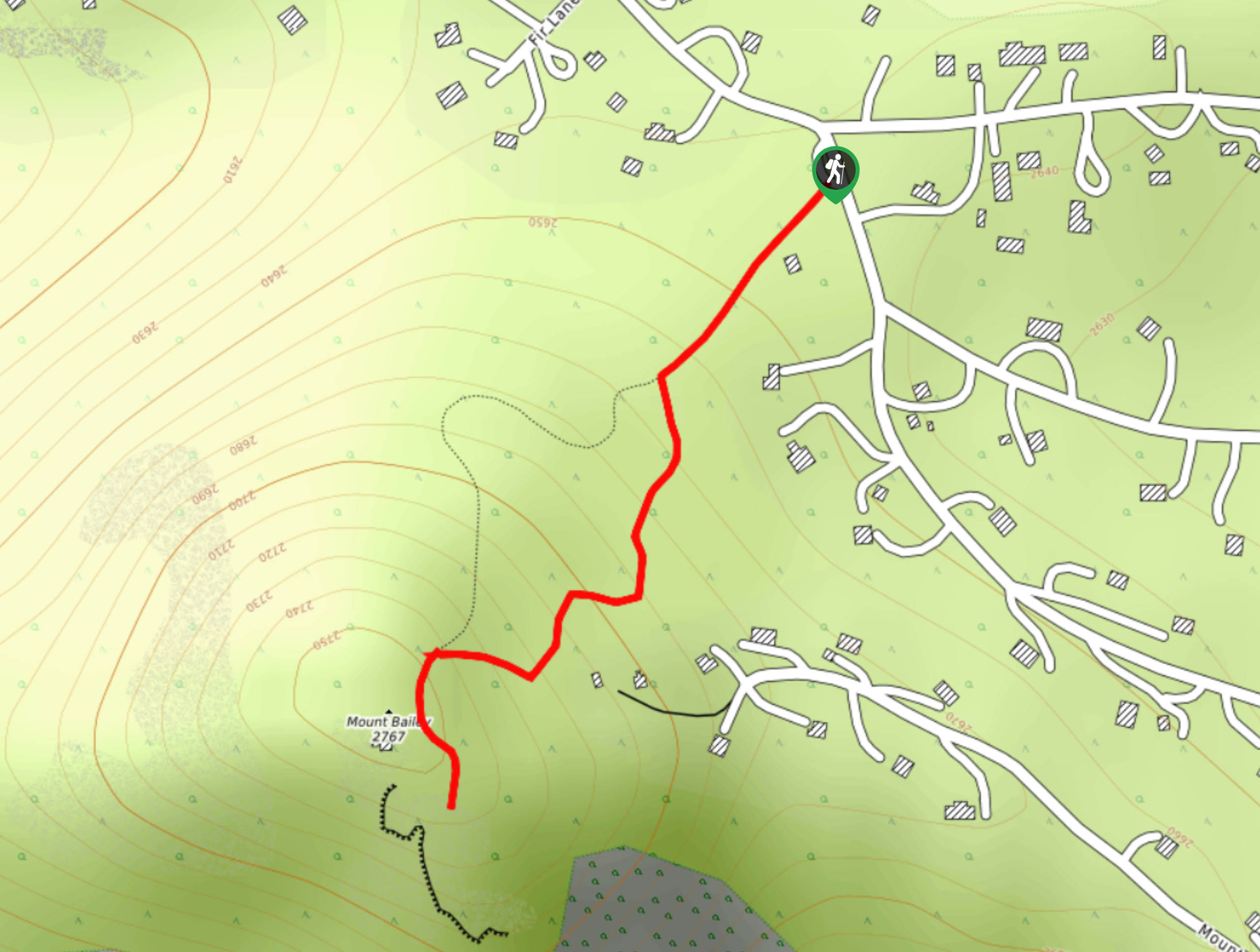
The Mount Bailey Hike is located in the Youth Park off of Burland Drive.

About
| Backcountry Campground | No |
| When to do | Year-Round |
| Pets allowed | Yes - On Leash |
| Family friendly | Yes |
| Route Signage | Good |
| Crowd Levels | Moderate |
| Route Type | Out and back |
Mount Bailey Hike
Elevation Graph
Weather
Mount Bailey Hike Description
If you are getting acclimated to the high altitude of the Colorado wilderness, then the Mount Bailey Hike is the perfect introductory excursion. Hike up the well-marked path to the summit of Mount Bailey; you will be astounded by the breathtaking views this small mountain provides. The Mount Bailey Trail is short and sweet and lined with benches the whole way up. Thus, it is the perfect path for those with limited hiking experience and small children. Hike through the lovely forest land to the overlook.
Hidden in a residential neighborhood, the Mount Bailey Hike is off-the-beaten-path. Take Burland Drive Road and find the Mount Bailey Trailhead in Youth Park. Track southwest from the trailhead onto the Mount Bailey Trail. Hike through the mixed spruce forest and mind the odd root on the trail. As you climb up the route, the path will wind you through a few switchbacks before delivering you to the summit.
At the summit of Mount Bailey, tree coverage is sparse, so expect windier conditions at the peak. Explore the rocky mountain top and enjoy the impressive vistas of the Front Range’s snow-dusted peaks. Revel in the alpine scenery and when you are ready to descend, retrace your steps back to the parking lot.
Similar hikes to the Mount Bailey Hike hike

Miller Gulch Loop Trail
The Miller Gulch Loop Trail is a scenic meadowland adventure in the Pike National Forest. Hike through grassy meadows laden…

The Castle Hike
The Castle Hike is an exciting adventure up the steep, forested terrain to The Castle Rock. From atop the summit,…

Rutherford Trail
The Rutherford Hike is a charming nature walk in Georgetown Colorado. This secluded trail is a wonderful adventure the whole…
Comments