Gibson Lake Trail
View Photos
Gibson Lake Trail
Difficulty Rating:
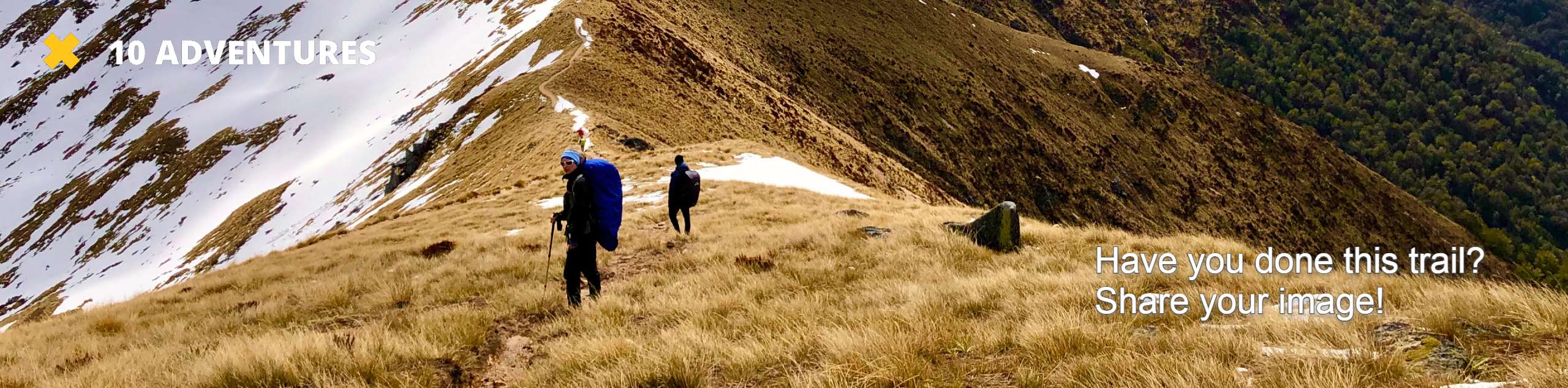
Hike the Gibson Lake Trail along the banks of the South Platte River up to the shimmering alpine lake. Whether you are hoping to fish at the lake or simply enjoy the scenery of the Continental Divide, this trail is a must add to your Front Range bucket list. The ideal ratio between challenging and relaxing, this path is a crowd favorite.
Getting there
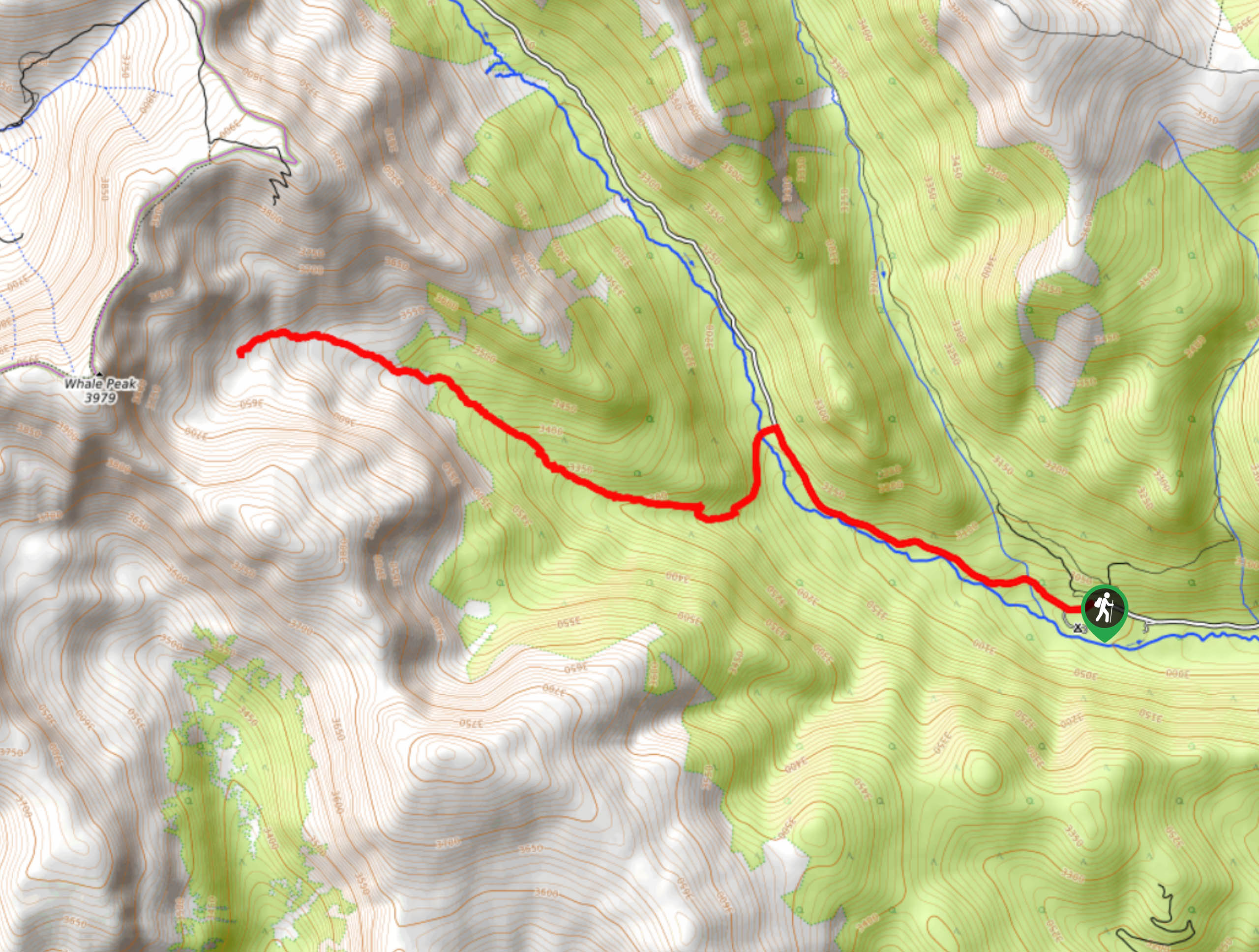
The Gibson Lake Hike departs from the Hall Valley Campground along County Road 60.

About
| Backcountry Campground | Dispersed backcountry camping, see rules. |
| When to do | June-October |
| Pets allowed | Yes - On Leash |
| Family friendly | Older Children only |
| Route Signage | Average |
| Crowd Levels | Moderate |
| Route Type | Out and back |
Gibson Lake Trail
Elevation Graph
Weather
Gibson Lake Hike Description
Hike the Gibson Lake Trail up to the alpine lake flanked with striking Pass dotted with spruce trees. The perfect amount of elevation gain and the easy to navigate terrain attracts hikers seeking a Colorado day hike. Ensure to pack plenty of water or a filter to stay hydrated as you gradually climb towards the lake. As you ascend the trail and summit the lake, the terrain will be almost entirely exposed and windy. A wind breaker is great insurance against chilly alpine conditions. Note that the initial section is a shared OTV and Jeep route. You can drive up to the trailhead if you have a 4×4 vehicle with high clearance, but we recommend parking at the campground and walking in.
Depart on your adventure up Gibson Lake Trail from the Hall Valley Campground. From the campground, head northwest continuing up County Road 60. Share the road with OTV vehicles along the banks of the North Fork of the South Platte River. After a few kilometers, you will meet the Gibson Lake Trailhead in the west. Turn left, cross the bridge over the river and begin hiking up the forested path. Hike up the forested valley and along the alpine stream. As you climb up the trail, the terrain will become increasingly rocky and tree shade will thin. Ascend the timberline and crest the rocky ridge of the Gibson Lake. Dip your tired feet in the inviting alpine lake and enjoy the vistas of the towering ridges of the Continental Divide.
If you brought your fishing pole, try your hand at some trout. Relax and admire the grandeur of the Continental Divide and Whale Peak that sits atop. When you are ready to begin the tail end of your adventure, backtrack along the trail down the valley back to County Road 60 and down to the campground.
Similar hikes to the Gibson Lake Trail hike

Hankins Pass Hike
The Hankins Pass Hike is a quintessential adventure across the Lost Creek Wilderness. The hike demonstrates the diversity of the…

Miller Gulch Loop Trail
The Miller Gulch Loop Trail is a scenic meadowland adventure in the Pike National Forest. Hike through grassy meadows laden…

The Castle Hike
The Castle Hike is an exciting adventure up the steep, forested terrain to The Castle Rock. From atop the summit,…
Comments