
Wichita State Plane Wreck
View Photos
Wichita State Plane Wreck
Difficulty Rating:
On October 2, 1970, a plane carrying the Wichita State Football Team went down near Georgetown, Colorado. With a devastating 31 fatalities, there were 9 sole survivors. The catastrophic crash left tons of steel metal wedged into the hillside. Tourists can explore the wreck and pay respect to the memorial at the crash site.
Getting there
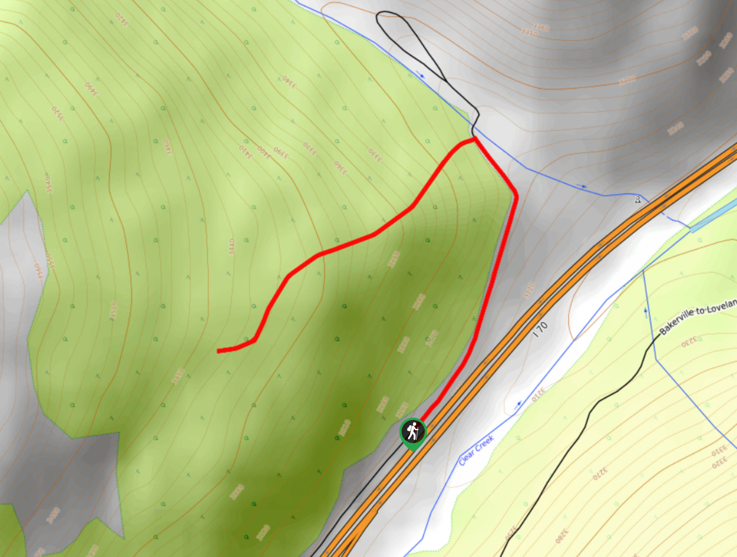
The Wichita Plane Wreckage is off Interstate-70 near Georgetown, Colorado.

About
| Backcountry Campground | No |
| When to do | Year-Round |
| Pets allowed | Yes - On Leash |
| Family friendly | Older Children only |
| Route Signage | Average |
| Crowd Levels | Moderate |
| Route Type | Out and back |
Wichita State Plane Wreck
Elevation Graph
Weather
Wichita State Plane Wreck Description
The hike up to the Wichita State Plane Wreck is shaded, but steep. Though the wreckage is interesting to explore, it is extremely sobering. Be respectful of the area and those visiting the memorial to pay their respects. There are plenty of loose rocks along the path so on the hike up, mind your footing. Bring poles to help navigate the steep terrain.
Park in the car park off of the I-70, and track the trail behind the gate to ascend the trail to the Wichita State Plane Wreck. Hike up the rocky path as it guides you north. Follow the rock cairns that mark the wooded trail. When you near the small creek the path will curve south. Navigate the extremely steep and rocky terrain up to Wichita State Plane Wreck. Explore the eerie sights of the wreckage and read the memorial.
Hike around the sobering crash site and when you are ready to descend, retrace your steps. Mind your footing and take your time as you descend the rocky route.
Similar hikes to the Wichita State Plane Wreck hike

Hankins Pass Hike
The Hankins Pass Hike is a quintessential adventure across the Lost Creek Wilderness. The hike demonstrates the diversity of the…

Miller Gulch Loop Trail
The Miller Gulch Loop Trail is a scenic meadowland adventure in the Pike National Forest. Hike through grassy meadows laden…

The Castle Hike
The Castle Hike is an exciting adventure up the steep, forested terrain to The Castle Rock. From atop the summit,…
Comments