Diamond Peaks Hike
View Photos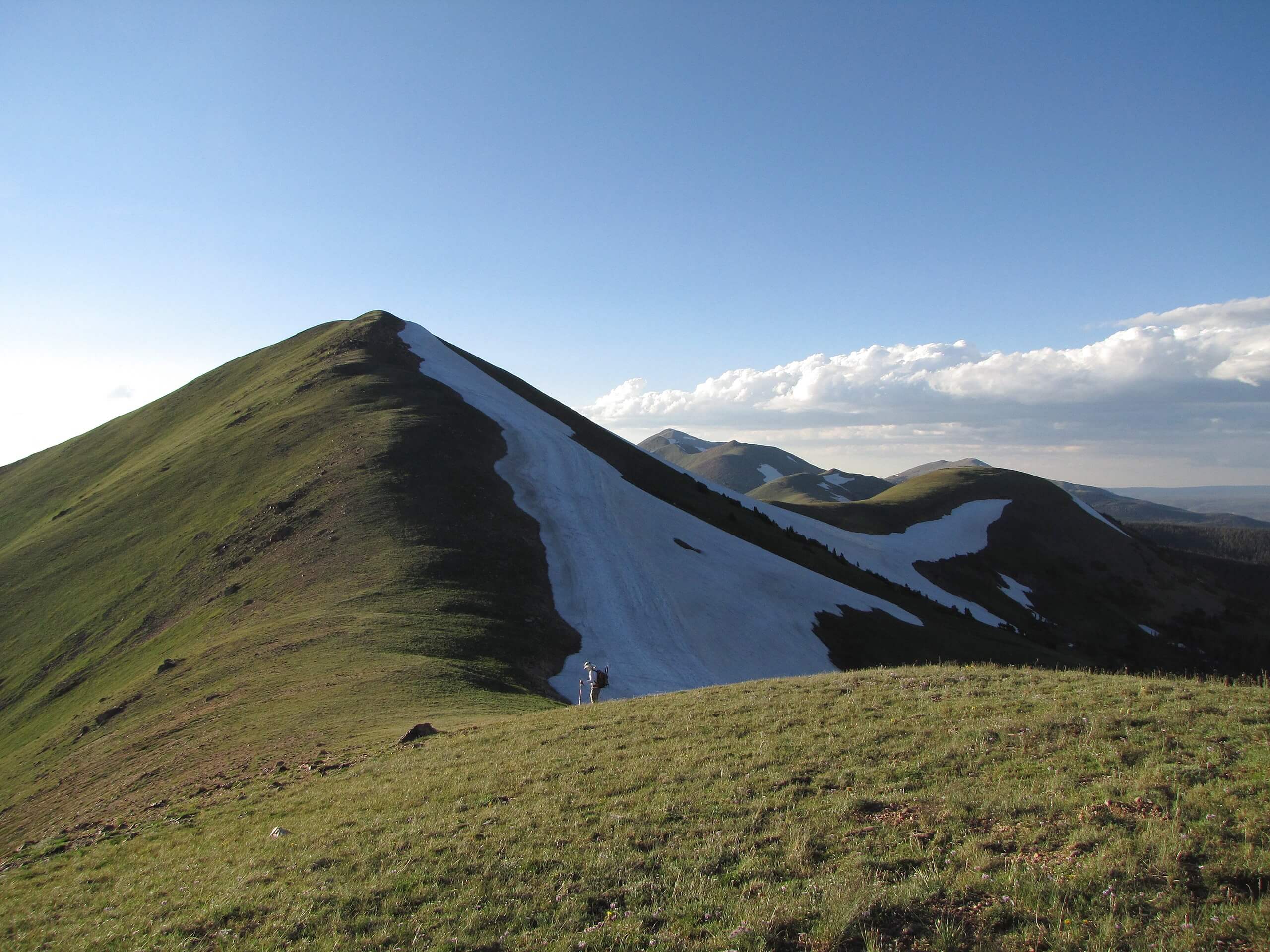
Diamond Peaks Hike
Difficulty Rating:
The Diamond Peaks Hike is a scenic trek through the Colorado wilderness up the North Diamond Peak and the Montgomery Pass. This hike is steep and demanding, but the views from the summit outweigh the effort. This adventure is a great introductory excursion to primitive backcountry hiking.
Getting there
Begin your adventure up the Diamond Peaks Trail from the Zimmerman Lake Parking Lot off highway CO-14.

About
| Backcountry Campground | Dispersed Backcountry Camping, see rules and regulations. |
| When to do | June-October |
| Pets allowed | Yes - On Leash |
| Family friendly | Older Children only |
| Route Signage | Poor |
| Crowd Levels | Low |
| Route Type | Circuit |
Diamond Peaks Hike
Elevation Graph
Weather
Diamond Peaks Hike Description
If you enjoy navigating primitive trails and exploring the backcountry, then you will love the Diamond Peaks Hike. This hike will guide you through dense forests, through alpine tundras, and up steep trails to summit the North Diamond Peak. We recommend wearing sturdy hiking boots and layers to adapt to the changing climate of the trail. This trail weaves through unmarked primitive trails to distinct hiking paths. Consider bringing along the trail GPS to aid in your navigation of the challenging terrain. Note this trail does return along the CO-14, but there is a large shoulder for hikers to track.
Additionally, you will be bushwhacking for much of this hike. Wear thick pants to avoid any scrapes! A bear bell is also a welcomed accessory for this hike, it will help to deter any nearby wildlife from getting any closer. As you progress through the dense woodlands and begin to summit the pass, the trail becomes steep and technical. Though not necessary, hiking poles and microspikes will help you navigate the steep and often snow packed terrain. Don’t forget to bring plenty of water and snacks too!
Though this hike may seem daunting, it is actually a very stimulating and fun adventure! We love this hike because you get to experience different types of the quintessential Colorado terrain all in one hike. Hike through aspen forest, through meadows and alpine tundras all before summiting not one, but two Colorado Peaks. I mean what more could you ask for? Well, maybe an alpine lake, but we’ll let that one slide.
When you are all packed and ready, begin your adventure from the Zimmerman Lake Parking Lot. From here cross the CO-14 and begin your trek from the Montgomery Pass Trailhead. Hike along the forested path as it guides you west. The route will begin to gain elevation as you near the pass. You will encounter a junction not too long after setting out. Here, stay right on the Montgomery Pass Trail.
Hike through the alpine tundra before ascending a steep trail to the pass. From here until you reach North Diamond Peak, the trail will be exposed. Once you ascend the pass you will confront another intersection, divert left and head south on the North Diamond Peak Trail. This section of the trail is unmarked.
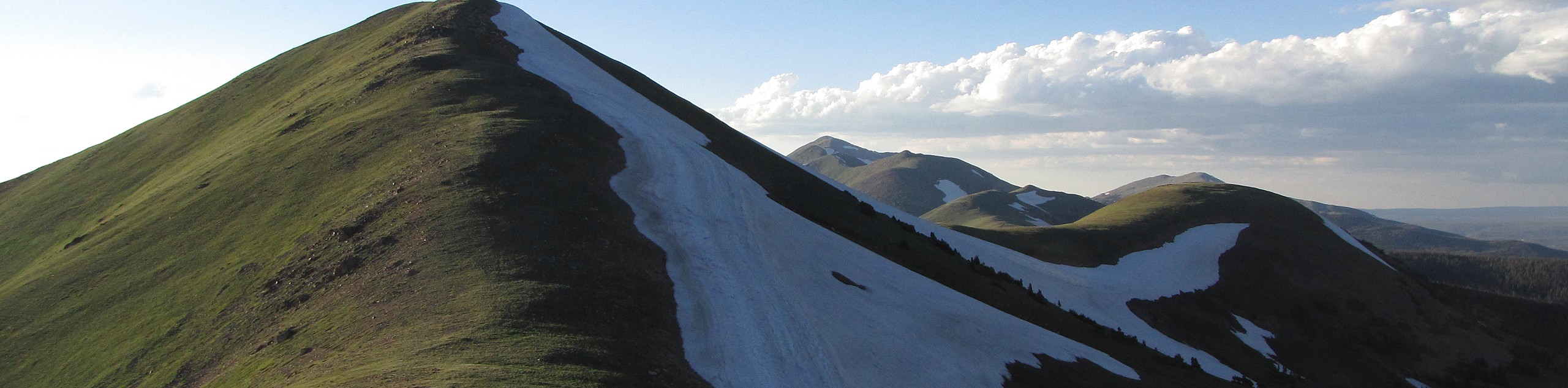
Try and maintain your balance as you trek across the windy ridge. Maintain south as the trail’s elevation picks up and you begin your final ascent to the summit. Navigate the steep alpine tundra terrain to the summit. Once you summit the North Diamond Peak make sure to take a moment to appreciate the stunning vista. Let the fresh mountain air fill your lungs before beginning your descent.
From the summit, scramble your way down the south side of the mountain. Head down into the saddle between the South and North Diamond Peaks. If you wish to ascend the South Diamond Peak, simply scramble up the short ridge to the summit. From the peaks’ saddle, divert east down the Cameron Pass Trail.
The descent down the Cameron Pass Trail is very steep and primitive. Use the trail GPS to navigate this route. Mind your footing as you hike down the steep rocky path. This trail will guide you back below the treeline and release you in the Cameron Pass Parking Lot. From the carpark, track the CO-14 northwards along the shoulder of the road until you arrive back at the Montgomery Pass Trailhead. Cross the road to get back to your car.
Trail Highlights
The Diamond Peaks
North Diamond Peak sits at about 12116ft of elevation and the South Diamond Peak at 11699ft. Unfortunately, the Diamond Peaks namesake is deceiving, you will not find any diamonds along your hike up these snow-dusted Colorado Mountains. Instead, the Diamond Peaks got their names after a diamond salting scheme transpired on the side of this northwestern Colorado mountain hundreds of years ago.
Insider Hints
Consider leaving your dog at home for this hike. The rocky and steep terrain might bother their paws.
Pack lots of water as there are not many sources for water filtration along the path.
If you want to avoid walking up the CO-14, simply end your hike at the North Diamond Peak and retrace your steps back down the Montgomery Pass Trail to the carpark.
Wear a bear bell to ward off and unwelcome visitors.
Similar hikes to the Diamond Peaks Hike hike

Hankins Pass Hike
The Hankins Pass Hike is a quintessential adventure across the Lost Creek Wilderness. The hike demonstrates the diversity of the…

Miller Gulch Loop Trail
The Miller Gulch Loop Trail is a scenic meadowland adventure in the Pike National Forest. Hike through grassy meadows laden…

The Castle Hike
The Castle Hike is an exciting adventure up the steep, forested terrain to The Castle Rock. From atop the summit,…
Comments