
Wigwam Trail
View Photos
Wigwam Trail
Difficulty Rating:
Hike from one end of the Lost Creek Wilderness to the other on the Wigwam Trail. This trail is an epic backpacking excursion or an even better day hike. We don’t know about you, but one-way trails might just be our favorite type of adventure because the scenery is new every step of the way! Hike the Wigwam trail and experience the diverse terrain that the Colorado wilderness has to offer.
Getting there
The Wigwam Trailhead is off Forest Road 545.

About
| Backcountry Campground | Several Dispersed Campsites Along the Trail |
| When to do | April-November |
| Pets allowed | Yes - On Leash |
| Family friendly | Older Children only |
| Route Signage | Average |
| Crowd Levels | Moderate |
| Route Type | Out and back |
Wigwam Trail
Elevation Graph
Weather
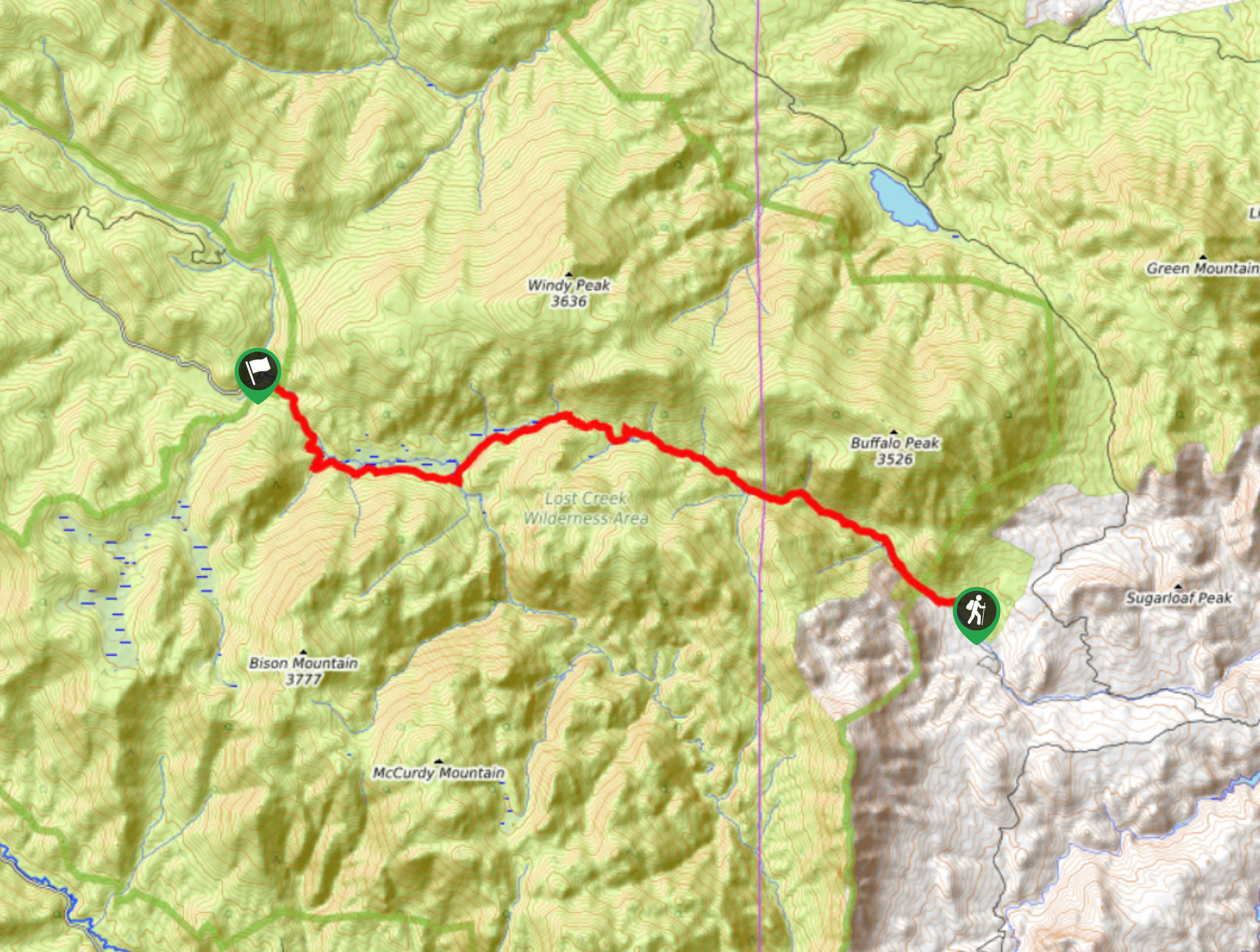
Wigwam Hike Description
As you can tell, we love a good point to point adventure. The Wigwam Trail is an incredibly scenic hike through meadowlands, across rivers, under tree coverage and over rocky terrain in the Lost Creek Wilderness. This route is a popular overnight backpacking destination, but we prefer to complete this trail in one day. Remember to leave a vehicle at the end point or have someone come pick you up, because figuring out transportation is the last thing you want to do after a tiring adventure. Leave a vehicle at the end point and hike one-way. Additionally, wear layers as the ever-changing terrain of this hike means ever-changing weather.
After dropping off a vehicle at the end point, depart on your adventure across the Lost Creek Wilderness from the Wigwam Trailhead. Follow the Wigwam Trail northwest along the Wigwam Creek. The path will guide you through the woodlands and you will eventually meet Wigwam Park Creek. At this intersection, stay straight on Wigwam Trail. Hike along the creek and past the several dispersed campsites. At the next junction, stay straight on Wigwam Trail and you will begin to ascend a rocky ridge. Navigate the switchbacks and the route will deliver you to a vast meadow. Hike the exposed path along East Long Park.
At this point you are near the end of the route. Travel along Lost Creek and back under tree coverage. Soon you will meet the Lost Creek Campground, this is the adventure’s end.
Similar hikes to the Wigwam Trail hike

Hankins Pass Hike
The Hankins Pass Hike is a quintessential adventure across the Lost Creek Wilderness. The hike demonstrates the diversity of the…

Miller Gulch Loop Trail
The Miller Gulch Loop Trail is a scenic meadowland adventure in the Pike National Forest. Hike through grassy meadows laden…

The Castle Hike
The Castle Hike is an exciting adventure up the steep, forested terrain to The Castle Rock. From atop the summit,…
Comments