
Ben Tyler Trail
View Photos
Ben Tyler Trail
Difficulty Rating:
The Ben Tyler Trail exhibits all the best of what the Colorado wilderness has to offer. Hike through aspens grove, under towering lodgepole pines, along alpine meadows, and past stunning overlooks. Immerse yourself in nature and leave stressors in the rear-view mirror as you trek along the Ben Tyler Trail.
Getting there
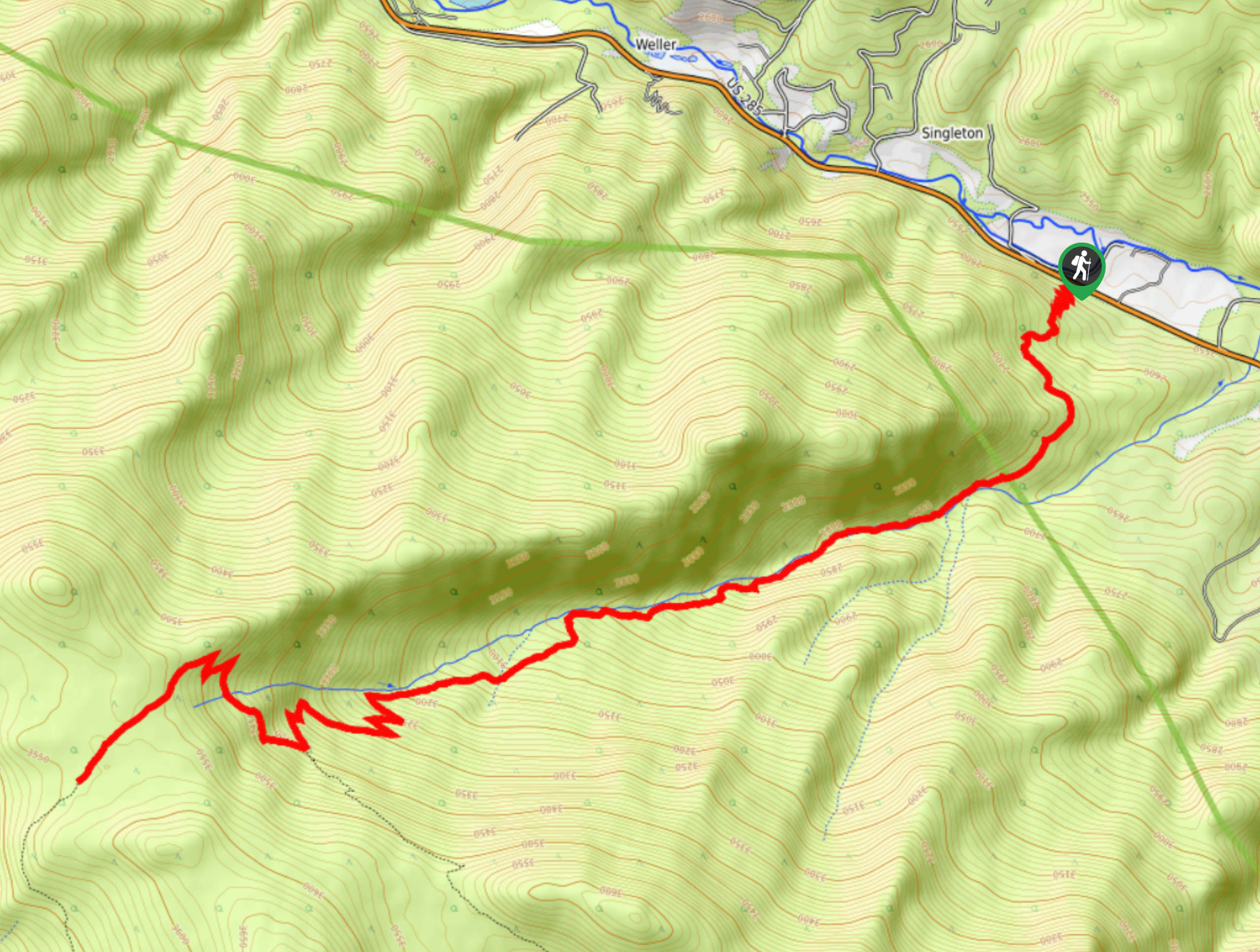
Access the Ben Tyler Trailhead via US Highway 285.

About
| Backcountry Campground | Dispersed backcountry camping, restrictions apply. |
| When to do | Year-round |
| Pets allowed | Yes - On Leash |
| Family friendly | No |
| Route Signage | Average |
| Crowd Levels | High |
| Route Type | Out and back |
Ben Tyler Trail
Elevation Graph
Weather
Ben Tyler Hike Description
The Ben Tyler Trail is a lengthy day hike or an epic backpacking excursion. Travel through the Lost Creek Wilderness which will overwhelm you with its breathtaking beauty. Reserved for experienced hikers, this path requires stamina and an intrepid spirit. Travel the panoramic path through diverse terrains and up to the Rock Creek drainage. Make sure to pack plenty of provisions and water to keep you energized along this trek. If you are hiking during the autumn and winter months, consider microspikes and snowshoes to help you navigate the likely snowy terrain.
Embark on this exciting journey along the Ben Tyler Trail from the trailhead. Track southwest along the Ben Tyler Trail through the namesake’s gulch. Hike up the forested gulch and along the Ben Tyler Creek. Travel the scenic forested path through aspen groves and lodgepole pines. Enjoy the ambiance of the babbling creek as you ascend the woodland route. Soon you will graduate from the timberline and trek along a mountain saddle. Traverse the high ridge and revel in the spectacular panoramic views.
At this point, you will confront an intersection, stay right on the Ben Tyler trail. Shortly after the junction you will meet the trail’s end at the Rock Creek drainage. Admire the expansive vistas of the mountainous landscape and the lush forests below. Set up a tent, or head back to the trailhead from here. To get back to the parking lot, simply retrace your steps along the route.
Similar hikes to the Ben Tyler Trail hike

Hankins Pass Hike
The Hankins Pass Hike is a quintessential adventure across the Lost Creek Wilderness. The hike demonstrates the diversity of the…

Miller Gulch Loop Trail
The Miller Gulch Loop Trail is a scenic meadowland adventure in the Pike National Forest. Hike through grassy meadows laden…

The Castle Hike
The Castle Hike is an exciting adventure up the steep, forested terrain to The Castle Rock. From atop the summit,…
Comments