
Limber Pine Trail
View Photos
Limber Pine Trail
Difficulty Rating:
The Limber Pine Trail is a stunning nature hike through diverse landscapes to a breathtaking overlook. This unique trail will guide adventurers through meadows, aspen groves, past granite outcropping and up to Kreuger Rock. From the summit revel in the impressive lookout over Estes Park from high above.
Getting there
The Limber Pine Trailhead is off N St. Vrain Avenue.

About
| Backcountry Campground | |
| When to do | May-October |
| Pets allowed | Yes - On Leash |
| Family friendly | Older Children only |
| Route Signage | Average |
| Crowd Levels | Moderate |
| Route Type | Out and back |
Limber Pine Trail
Elevation Graph
Weather
Limber Pine Hike Description
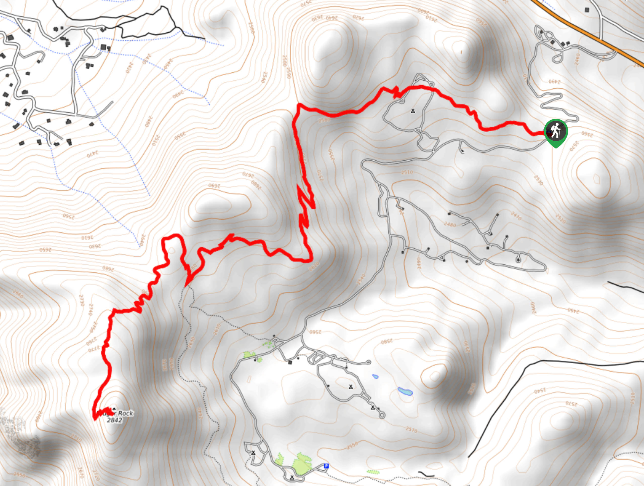
The Limber Pine Trail does not disappoint. As you traverse the diverse terrain you will be rewarded with impressive vistas of the campers that dot the meadow landscape below and the snow-dusted peaks in the above. This trail is a wonderful introductory excursion to summit hikes in the Front Range. Climb up the gradual grade up to the unique granite spires atop Krueger Rock. If you venture this trail in the late autumn or winter, make sure to wear microspikes to grip the slippery, rocky terrain. Note this area is subject to wildlife closures, check the Larmier website and trailhead bulletin for announcements.
Begin your journey along the Limber Pine Trail from the trailhead. Track northwest up the path and pass the Hermit’s Hallow Campground. Continue along the Limber Pine trail as it weaves between meadowlands and aspen groves. As you trek along the path it will become increasingly steep as you near Kruger Rock. Enjoy the mountainous vistas from the exposed sections of the path and notice campers below. Soon you will encounter a junction. Stay right on the Limber Pine Trail and you will have to ascend the rocky terrain to the summit of Kreuger Rock. Navigate the rocky switchbacks up to the summit of Kreuger Rock.
Admire the unique mountain top. Explore the granite spires and canyons that compose the mountain and enjoy the expansive views of the wilderness below. When you are through adventuring the rocky summit, backtrack along the path all the way to the trailhead.
Similar hikes to the Limber Pine Trail hike

Hankins Pass Hike
The Hankins Pass Hike is a quintessential adventure across the Lost Creek Wilderness. The hike demonstrates the diversity of the…

Miller Gulch Loop Trail
The Miller Gulch Loop Trail is a scenic meadowland adventure in the Pike National Forest. Hike through grassy meadows laden…

The Castle Hike
The Castle Hike is an exciting adventure up the steep, forested terrain to The Castle Rock. From atop the summit,…
Comments