
Pole Hill Hike
View Photos
Pole Hill Hike
Difficulty Rating:
Shared with off-road vehicles and mountain bikers, the Poll Hill Trail is an epic adventure to satisfy outdoor enthusiasts of all sorts. If you are seeking an awesome outdoor adventure, then immerse yourself in nature along the Poll Hill Hike.
Getting there
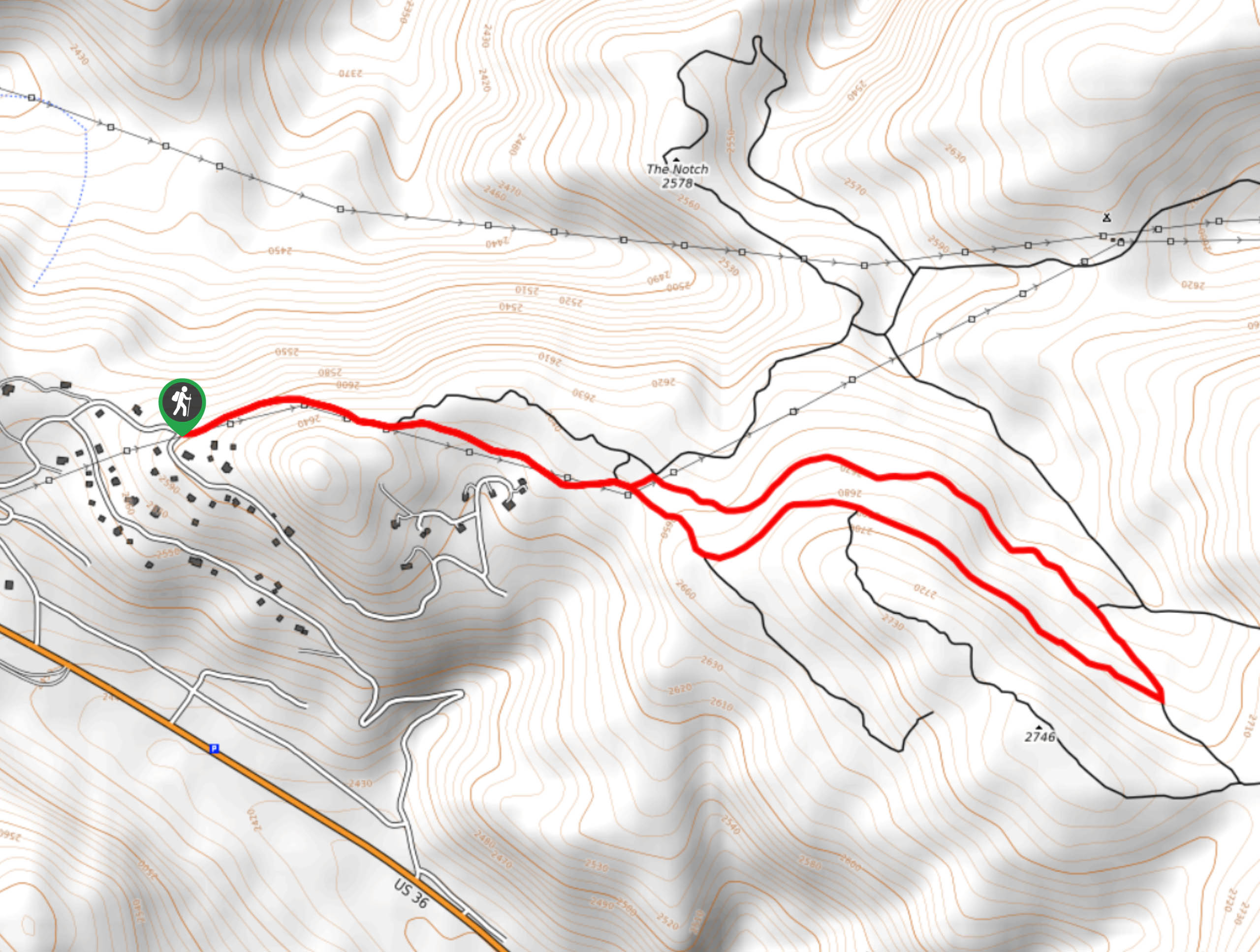
The Poll Hill Hike is accessed via Alpine Drive near Estes Park.

About
| Backcountry Campground | Dispersed Backcountry Camping |
| When to do | Year-round |
| Pets allowed | Yes - On Leash |
| Family friendly | Yes |
| Route Signage | Average |
| Crowd Levels | Moderate |
| Route Type | Lollipop |
Pole Hill Hike
Elevation Graph
Weather
Poll Hill Hike Description
Adventure into the wilderness, return to your natural roots and trek up the Poll Hill Trail. Shared with other intrepid explorers, this hike is one for the books. Hike the well-maintained route through the aspen groves up to the summit of Poll Hill. From the peak, enjoy 360-degree panoramic vistas of the Colorado wilderness. From atop the mountain, notice Panorama Peak across the saddle. Note the wide path is exposed, prepare accordingly and layers are always a good insurance against inclement weather.
From the trailhead, track northeast along the Forest Development Road (FDR) past the metal gate. Travel up the road among the other intrepid adventurers. Enjoy the vibrant aspens towering above and at the intersection, veer right. Continue trekking the FDR, ignoring merging routes. Trek along the now exposed path to the summit of Poll Hill. Appreciate the expansive views of the mountainous landscape, and at the next junction, take a sharp left on FDR277.
Hike the forested road as it begins to descend to the FDR. At the intersection, retrace your steps down the FDR to the gate and parking lot.
Similar hikes to the Pole Hill Hike hike

Miller Gulch Loop Trail
The Miller Gulch Loop Trail is a scenic meadowland adventure in the Pike National Forest. Hike through grassy meadows laden…

The Castle Hike
The Castle Hike is an exciting adventure up the steep, forested terrain to The Castle Rock. From atop the summit,…

Rutherford Trail
The Rutherford Hike is a charming nature walk in Georgetown Colorado. This secluded trail is a wonderful adventure the whole…
Comments