
M. Walter Pesman Trail
View Photos
M. Walter Pesman Trail
Difficulty Rating:
The M. Walter Pesman Trail is a scenic adventure that borders the Mount Evans Wilderness. Hike through rock gardens, vibrant wildflowers, and bristlecone pines on this excursion. Suitable for kids and novice hikers alike, this trail is a popular nature excursion.
Getting there
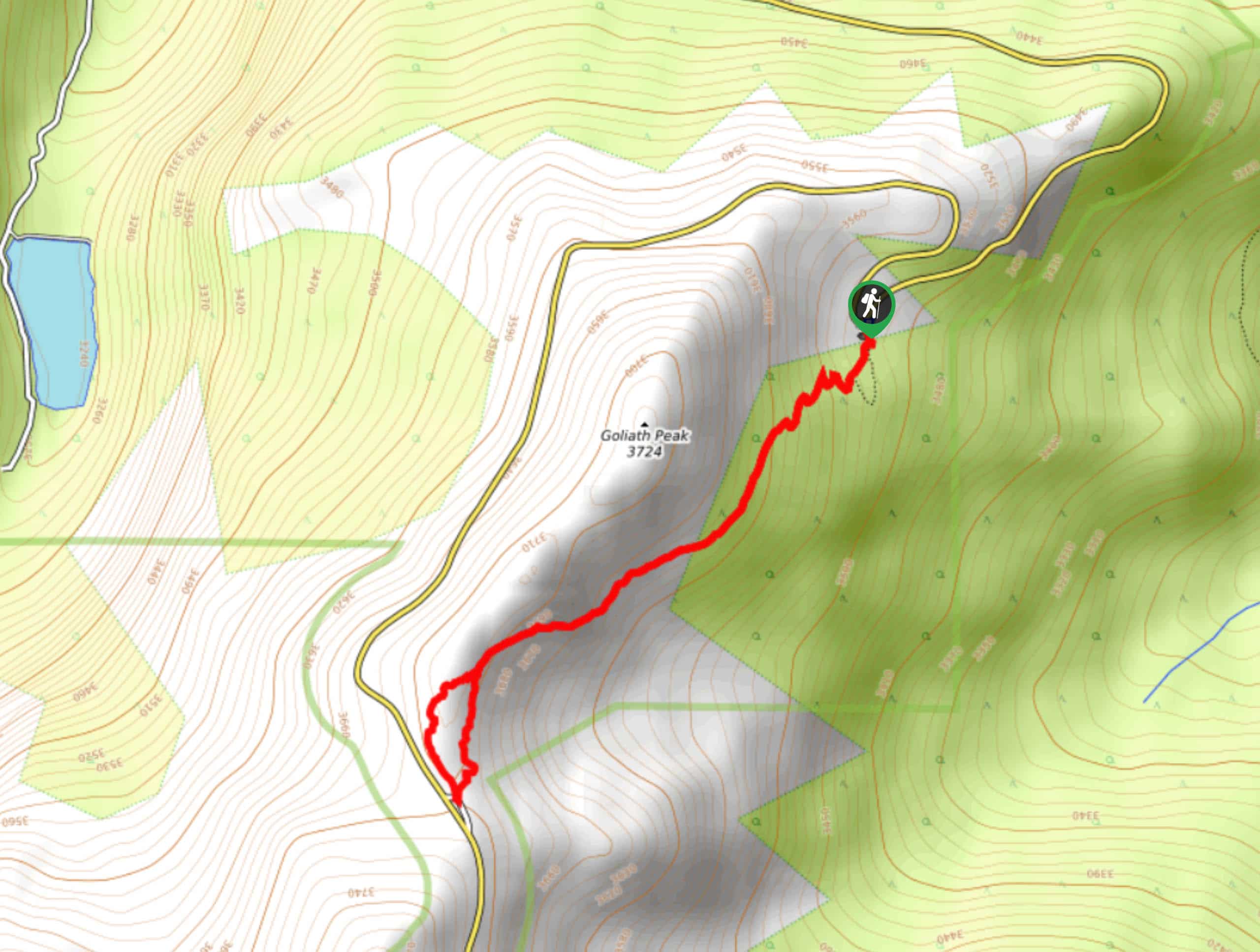
The M. Walter Pesman Trail is accessed via the Mount Goliath Visitors Centre off the Mount Evans Road.

About
| Backcountry Campground | No |
| When to do | June-October |
| Pets allowed | Yes - On Leash |
| Family friendly | Yes |
| Route Signage | Average |
| Crowd Levels | Moderate |
| Route Type | Lollipop |
M. Walter Pesman Trail
Elevation Graph
Weather
M. Walter Pesman Hike Description
Hike amongst ancient bristlecone pine trees and through rock gardens on the M. Walter Pesman Trail. Encompassed by incredible scenery, this path is scenic every step of the way. As you hike along the path, check out the interpretive signs that explain the environment and wildlife that surrounds you. Kids and adults alike will enjoy this stimulating adventure around the base of Mount Goliath. Note that the route will weave you between exposure and tree shade, so ensure to lather on the sunscreen on sunny days.
Begin your adventure along the M. Walter Pesman Trail from the Mount Goliath Visitors Centre. From the visitor’s centre, track south along the M. Walter Pesman Trail. Hike through the bristlecone pines and read the interpretive signs that line the path. Continue hiking, and you will eventually ascend the tree shade—trek up the rock garden and through the wildflower-carpeted trail. At the intersection, you can hike either way around the loop.
Walk around the small loop and then retrace your steps along the M. Walter Pesman Trail back to the visitor’s centre.
Similar hikes to the M. Walter Pesman Trail hike

Miller Gulch Loop Trail
The Miller Gulch Loop Trail is a scenic meadowland adventure in the Pike National Forest. Hike through grassy meadows laden…

The Castle Hike
The Castle Hike is an exciting adventure up the steep, forested terrain to The Castle Rock. From atop the summit,…

Rutherford Trail
The Rutherford Hike is a charming nature walk in Georgetown Colorado. This secluded trail is a wonderful adventure the whole…
Comments