Bison Peak Summit
View Photos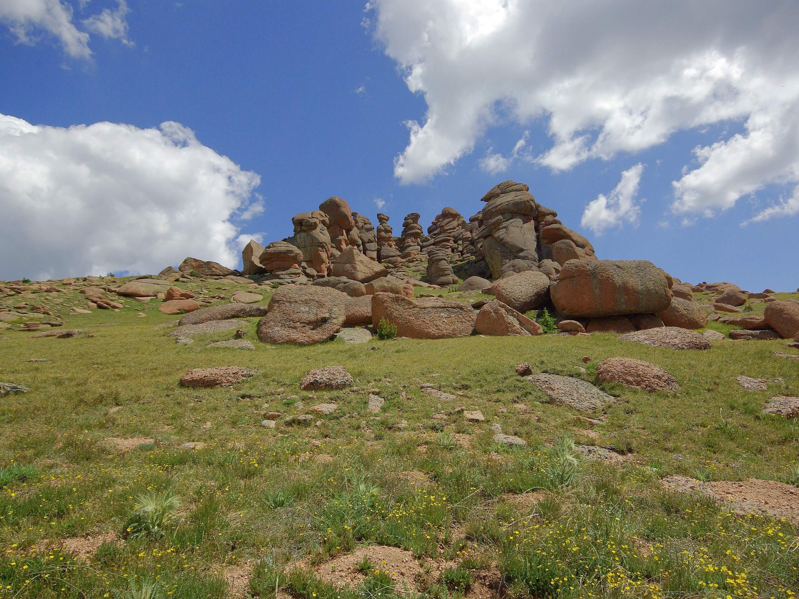
Bison Peak Summit
Difficulty Rating:
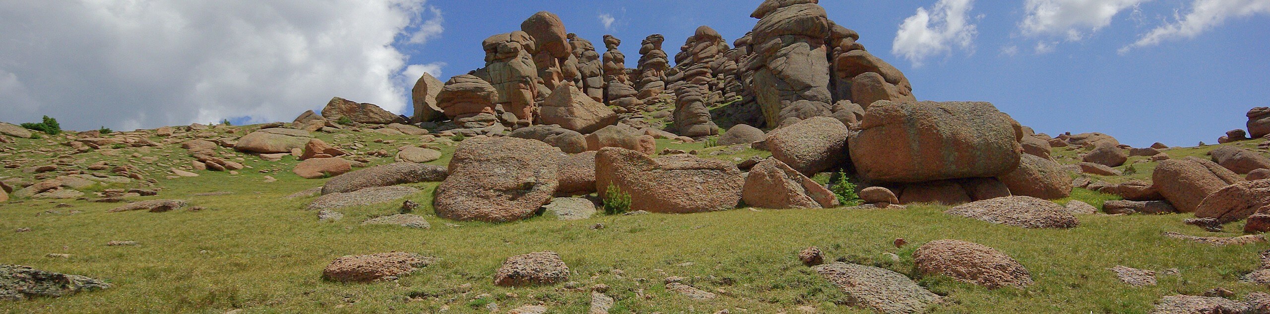
Hike the Bison Peak Summit Trail to one of the most unique mountain plateaus. Dotted with large granite sculptures, Bison Peak is well worth exploring. Adventure to Bison Peak as a lengthy day hike, or consider camping on the summit, sheltered by large boulders. This hike is one for the books. On your next adventure to the Lost Creek Wilderness, make sure you hike the Bison Peak Summit Trail.
Getting there
Find the trailhead for Bison Peak Summit off of County Road 77.

About
| Backcountry Campground | Backcountry Dispersed Camping Permitted |
| When to do | June-October |
| Pets allowed | Yes - On Leash |
| Family friendly | No |
| Route Signage | Poor |
| Crowd Levels | Moderate |
| Route Type | Out and back |
Bison Peak Summit
Elevation Graph
Weather
Bison Peak Summit Hike Description
Bison Peak sits at 12392ft in the Lost Creek Wilderness. Unfortunately, this trail is not well known, thus the trail is often desolate. We think that may change as adventurers realized how epic the Bison Peak Summit Trail really is. Unlike many of the mountain hikes in the area, the Bison Peak Summit is a wonderful year-round expedition. The lower altitude and dry climate of the area ensure easy hiking year-round. If you do adventure the Bison Peak Summit Hike in the winter, ensure to bring microspikes to help you navigate any possible slippery sections. Year-round, this trail is demanding and long. Make sure to pack plenty of water and snacks to refuel.
Embark on your adventure up to the Bison Peak Summit from the Bison Peak Trailhead off of County Road 77. Parking is plentiful so you should have no problem getting a spot. From the parking lot, take the Ute Creek Trail. This path will guide you along a meadow before curving you northeast. The route will follow the curves of the Ute Creek as you hike underneath tree coverage. Enjoy the grandeur of the fir and spruce trees that surround you and continue ascending the valley trail. As you hike up the trail, the path will diverge away from the creek and you will meet a fork in the road. Here, veer right, and you will be diverted onto the Bison Peak Trail.
At this point, the route will be exposed and rocky as you ascend towards the summit. Follow the cairns that mark the steep path from this point forward. You will encounter another intersection, stay left. Climb the rocky path to Bison Peaks Summit. Enjoy exploring the large rock garden and granite spires that litter the summit and revel in the panoramic mountain views. Look around the large sculptures and you might even find a logbook! Sign it to let people know you conquered the hike! Stay overnight if you have the proper gear or head back. To get back to the trailhead, retrace your steps along the route all the way back to the parking lot.
Similar hikes to the Bison Peak Summit hike

Hankins Pass Hike
The Hankins Pass Hike is a quintessential adventure across the Lost Creek Wilderness. The hike demonstrates the diversity of the…

Miller Gulch Loop Trail
The Miller Gulch Loop Trail is a scenic meadowland adventure in the Pike National Forest. Hike through grassy meadows laden…

The Castle Hike
The Castle Hike is an exciting adventure up the steep, forested terrain to The Castle Rock. From atop the summit,…
Comments