James Peak Loop Trail
View Photos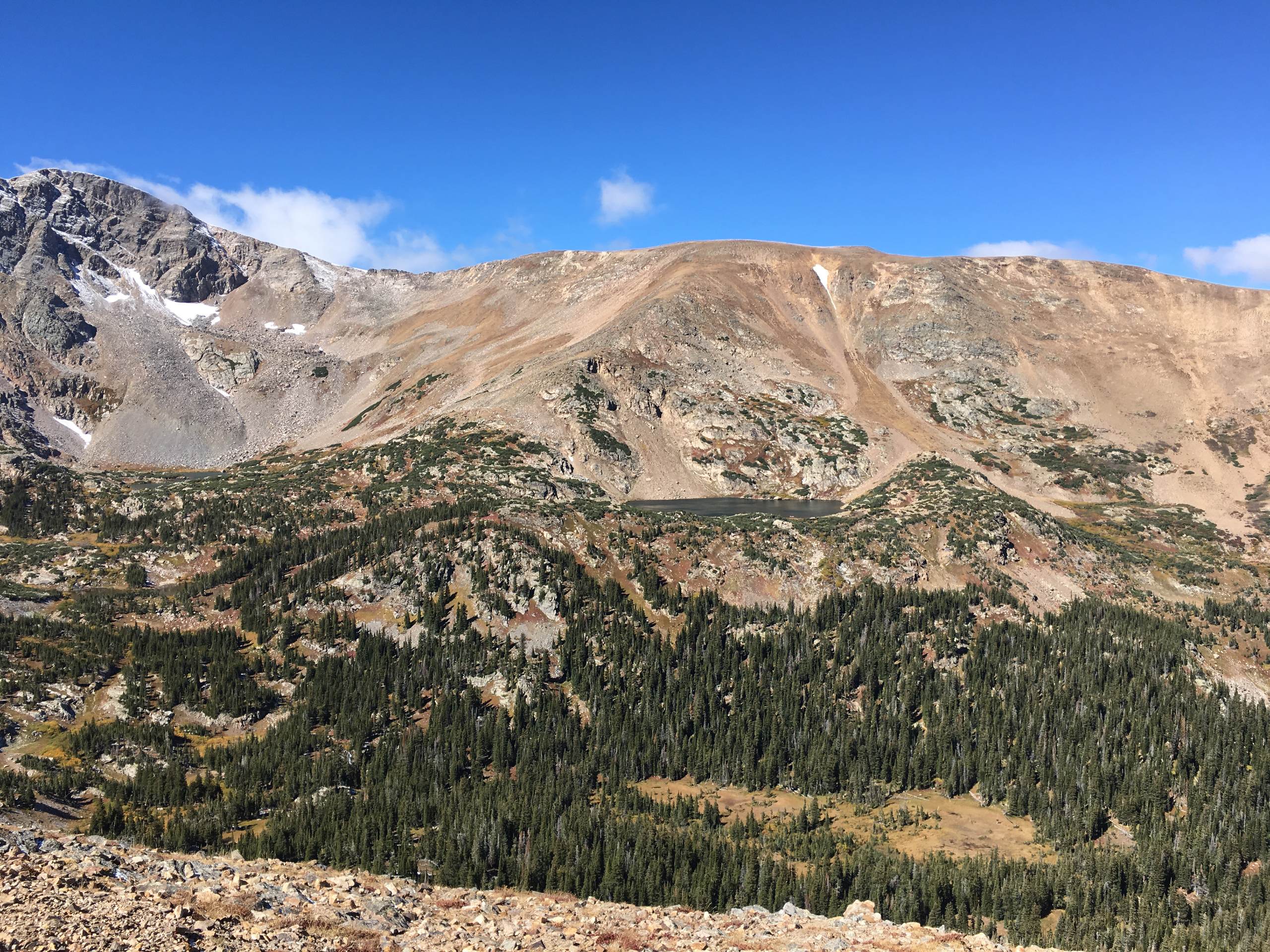
James Peak Loop Trail
Difficulty Rating:
The James Peak Loop Trail will reveal the diversity of the Colorado Wilderness. Travel through well-maintained forestland trails to unmarked technical terrain. This adventure, though incredibly scenic, warrants an intrepid adventurer who doesn’t shy away from a challenge.
Getting there
Begin your adventure around the James Peak Loop Trail from the end of Kingston Peak Road.

About
| Backcountry Campground | Dispersed Backcountry Camping, restrictions apply. |
| When to do | Year-round |
| Pets allowed | Yes - On Leash |
| Family friendly | Older Children only |
| Route Signage | Poor |
| Crowd Levels | High |
| Route Type | Circuit |
James Peak Loop Trail
Elevation Graph
Weather
James Peak Loop Hike Description
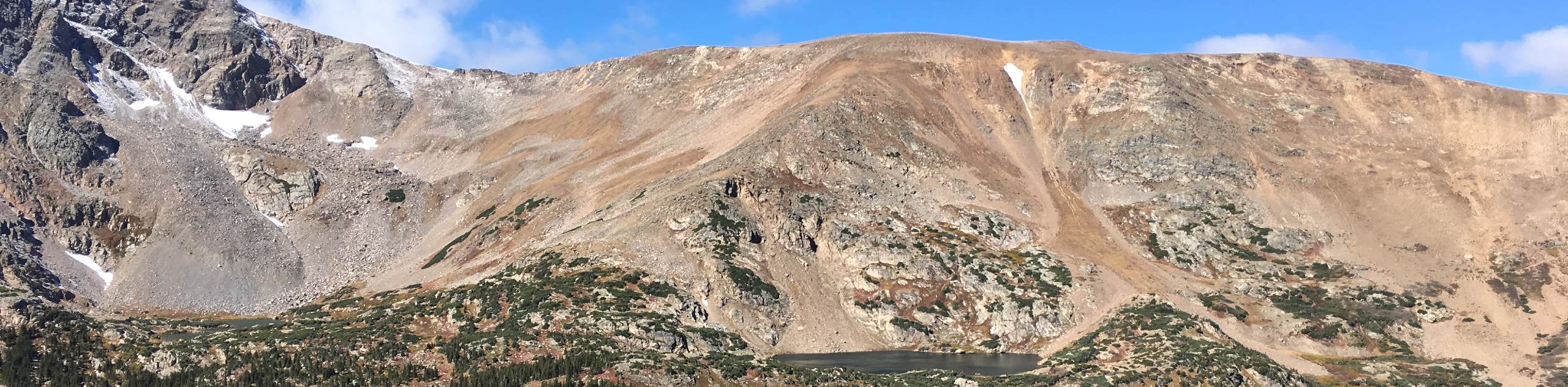
Load the trail GPS and lace up your hiking shoes because we are adventuring the James Peak Loop Trail. This exciting excursion is undeniably panoramic, hike through towering pines, past crystalline blue-hued lakes, through the alpine tundra and to a summit that rewards dumbfounding views of the Front Range and Indian Peaks Wilderness. This expedition is not for the faint of heart! We recommend microspikes and trekking poles to help navigate the rocky and often snow-draped terrain. This trail also ascends high altitudes, so ensure you are acclimated and bring plenty of water. Additionally, you will be traveling along exposed routes, so ensure to head out early and check the forecast to avoid getting caught in an afternoon storm!
Begin your adventure from the informal trailhead at the end of the Kingston Peak Road. Take the Ute Trail north, passing both James Peak Lake and Little Echo Lake. Hike this path up a rocky ridge, and at the junction, veer left. Continue trekking along the exposed, windy ridge and notice Haystack Mountain in the north. At the next intersection, turn left, and you will be diverted onto the James Peak South Trail. Ascend several tightly wound switchbacks up to the summit of James Peak. Revel in the expansive views from atop the Colorado 13er. Enjoy the sights of the alpine lakes and mountain cirque below before beginning your descent.
Track down the south ridge of the mountain and mind your footing on the loose rocky scree. Descend the switchbacks and at the next junction, stay left on the James Peak Trail. Travel east along the exposed mountain saddle, admiring the craggy snow-capped peaks that encompass you. Soon the James Peak Trail will merge into the Kingston Peak Road. Hike along this route until it delivers you back to the trailhead.
Similar hikes to the James Peak Loop Trail hike

Hankins Pass Hike
The Hankins Pass Hike is a quintessential adventure across the Lost Creek Wilderness. The hike demonstrates the diversity of the…

Miller Gulch Loop Trail
The Miller Gulch Loop Trail is a scenic meadowland adventure in the Pike National Forest. Hike through grassy meadows laden…

The Castle Hike
The Castle Hike is an exciting adventure up the steep, forested terrain to The Castle Rock. From atop the summit,…
Comments