
Granite Ridge Trail
View Photos
Granite Ridge Trail
Difficulty Rating:
The Granite Ridge Trail lived up to its name. Hike the meadowland trail past several large granite outcroppings. As you traverse the rocky trail, you will be rewarded with sights of the surrounding mountainous wilderness and the surrounding shimmering lakes.
Getting there
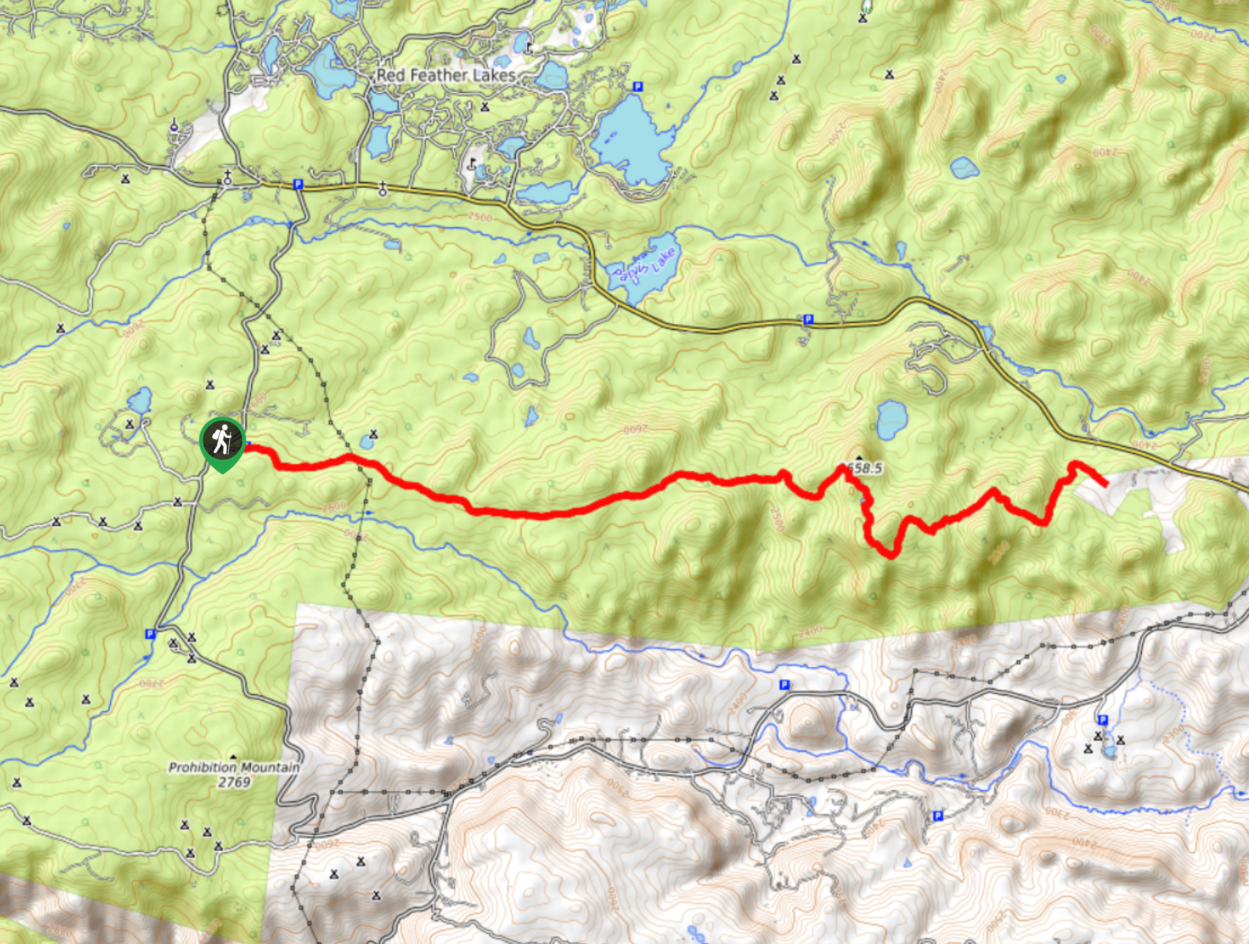
Find the Granite Ridge Trail off Manhattan Road.

About
| Backcountry Campground | Dispersed Backcountry Camping, restrictions apply. |
| When to do | February-October |
| Pets allowed | Yes - On Leash |
| Family friendly | Older Children only |
| Route Signage | Average |
| Crowd Levels | Moderate |
| Route Type | Out and back |
Granite Ridge Trail
Elevation Graph
Weather
Granite Ridge Hike Description
Like we said, the Granite Ridge Trail does not disappoint, it certainly lives up to its name. Hike through meadowlands and past impressive granite outcroppings. This lengthy trail will guide you across the Cache La Poudre Wilderness and could easily be transformed into a one-way trail. Not only will you come face-to-face with gigantic granite boulders, but you will also be granted with expansive views of the encompassing landscapes.
Begin your journey across the Granite Ridge Trail from the parking lot and trailhead. From the trailhead, this route follows a meadowed trail southwest. Track along the path and notice Molly Lake on your left. As you hike through the plains there will be plenty of merging trails, ignore them and continue along the Granite Ridge Trail. Hike past the immense granite outcroppings and revel in the impressive scenery. Trek along the route and notice Lady Moon Lake in the north and continue down into the valley. Travel along the path and you will eventually meet the trail’s end.
At the route’s end turn around and retrace your steps back along the ridge to the trailhead. If you are exhausted, consider getting someone to pick up along County Road 74E.
Similar hikes to the Granite Ridge Trail hike

Hankins Pass Hike
The Hankins Pass Hike is a quintessential adventure across the Lost Creek Wilderness. The hike demonstrates the diversity of the…

Miller Gulch Loop Trail
The Miller Gulch Loop Trail is a scenic meadowland adventure in the Pike National Forest. Hike through grassy meadows laden…

The Castle Hike
The Castle Hike is an exciting adventure up the steep, forested terrain to The Castle Rock. From atop the summit,…
Comments