
Stanley Mountain Hike
View Photos
Stanley Mountain Hike
Difficulty Rating:
Ascend the Berthoud Pass to the summit of Stanley Mountain. The Stanley Mountain hike is a demanding, off-roading adventure up the rocky ridge of the Berthoud Pass. Intrepid adventurers will thrive! Navigate the primitive path through the towering pines up to the windy pass. This hike is one for the books!
Getting there
The Stanley Mountain Trailhead is located off Henderson Mine Road.

About
| Backcountry Campground | Dispersed Backcountry Camping, restrictions apply. |
| When to do | April-October |
| Pets allowed | Yes - On Leash |
| Family friendly | No |
| Route Signage | Poor |
| Crowd Levels | Moderate |
| Route Type | Out and back |
Stanley Mountain Hike
Elevation Graph
Weather
Stanley Mountain Hike Description
The Stanley Mountain Hike is a demanding adventure up to the summit of Stanley Mountain. Reserved for experienced hikers and those who don’t mind blazing their own path, this excursion is not for the faint of heart. Travel through towering pine trees up to the rocky Berthoud Pass before scrambling to the summit. This adventure is a butt-burner! Make sure to pack plenty of water and wear layers as the climate atop the pass will undoubtedly be windy and cold! We would also suggest using the trail GPS to aid in your navigation of the unmarked paths.
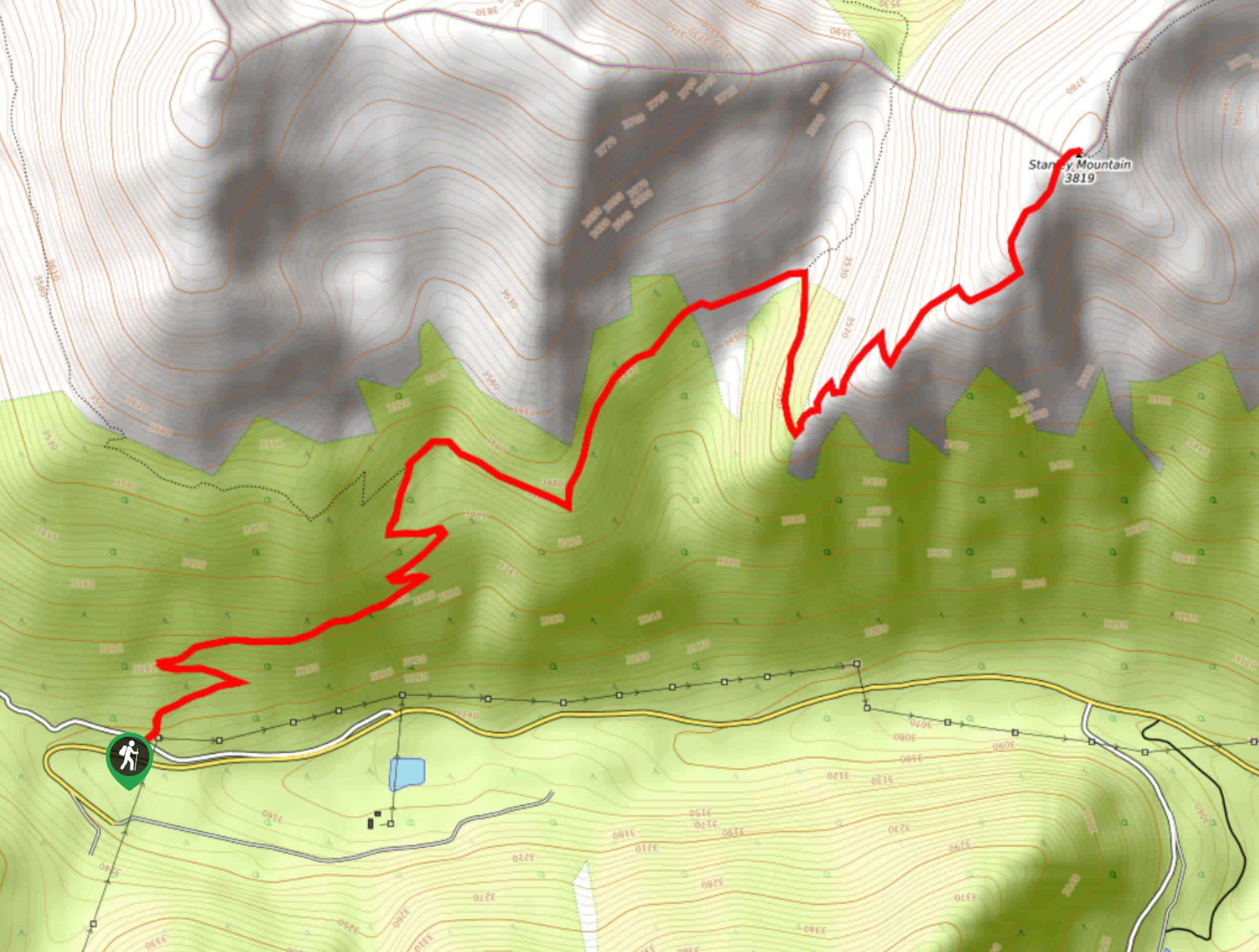
The Stanley Mountain Hike is a scenic adventure in the Arapaho National Forest. Begin from the trailhead off the Henderson Mine Road. Hike the worn path southeast through the forested terrain. Ascend the forested route, minding your footing as you trek the switchbacks. Eventually, the trail will ascend the timberline and guide you to a junction, turn right on the Berthoud Pass West Trail. Trek along the exposed ridge until you confront another intersection. Turn right up the summit trail and scramble up the rocky scree to the summit of Stanley Mountain.
Enjoy the breathtaking vistas from atop the mountain. Notice the Henderson Mine below in the southwest and Vasquez Peak in the west, across the saddle. Bask in the uninterrupted mountain views before retracing your steps down the route all the way to the trailhead.
Similar hikes to the Stanley Mountain Hike hike

Hankins Pass Hike
The Hankins Pass Hike is a quintessential adventure across the Lost Creek Wilderness. The hike demonstrates the diversity of the…

Miller Gulch Loop Trail
The Miller Gulch Loop Trail is a scenic meadowland adventure in the Pike National Forest. Hike through grassy meadows laden…

The Castle Hike
The Castle Hike is an exciting adventure up the steep, forested terrain to The Castle Rock. From atop the summit,…
Comments