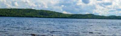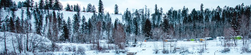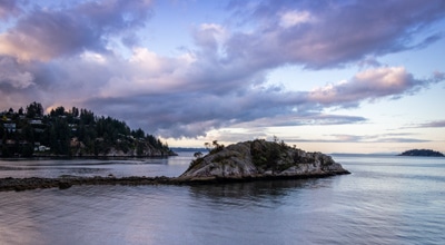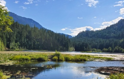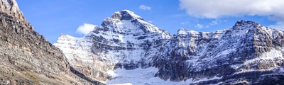
hikes in Fraser Valley
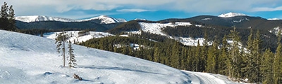
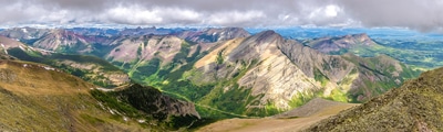
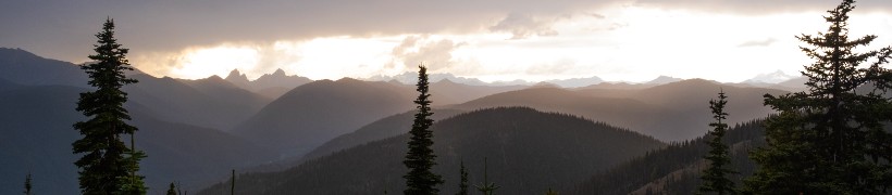
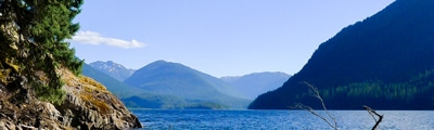
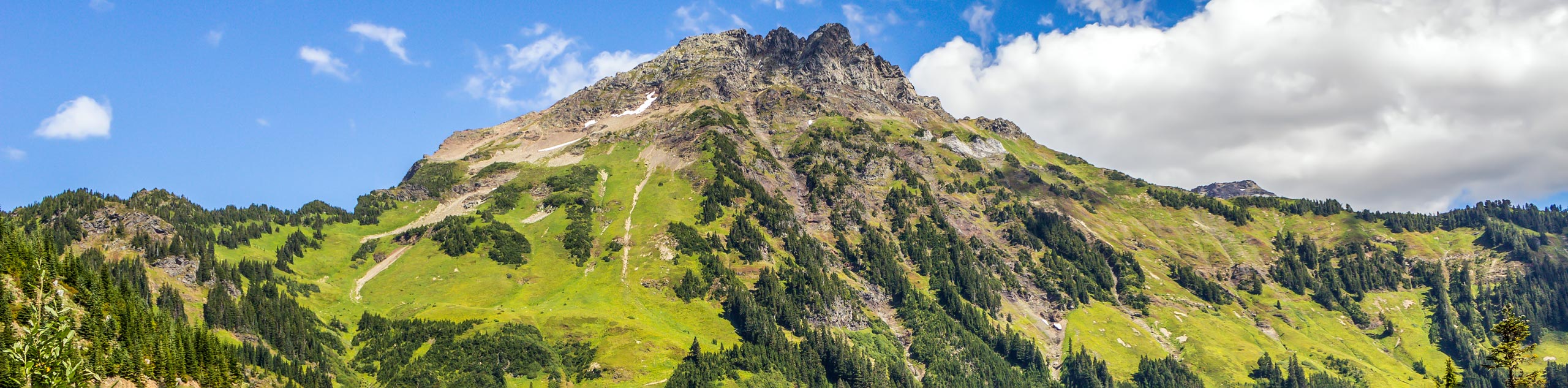
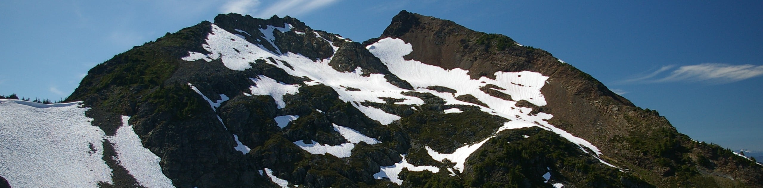
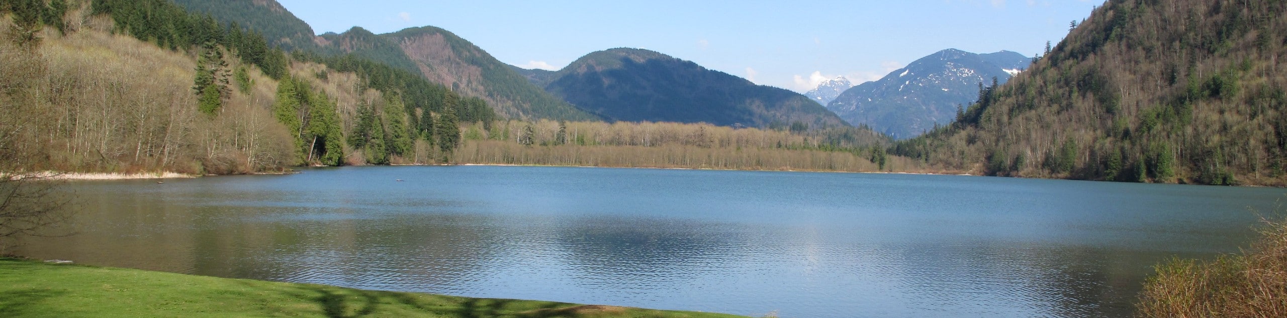
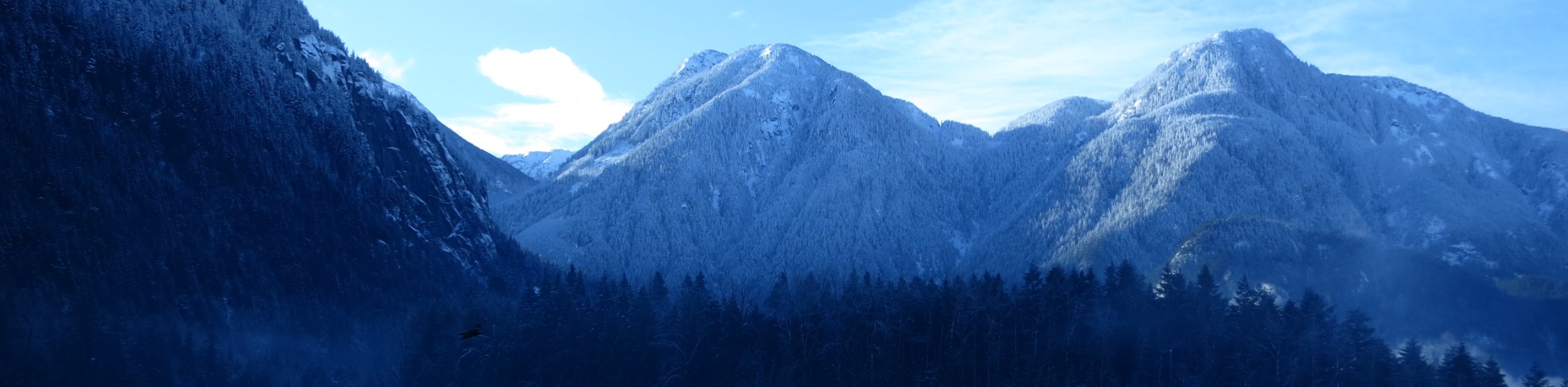
Best known as the agricultural hub of BC, the Fraser Valley is also an amazing place to plan an exciting outdoor adventure. Due to its easy accessibility from a number of relatively dense population centres and its close proximity to a variety of different landscapes, this area is a great place to get out and explore beautiful British Columbia. Centrally located along the winding banks of the Fraser River, the area offers countless options for hiking, no matter your skill level or physical fitness. From challenging summits to casual wetland walks, you will be sure to find the perfect hike to meet all of your adventure needs.
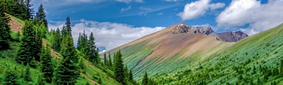
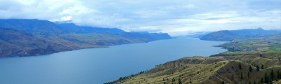
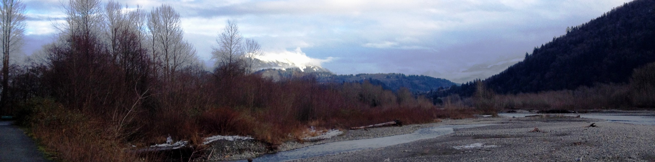
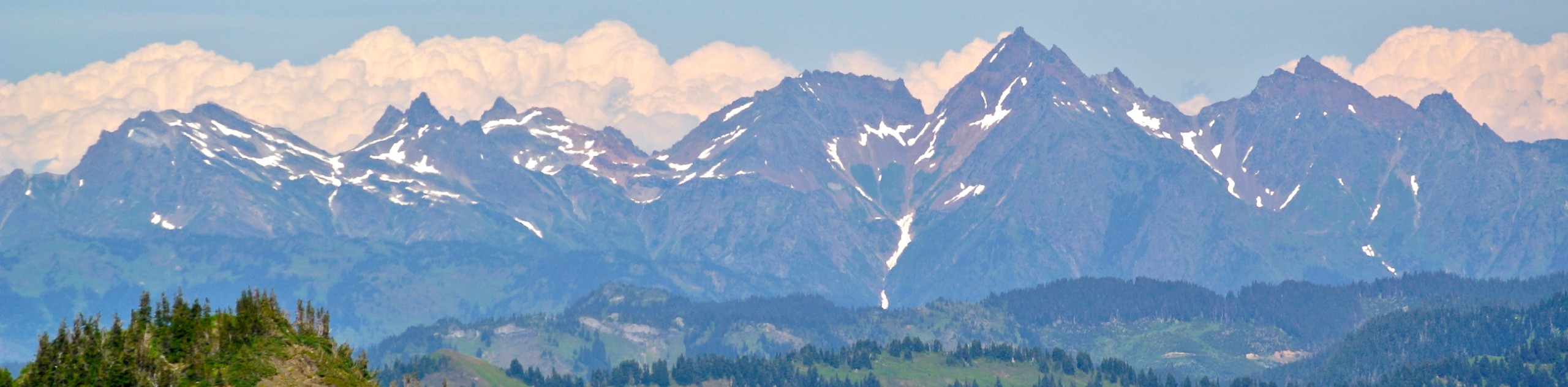
Close enough to Vancouver, yet far enough away to avoid the hustle and bustle of the city, the Fraser Valley and surrounding mountains will produce some truly breathtaking views unlike anywhere else in BC. With countless rivers, lakes, forests, and peaks spread out in every direction, there is no shortage of wild terrain for you to explore along the fringe of the valley landscape.
The 15 Greatest Hikes in the Fraser Valley
With a number of larger cities located throughout the valley and smaller communities spread out further afield, you will have no trouble accessing the amazing hiking routes that can be found in this charming region. Abbotsford, Mission, and Chilliwack all offer a number of excellent hiking routes that range from urban walkways to heavily wooded mountainsides; while smaller communities like Hope provide a more rugged experience on the peaks that tower above the coursing waters of the Fraser River. These areas provide beginner, casual, and experienced hikers with countless opportunities to explore the natural beauty of the valley without getting overly technical.
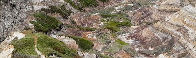
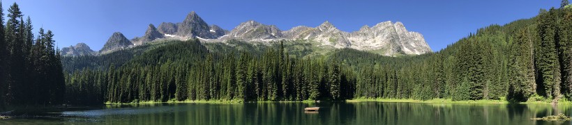
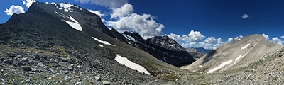
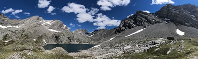
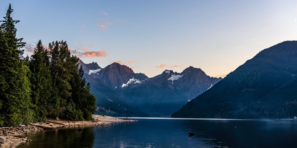
If you are looking for more of a remote experience, try heading to the southeast of the valley to explore the beautiful and challenging terrain of Chilliwack Lake Provincial Park, where you can find a number of rugged peaks with viewpoints overlooking the Canada-United States border. It doesn’t matter if you have been hiking for your entire life or if it is your first foray into the pastime, the amazing landscape of the Fraser Valley will provide you with everything that you will need for a great experience on the trails. Check out this list of popular Fraser Valley route guides below:
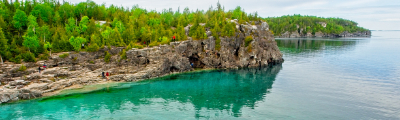
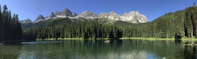
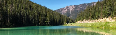
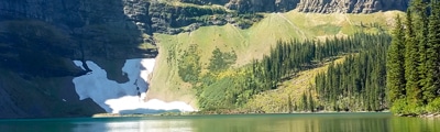
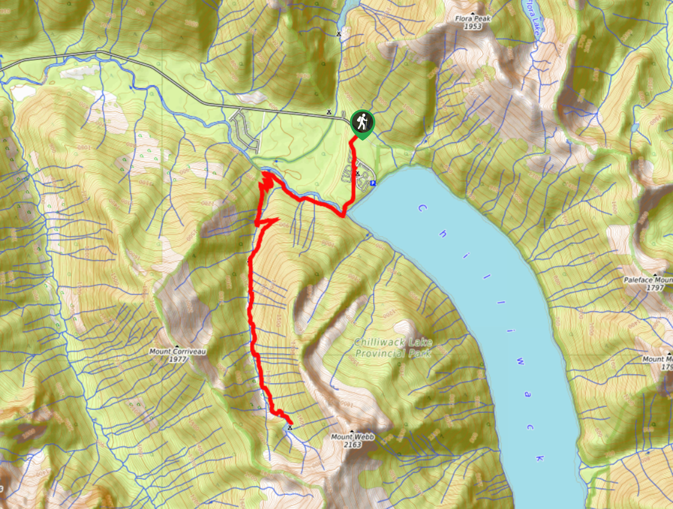
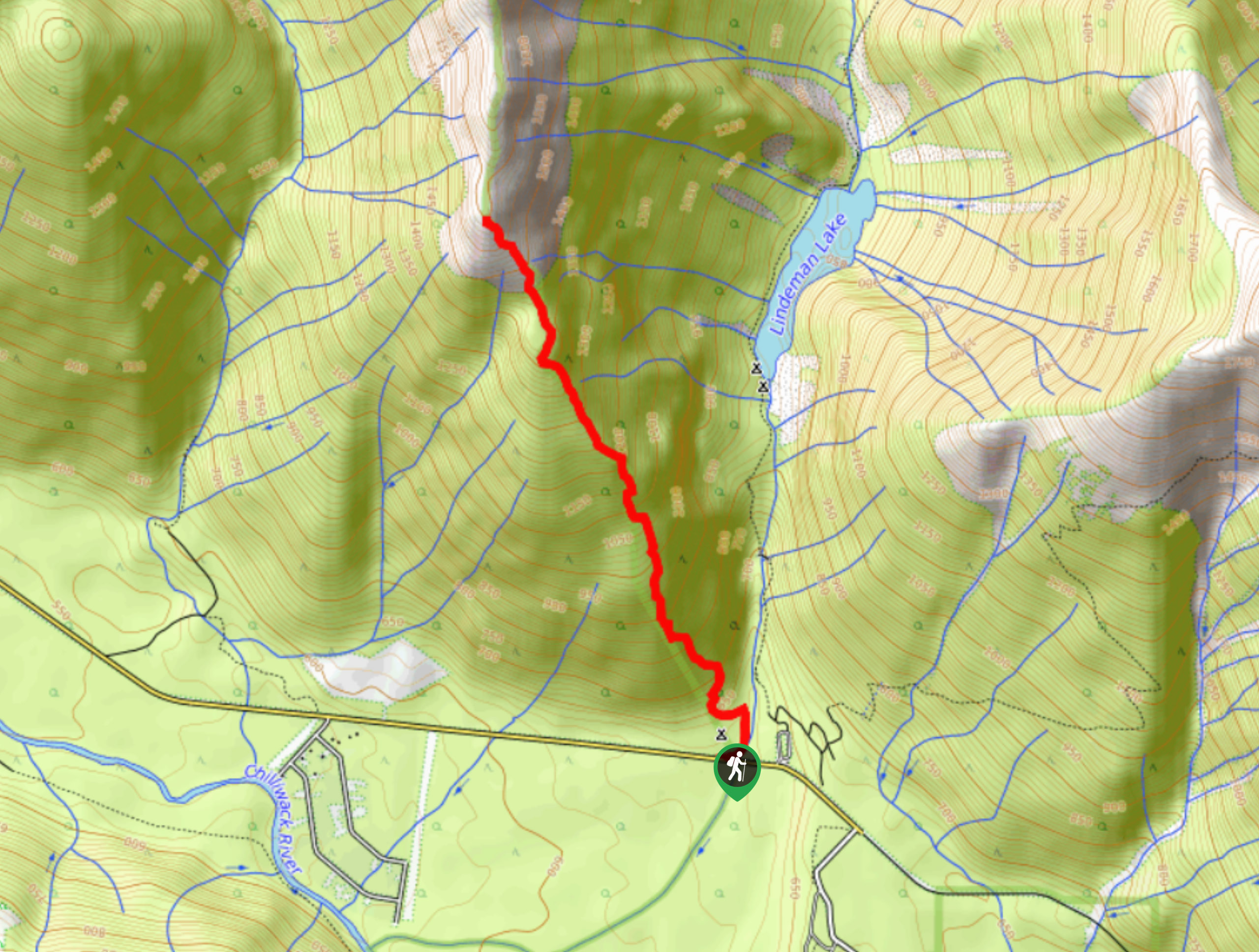
- Lindeman Lake Hike: The Lindeman Lake Trail is a great hiking route in Chilliwack Lake Provincial Park that will take you to a beautiful lakeside setting. After traversing some rugged and rocky terrain through the forest, you will arrive at the charming turquoise waters of Lindeman Lake. The lake is likely too cold to swim in, but the views are well worth the effort on this short hike.
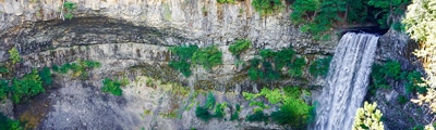
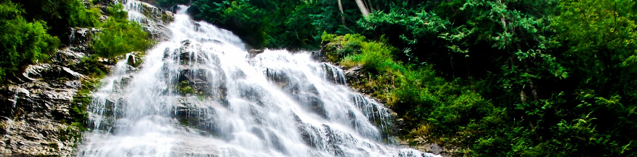
- Bridal Veil Falls Hike: This hike is a very short adventure that passes through the dense forest canopy of Bridal Veil Falls Provincial Park to visit the cascading water of the falls. This hike is an extremely popular outdoor destination for families and hikers of all skill levels due to the short distance and minimal elevation gain.
- Teapot Hill: The hike to Teapot Hill is a unique experience, as past hikers have deposited a number of old tea sets along the path that stand out in contrast to the natural beauty of the forest. The trail features several lookouts with scenic views over Cultus Lake and the Canada/United States border to the south. There are also education signs along the trail with information on local plant and animal life.
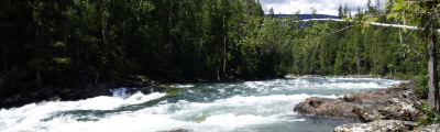
- Cascade Falls: The hike to Cascade Falls is a brief 0.4mi journey near Mission that will take you to an awesome suspension bridge overlooking a stunning waterfall. This is a great hike for families with young kids, as there is a parallel gravel road that offers easy access to the bridge for less mobile hikers.
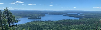
- Elk Mountain Trail: This hiking route can be found southeast of Chilliwack and climbs through a beautiful stretch of forest and over a rugged ridgeline to reach the top of Elk Mountain. Although challenging in a few areas, this trail will produce amazing views overlooking the valley below and surrounding mountain peaks. This is a very popular trail, so be sure to arrive early.
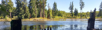
- Hicks Lake Trail: This trail is an easy 4.1mi loop trail in Sasquatch Provincial Park that will take you around a serene lake. While out on the trail you will pass through stretches of woodland terrain and cross over a number of streams that feed into the lake. This is a great hike for families and casual hikers.
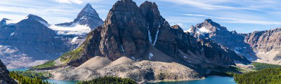
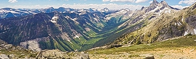
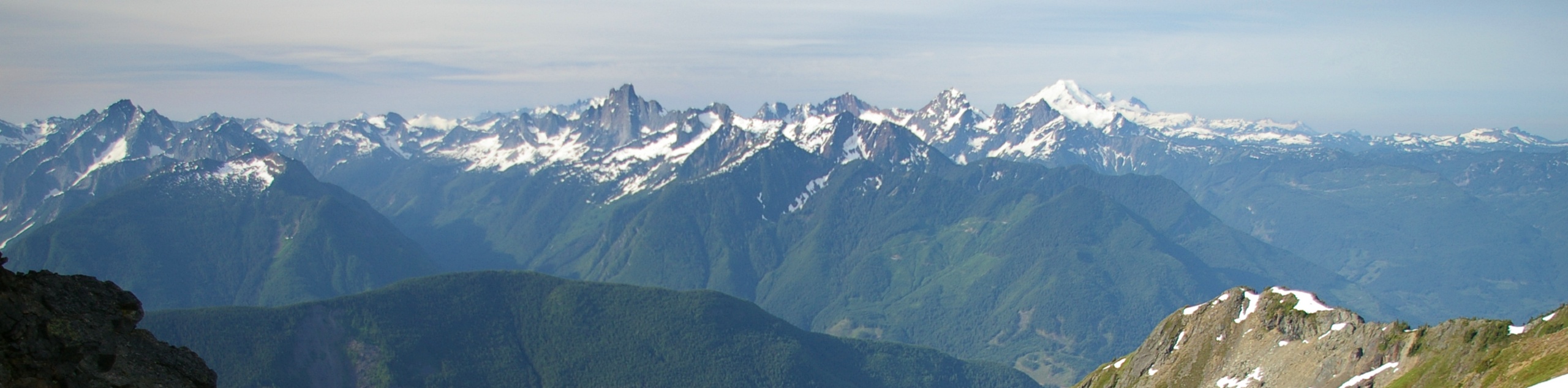
- Cheam Peak: The hike to Cheam Peak is an 5.2mi route near Bridal Falls that will take you up a steep hill to provide amazing views of the Fraser Valley. On this hike you will experience a variety of terrain that includes mountain streams, beautiful alpine meadows, and a rugged ridgeline traverse on the way to the summit of the peak. Here, you will have panoramic views that stretch from the Fraser Valley toward the Canada-United States border.
- Abby Grind Trail: This hiking route is an intense adventure that climbs a steep 1391ft over a distance of 2.1mi. Sometimes compared to the Grouse Grind in Vancouver, this trail is definitely a great workout that is a bit more on the challenging side. From the top of the trail you will have views overlooking the Fraser Valley and surrounding mountain peaks.
- Pierce Lake Trail: Hiking along the Pierce Lake Trail is a challenging experience that will test your endurance. As you make your way uphill along this 9.8mi trail, you will have breathtaking views overlooking the vast expanse of the Fraser Valley. Additionally, the area surrounding the two picturesque mountain lakes is often used as a backcountry camping spot, making for a fun weekend of camping in the mountains.
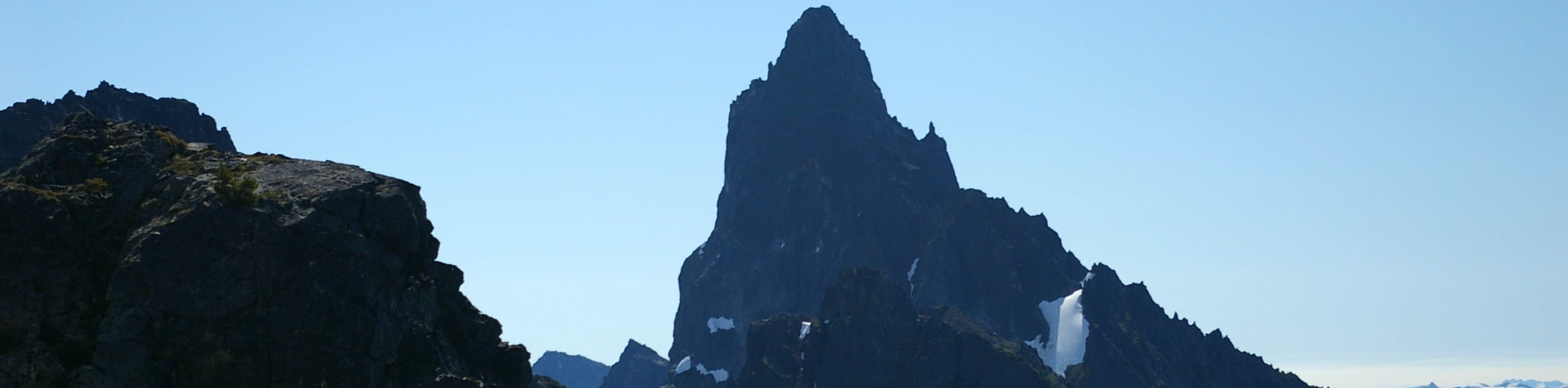
- Mount Slesse Memorial Trail: This hiking route will take you through the dense canopy of the forest to reach the 1959 crash site of Trans Canada Flight 810. This popular route climbs uphill to the memorial where hikers can still see remnants of the plane, before working up to the viewpoint overlooking Slesse Mountain and Mount Rexford.
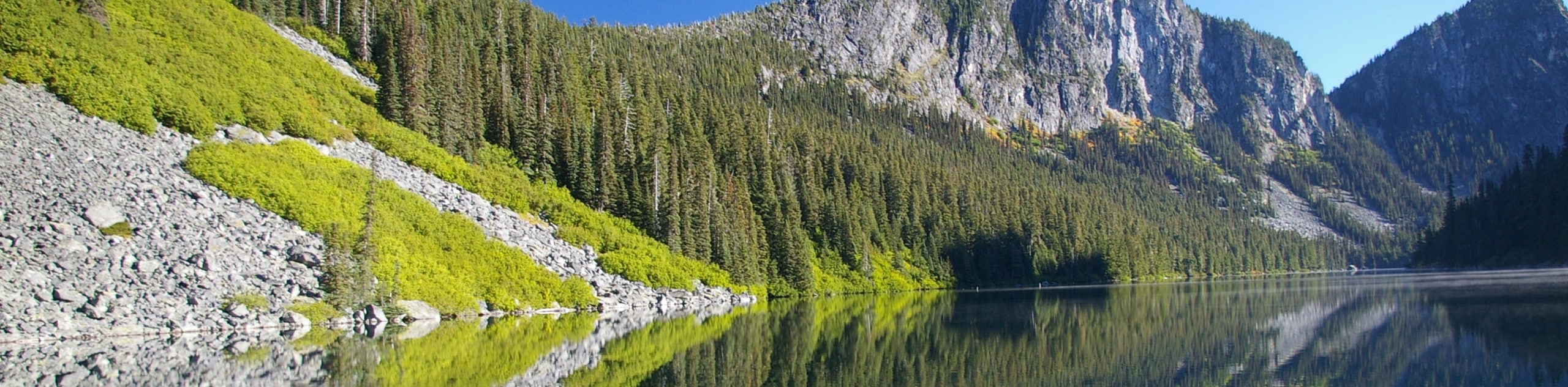
- Chadsey Lake Trail: This moderate hike near Abbotsford climbs uphill through the forest at a steady pace to visit a beautiful woodland lake, making it a great option for both casual and seasoned hikers. Enjoy the relaxing atmosphere around the lake and jump into the refreshing water to cool off on a hot day.
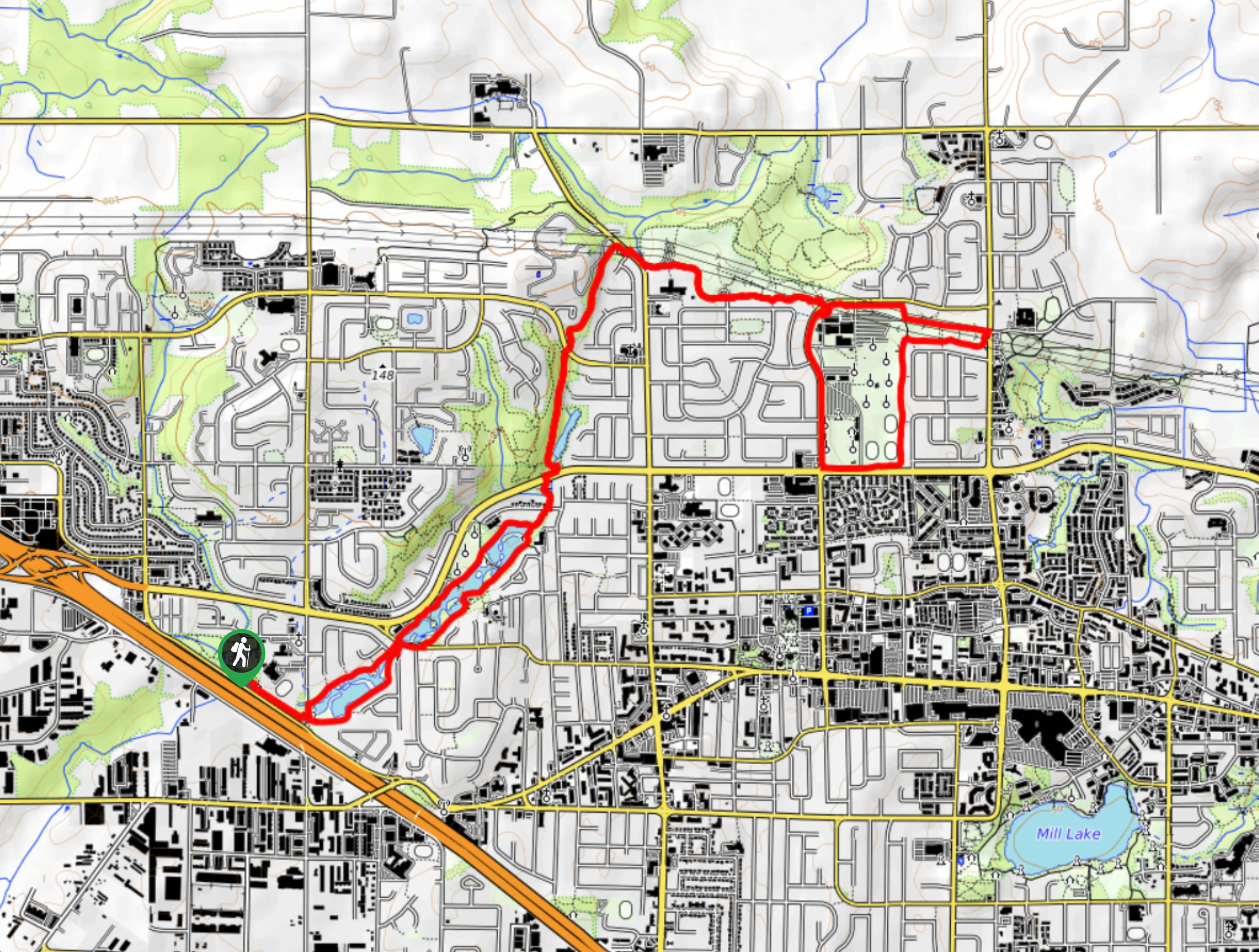
- Mill Lake Loop: This is a charming lakeside circuit in Abbotsford that provides several scenic viewpoints for spotting local wildlife. The trail passes predominantly through easy terrain, making it perfect for hikers of all skill levels and ages. There are also several picnic areas along the route to sit and relax outdoors.
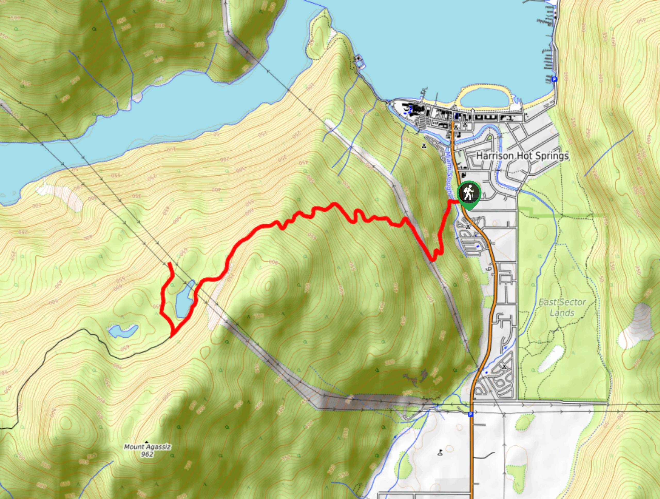
- Sumas Mountain Trail: The Sumas Mountain Trail is a rugged 10.5mi adventure that will take you through the forests near Abbotsford, BC to experience views over Chadsey Lake. From here, you will continue to the viewpoint at the summit of Sumas Mountain to enjoy views over the Fraser Valley, including the Fraser River and the cities that can be found along its length.
- Weaver Lake Trail: This popular hiking loop trail near Chilliwack meanders around a charming woodland lake and takes you across a variety of terrain to produce some scenic views across the water. This relaxed hike is a great adventure for those that enjoy a bit of variation in their route without too much in the way of difficulty.
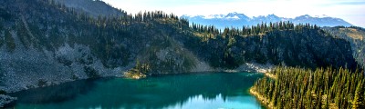
- Lindeman and Greendrop Lakes Trail: This 6.8mi hiking route will take you through Chilliwack Lake Provincial Park to experience dense forests and rocky terrain on the way to reach two beautiful woodland lakes. Here, you will have wonderfully scenic views over the water that are reward enough for setting out on this tough and technical trail. Each of these lakes offer the opportunity to camp overnight, making this a great option for a multi-day trek in the backcountry.
When is the Best Time to Hike in the Fraser Valley
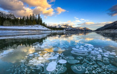
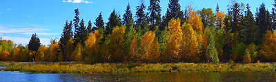
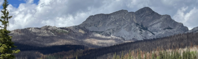
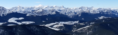
Each of the four seasons in the Fraser Valley has its own charm, providing a constantly changing backdrop of scenery that can truly be experienced at any time of the year. Depending on your agenda, hiking experience, and fitness level, you might want to avoid visiting the area during the winter, as many of the higher peaks that can be hiked during the summer will increase in difficulty. The increased water levels in the spring mean that rivers and waterfalls will be more prominent, creating some dramatic views that you won’t want to miss. Alternatively, the summer season provides the driest weather for hiking, meaning you will safely and comfortably be able to navigate the trails - so long as you stay protected from the sun!
Other Outdoor Activities in the Fraser Valley
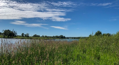
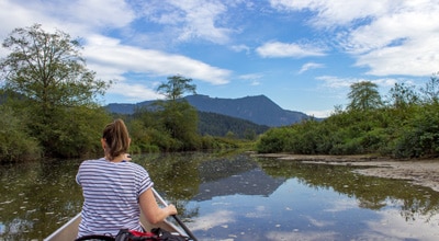
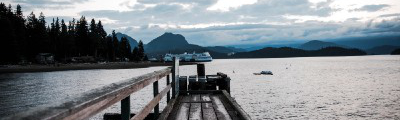
With access to a wide range of terrain that includes rugged mountain peaks, vast swathes of forest, winding rivers, and scenic wetlands; there is virtually no limit on the number of activities that can be experienced in the Fraser Valley. Whether you are looking to fish in one of the area’s many waterways, go boating on a scenic lake, navigate some craggy terrain while rock climbing, or go paragliding high above the valley floor; you can rest assured knowing that the possibilities for adventure travel in the Fraser Valley are almost endless.
Frequently Asked Questions About the Fraser Valley
What is the Fraser Valley known for?
The Fraser Valley is a fertile tract of land that is characterized by the winding river along the valley floor and the steep mountain slopes that flank it on either side. Due to the high levels of nutrients in the soil and excellent transportation routes, this area is known to be the agricultural heart of British Columbia. Here, you can find countless farms, dairies, and vineyards that help supply both the province and the rest of the world with great food products.
What cities can be found in the Fraser Valley?
The Fraser Valley is a vast area of land along the winding banks of the Fraser River that includes eight unincorporated electoral areas and six municipalities. These include: Abbotsford, Chilliwack, Harrison Hot Springs, Hope Kent, and Mission. These are all found in relatively close proximity to the river and provide great access to outdoor activities across the surrounding landscape.
Read MoreThe best hikes in Fraser Valley

01. Lindeman Lake Trail
Difficulty
The Lindeman Lake Trail is a 2.2mi out-and-back hiking route in Chilliwack Lake… Read More
02. Bridal Veil Falls
Difficulty
The hike to Bridal Veil Falls is a very short 0.6mi out-and-back hiking… Read More
03. Cascade Falls
Difficulty
The trail to Cascade Falls is a short 0.4mi out-and-back hiking route north… Read More
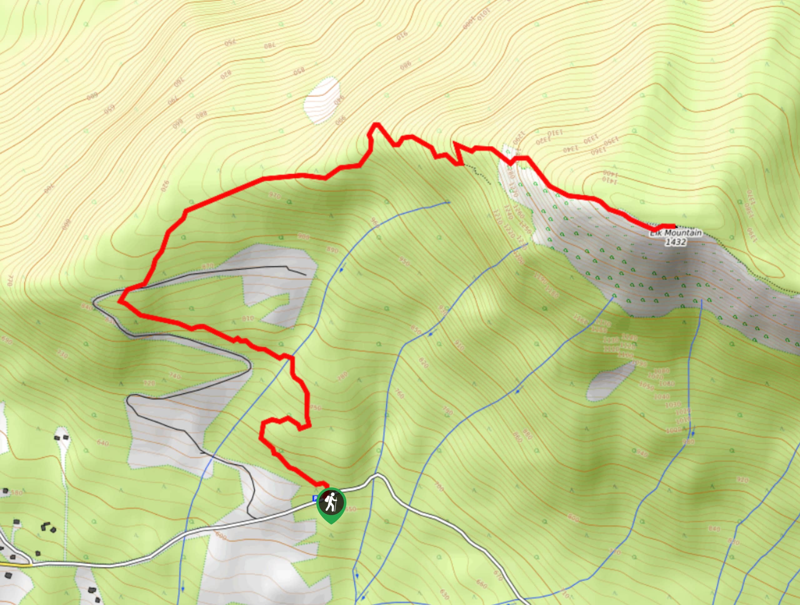
04. Elk Mountain Trail
Difficulty
The Elk Mountain Trail can be found southeast of Chilliwack and climbs uphill through the… Read More
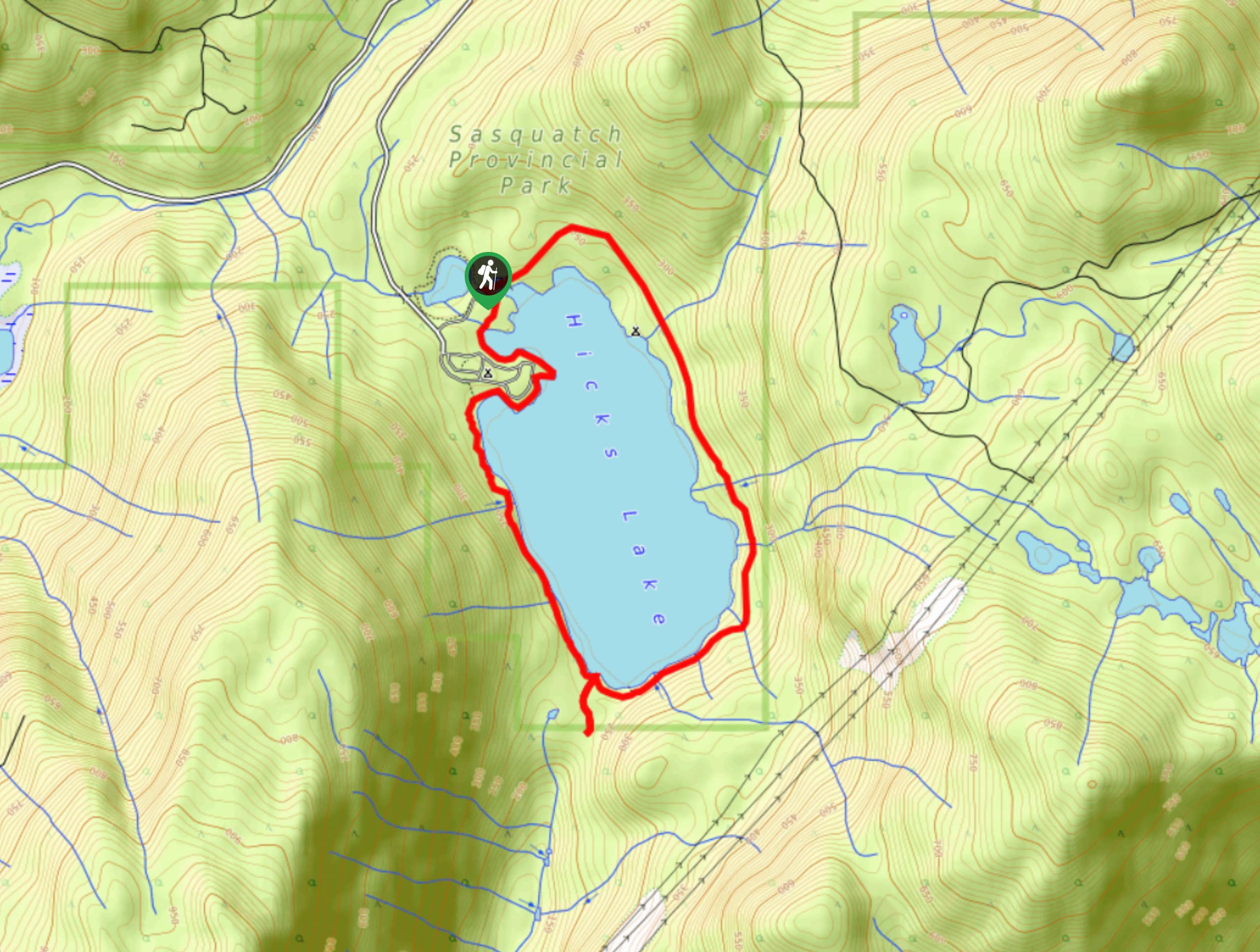
05. Hicks Lake Trail
Difficulty
The Hicks Lake Trail is an easy 4.1mi loop trail in Sasquatch Provincial… Read More
06. Mount Cheam
Difficulty
The hike to Cheam Peak is an 5.2mi out-and-back hiking route near Bridal… Read More
07. Abby Grind Trail
Difficulty
The Abby Grind Trail is an out-and-back hiking route that climbs a sharp 1391ft Read More
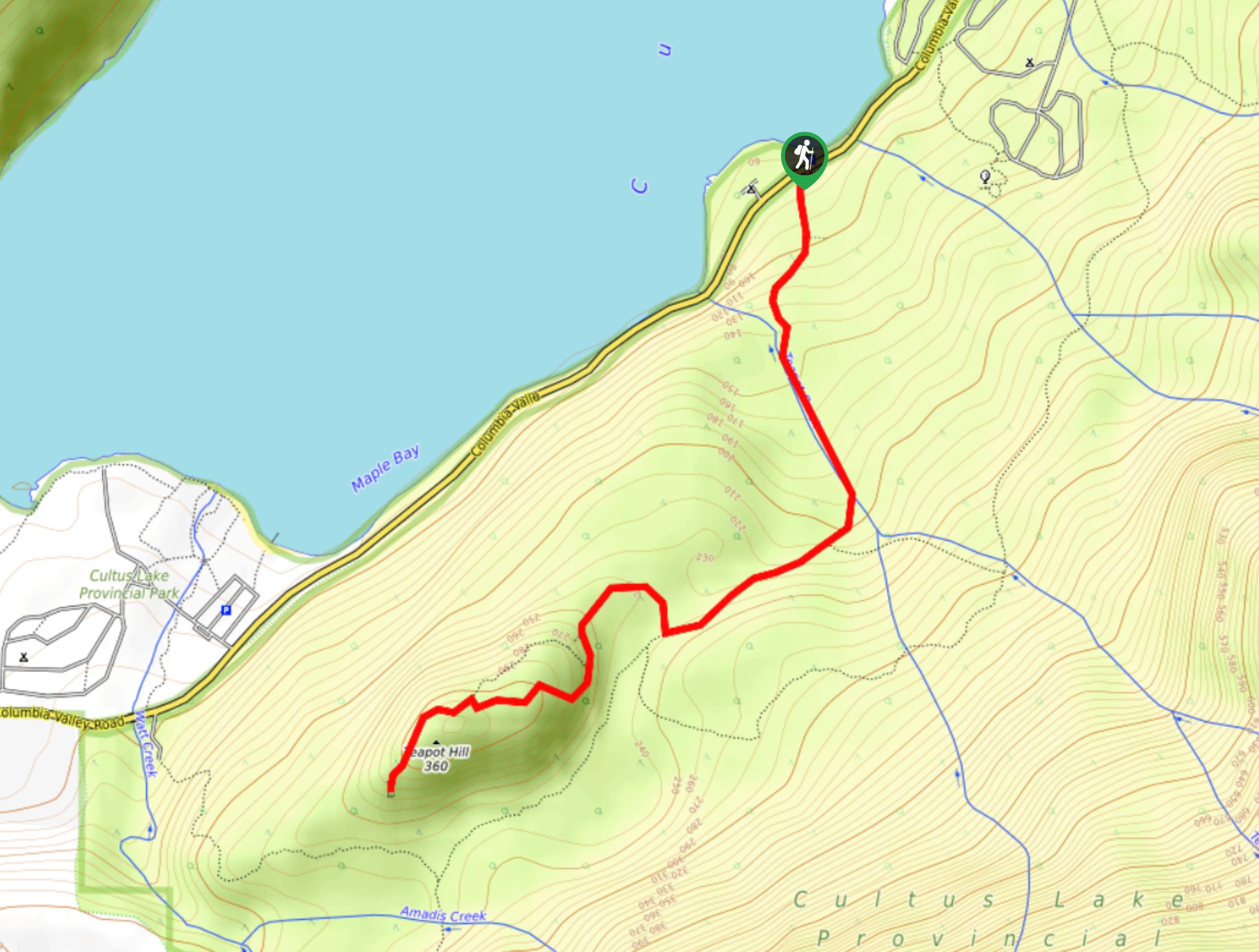
08. Teapot Hill
Difficulty
Hiking along the trail to Teapot Hill is a unique experience due to the numerous… Read More
09. Lindeman and Greendrop Lakes Trail
Difficulty
The Lindeman and Greendrop Lakes Trail is a 6.8mi out-and-back hiking route in… Read More
10. Chadsey Lake Trail
Difficulty
The Chadsey Lake Trail is a moderately difficult out-and-back trail near Abbotsford that climbs through… Read More
Yes, there are more than 10
Fraser Valley is so beautiful that we can not give you only 10 hikes. So here is a list of bonus hikes in Fraser Valley that you should take a look at as well
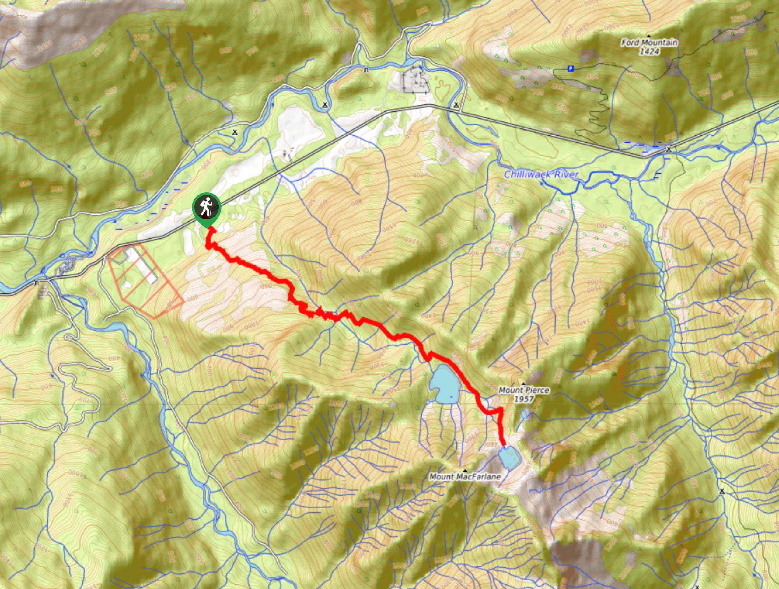
11. Pierce Lake Trail
Difficulty
Hike along the Pierce Lake Trail to experience a challenging hiking route that will tire… Read More
12. Mount Slesse Memorial Trail
Difficulty
The Mount Slesse Memorial Trail is a 9.5mi out-and-back hiking route that travels… Read More
13. Eaton Lake Trail
Difficulty
The Eaton Lake Trail is a difficult out-and-back trail that climbs 7.4mi uphill… Read More
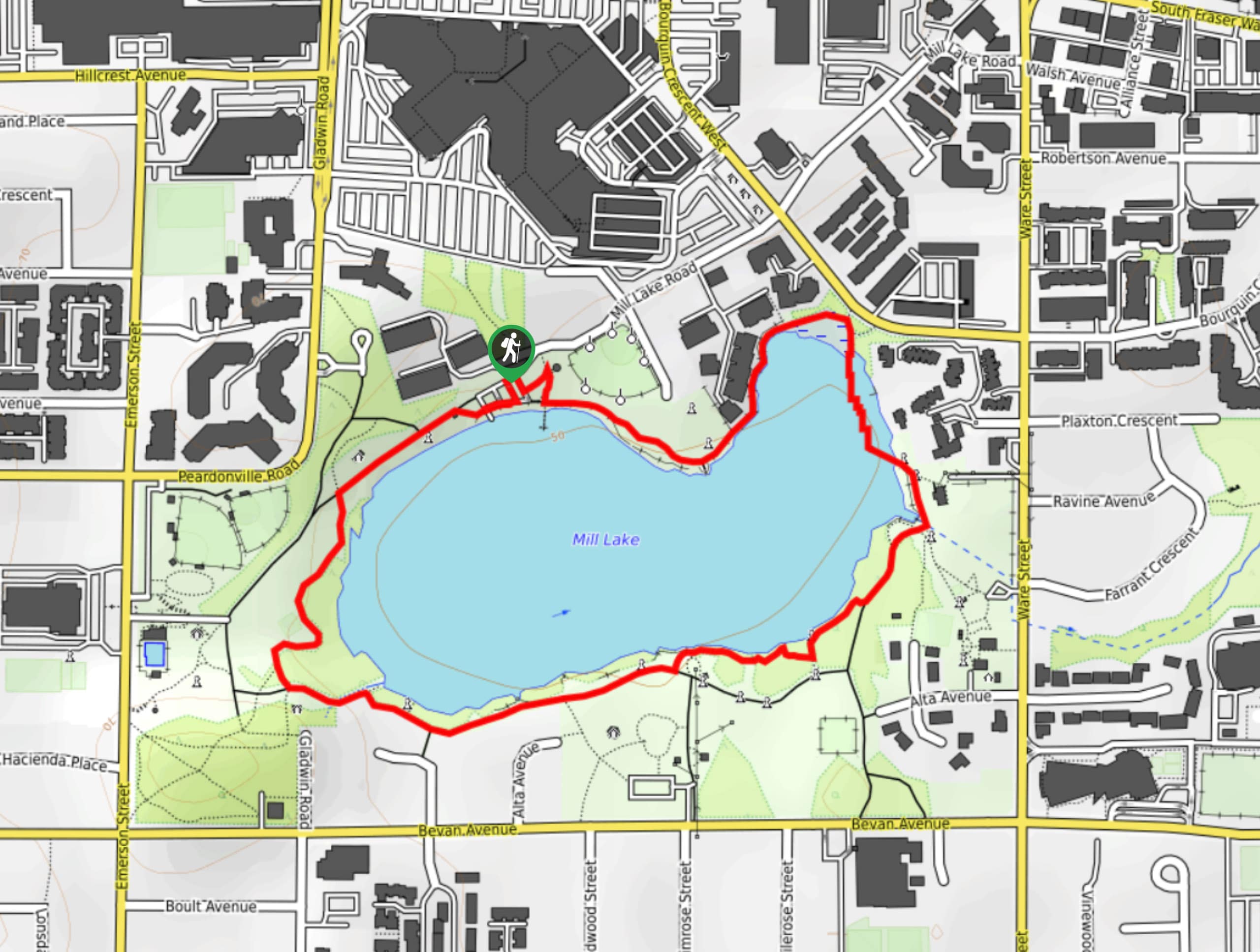
14. Mill Lake Loop
Difficulty
The Mill Lake Loop is a charming lakeside circuit in Abbotsford that travels around the… Read More
15. Sumas Mountain Trail
Difficulty
The Sumas Mountain Trail is a 10.5mi out-and-back hiking route that climbs through… Read More
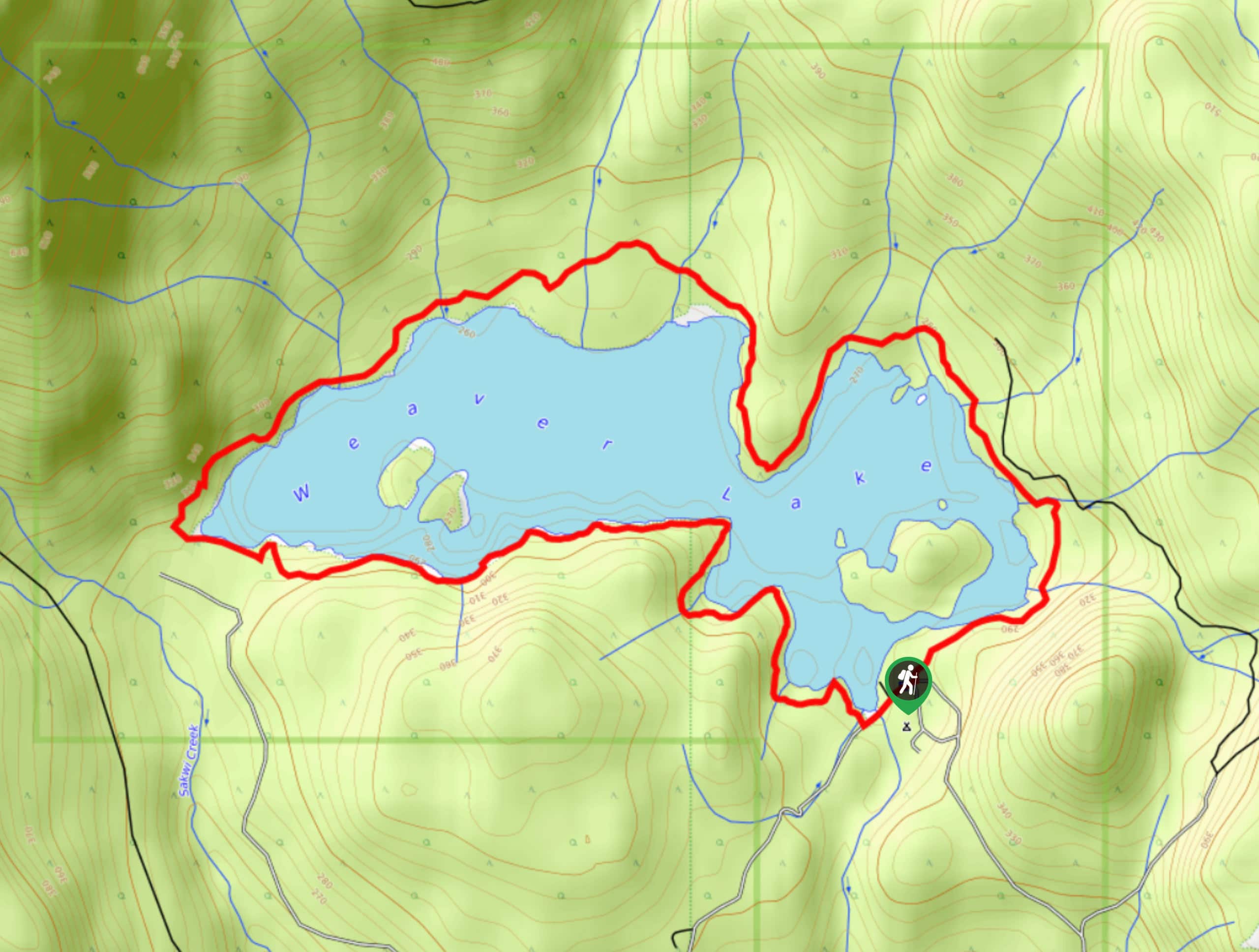
16. Weaver Lake Trail
Difficulty
The Weaver Lake Trail is a popular 4.6mi loop trail near Chilliwack that… Read More
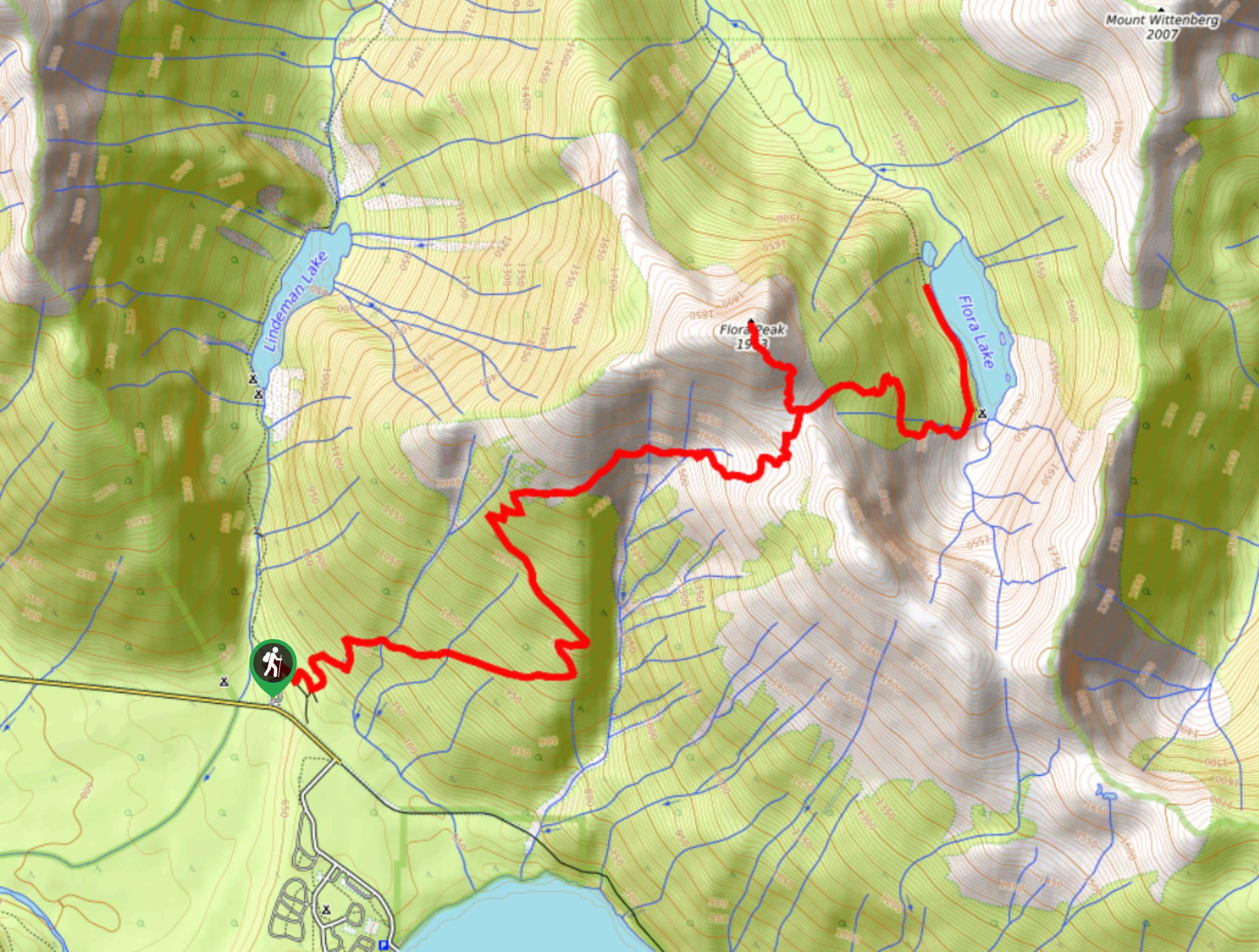
17. Flora Lake Trail
Difficulty
The Flora Lake Trail is a difficult 9.5mi out-and-back hiking route that will… Read More

18. Othello Tunnels via Kettle Valley Trail
Difficulty
Visit the Othello Tunnels via Kettle Valley Trail as you hike alongside the rushing waters… Read More
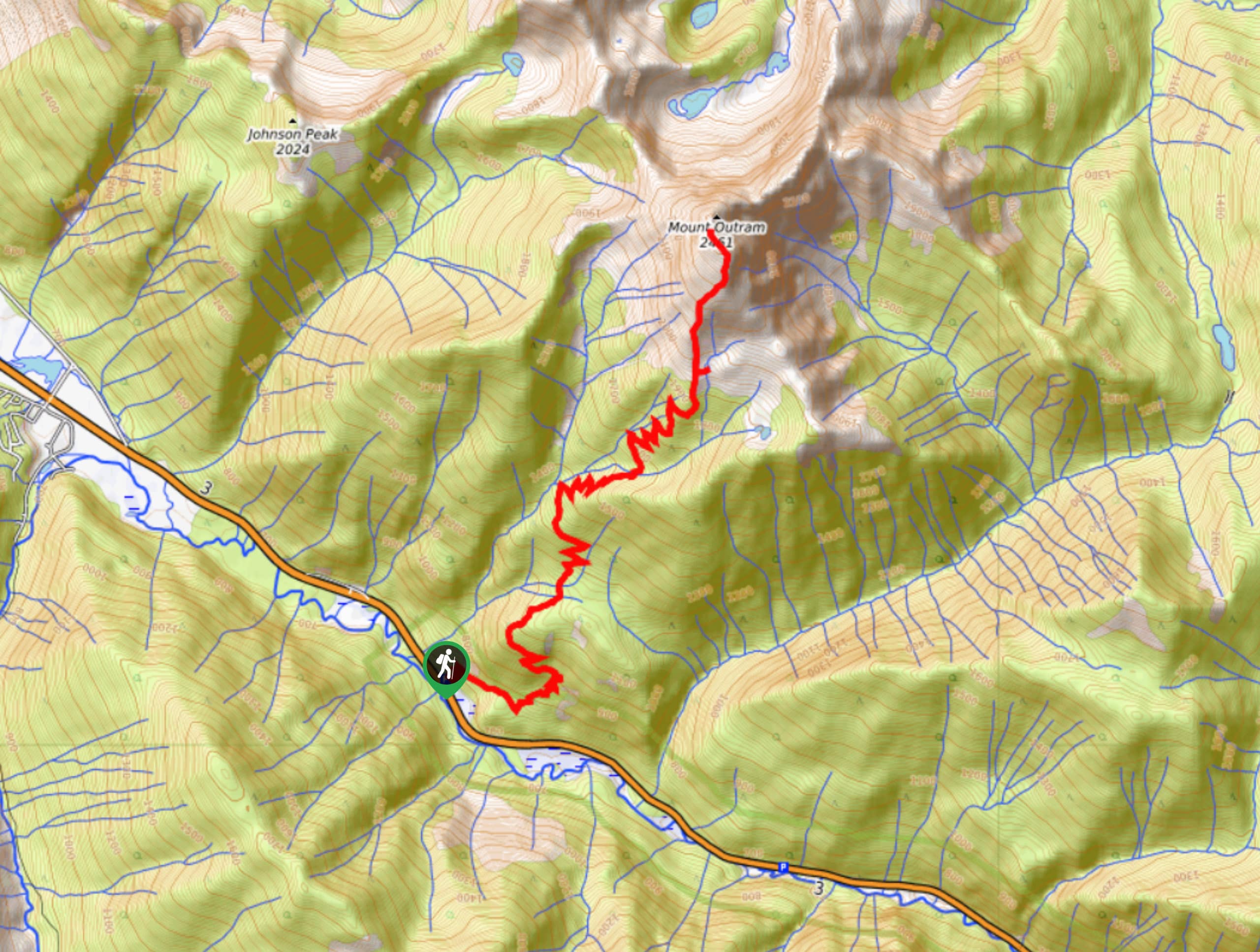
19. Mount Outram Trail
Difficulty
The Mount Outram Trail is an 11.5mi out-and-back hiking route near E.C. Manning… Read More
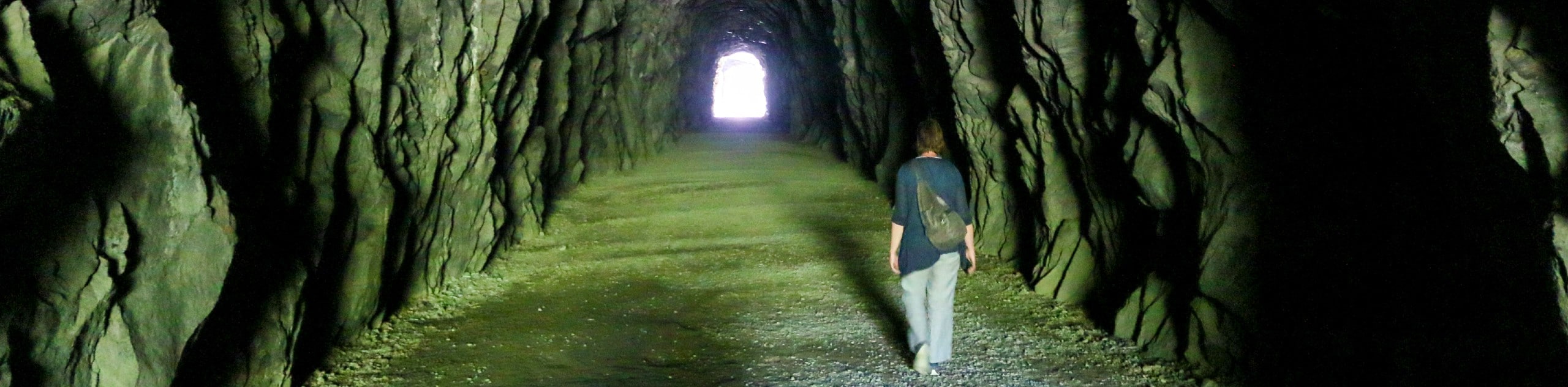
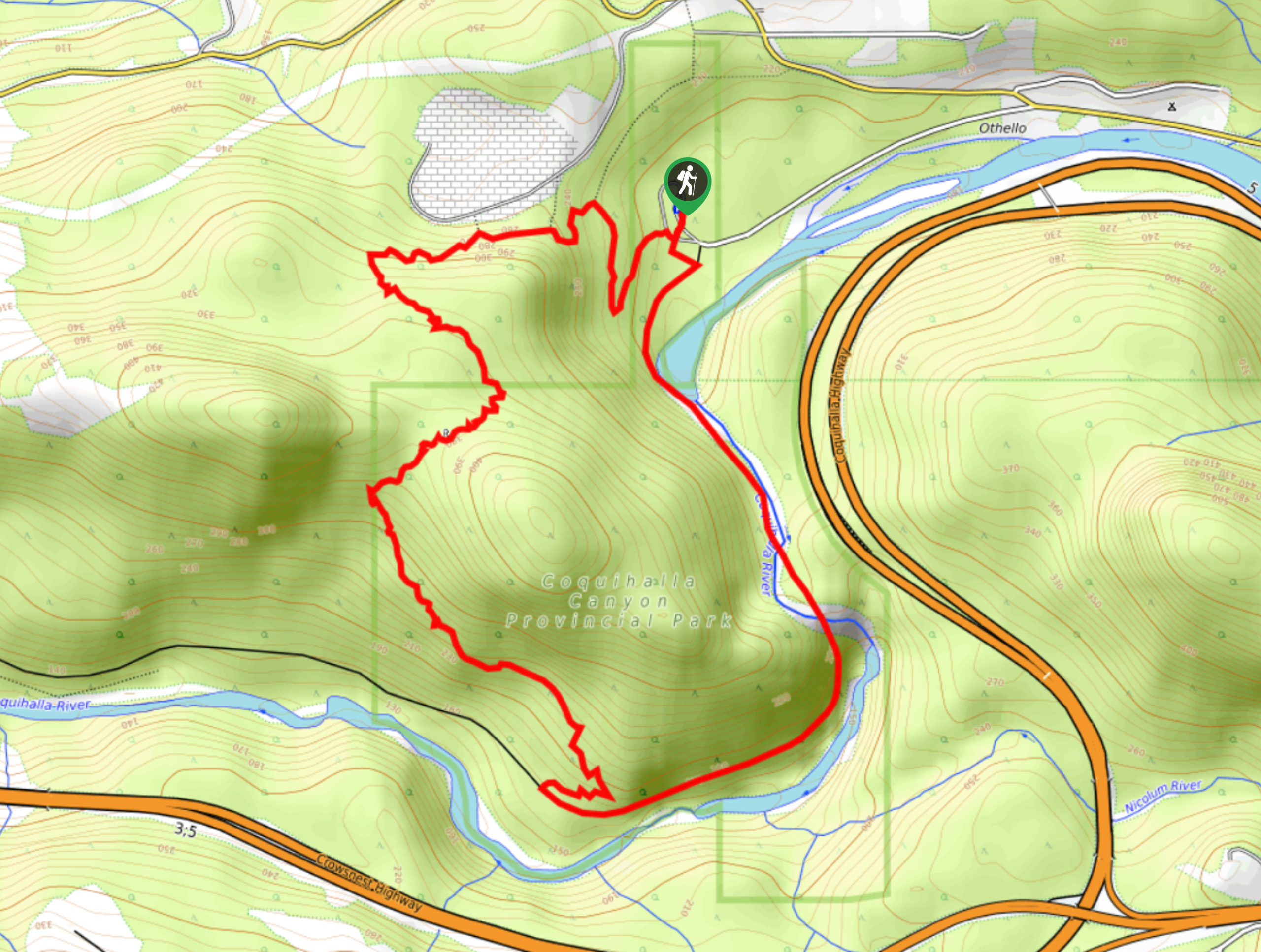
20. Othello Tunnels
Difficulty
The Othello Tunnels is a 1.1mi out-and-back hiking route near Hope that travels… Read More
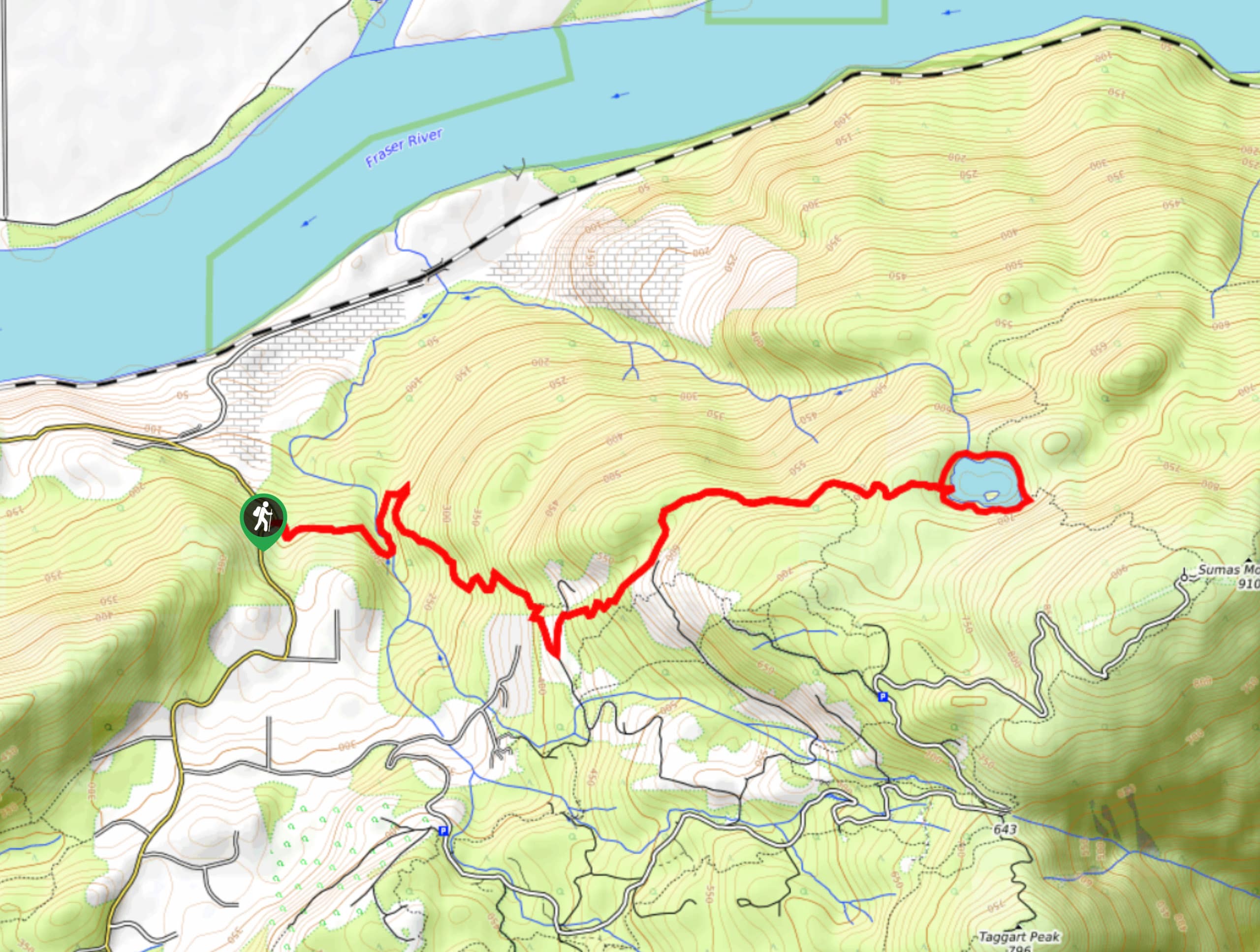
21. Mount MacFarlane Trail
Difficulty
The Mount MacFarlane Trail is a difficult 12.0mi out-and-back route in the Fraser… Read More
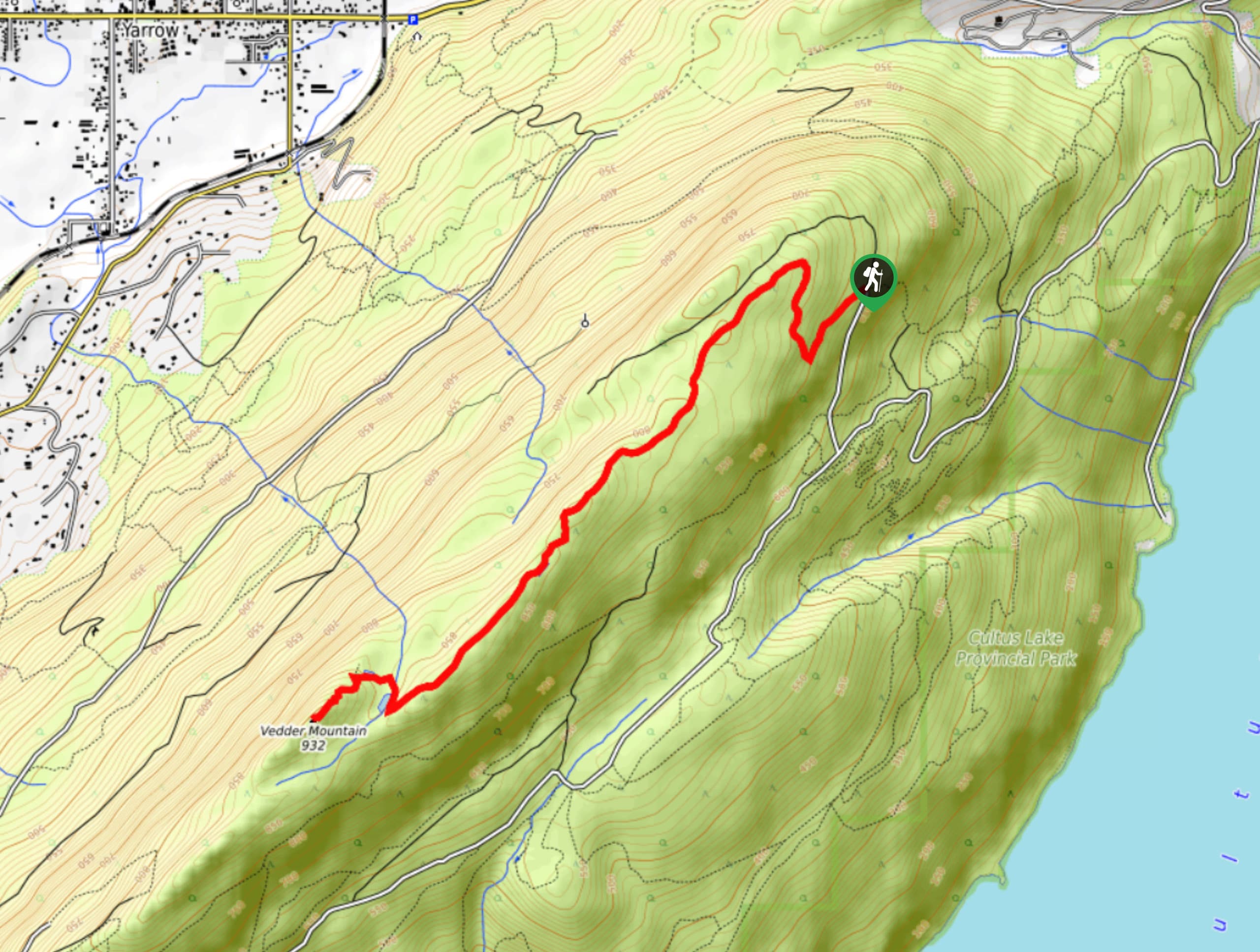
22. Vedder Mountain Ridge Trail
Difficulty
The Vedder Mountain Ridge Trail is a moderate out-and-back hiking route near Chilliwack that has… Read More
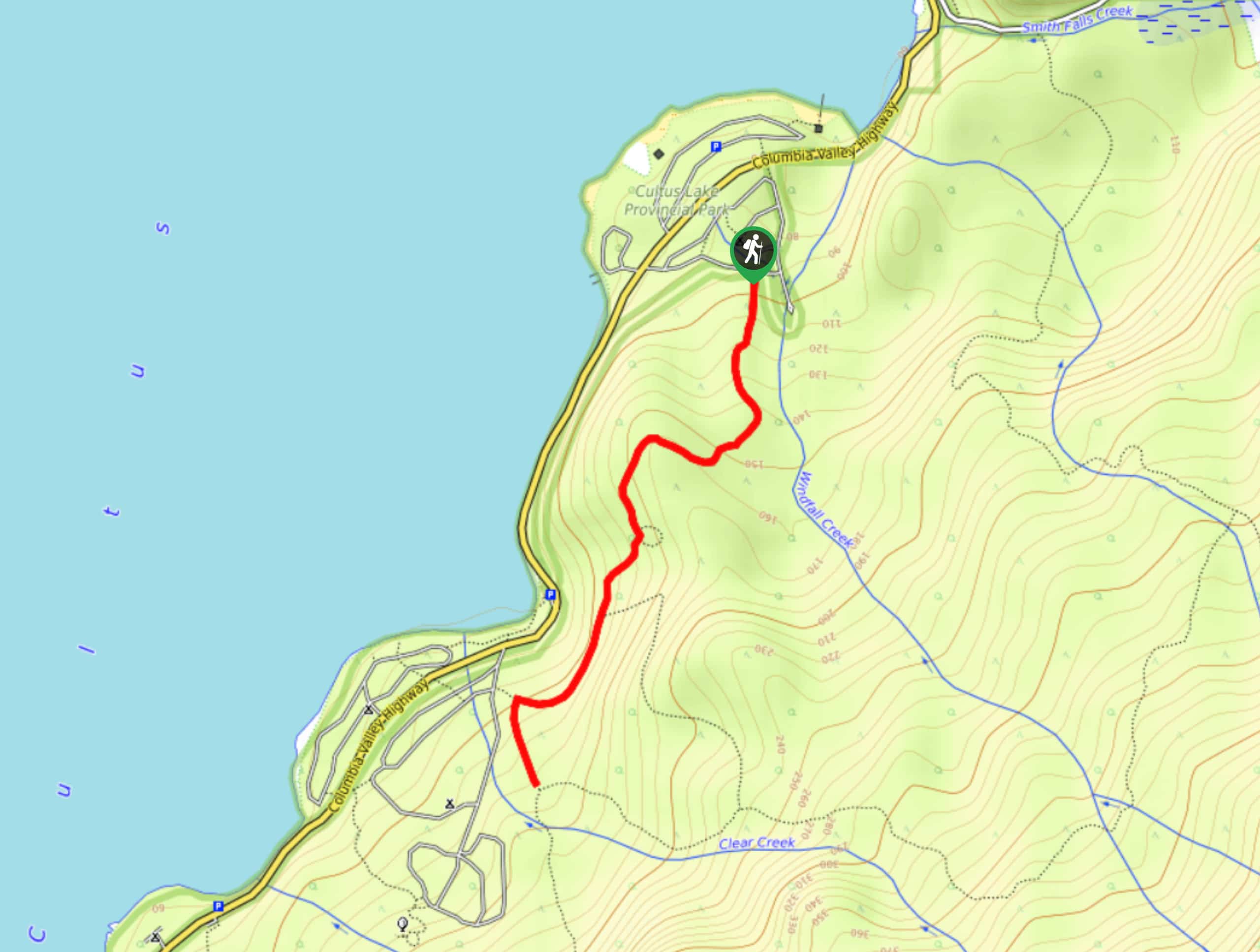
23. Seven Sisters Trail
Difficulty
The Seven Sisters Trail is a scenic out-and-back hiking route in Cultus Lake Provincial Park… Read More
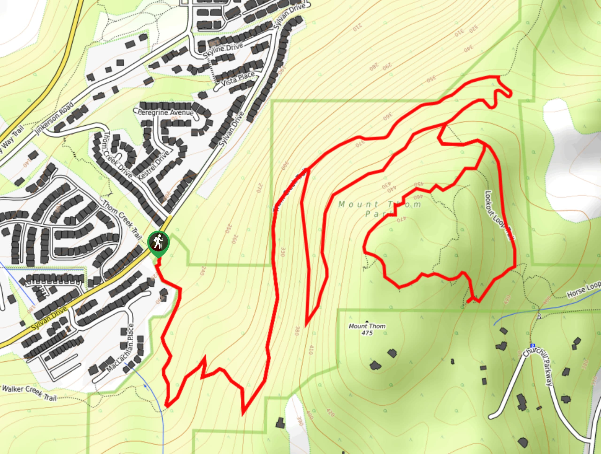
24. Mount Thom
Difficulty
The hike to Mount Thom is a heavily-trafficked out-and-back route that is part of a… Read More
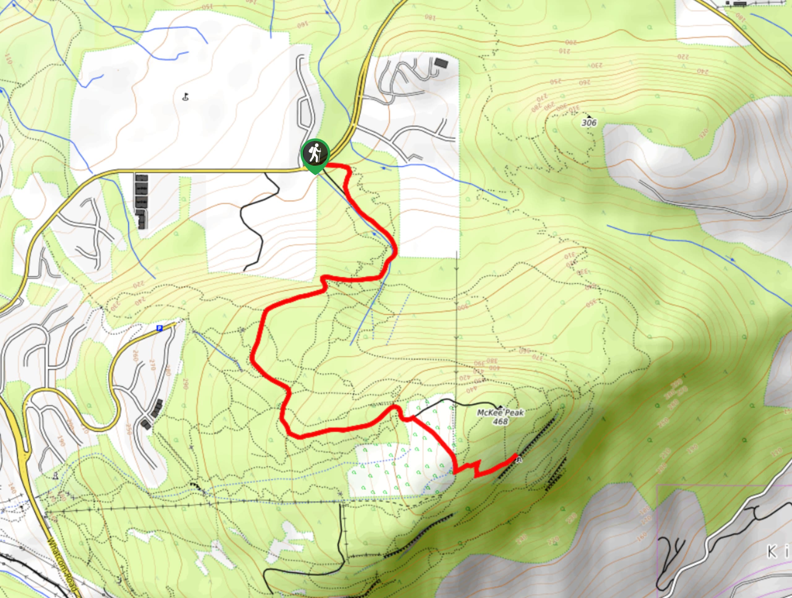
25. McKee Peak Trail
Difficulty
The McKee Peak Trail is a moderate hike that climbs uphill through a dense network… Read More
26. Deer Lake
Difficulty
Hiking around Deer Lake on this 2.0mi trail will take you along the… Read More
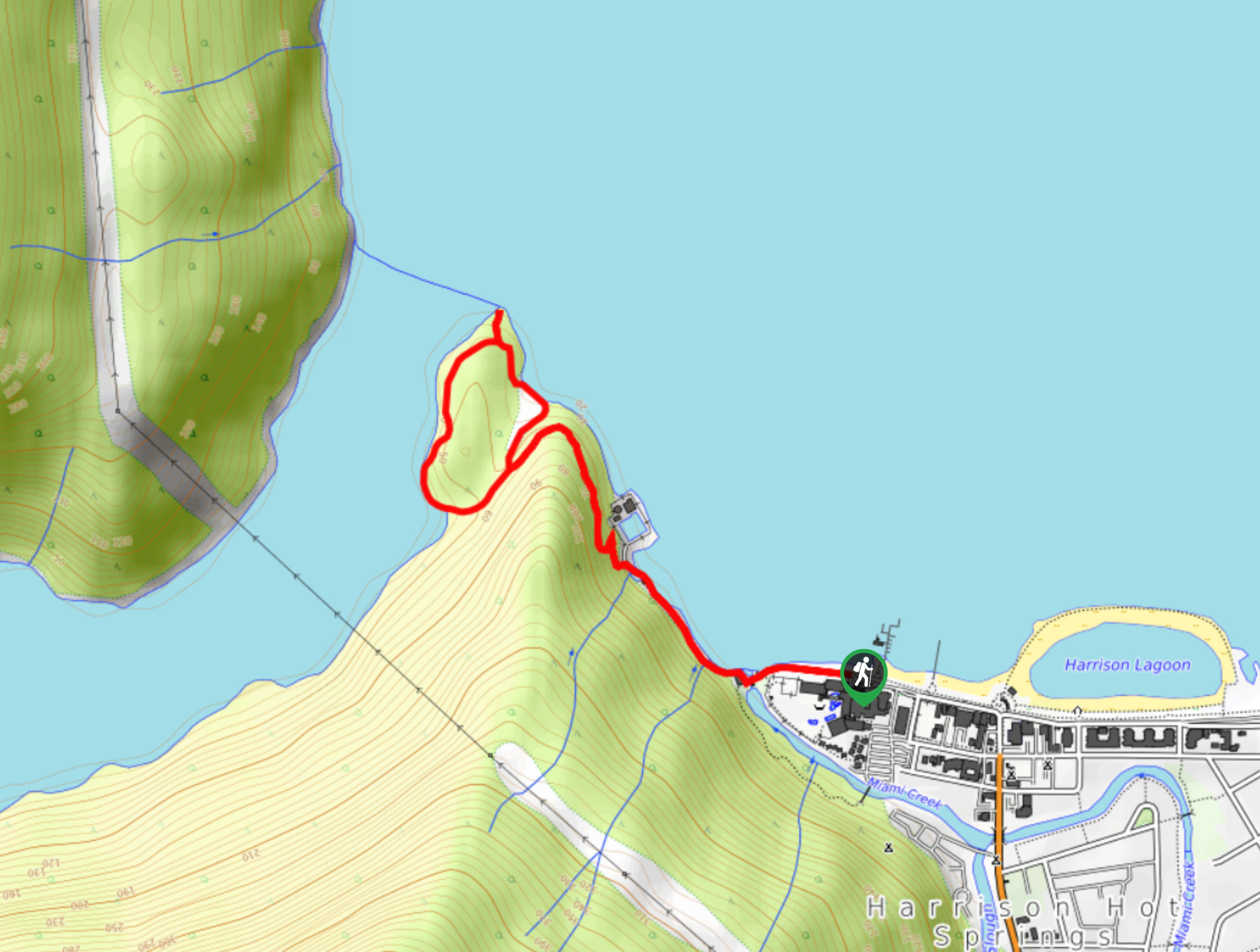
27. Sandy Cove Trail
Difficulty
The Sandy Cove Trail is a peaceful forest hike near Harrison Hot Springs that will… Read More
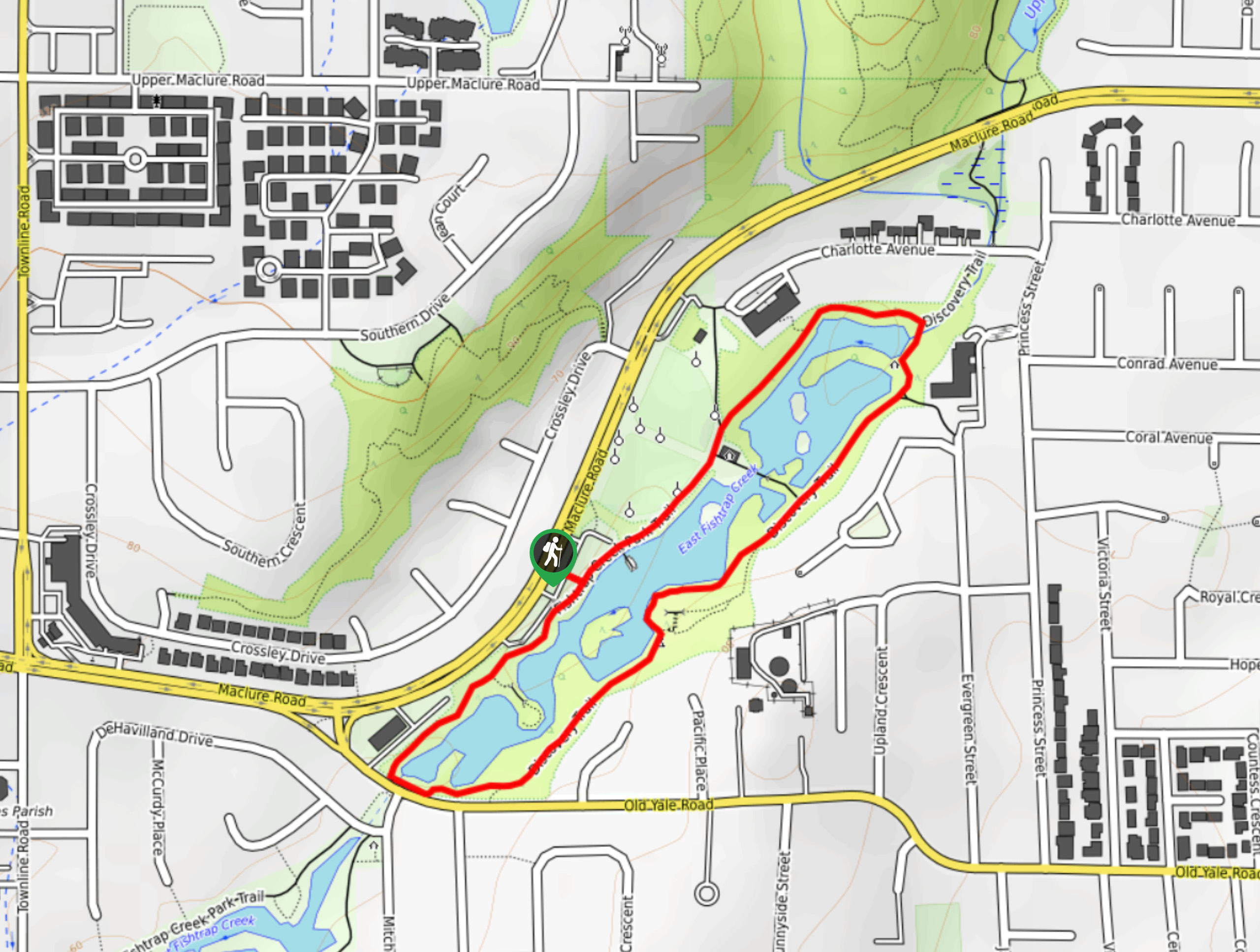
28. Discovery Trail
Difficulty
The Discovery Trail is an exciting 7.7mi loop trail in Abbotsford, BC that… Read More
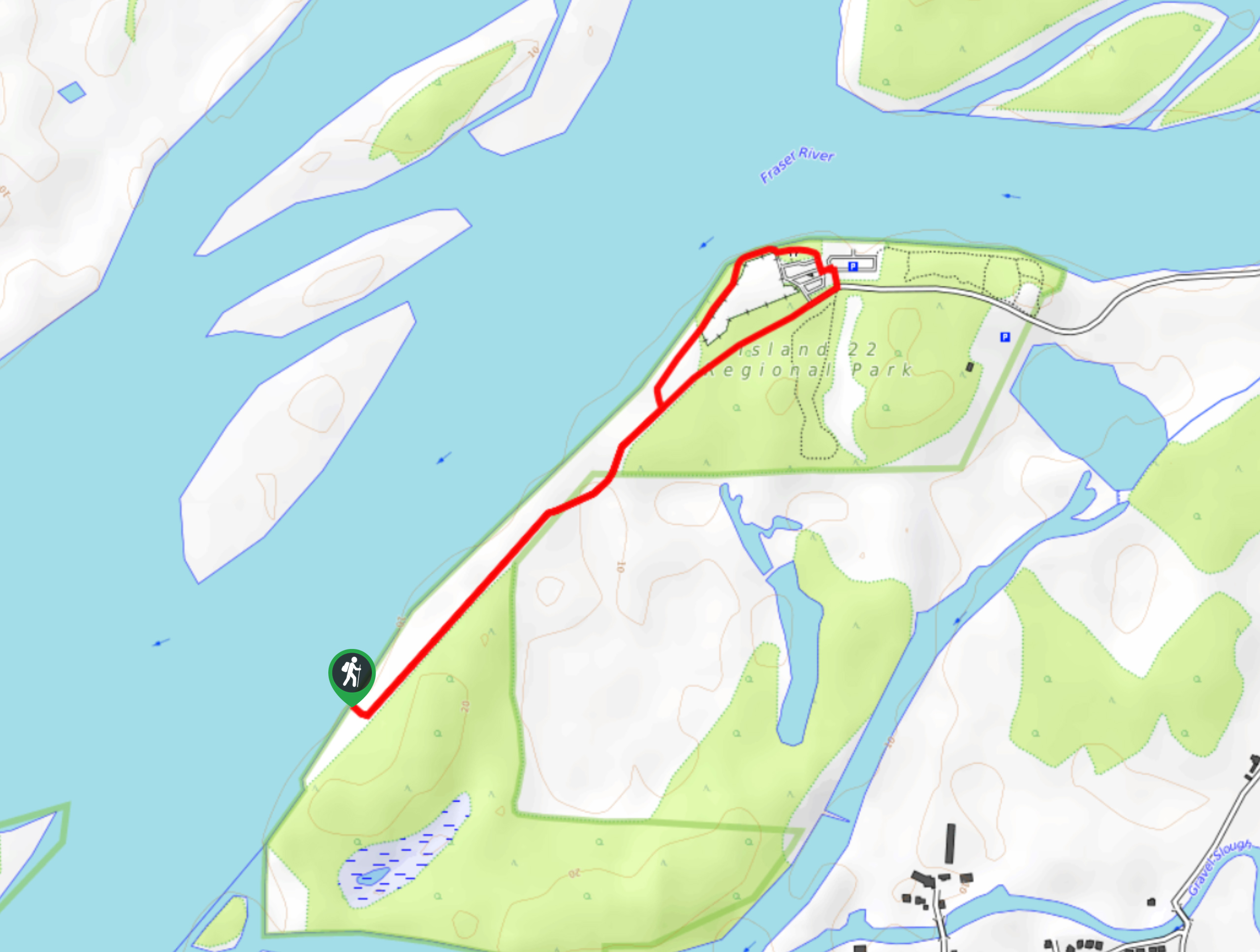
29. Island 22 Regional Park Trail
Difficulty
The Island 22 Regional Park Trail is a 2.0mi out-and-back hiking route that… Read More
30. Hunter Trail
Difficulty
The Hunter Trail is a 4.8mi out-and-back route that offers a big bang… Read More
31. Williamson Lake Trail
Difficulty
The Williamson Lake Trail is a short but intense 2.5mi hiking route near… Read More
32. Mount Woodside Trail
Difficulty
The hike up Mount Woodside is a solid out-and-back route in the Fraser Valley due… Read More
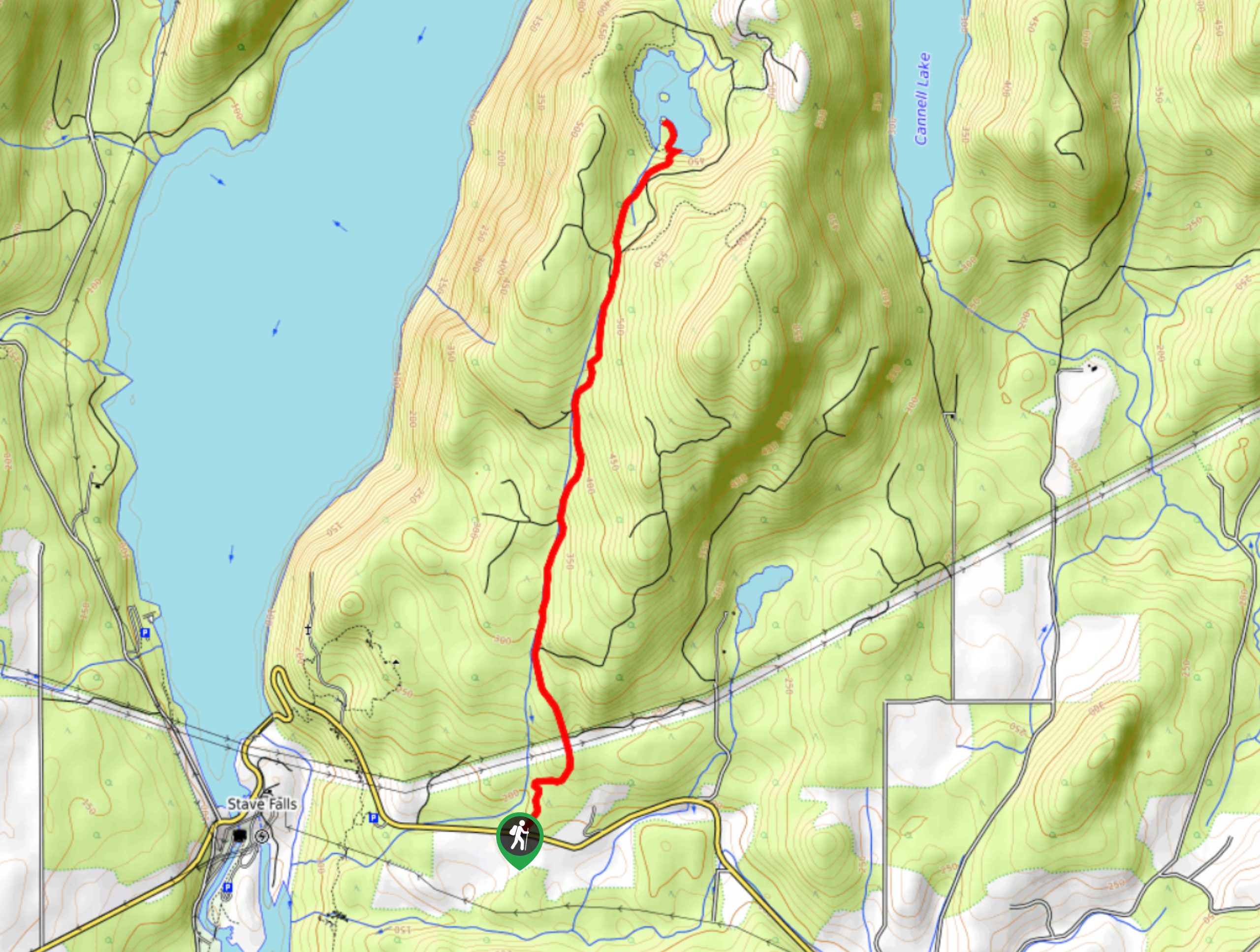
33. Davis Lake Trail
Difficulty
The Davis Lake Trail can be found just north of Mission, BC in the Fraser… Read More
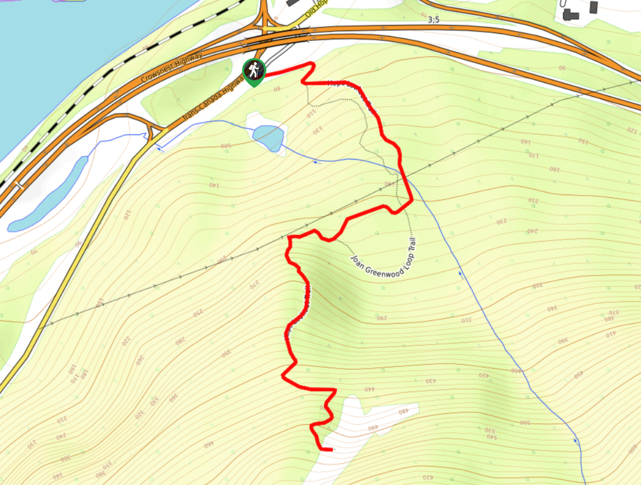
34. Hope Lookout Trail
Difficulty
The Hope Lookout Trail is a physically demanding, short hiking route just south of Hope… Read More
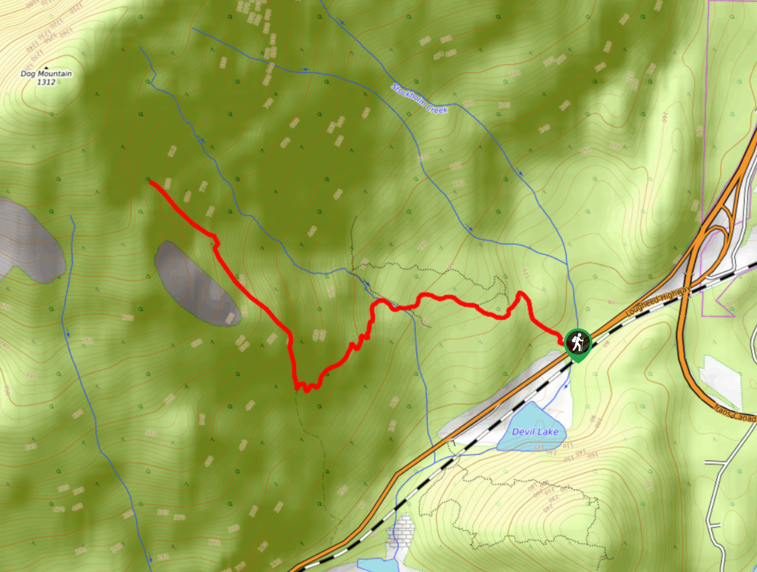
35. Dog Mountain Trail
Difficulty
The Dog Mountain Trail is a 3.1mi out-and-back hiking route near Hope, BC… Read More
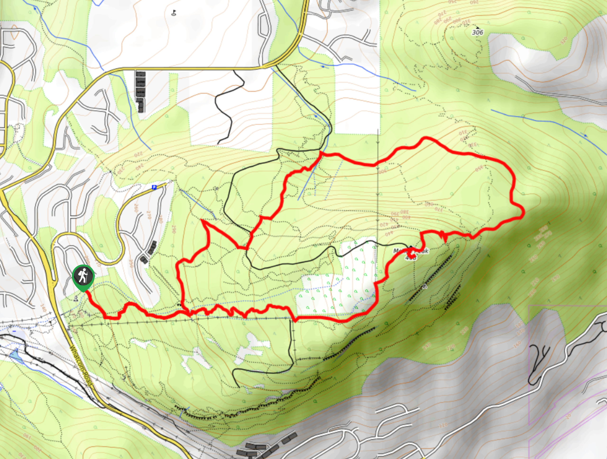
36. Ledgeview Loop
Difficulty
Hike along the scenic Ledgeview Loop as you climb uphill through a dense network of… Read More
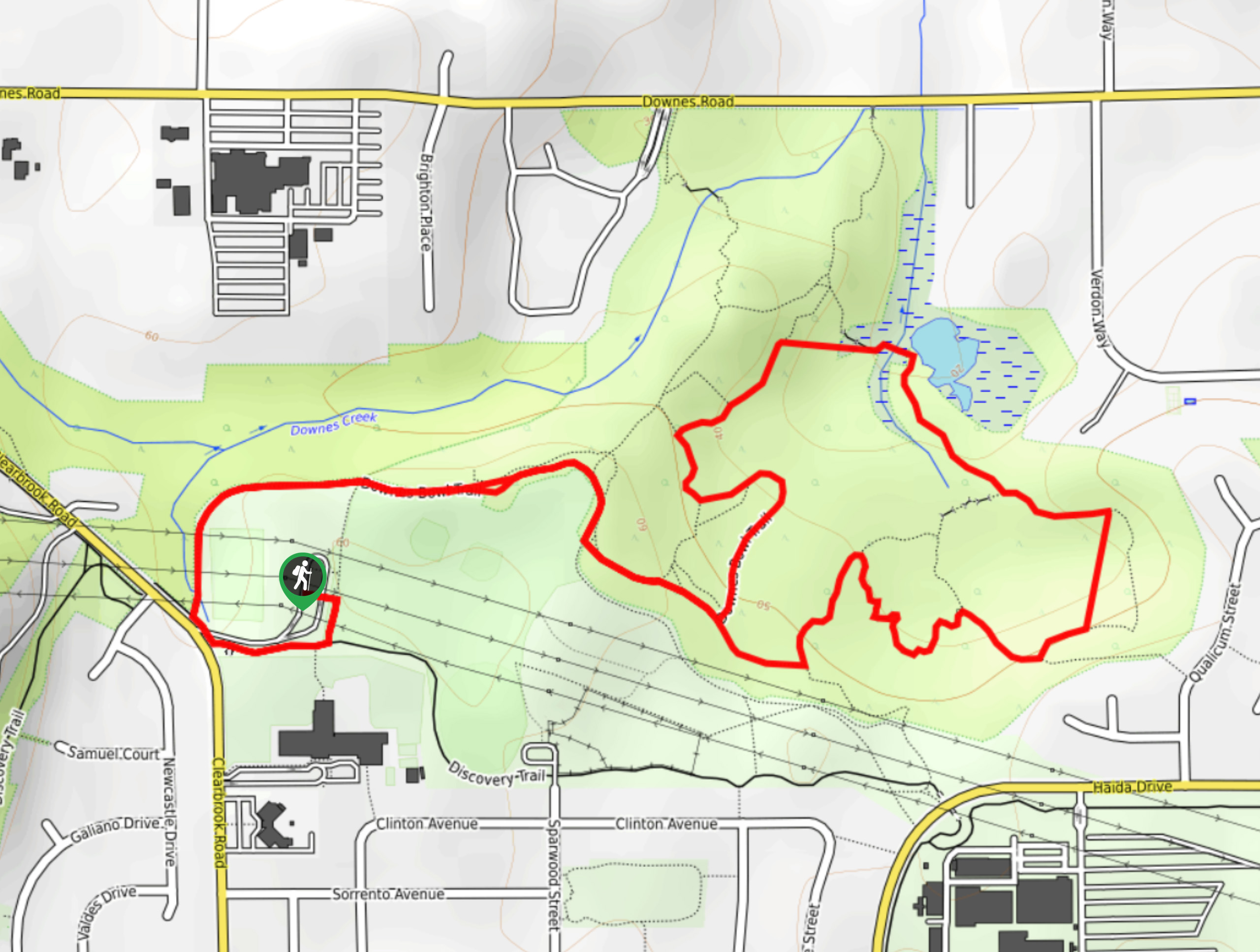
37. Downes Bowl Park
Difficulty
Hiking through Downes Bowl Park is a great way to experience the natural beauty within… Read More
38. Radium Lake Trail
Difficulty
The Radium Lake Trail is a 10.9mi out-and-back hiking route that climbs through… Read More
39. Vedder River Loop
Difficulty
The Vedder River Loop is a scenic trail that encompasses both the north and south… Read More
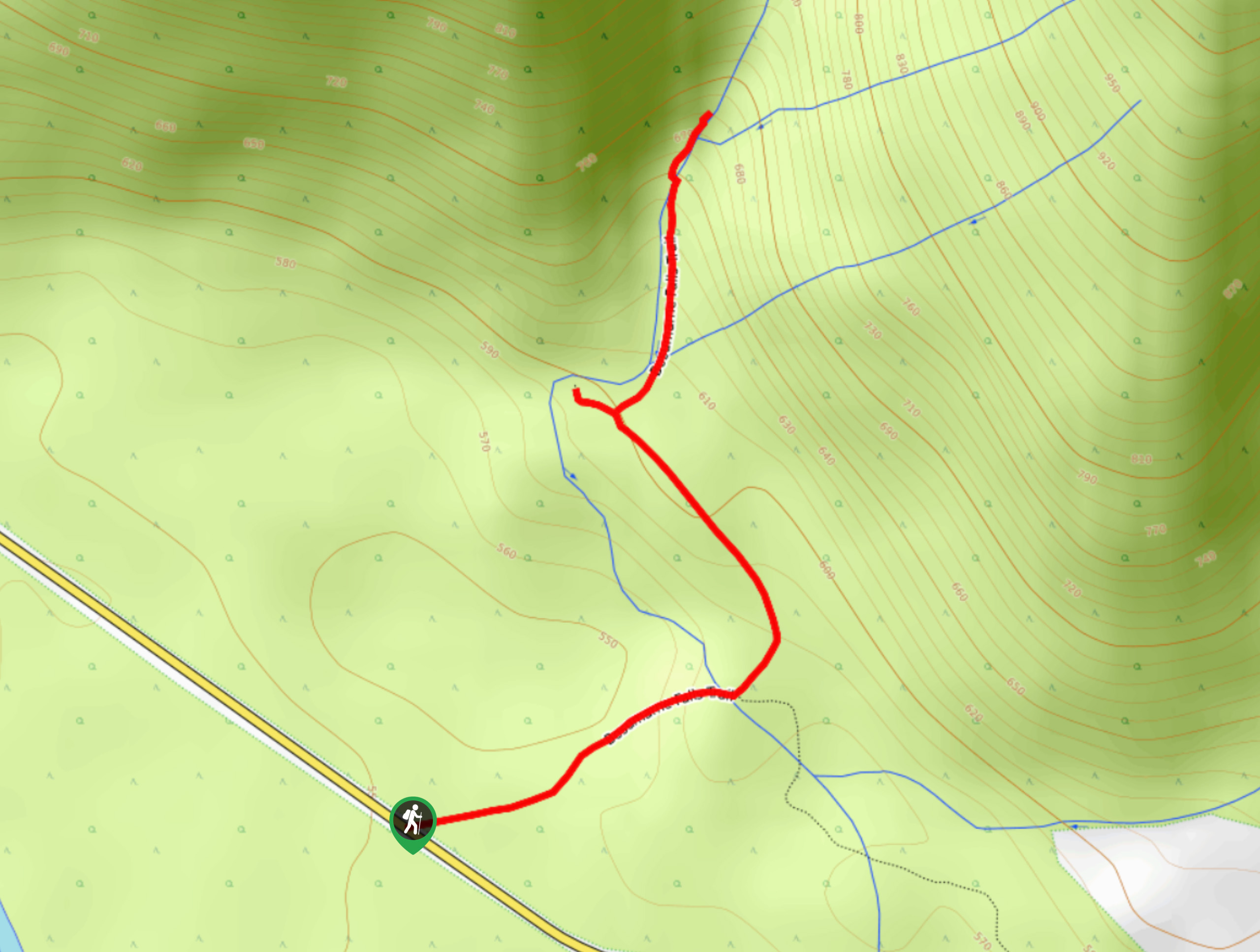
40. Bosumarne Falls
Difficulty
The short trek to Bosumarne Falls is a quick little adventure through a scenic stretch… Read More
41. Hope Mountain Trail
Difficulty
The Hope Mountain Trail climbs steeply uphill along a mixture of forest service road and… Read More
42. Campbell Lake Trail
Difficulty
The Campbell Lake Trail is a tough route near Harrison Hot Springs that climbs up… Read More
43. Goat Ridge
Difficulty
The hike up Goat Ridge is a steep climb that will take you through the… Read More
44. Thurston Mountain
Difficulty
Thurston Mountain is a challenging out-and-back hiking trail southeast of Chilliwack, BC that climbs uphill… Read More
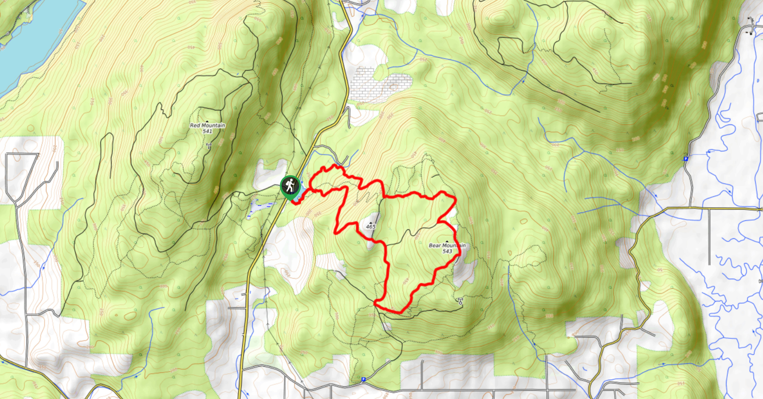
45. Bear Mountain Loop
Difficulty
The Bear Mountain Loop is a forested hiking route just north of Mission, BC that… Read More
46. Knight Peak Trail
Difficulty
The Knight Peak Trail is an extremely challenging hike into the Cheam Mountain Range that… Read More
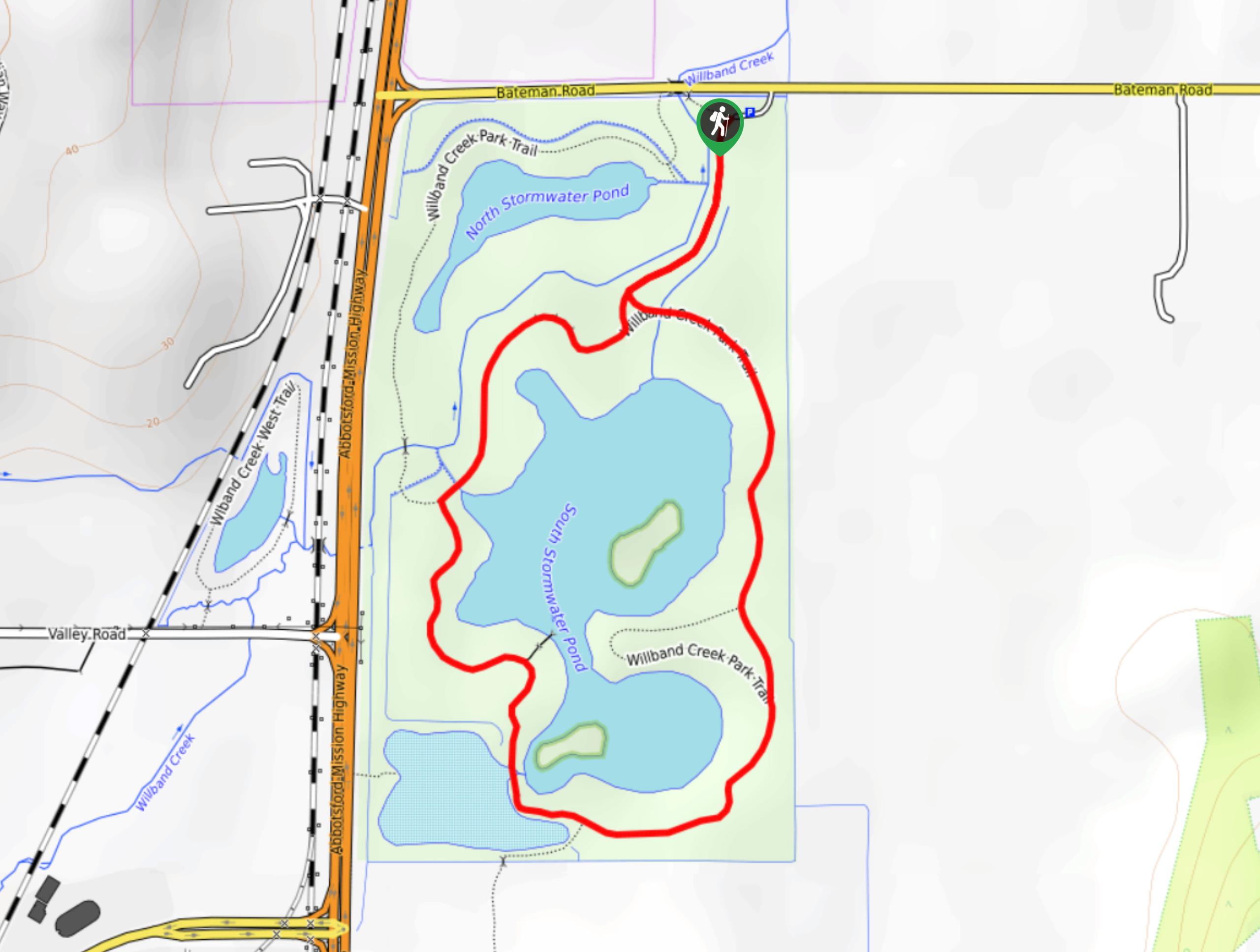
47. Willband Creek Park
Difficulty
Hiking through Willband Creek Park is a fun outdoor experience in a scenic wetland landscape… Read More
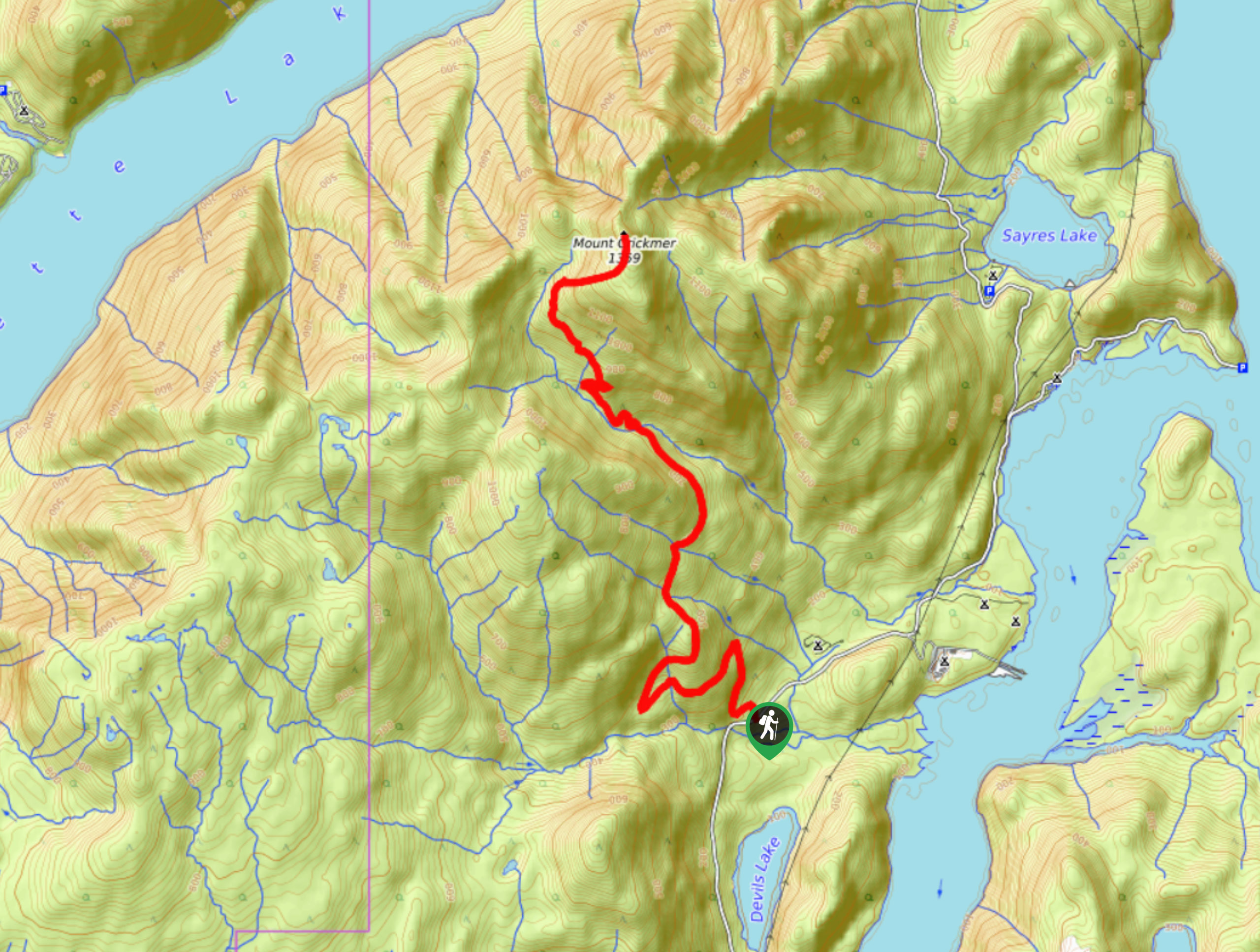
48. Mount Crickmer
Difficulty
The hike up to Mount Crickmer is a difficult climb along an overgrown trail that… Read More
49. Flood Falls
Difficulty
The hike to Flood Falls is a short out-and-back trail that travels along a 0.6mi Read More
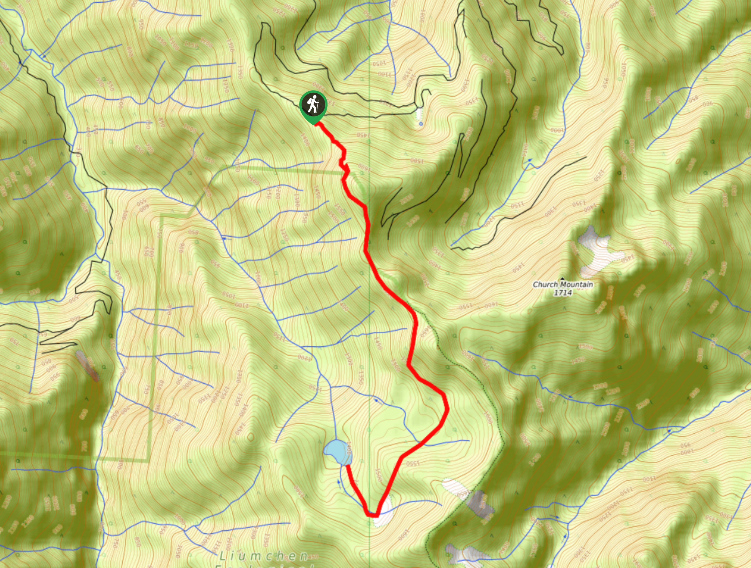
50. Liumchen Lake Trail
Difficulty
The Liumchen Lake Trail is an excellent out-and-back hiking route that travels through the Liumchen… Read More
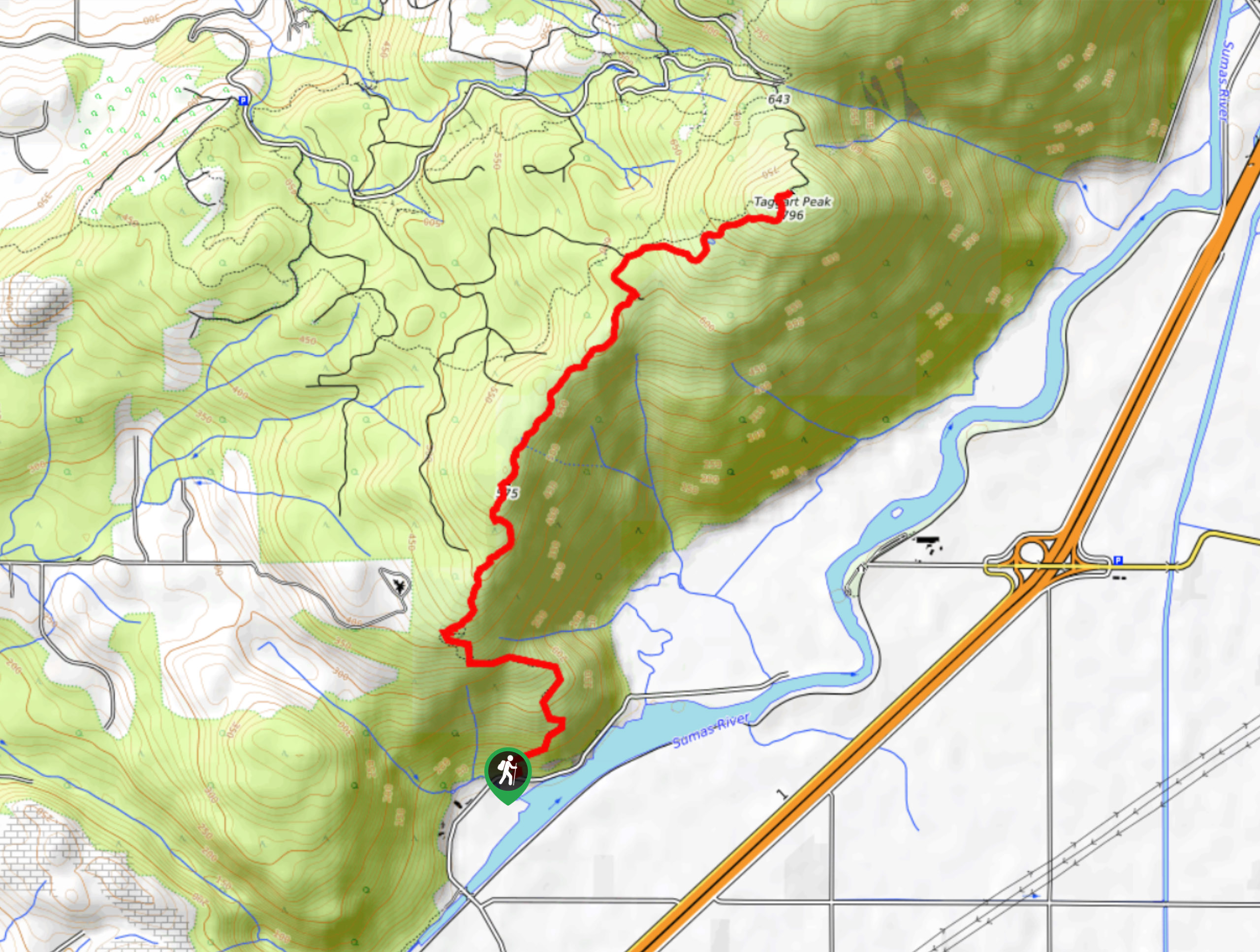
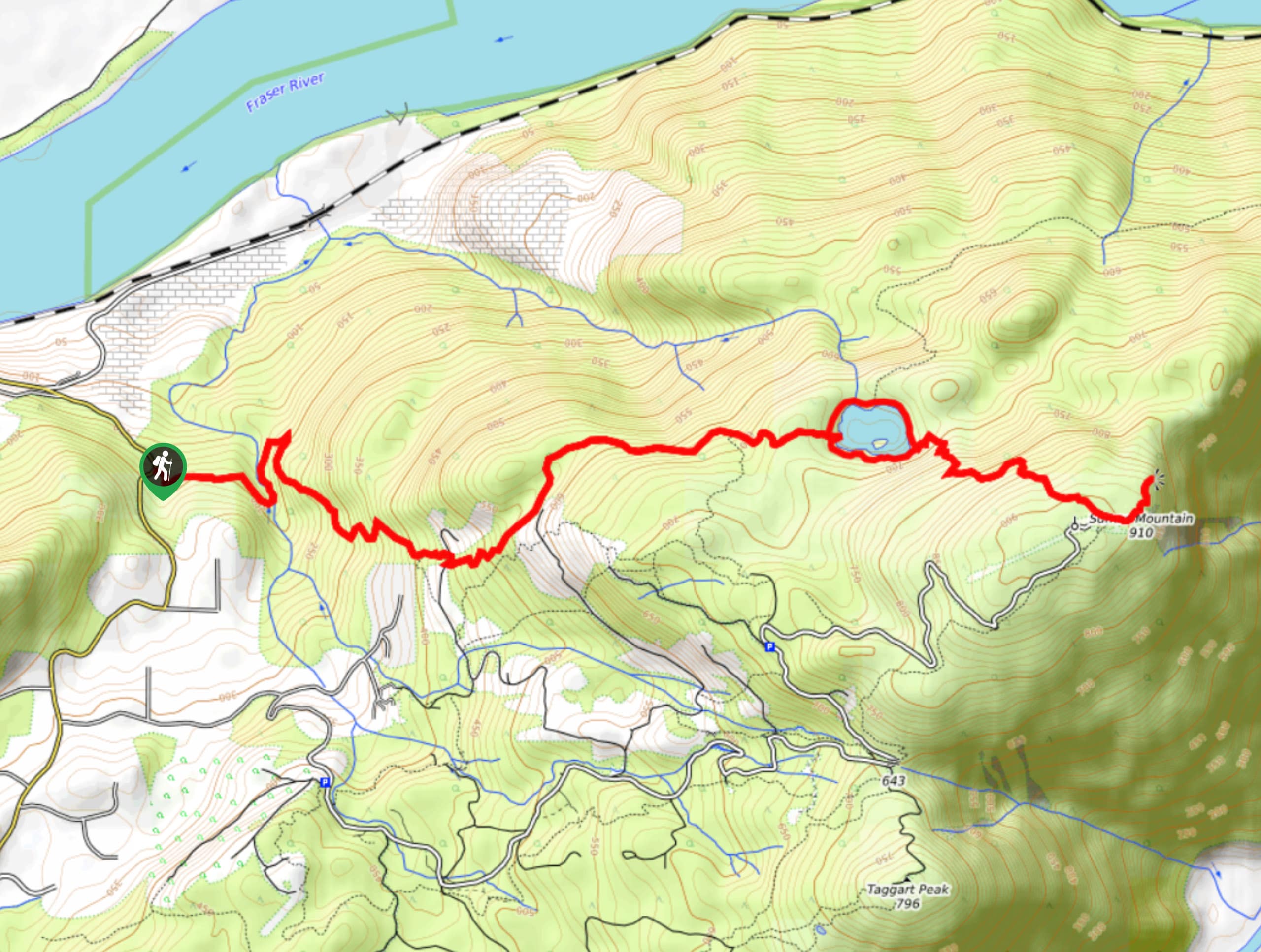
51. Taggart Peak
Difficulty
Hiking up to Taggart Peak is a 6.8mi journey that includes the steep… Read More
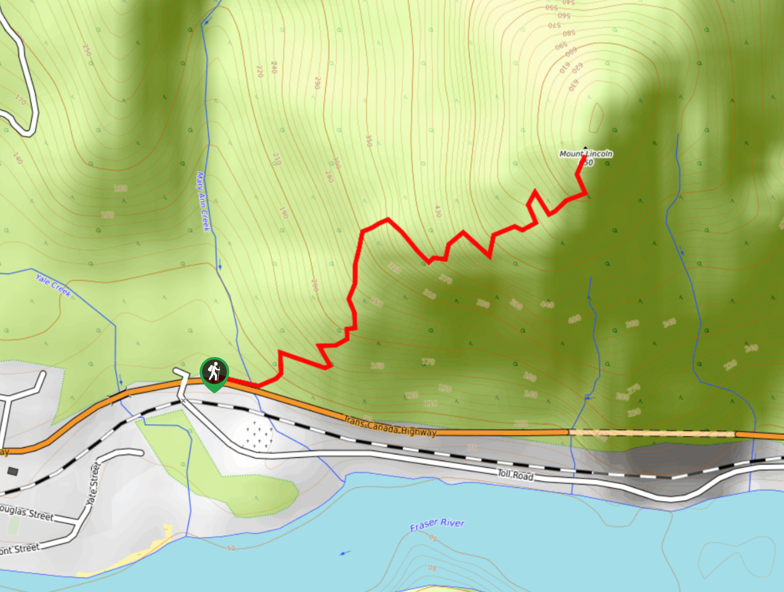
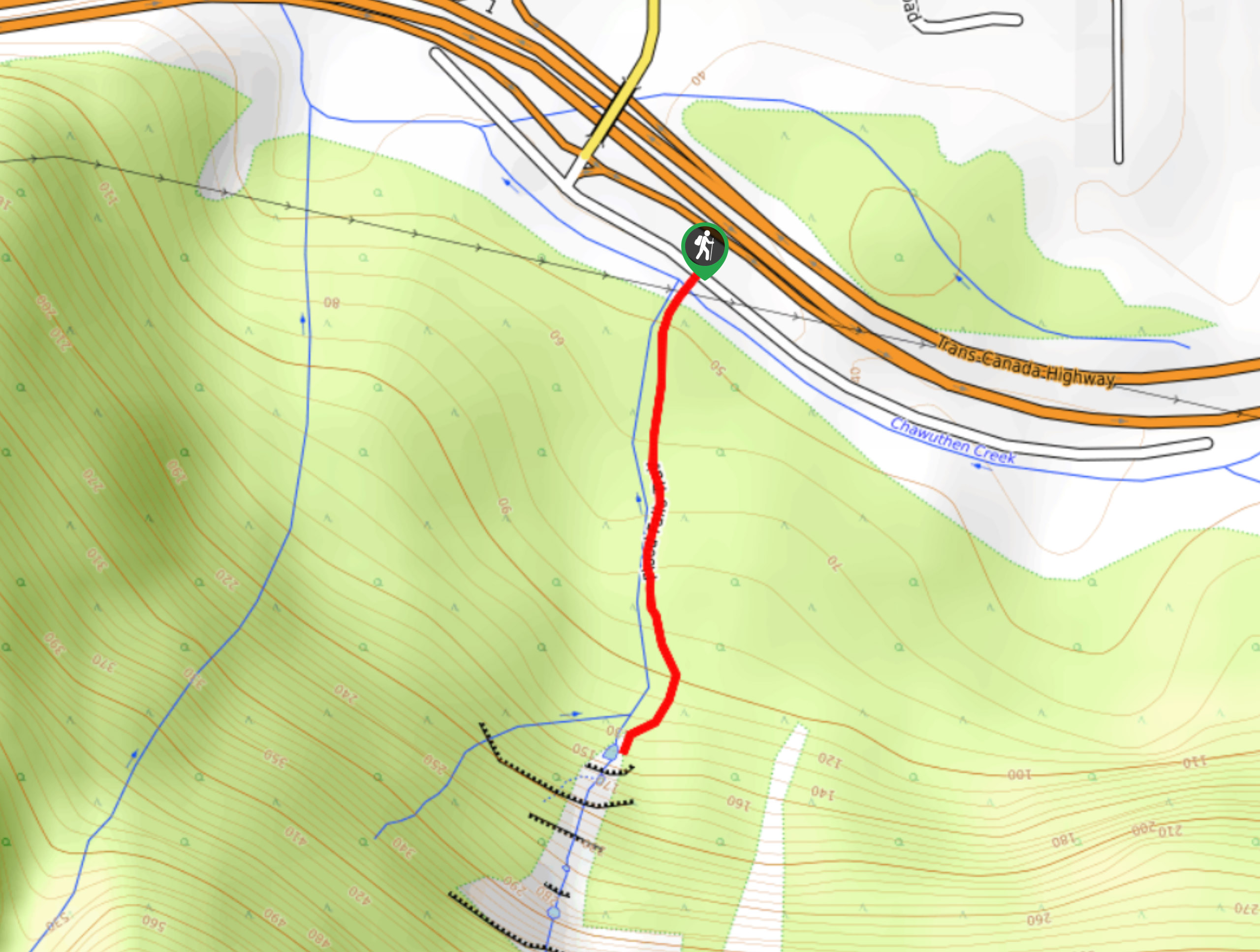
52. Mount Lincoln Trail
Difficulty
Hike along the Mount Lincoln Trail to experience beautiful views over the Fraser Valley on… Read More
53. Hope-Nicola Valley Trail
Difficulty
Hike along the Hope-Nicola Valley Trail to experience the natural beauty and historic sites of… Read More
54. Hoover Lake Trail
Difficulty
The Hoover Lake Trail is a moderate out-and-back hiking route that will take you through… Read More
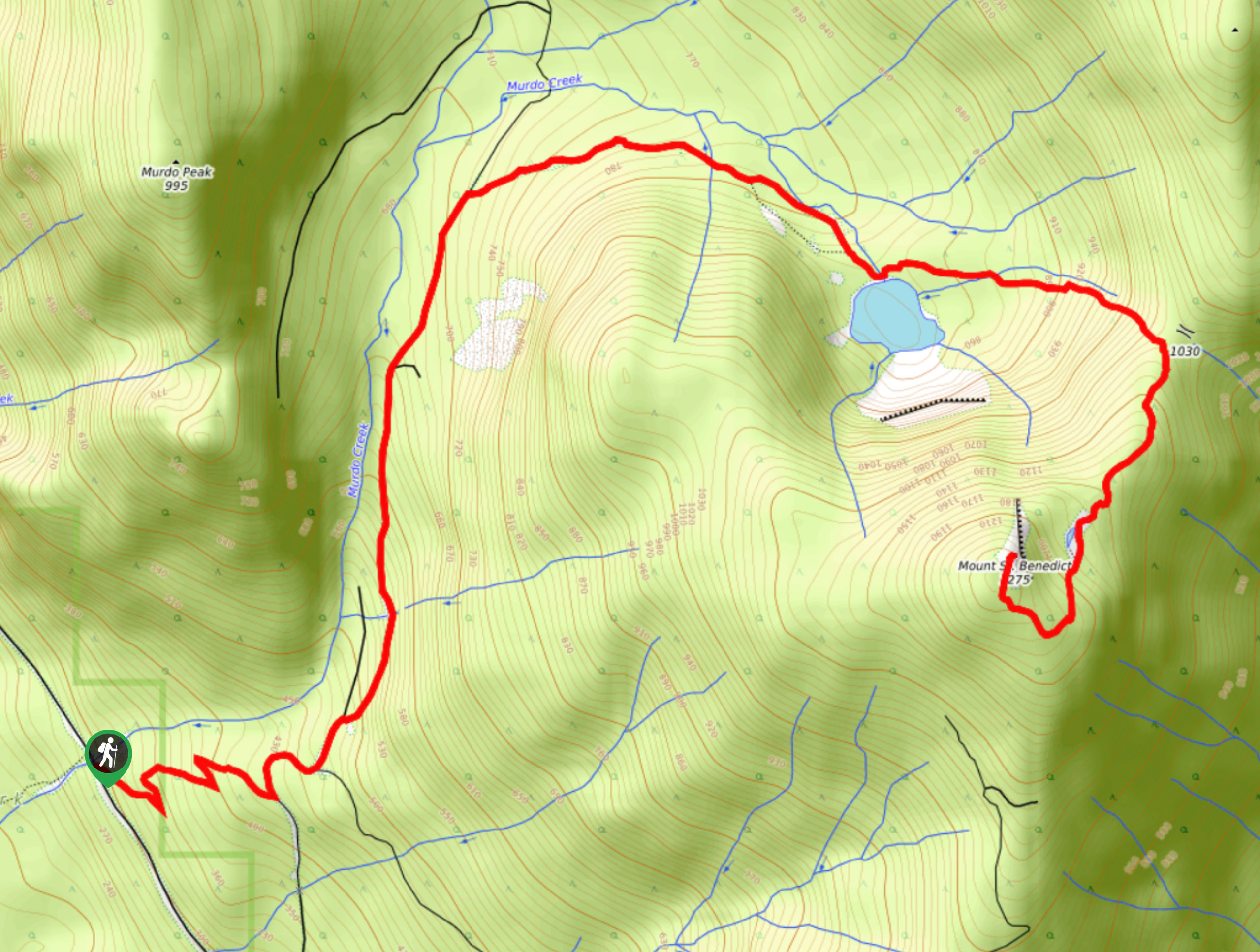
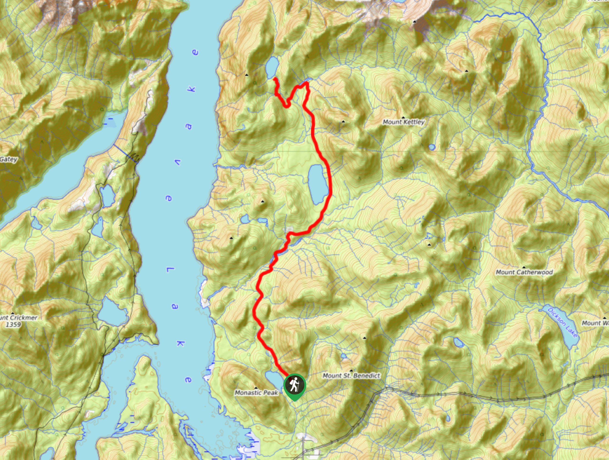
55. Mount Saint Benedict Trail
Difficulty
The Mount Saint Benedict Trail is a challenging 6.8mi out-and-back hiking route that… Read More
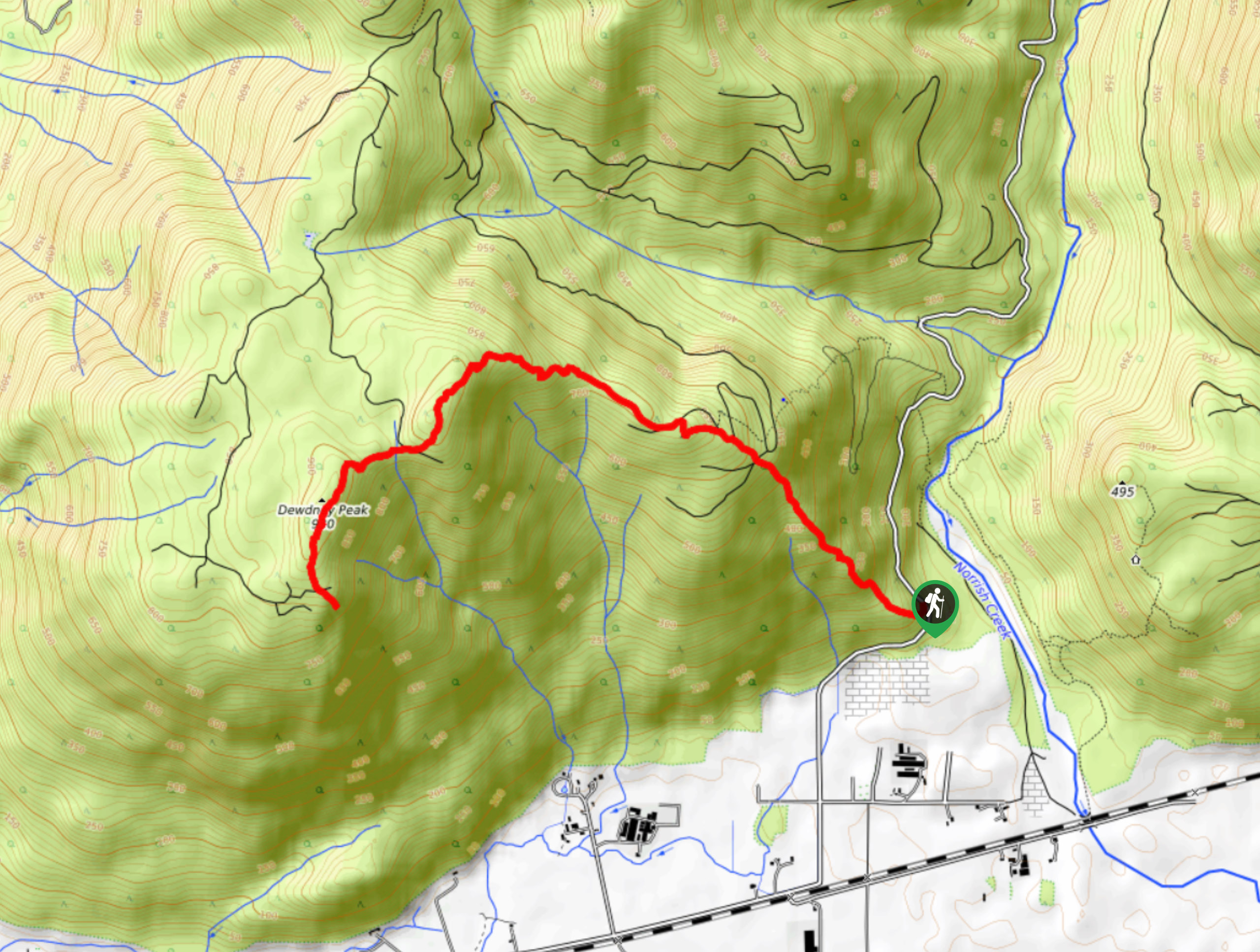
56. Dewdney Grind Trail
Difficulty
Hiking the Dewdney Grind is a challenging affair due to the steep incline and heavily-forested… Read More

57. Flora Peak Trail
Difficulty
The Flora Peak Trail is an 7.1mi out-and-back hiking route that will take… Read More

58. Matsqui Trail
Difficulty
The Matsqui Trail is a 16.7mi multi-use trail that travels alongside the Fraser… Read More
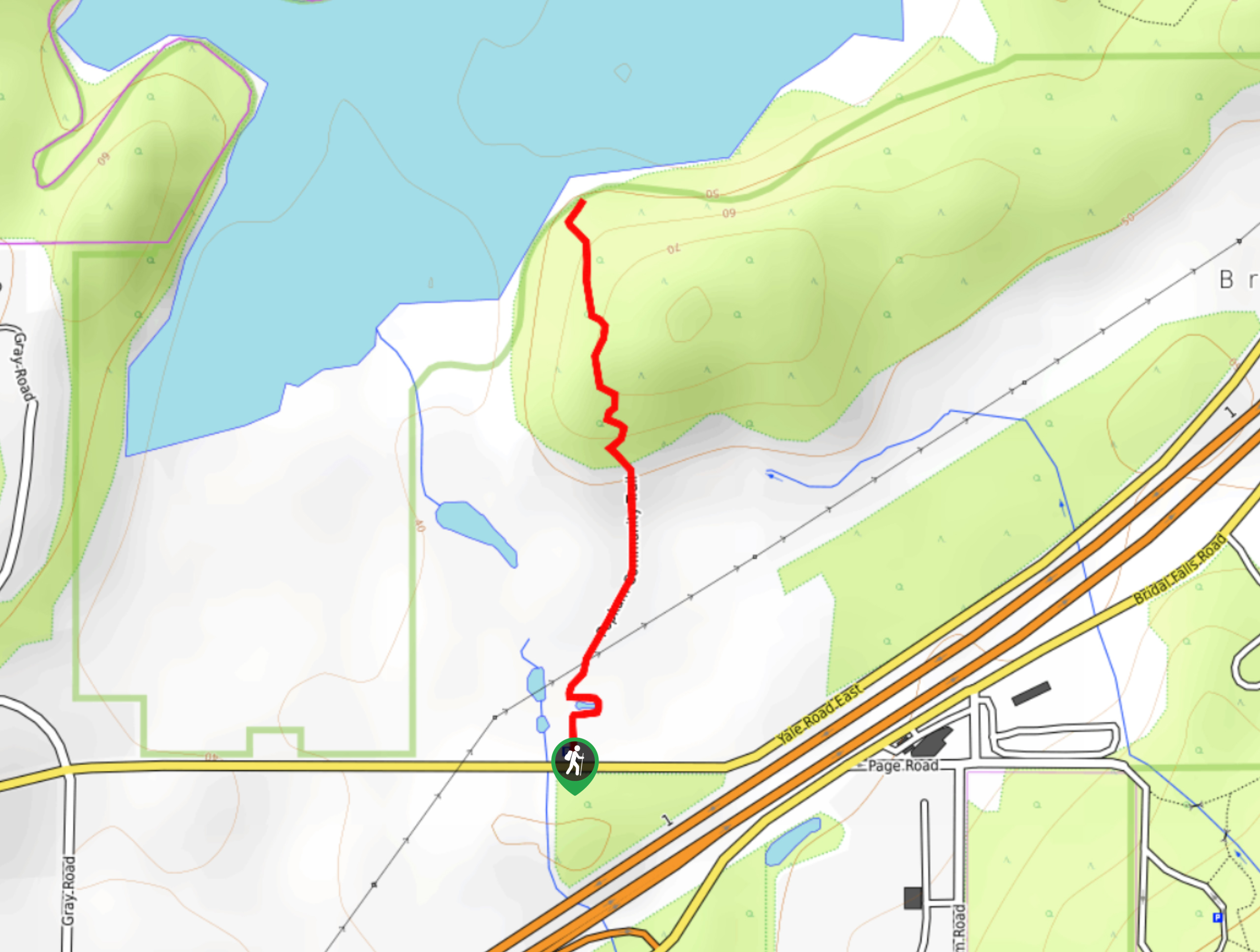
59. Fishtrap Creek Loop
Difficulty
Hiking the Fishtrap Creek Loop in Abbotsford is a great way to get out and… Read More

60. Chipmunk Creek Trail
Difficulty
Hike along the Chipmunk Creek Trail to experience the feeling of solitude along the trail… Read More
61. Popkum Community Trail
Difficulty
Hike along the Popkum Community Trail for a fun and educational experience where you can… Read More
62. Williams Peak Trail
Difficulty
Hiking the Williams Peak Trail is a physically demanding adventure in the Fraser Valley that… Read More
Are we missing your favourite hike?
Tell us! If you've got photos, a GPS track and know the hike, we'd love to share your favourite hike with the rest of the 10Adventures community.