Davis Lake Trail
View Photos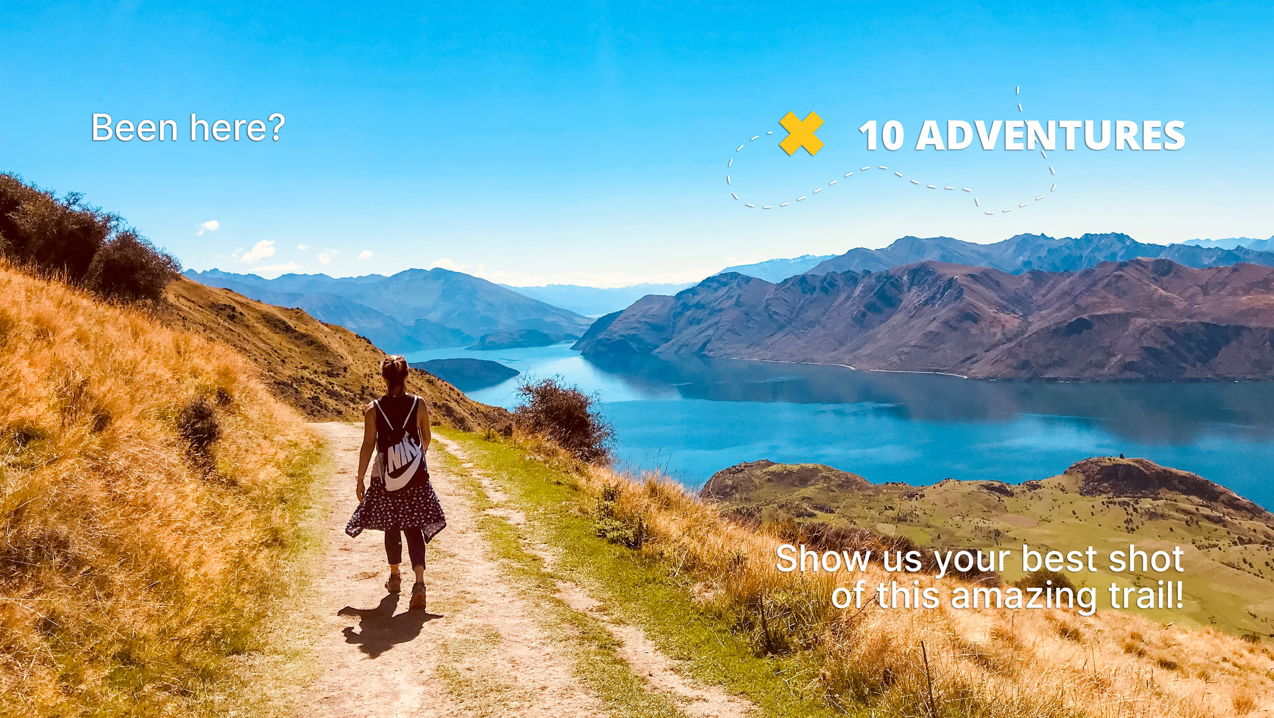
Davis Lake Trail
Difficulty Rating:
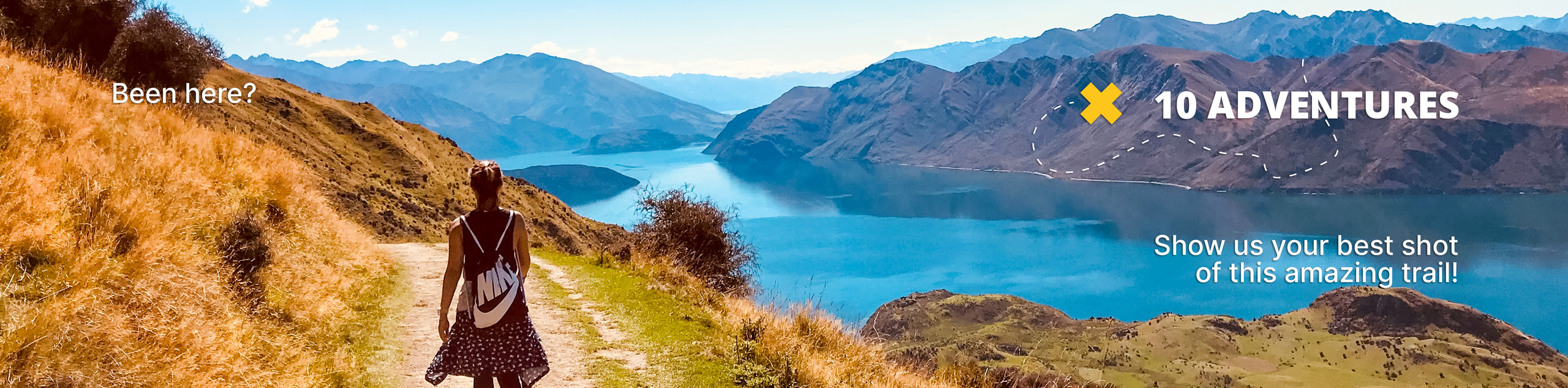
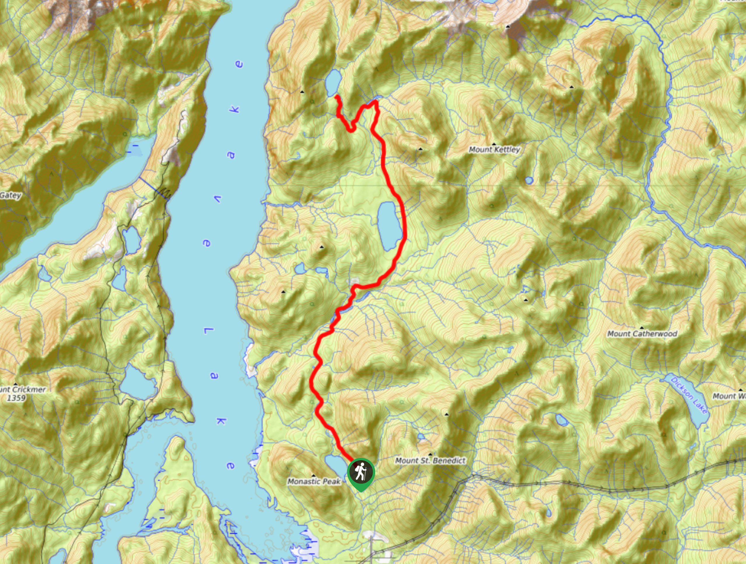
The Davis Lake Trail can be found just north of Mission, BC in the Fraser Valley and sets out from Davis Lake Provincial Park on a moderately-trafficked path that travels into the backcountry to arrive at Kenyon Lake. The trail follows along a forest service road, making it a popular multi-use route with some great forest scenery. Don’t miss out on the opportunity to check out these two picturesque lakes.
Getting there
To get to the Davis Lake trailhead from Mission, drive east on BC-7 for 3.7mi and turn left onto Sylvester Road. Continue on for 10.8mi to reach the trailhead on your left.

About
| When to do | March-October |
| Backcountry Campsites | Kenyon Lake Recreation Site |
| Pets allowed | Yes - On Leash |
| Family friendly | No |
| Route Signage | Average |
| Crowd Levels | Moderate |
| Route Type | One Way |
Davis Lake Trail
Elevation Graph
Weather
Davis Lake Trail Description
The Davis Lake Trail is a moderately trafficked point-to-point route near the Fraser Valley that travels through the forested backcountry to Kenyon Lake and is popular with hikers and off-road vehicle drivers. This one-way trail is densely forested and offers some moderate changes in elevation, as well as a more technical stretch of trail towards the end. As there aren’t any easily accessible roads to Kenyon Lake, hikers will need to either spend the night camping at the Kenyon Lake Recreation Site, arrange a pick up with a high clearance 4×4 vehicle, or make the long return journey back to the trailhead on the same day. No matter how you decide to plan your return trip, the Davis Lake Trail is an excellent opportunity to reconnect with nature while visiting these two beautiful woodland lakes.
We recommend that you keep animals on leash as you’ll likely be passed by several offroading vehicles along the trail.
Similar hikes to the Davis Lake Trail hike

Chipmunk Creek Trail
Hike along the Chipmunk Creek Trail to experience the feeling of solitude along the trail while taking in scenic views…

Matsqui Trail
The Matsqui Trail is a 16.7mi multi-use trail that travels alongside the Fraser River and provides nice views…

Flora Peak Trail
The Flora Peak Trail is an 7.1mi out-and-back hiking route that will take you through dense forests and…
Comments