

Flora Peak Trail
View Photos
Flora Peak Trail
Difficulty Rating:
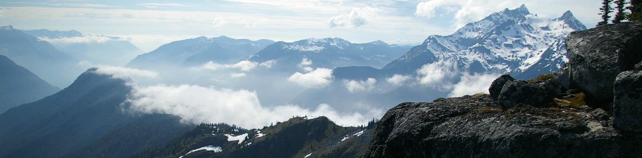
The Flora Peak Trail is an 7.1mi out-and-back hiking route that will take you through dense forests and over several creek crossings before attempting the final ascent of Flora Peak. From atop the mountain, hikers will have spectacular views that sweep across the landscape in all directions. This is a truly rewarding hike if you are looking to push yourself through a challenging uphill climb.
Getting there
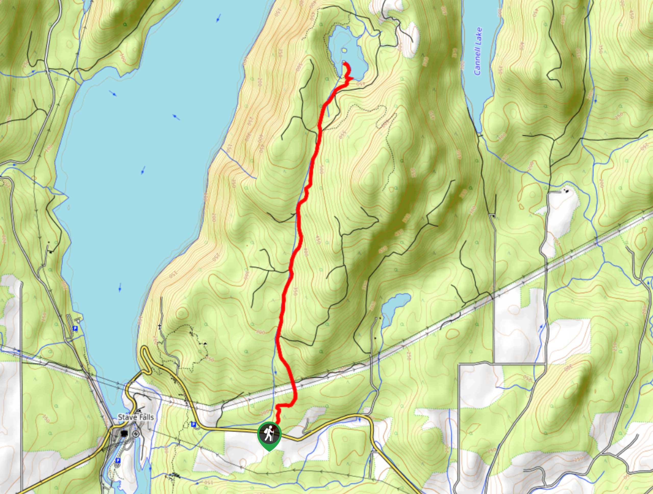
To reach the parking area for the Flora Peak Trail from Chilliwack, make your way south on Vedder Road for 3.2mi and use the second exit on the roundabout to get on Chilliwack Lake Road. Continue on for 24.7mi and make a left turn to enter the parking area and access the trail.

About
| When to do | June-October |
| Backcountry Campsites | N |
| Pets allowed | No |
| Family friendly | No |
| Route Signage | Average |
| Crowd Levels | Moderate |
| Route Type | Out and back |
Flora Peak Trail
Elevation Graph
Weather
Flora Peak Trail Description
The hike up to Flora Peak is a tough route in Chilliwack Lake Provincial Park that follows a steep course through the dense forest before breaking off from the main trail on an even more steep route up the mountain. With an elevation gain of 4288ft, this trail is sure to get your heart rate up, but the amazing panoramic views from the summit are well worth the challenge. From this mountain top perch, you will have a great sightline overlooking Chilliwack Lake and the multitude of peaks surrounding you, such as Williams Peak, Mount Wittenburg, and McDonald Peak off to the south. This is a great hike to push yourself and gain experience for longer/more challenging routes.
Similar hikes to the Flora Peak Trail hike
Williams Peak Trail
Hiking the Williams Peak Trail is a physically demanding adventure in the Fraser Valley that climbs up a steep ridge…

Chipmunk Creek Trail
Hike along the Chipmunk Creek Trail to experience the feeling of solitude along the trail while taking in scenic views…
Hoover Lake Trail
The Hoover Lake Trail is a moderate out-and-back hiking route that will take you through a beautiful stretch of forest…
Comments