Hoover Lake Trail
View Photos
Hoover Lake Trail
Difficulty Rating:
The Hoover Lake Trail is a moderate out-and-back hiking route that will take you through a beautiful stretch of forest to the scenic shores of a woodland lake. The trail is made up of non-technical and easy to navigate terrain, making it an ideal route for casual hikers. Make sure to spend some time exploring the trails that lead around the lake for an extended adventure.
Getting there
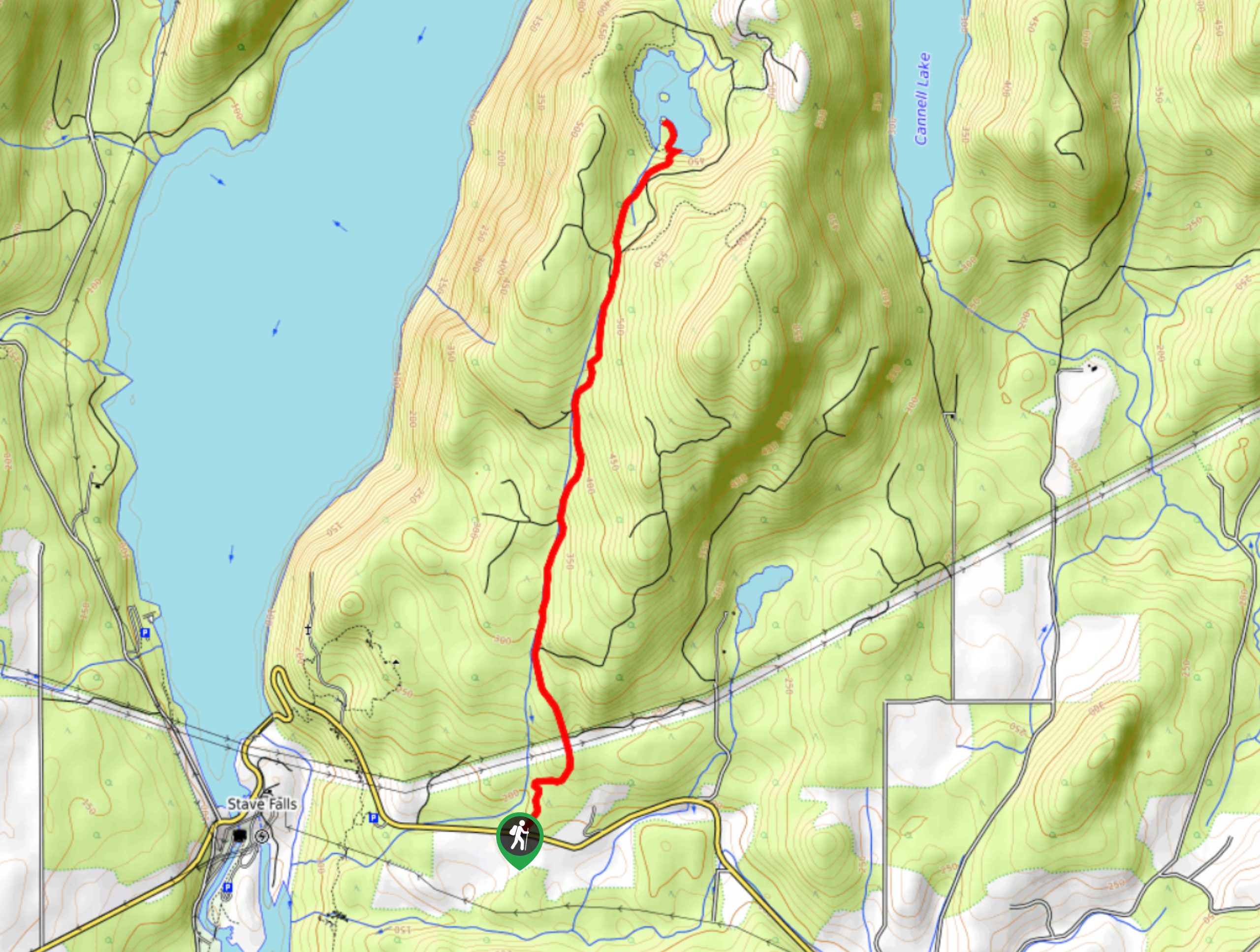
To reach the Hoover Lake trailhead from Mission, drive north on Cedar Street for 2.0mi and turn left onto Dewdney Trunk Road. Ater 0.9mi, turn right to stay on the road and follow it for another 4.8mi. Here, you will find the trailhead and the parking area on the right.

About
| When to do | April-October |
| Backcountry Campsites | No |
| Pets allowed | Yes - On Leash |
| Family friendly | Older Children only |
| Route Signage | Average |
| Crowd Levels | Moderate |
| Route Type | Out and back |
Hoover Lake Trail
Elevation Graph
Weather
Hoover Lake Trail Description
The Hoover Lake Trail is a trek through the woodlands north of Mission, BC that largely follows a forest service road before breaking off on a trail towards the scenic lake. This 4.8mi route follows closely alongside Brown Creek and steadily climbs uphill for the duration of the hike, gaining a moderate 1230ft of elevation. Once you reach Hoover Lake, you will be greeted by beautiful views over the calm water and its wooded surroundings. Hikers looking for a longer route can also utilize the optional trail on the left side of the lake to further explore the area.
Similar hikes to the Hoover Lake Trail hike

Chipmunk Creek Trail
Hike along the Chipmunk Creek Trail to experience the feeling of solitude along the trail while taking in scenic views…

Matsqui Trail
The Matsqui Trail is a 16.7mi multi-use trail that travels alongside the Fraser River and provides nice views…

Flora Peak Trail
The Flora Peak Trail is an 7.1mi out-and-back hiking route that will take you through dense forests and…
Comments