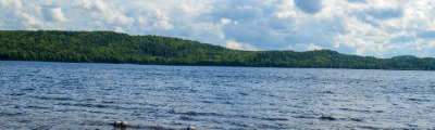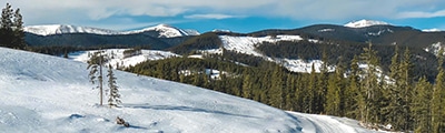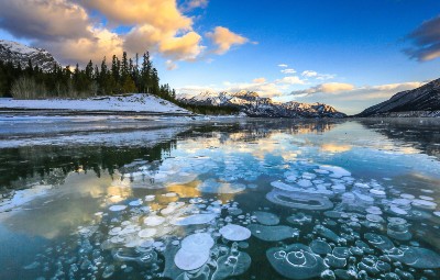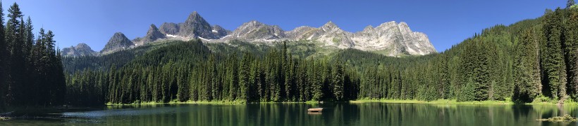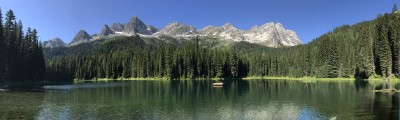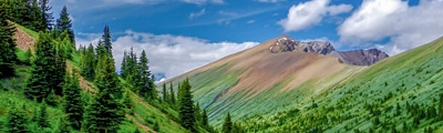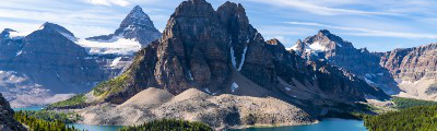
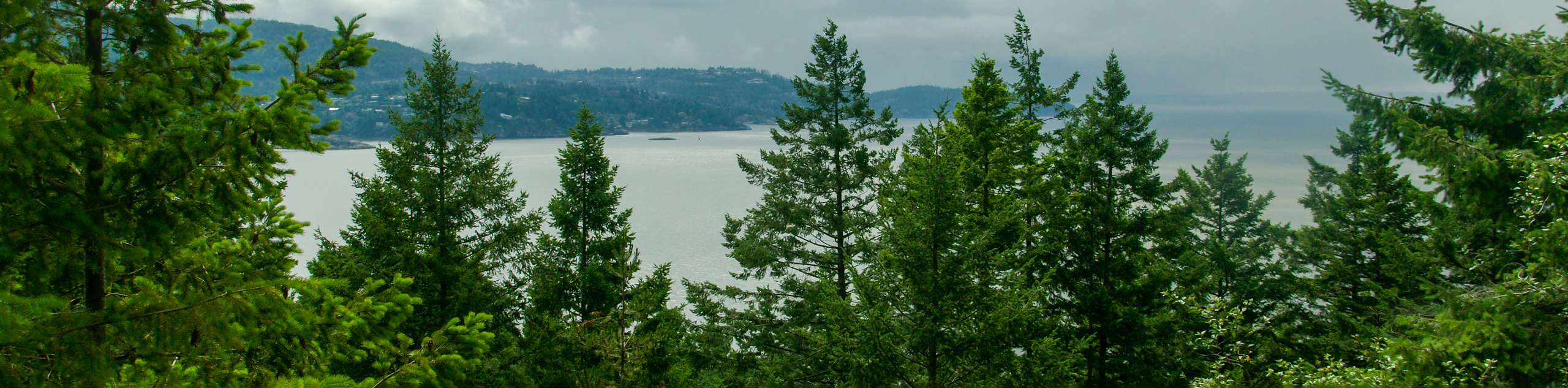
hikes in Sunshine Coast
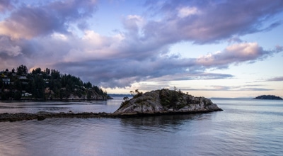
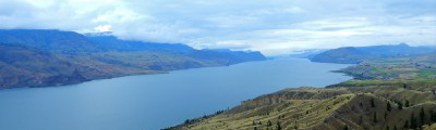
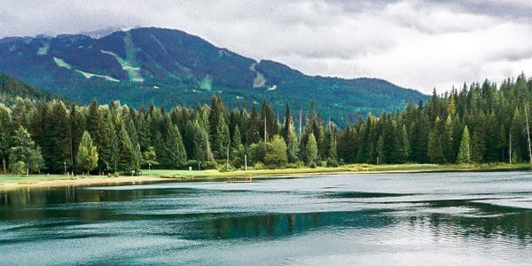
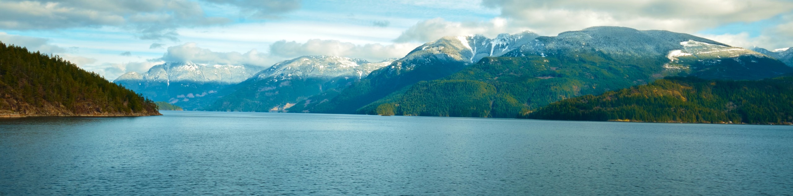
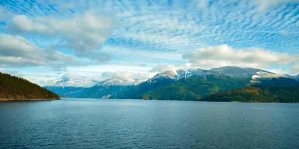
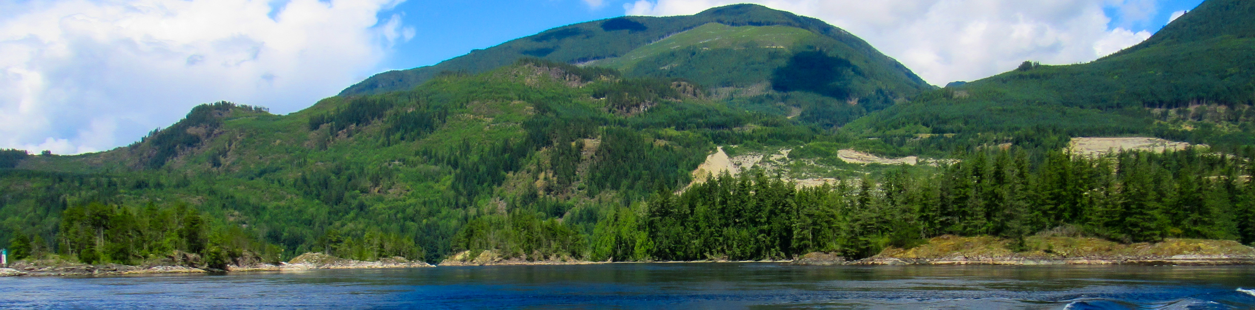
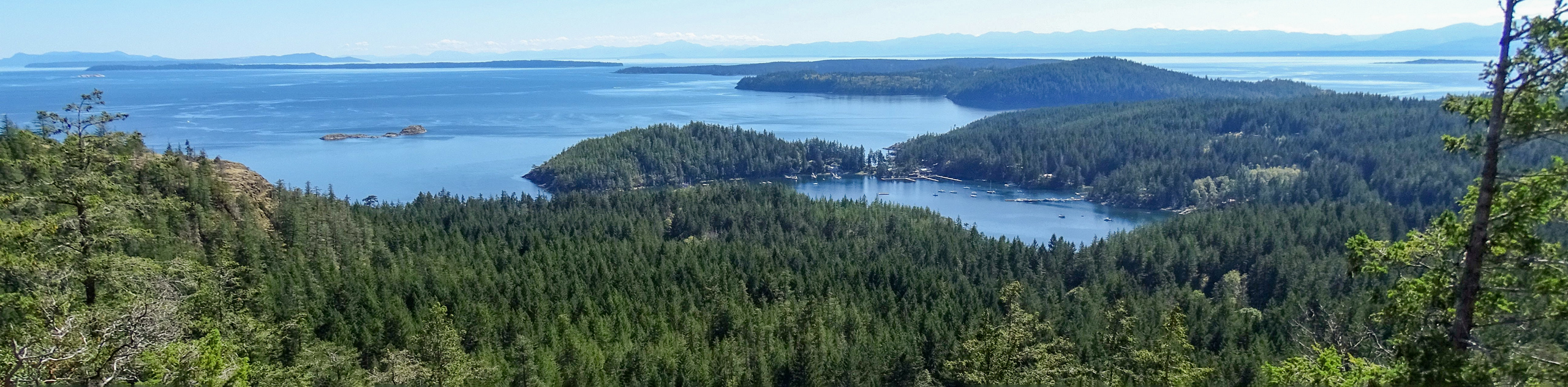
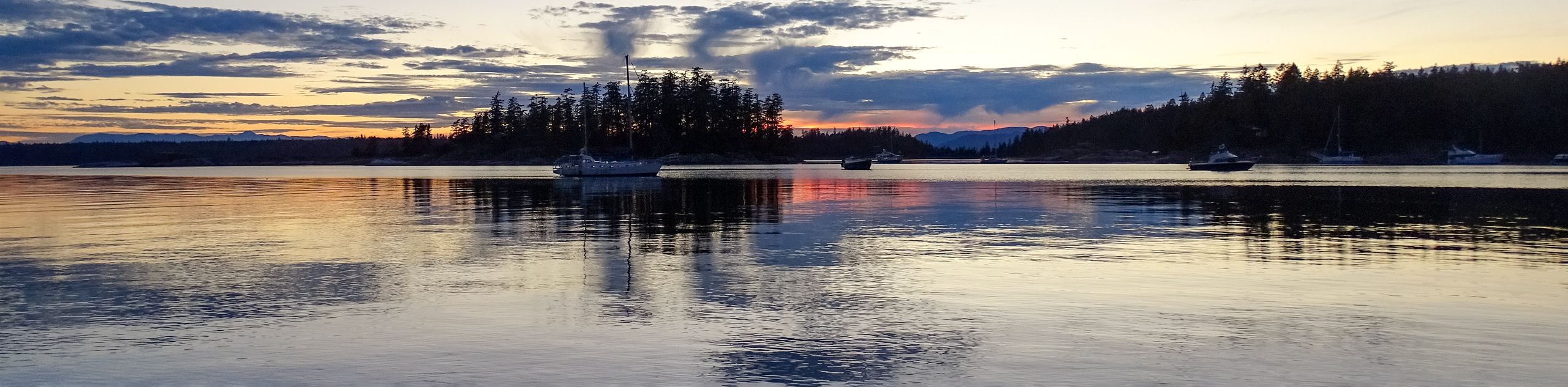
Located along the southern portion of mainland British Columbia’s coastline, the Sunshine Coast is a sparsely populated region that is geographically isolated by the Strait of Georgia to the west and the Coast Mountains of the interior to the east. Because of this, the communities along the Sunshine Coast are really only accessible by boat or air. Stretching 180km from Howe Sound to Desolation Sound, the dense rainforests and rugged coastline make for a remote and picturesque destination that is seen by many adventurers to be the perfect playground for a variety of outdoor activities.
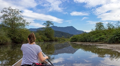
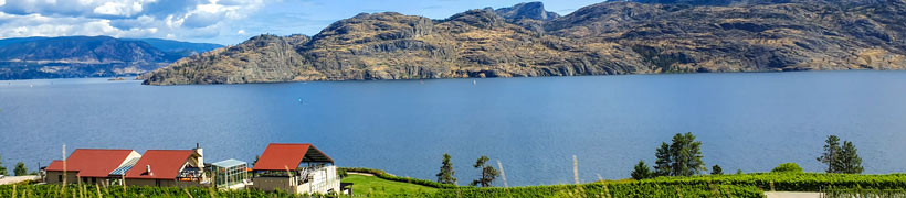
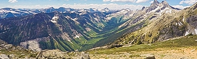
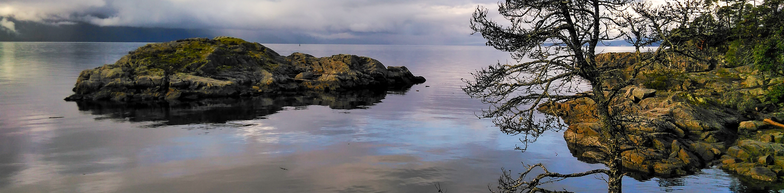
While easy access to a good number of waterways might make water sports like canoeing, kayaking, and paddleboarding popular options for exploring the beautiful terrain along the coast, the region’s many hiking and biking trails provide a means to traverse the rugged mountains and dense forests that characterize the land here. With a number of pristine provincial parks like Tetrahedron, Mt. Richardson, Spipiyus, Francis Point, and Smuggler Cove all preserving the wild British Columbia landscape, there is certainly no shortage of breathtaking scenery to be experienced along the Sunshine Coast.
10 Great Hiking Routes on the Sunshine Coast
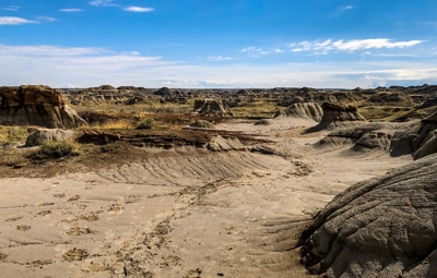
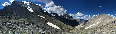
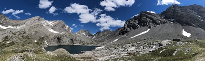
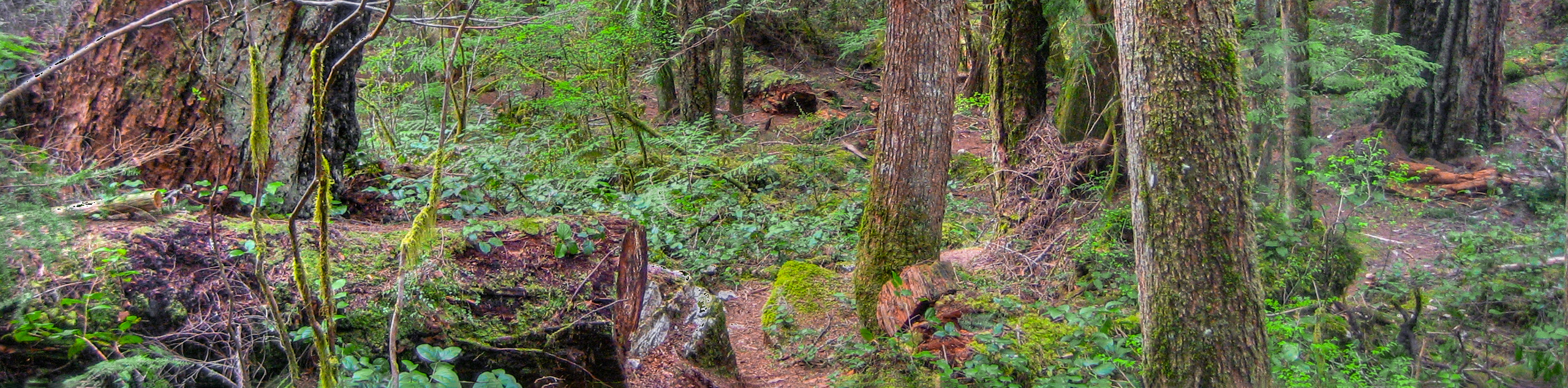
Although the rocky and rugged terrain along the Sunshine Coast might seem as though it fully exemplifies the terrain in the region, travelling just a bit further inland will reveal a wealth of wonderfully atmospheric temperate rainforests and rugged mountains featuring countless hiking routes that are suitable for all ages and skill levels. With a number of provincial parks that range from small coastal nature reserves where you can take in a beautiful sunset and watch the diverse wildlife to vast inland forests that are dotted with challenging peaks, there is no shortage of suitable terrain to be explored. Whether you are looking for a fun family-friendly walk along the beach or long distance route through the interior mountains of Tetrahedron Provincial Park, there is sure to be a hiking trail along the Sunshine Coast that is tailor-made to be your next adventure. Check out this list of our favourite hiking routes along the Sunshine Coast:
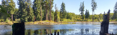
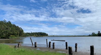
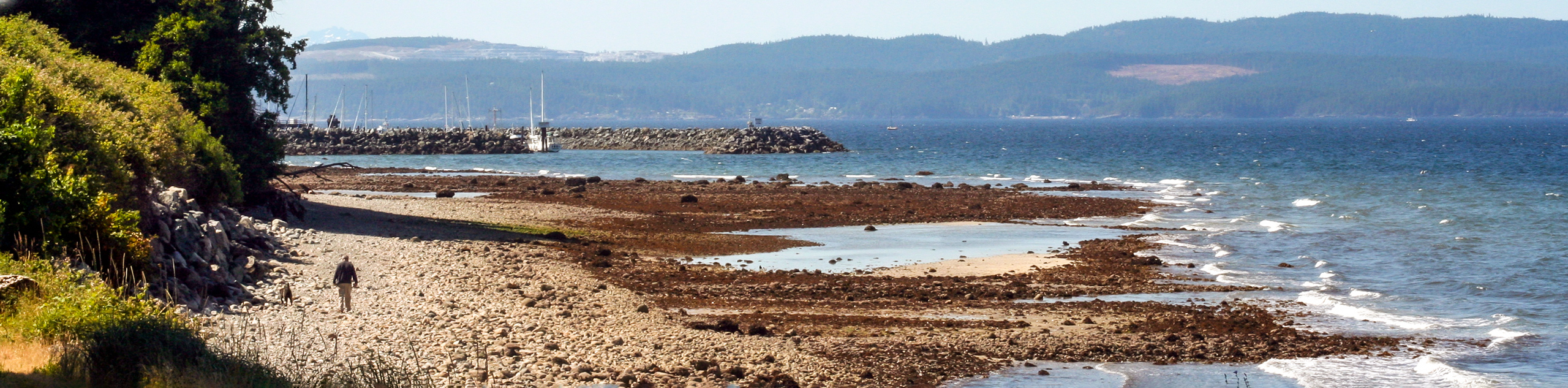
- Smuggler Cove: This 2.3mi hike is a fantastic adventure through Smuggler Cove Marine Provincial Park that provides some amazing views of the coast. With charming forest trails that are easy to navigate, this family-friendly hike is sure to be a favourite.
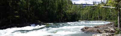
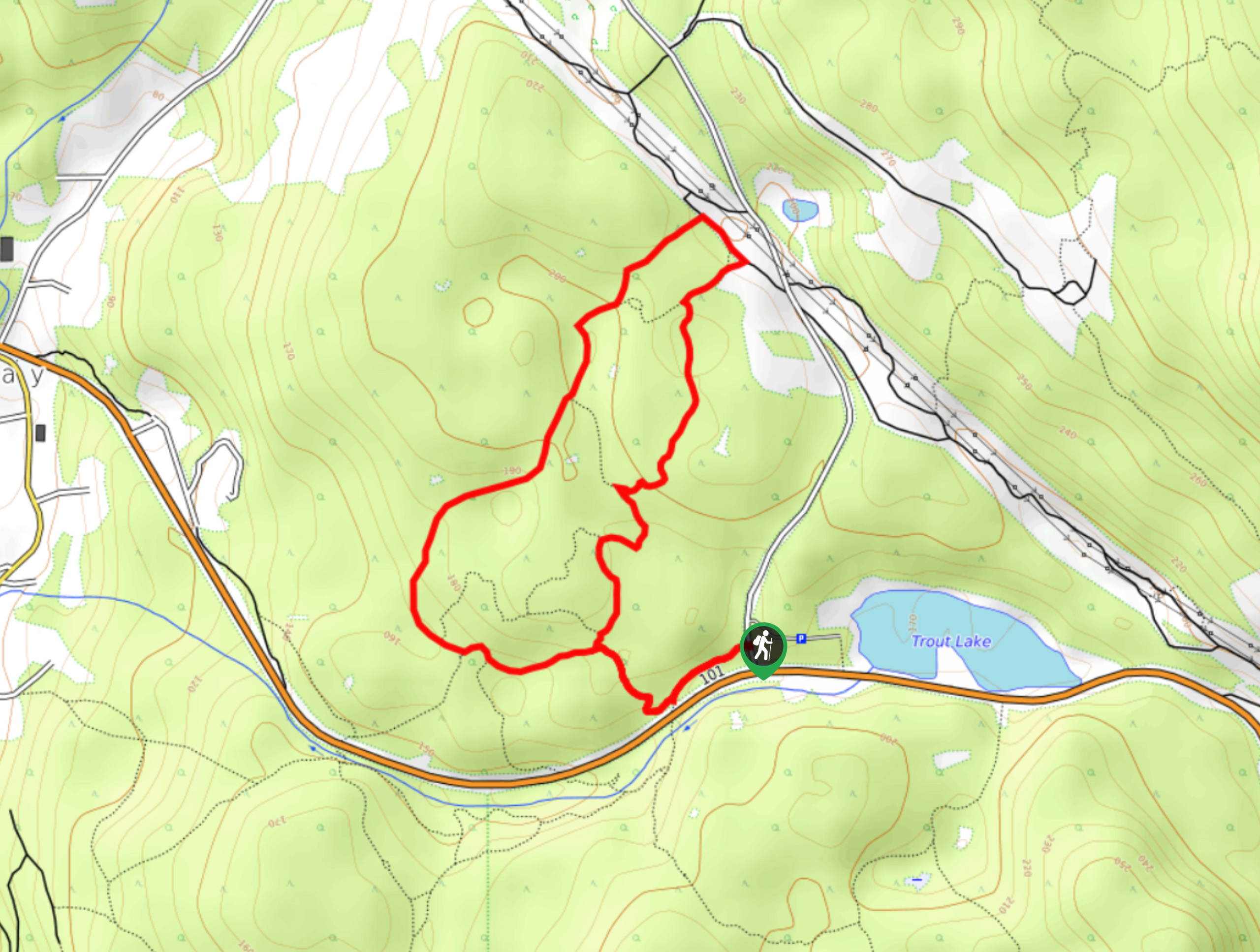
- Skookumchuck Narrows: A moderate length hike through the forest, this trail will take you to a scenic lookout with views of the churning waters of the Skookumchuck Narrows. Be sure to plan ahead and time your adventure with the tide to have the best viewing experience of this unique spot.
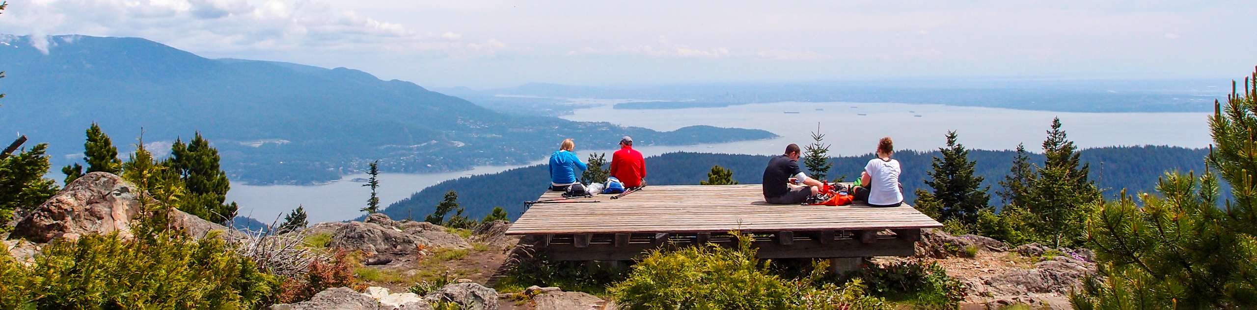
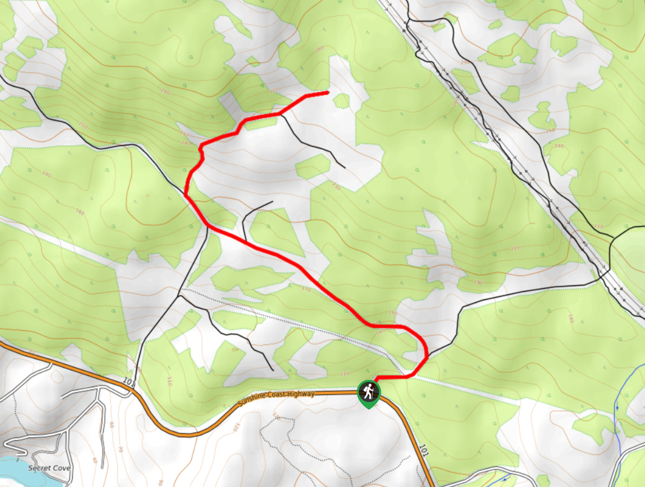
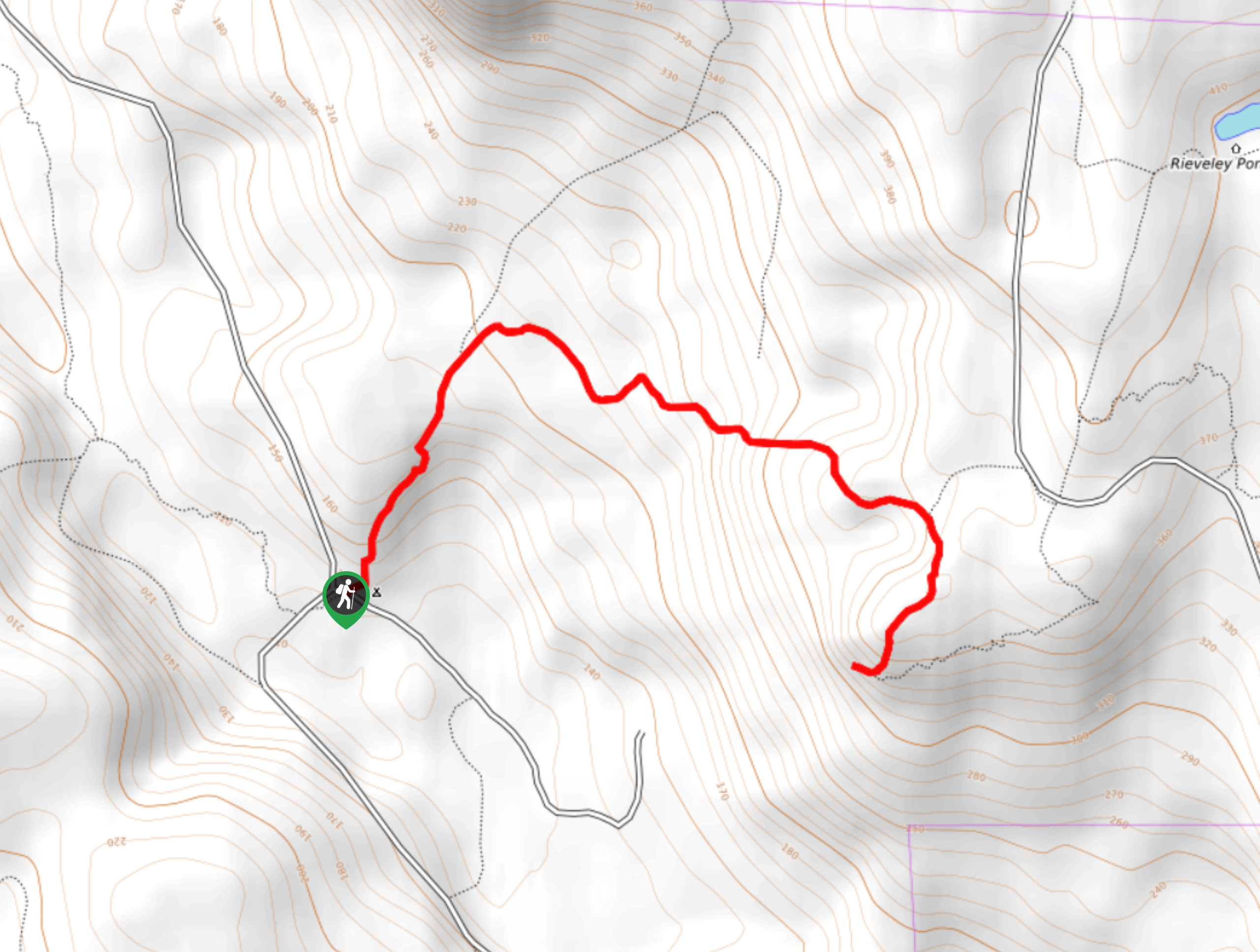
- Mount Elphinstone Summit Trail: This trail is an intermediate length adventure that will take you uphill for some stunning views of Howe Sound and Bowen Island. Although the trail has a fairly steep grade, it is more than manageable for casual hikers that want a bit of a challenge.
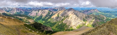
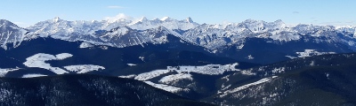
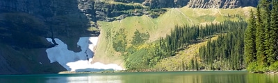
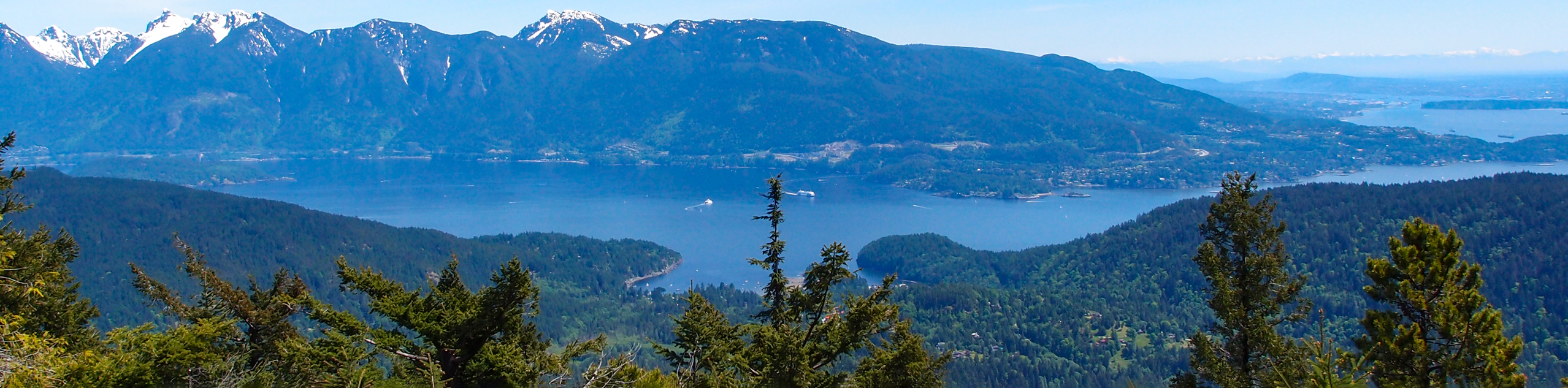
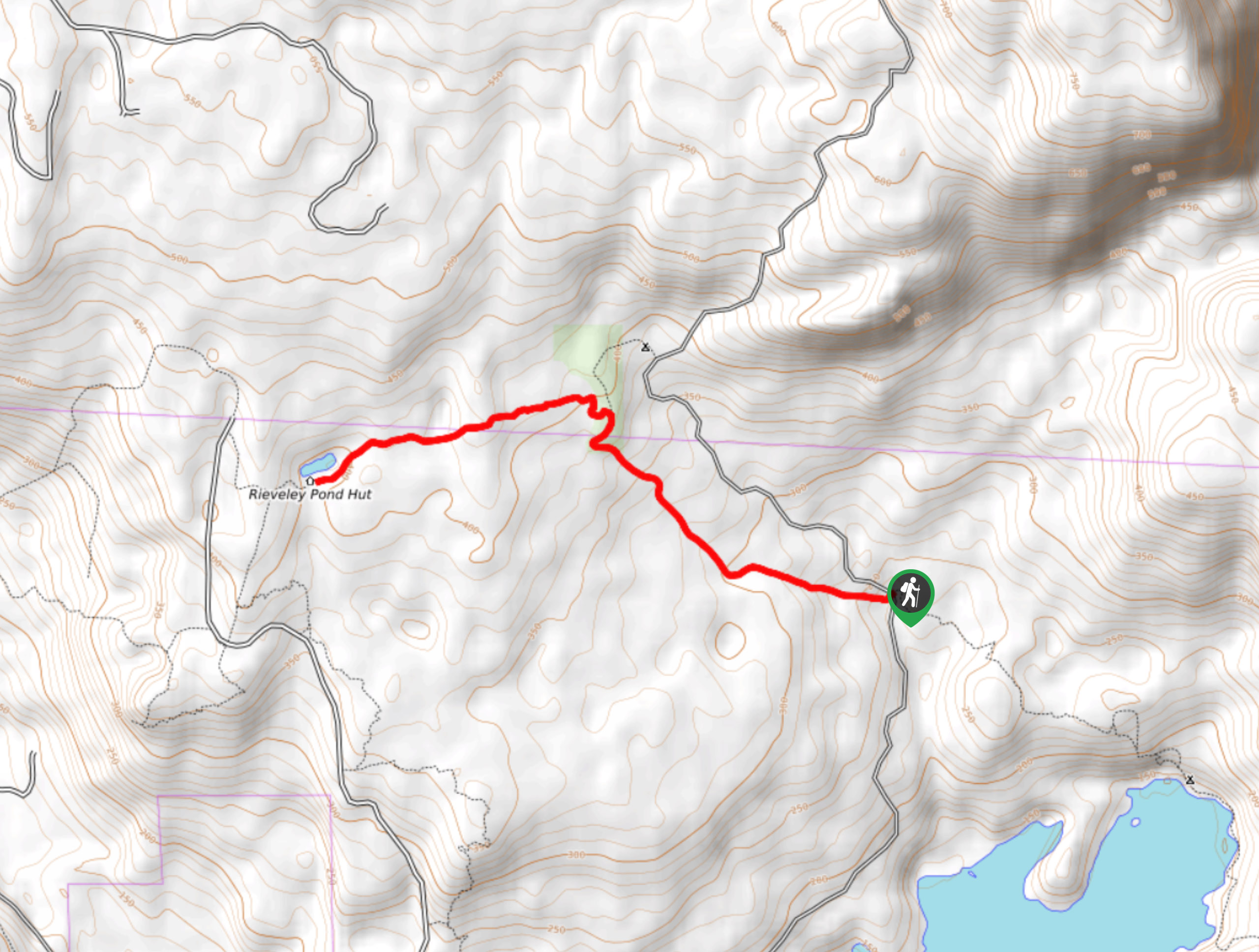
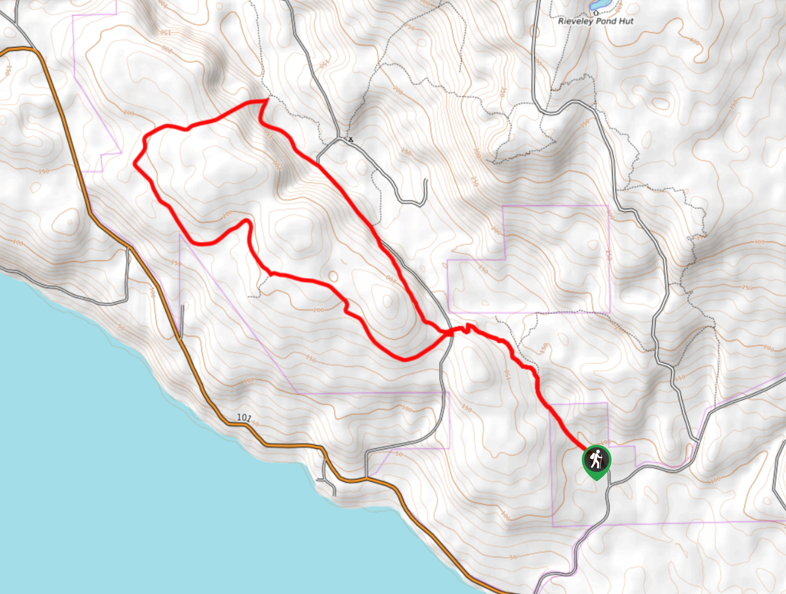
- Mount Steele: A bit of a longer hike, this 12.2mi journey through Tetrahedron Provincial Park will provide some amazing views of the nearby Tantalus Range. Elevation gain on this trail is largely spread throughout the route, making for a pleasant uphill climb through the forest and mountains.
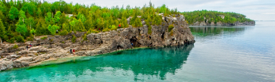
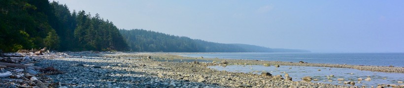
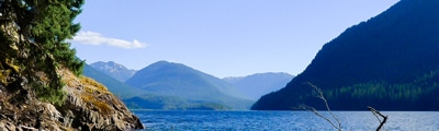
- Francis Point Lighthouse Trail: A charming 1.6mi hike along the coast, this short trail will take you through Francis Point Provincial Park and its beautiful groves of arbutus trees. Parts of this trail are a bit rocky; however, stunning coastal views that stretch out to Texada Island await.
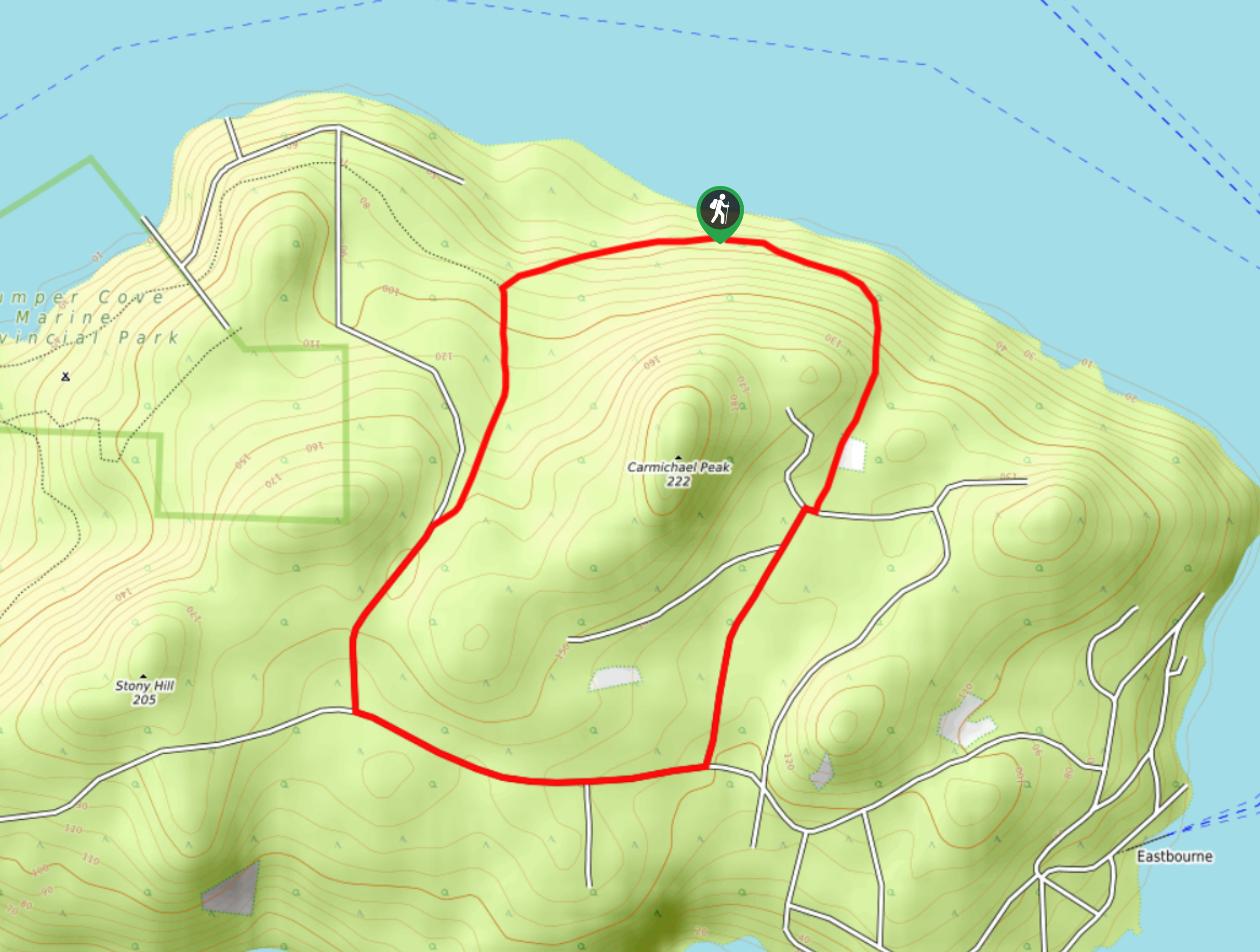
- Mount Gardner Loop Trail: A popular hiking route on Bowen Island, the Mount Gardner Loop will lead you uphill to a viewpoint with amazing views that sweep across the water from Vancouver Island to the mainland. Parts of the trail are poorly marked, so be sure to bring a map and keep an eye on the trail.
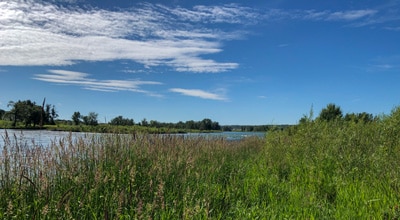
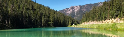
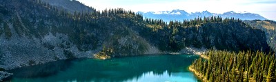
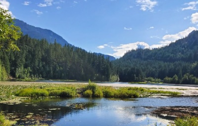
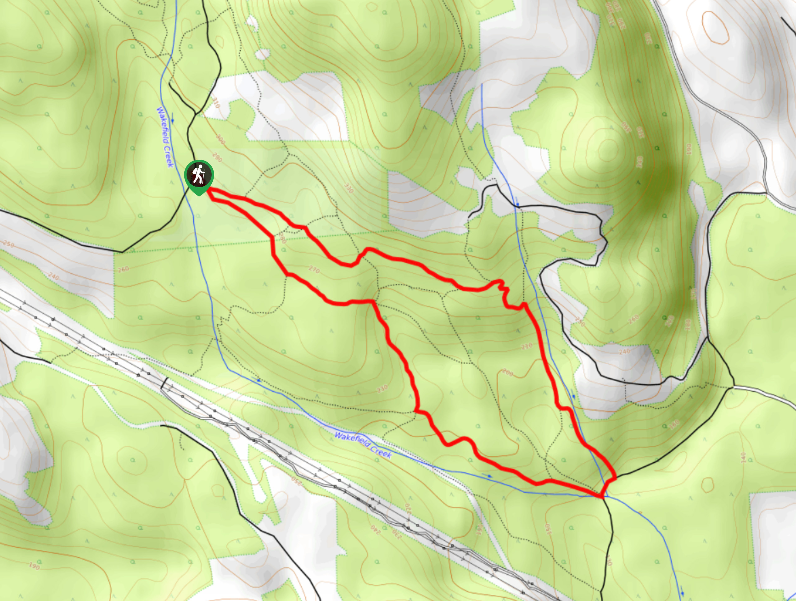
- Klein Lake: Another forested hike, this trail will lead you through a beautifully scenic woodland setting to arrive at the shores of Klein Lake. A good variety of terrain, scenic views, and the chance to hang out by the lake will make this hike a family favourite.
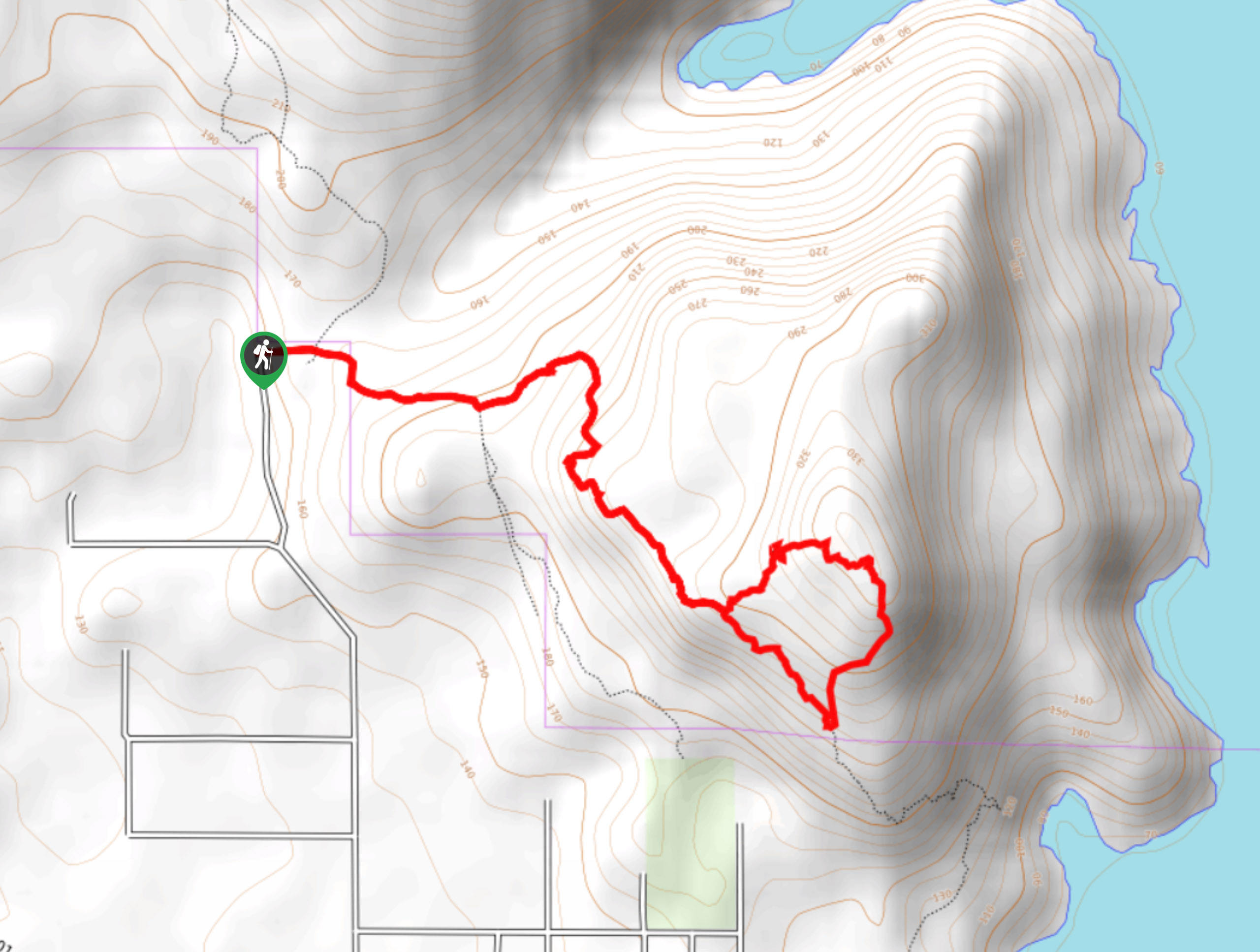
- Cliff Gilker Park Loop: A quick adventure near Sechelt, this trail will lead you through the rainforest to visit a lovely waterfall. The strong network of intersecting trails in the area can be a bit tricky to navigate, so be sure to bring a GPS for this one.
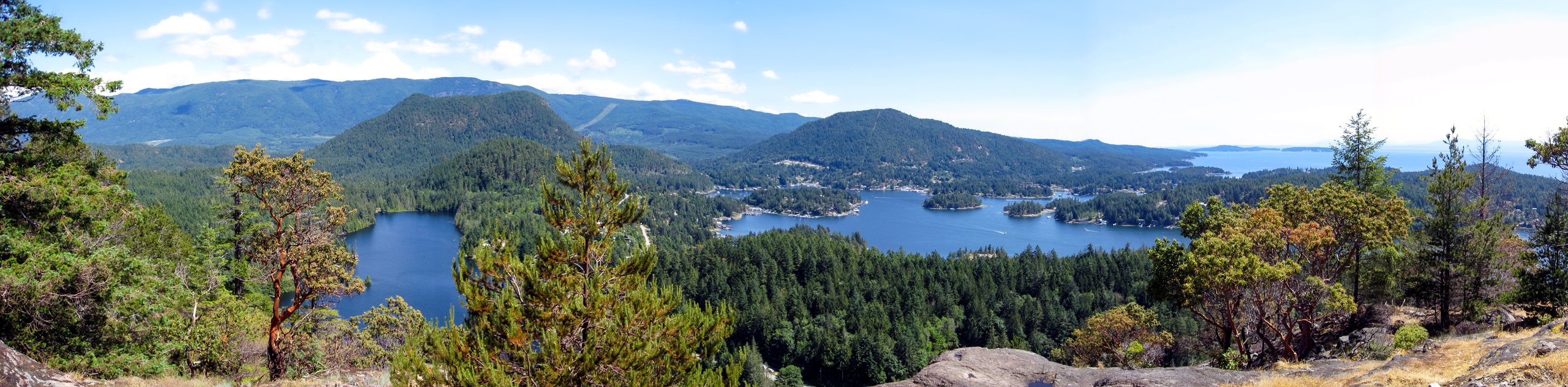
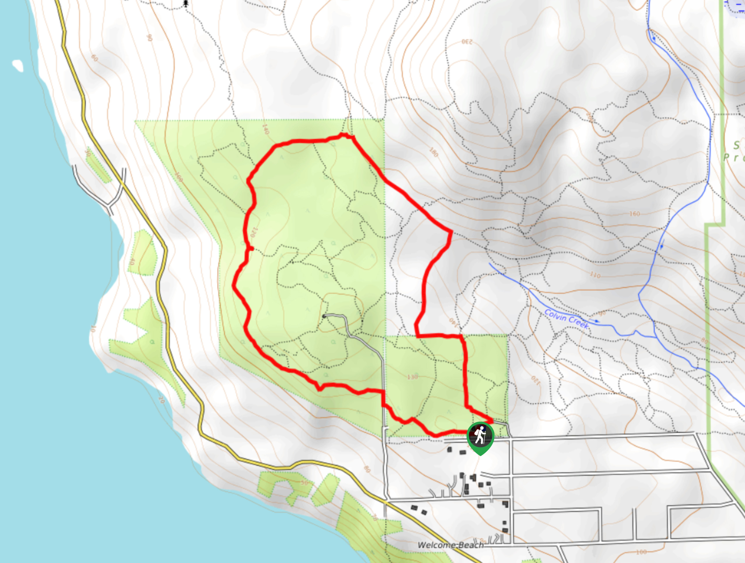
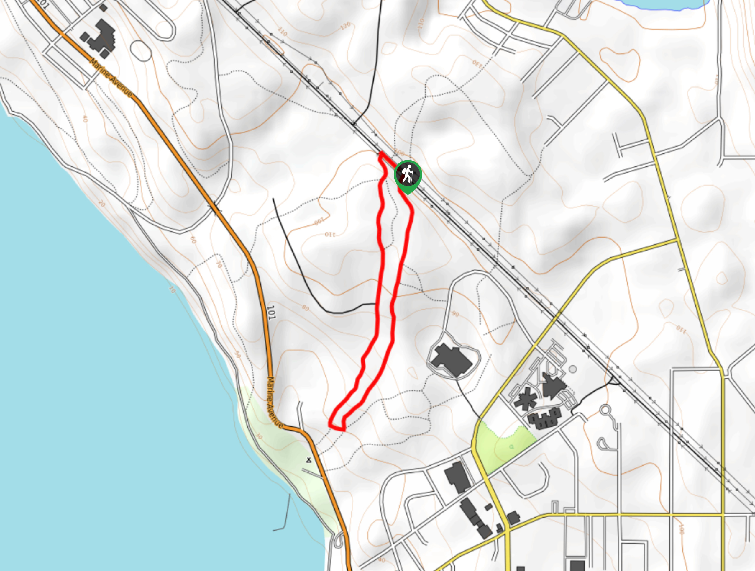
- Soames Hill Loop: Another short hike on the Sunshine Coast, the Soames Hill Loop will take you uphill to a viewpoint overlooking Howe Sound. Here, you will also enjoy views of the rugged mainland, as well as the Keats and Bowen islands.
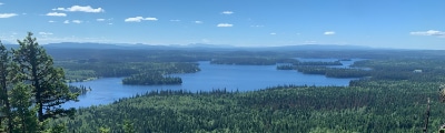
- Inland Lake Loop: This fantastic day hike can be found within Inland Lake Provincial Park and takes you through the forest to walk the shores of a charming lake. Although the route is an intermediate length, the relatively easy to navigate terrain makes it perfectly suitable for casual and experienced hikers alike.
When is the Best Time to Hike the Sunshine Coast?
With mild average temperatures, weather along the Sunshine Coast remains favourable year-round, making it possible to plan a hiking trip here at any point depending on your tolerance for rain. An ideal window for hiking in the region ranges from May-October, although trails will likely be at their driest from June-August. While this time will likely see the largest number of tourists to the region, you should still be able to find some peace and quiet on several of the amazing hiking trails that can be found along the Sunshine Coast.
Other Outdoor Activities on the Sunshine Coast
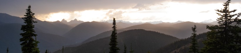
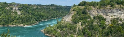
Thanks to its beautiful forests and idyllic location along the Strait of Georgia, the Sunshine Coast offers access to countless outdoor activities to enjoy both on land and out on the water. Boating, fishing, and water sports like kayaking/canoeing/paddle boarding are all popular pastimes here, while hiking, mountain biking, and road cycling are great ways to explore the various landscapes along the coast. Although most of the communities along the coast will see a plentiful amount of rain during the winter, travelling a bit further inland towards the rugged, mountainous interior will provide opportunities for skiing, snowshoeing, and snowmobiling for those that prefer cold weather adventures.
Frequently Asked Questions About the Sunshine Coast
What is considered the Sunshine Coast?
Located in the southwest corner of British Columbia, the Sunshine Coast is a 111.8mi swathe of land along the Strait of Georgia that stretches from Howe Sound to Desolation Sound.
How do I get to the Sunshine Coast from Vancouver?
Although part of the mainland, the mountainous terrain of the Sunshine Coast makes it extremely difficult to access by car. As such, water and air travel are the preferred methods to reach the different communities in the area. The best way to access the Sunshine Coast from Vancouver is to take the ferry between Horseshoe Bay and Langdale, an approximately 40 minute journey that runs every two hours.
Read MoreThe best hikes in Sunshine Coast
01. Smuggler Cove
Difficulty
The trail to Smuggler Cove is a 2.3mi lollipop hiking route that will… Read More
02. Skookumchuck Narrows
Difficulty
The Skookumchuck Narrows trail is a 4.8mi out-and-back hiking route within Skookumchuck Narrows… Read More
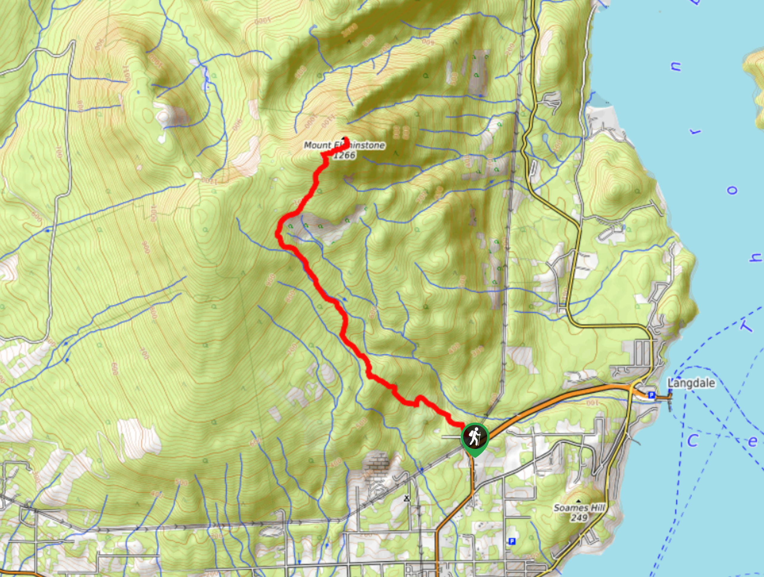
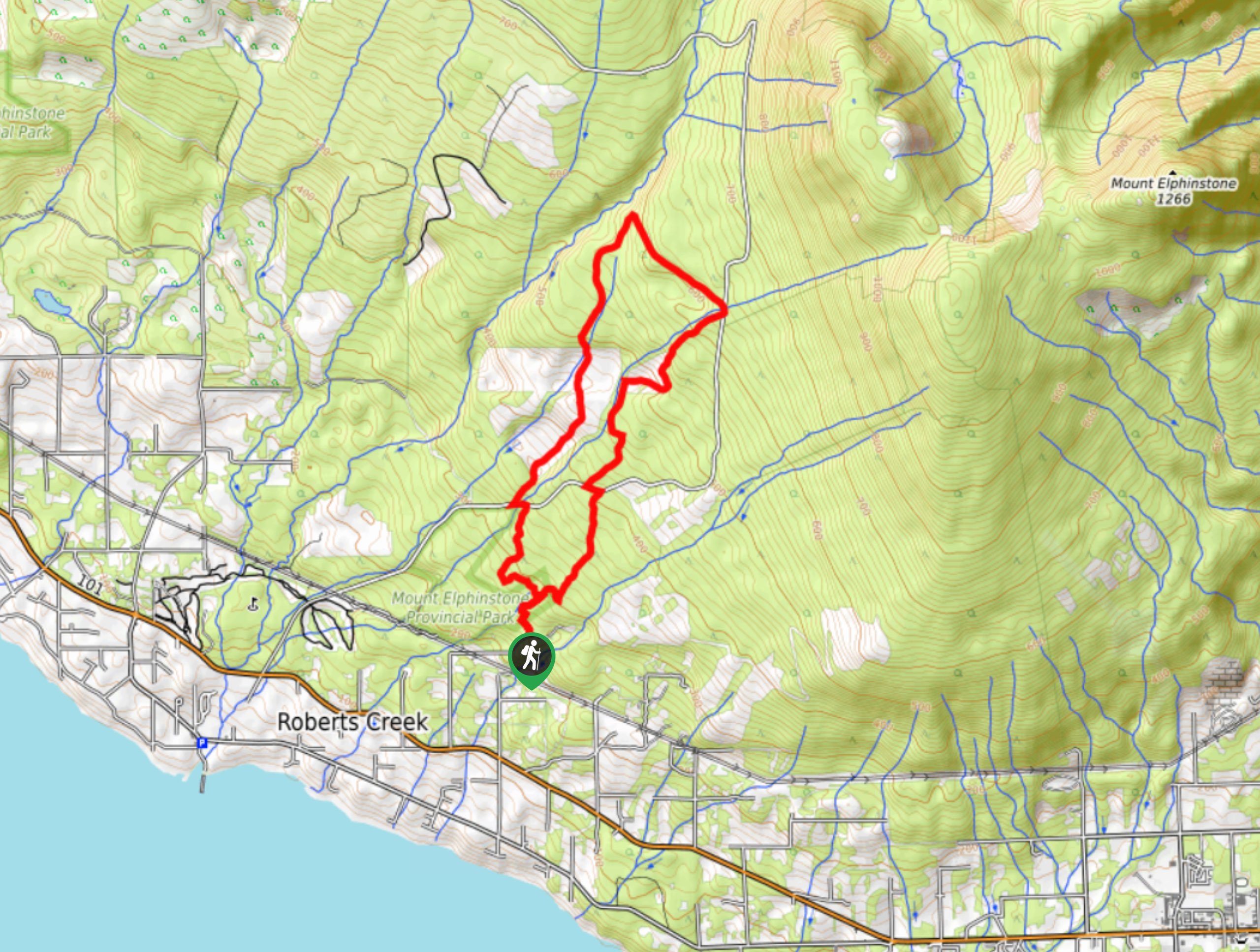
03. Mount Elphinstone Summit Trail
Difficulty
The Mount Elphinstone Summit Trail is a 7.6mi out-and-back hiking route near Gibsons,… Read More
04. Mount Gardner Loop Trail
Difficulty
The Mount Gardner Loop Trail is a 6.0mi lollipop hiking circuit on Bowen… Read More
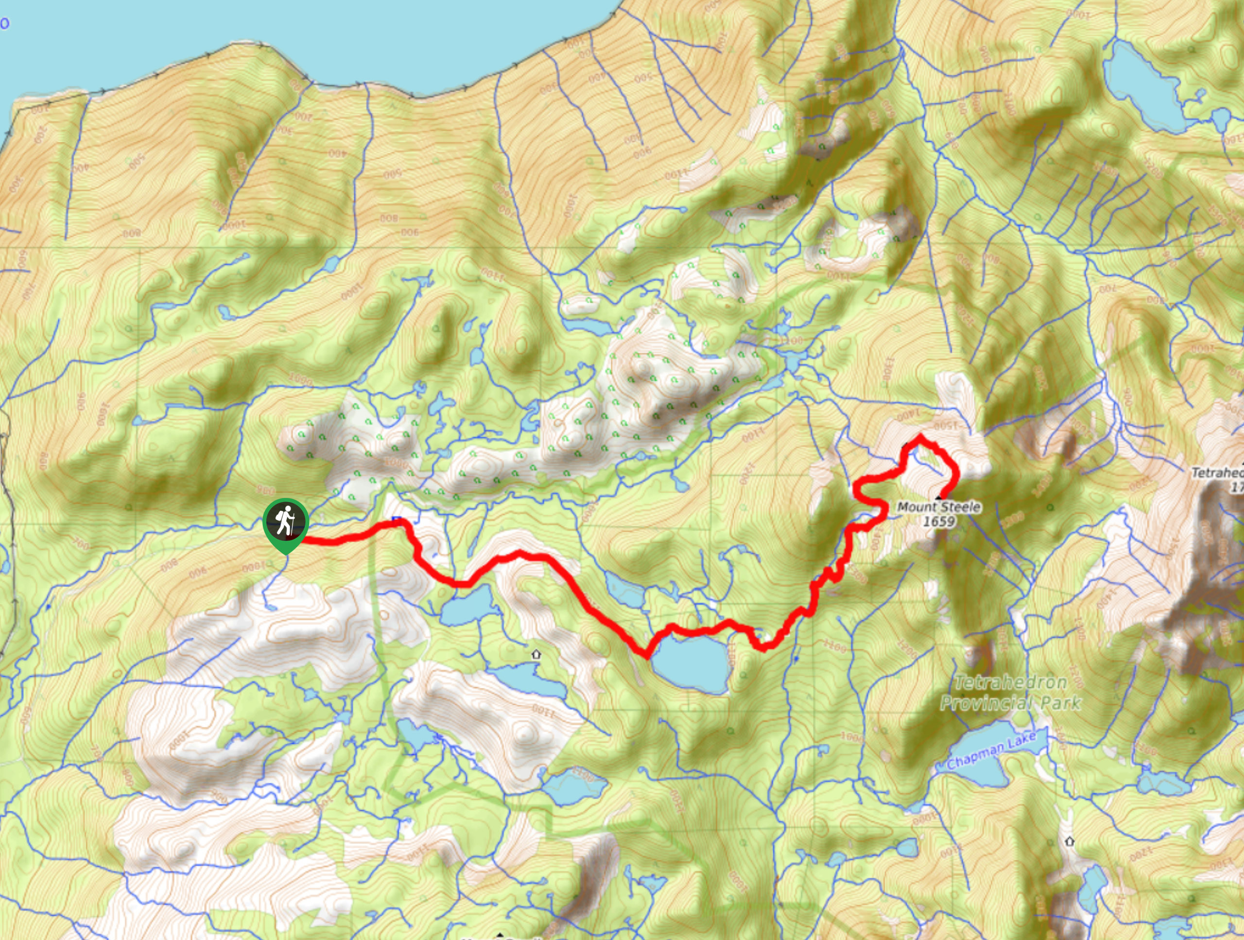
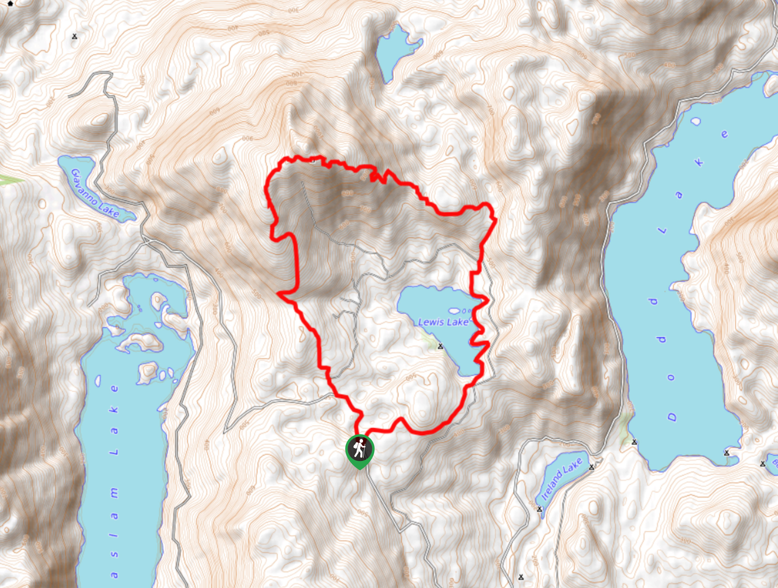
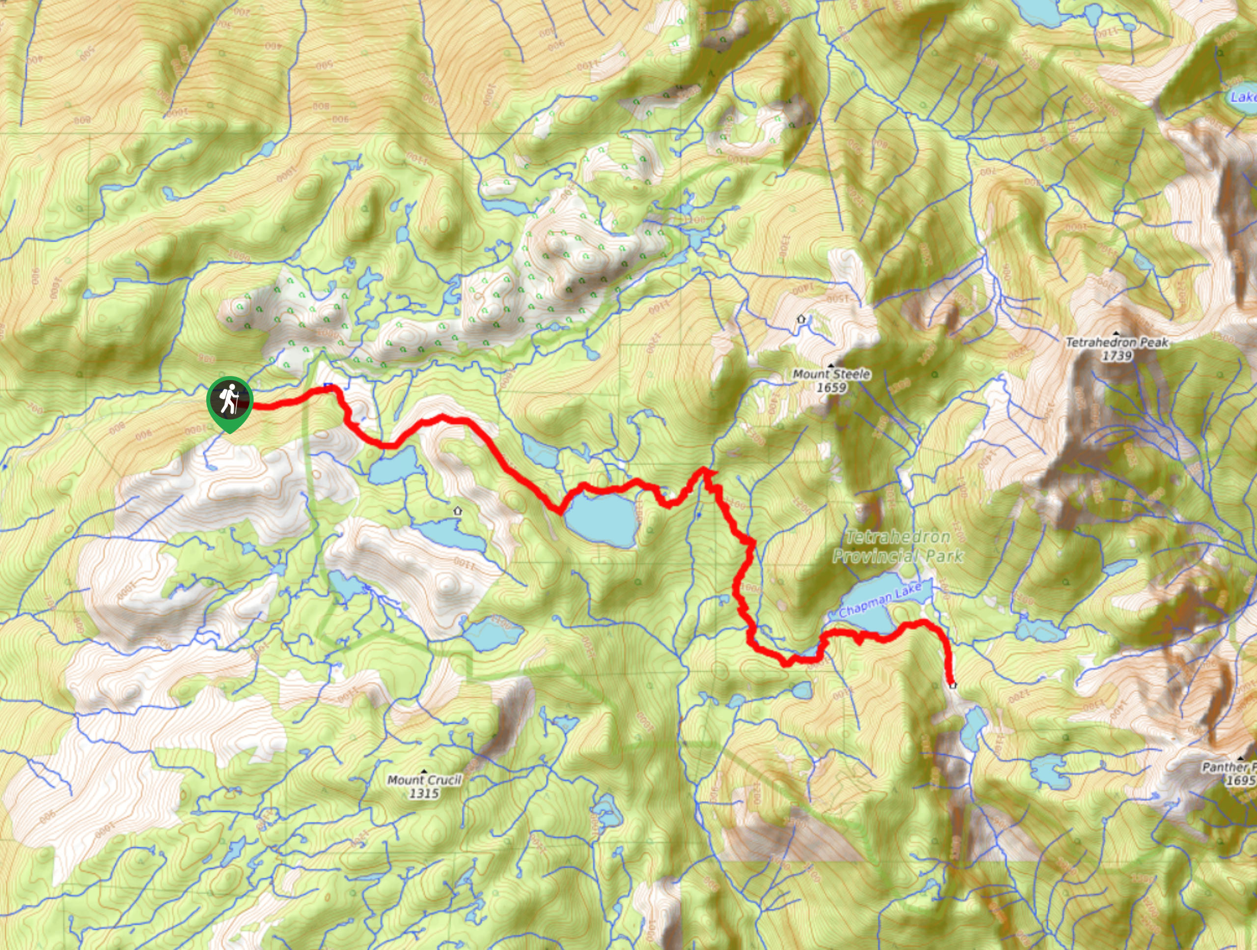
05. Mount Steele Hike
Difficulty
The Mount Steele trail is a 12.2mi out-and-back hiking route in Tetrahedron Provincial… Read More
06. Mount Gardner Hikers Trail
Difficulty
The Mount Gardner Hikers Trail is a 4.8mi out-and-back hiking route on Bowen… Read More
07. Cliff Gilker Park Loop
Difficulty
The Cliff Gilker Park Loop is a 1.3mi lollipop hiking route near Sechelt,… Read More
08. Soames Hill Loop Hike
Difficulty
The Soames Hill Loop is a 1.6mi lollipop hiking route in Gibsons, BC,… Read More
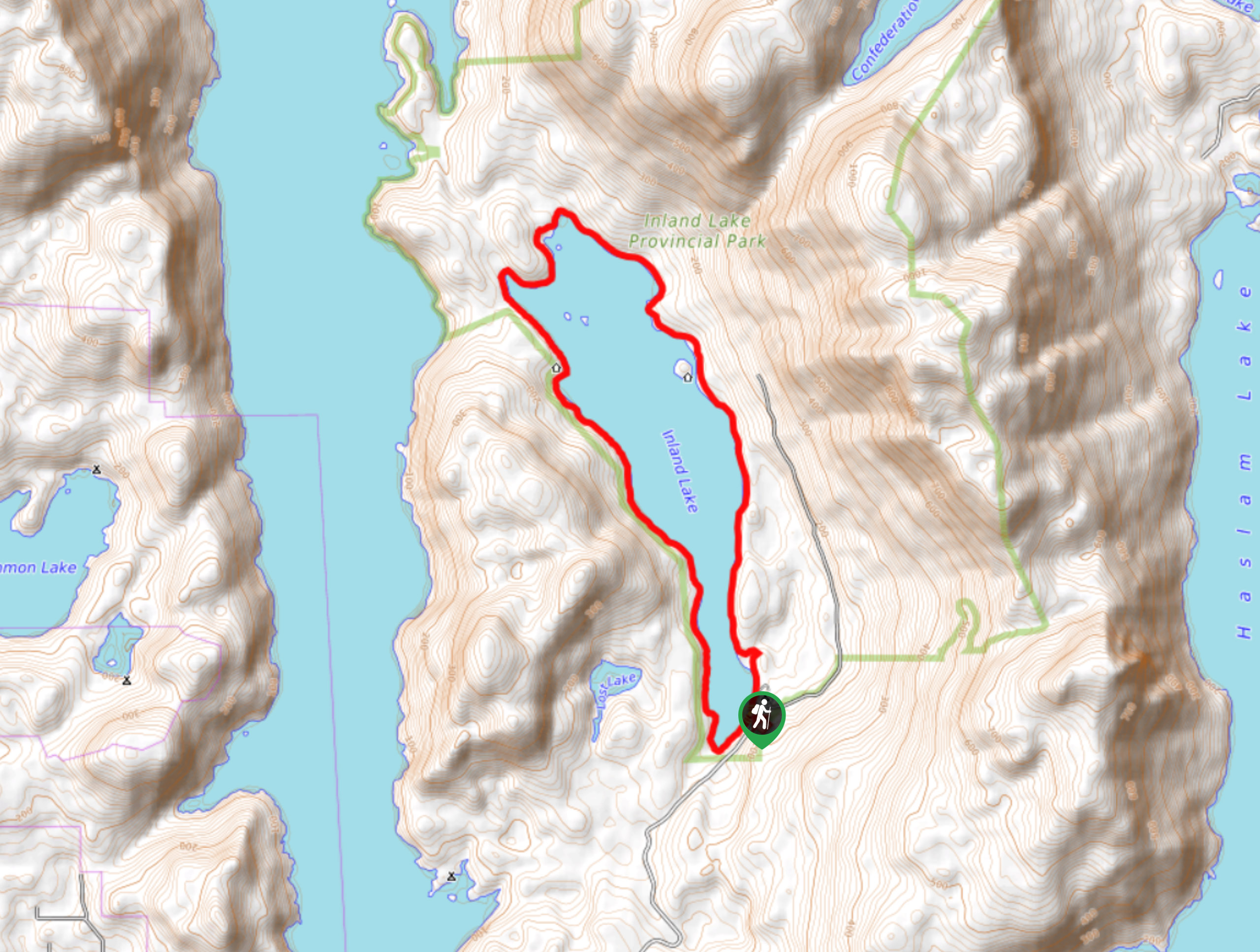
09. Inland Lake Loop Hike
Difficulty
The Inland Lake Loop is a 8.0mi hiking circuit near Powell River, BC,… Read More
10. Tin Hat Mountain Hike
Difficulty
The Tin Hat Mountain Hike is an 11.4mi hiking circuit near Powell River,… Read More
Yes, there are more than 10
Sunshine Coast is so beautiful that we can not give you only 10 hikes. So here is a list of bonus hikes in Sunshine Coast that you should take a look at as well
11. Francis Point Lighthouse Trail
Difficulty
The Francis Point Lighthouse Trail is a 1.6mi out-and-back hiking route in Francis… Read More
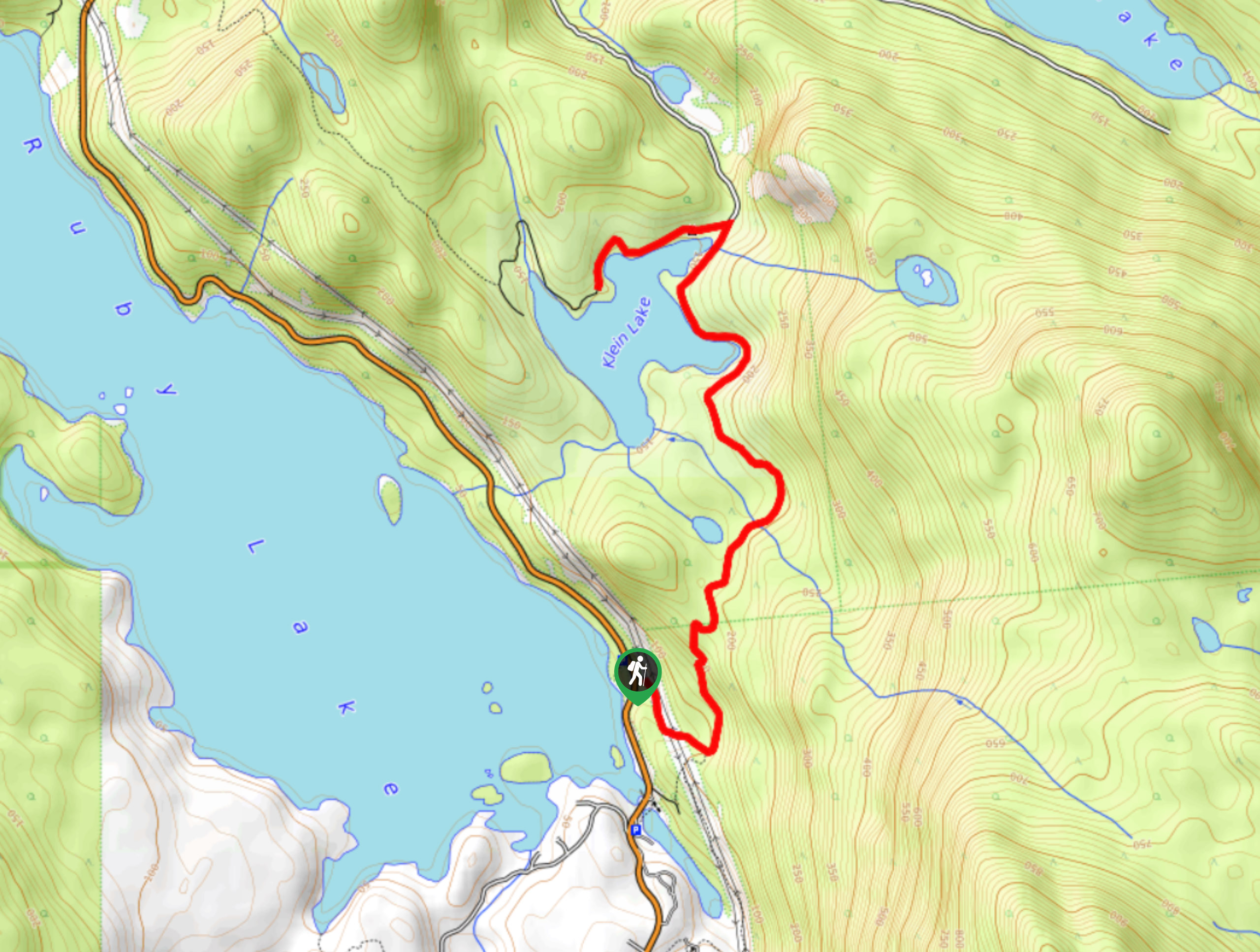
12. Klein Lake Hike
Difficulty
The Klein Lake Trail is an 5.4mi out-and-back hiking route that passes through… Read More
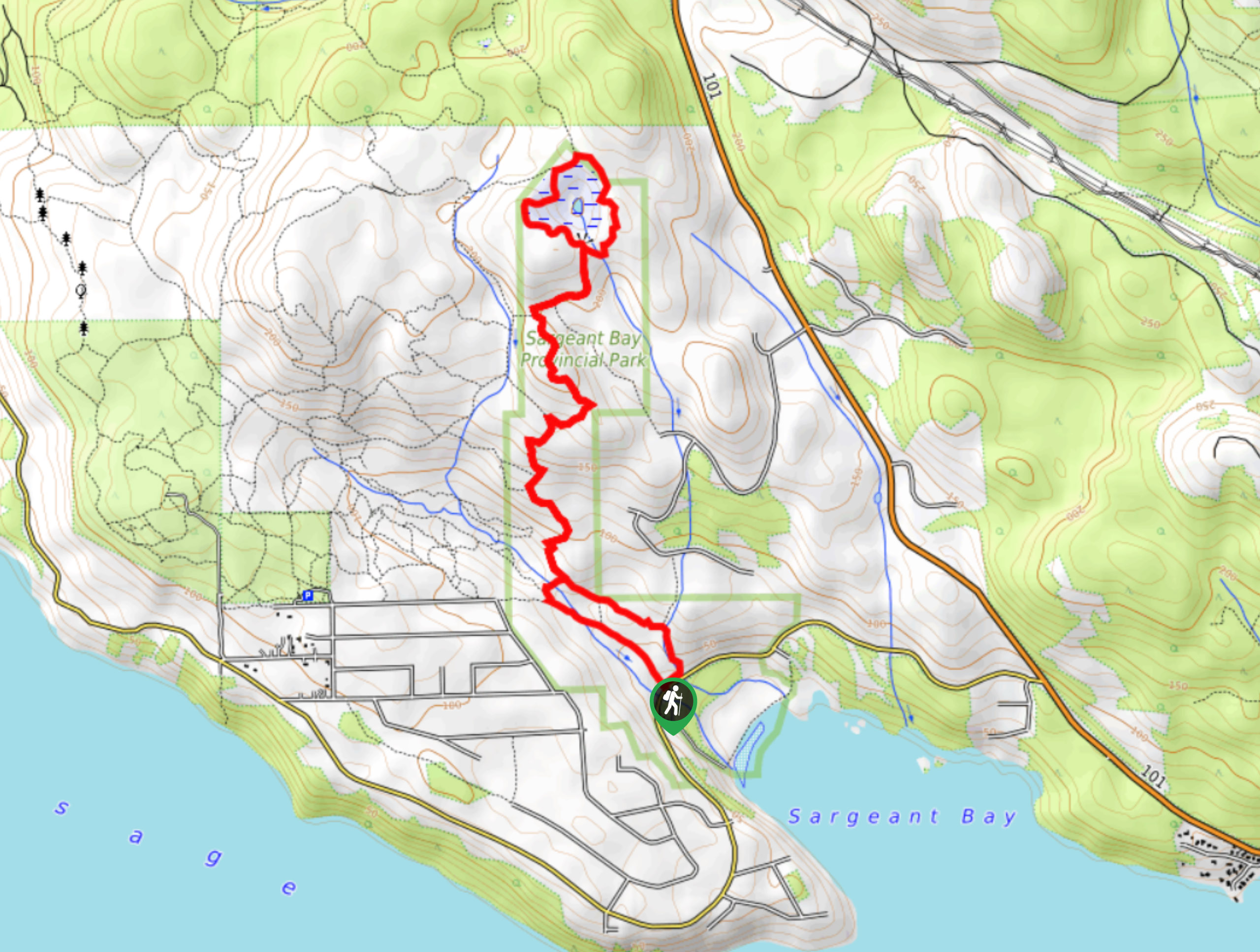
13. Triangle Lake Trail
Difficulty
The Triangle Lake Trail is an 5.3mi hiking circuit in Sargeant Bay Provincial… Read More
14. Dorman Point Trail
Difficulty
The Dorman Point Trail is a 1.5mi out-and-back hiking route on Bowen Island… Read More
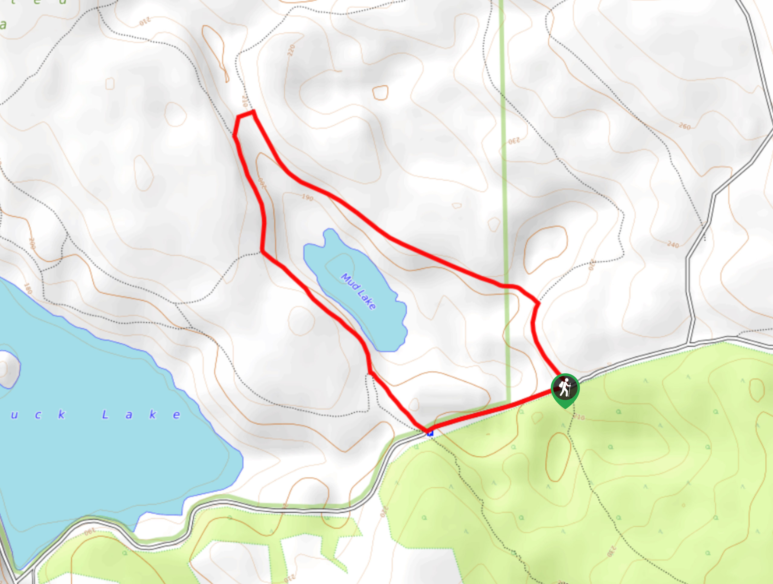
15. Mud Lake Hike
Difficulty
The Mud Lake Hike is a 2.4mi loop trail near Powell River, BC,… Read More
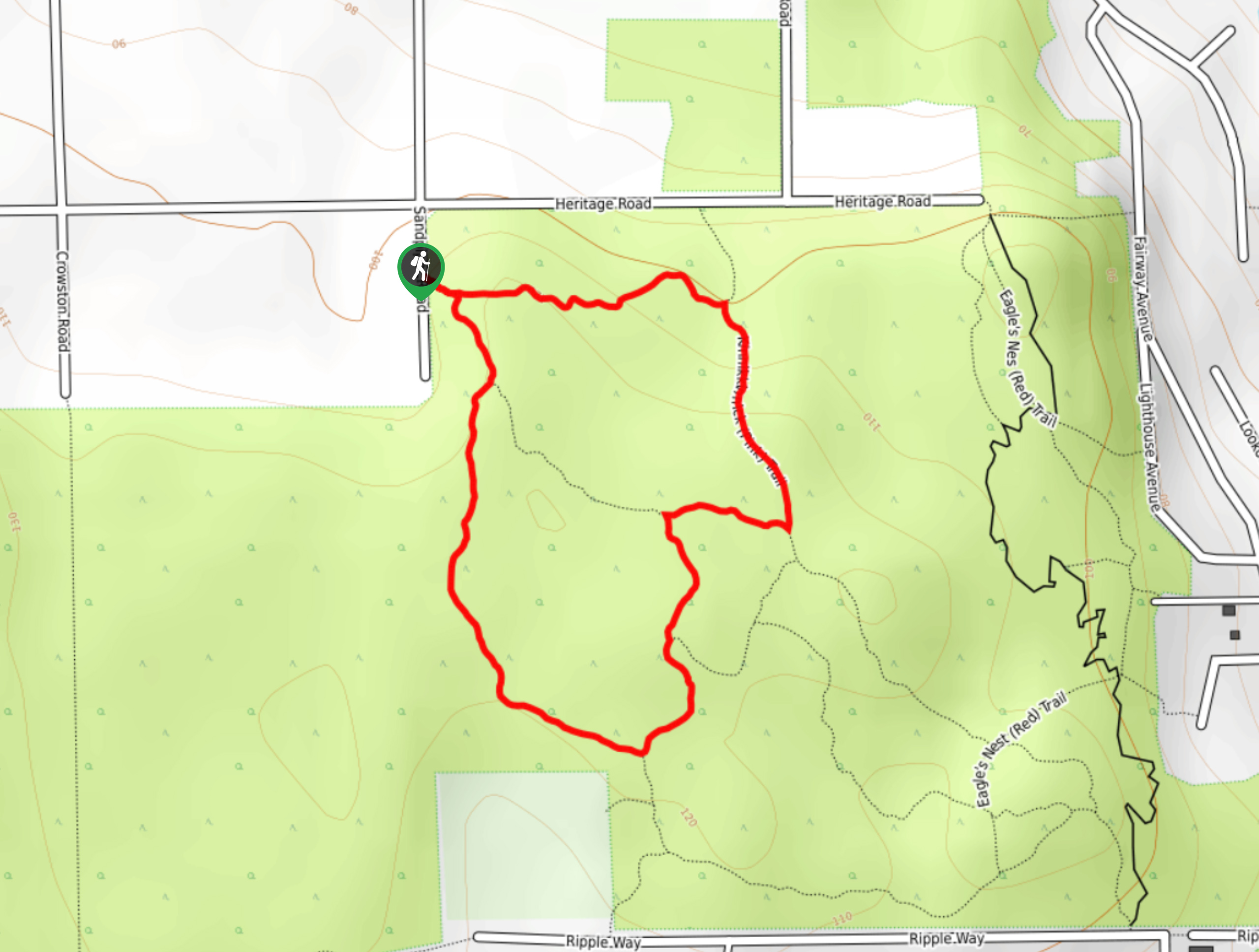
16. Hidden Grove Loop
Difficulty
The Hidden Grove Loop is a 2.9mi hiking circuit north of Sechelt, BC,… Read More
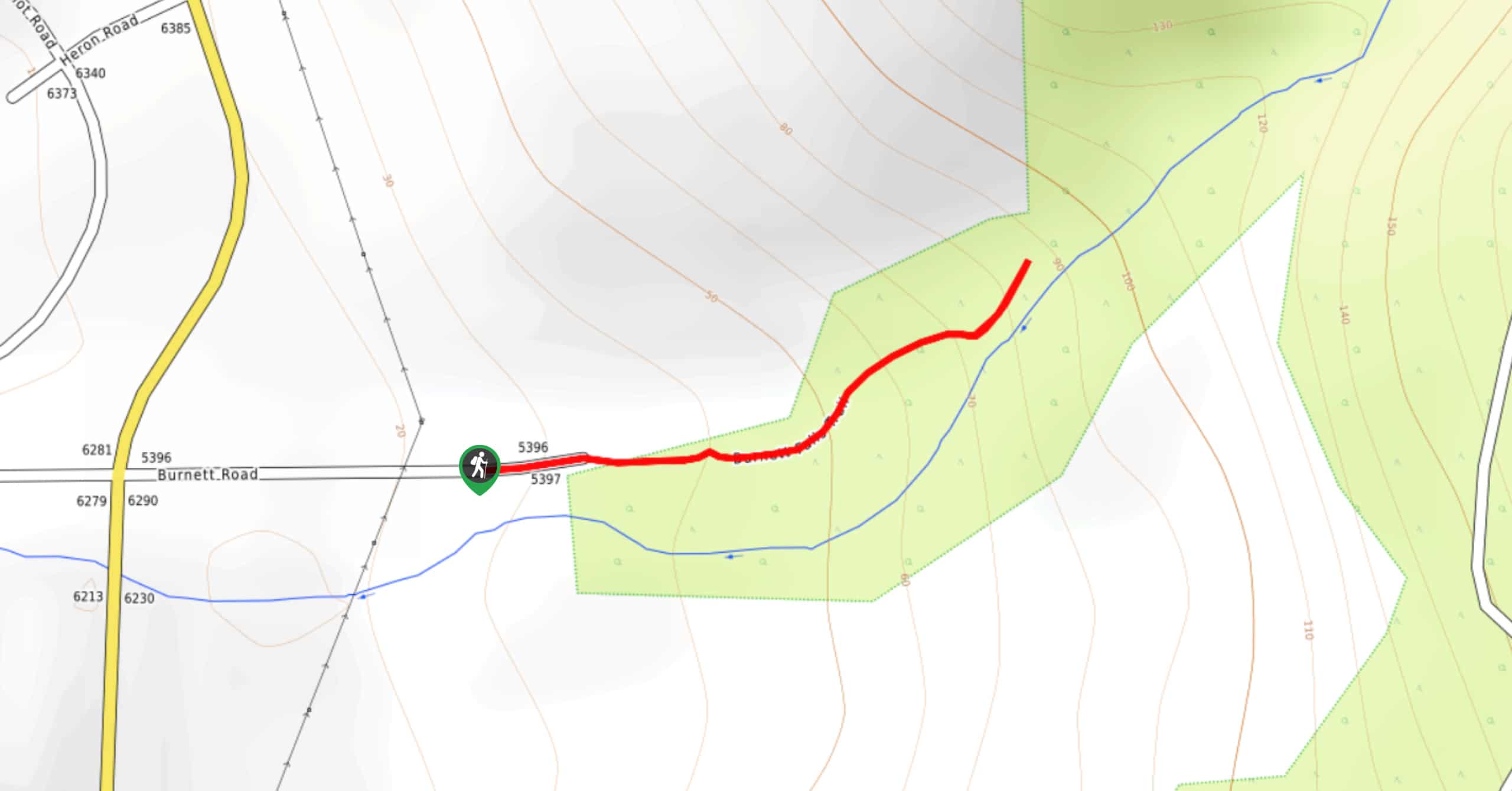
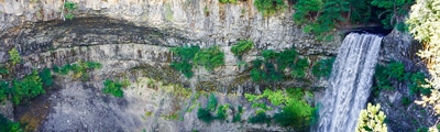
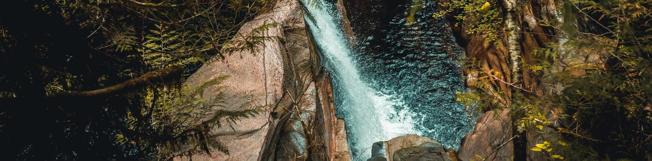
17. Burnett Falls Hike
Difficulty
The trek to Burnett Falls follows a 0.3mi out-and-back hiking route that climbs… Read More
18. Big Tree Loop Hike
Difficulty
The Big Tree Loop is a 2.8mi lollipop hiking route near Sechelt, BC,… Read More
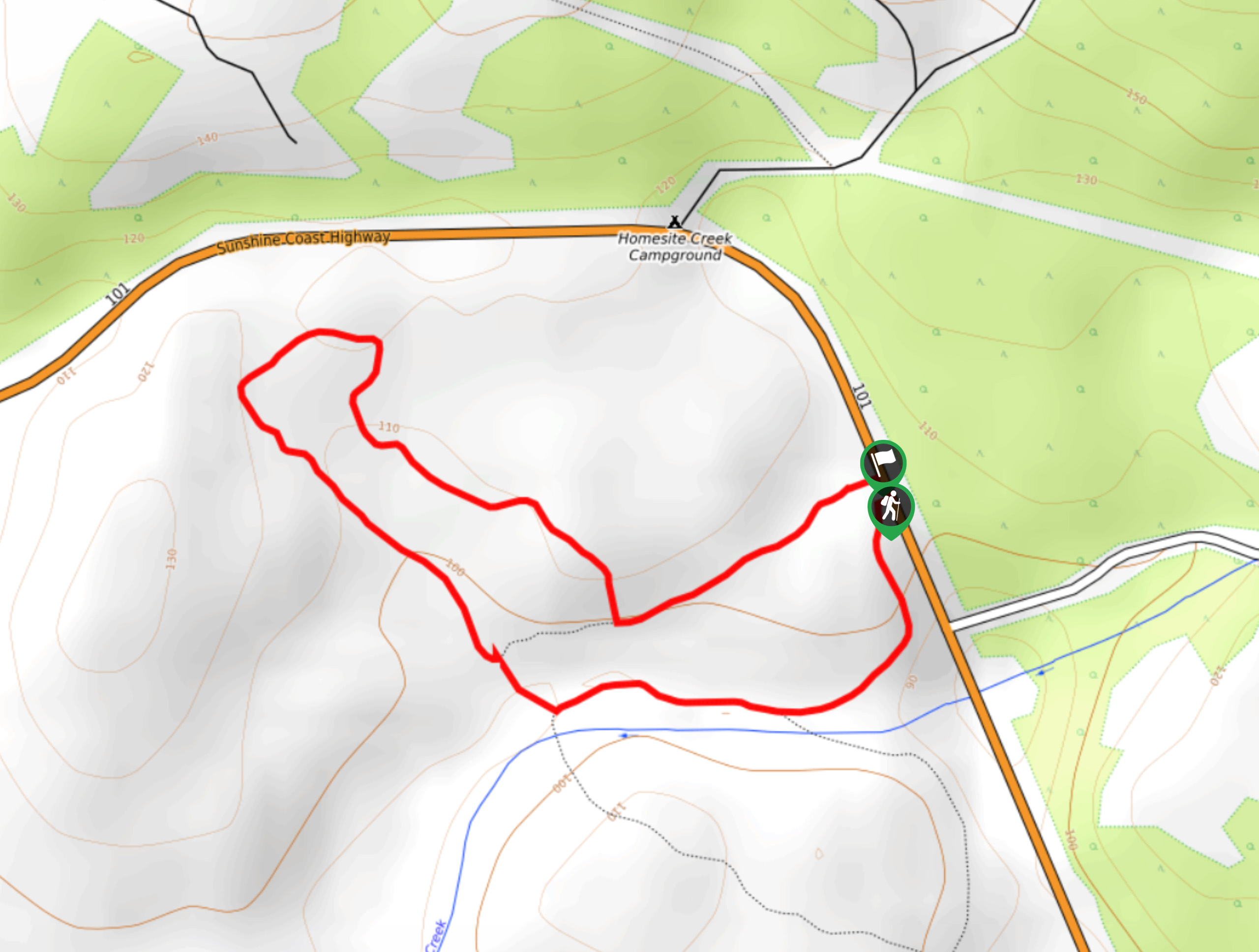
19. Homesite Creek Falls Hike
Difficulty
The Homesite Creek Falls Hike is made up of two scenic hiking routes that lead… Read More
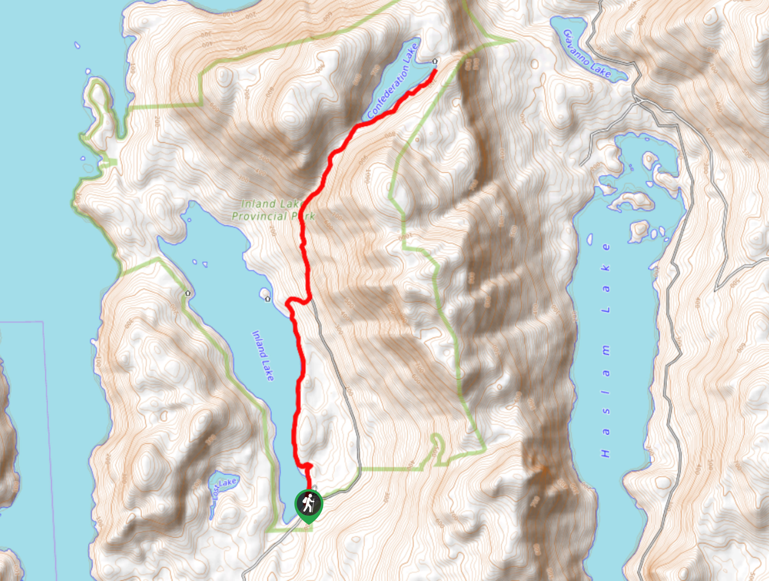
20. Confederation Lake Trail
Difficulty
The trail to Confederation Lake is a 10.1mi out-and-back hiking route near Powell… Read More
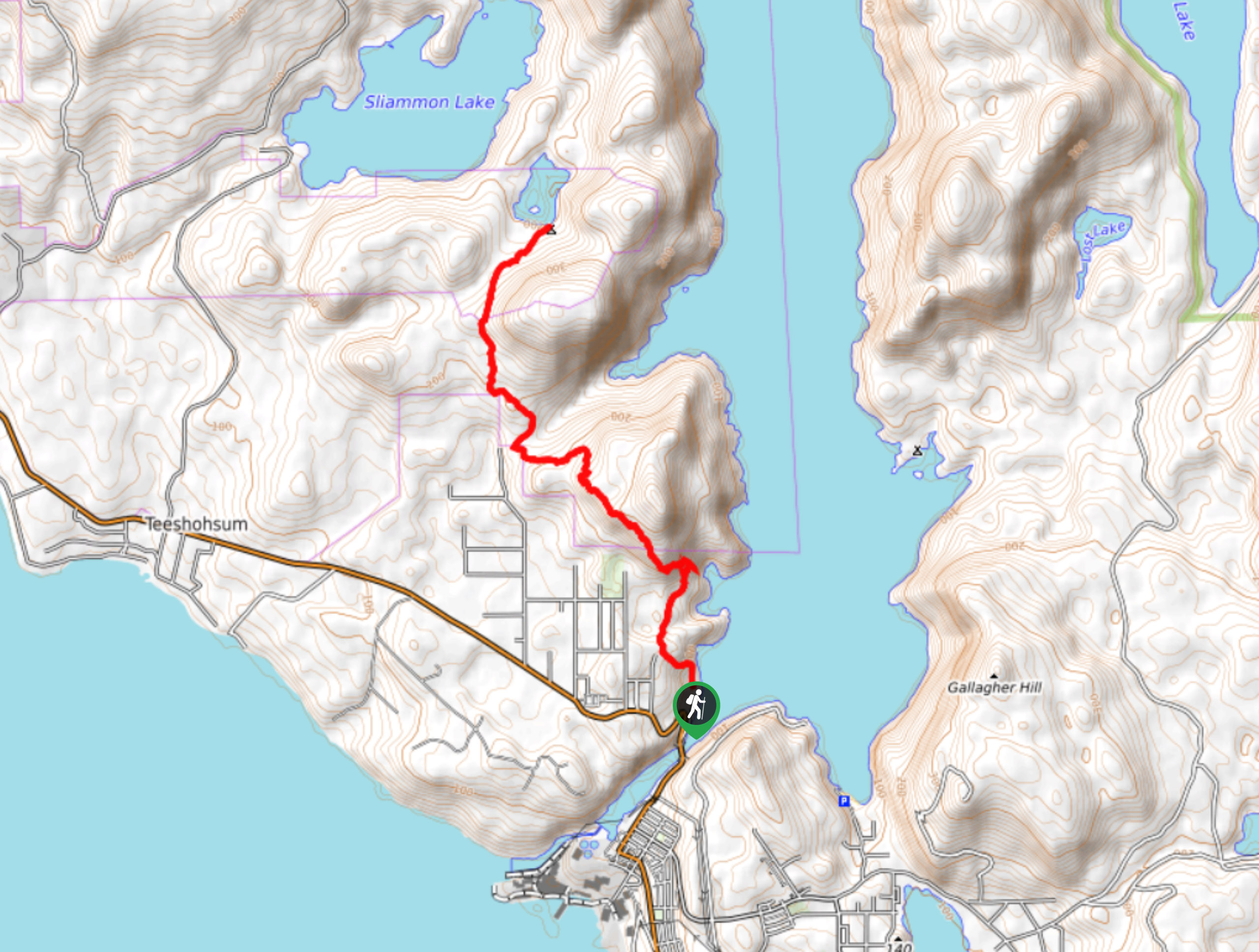
21. Little Sliammon Lake Hike
Difficulty
The trek to Little Sliammon Lake is an 7.4mi out-and-back hiking route that… Read More
22. Appleton Creek Trail
Difficulty
The Appleton Creek Trail is a 4.9mi out-and-back hiking route north of Powell… Read More
23. Scout Mountain Trail
Difficulty
The Scout Mountain Trail is a 2.9mi lollipop hiking route near Powell River,… Read More
24. Mount Daniel Trail
Difficulty
The Mount Daniel Trail is a 2.6mi out-and-back hiking route that will take… Read More
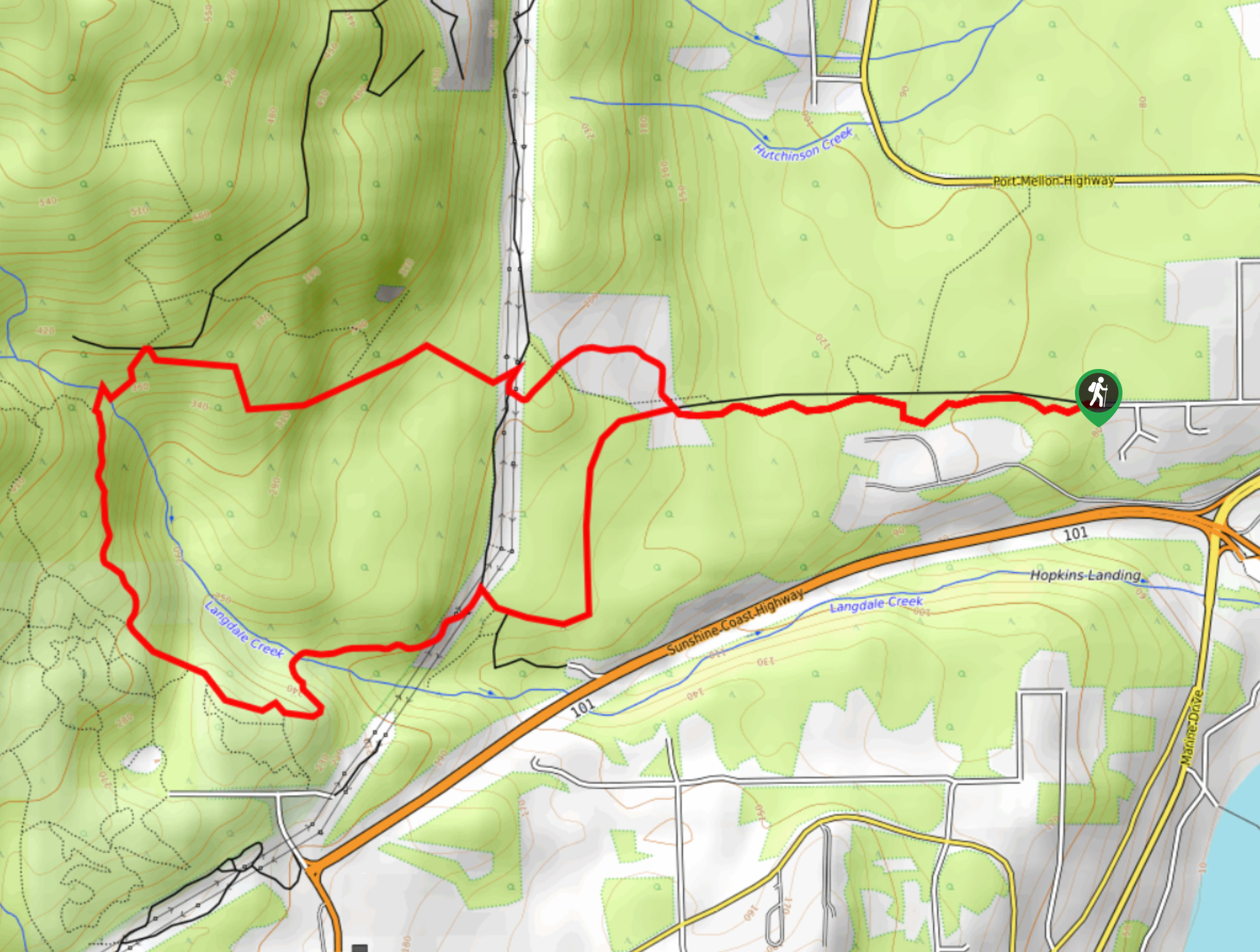
25. Langdale Falls Loop Hike
Difficulty
The Langdale Falls Loop is a 4.1mi lollipop hiking route in Langdale, BC… Read More
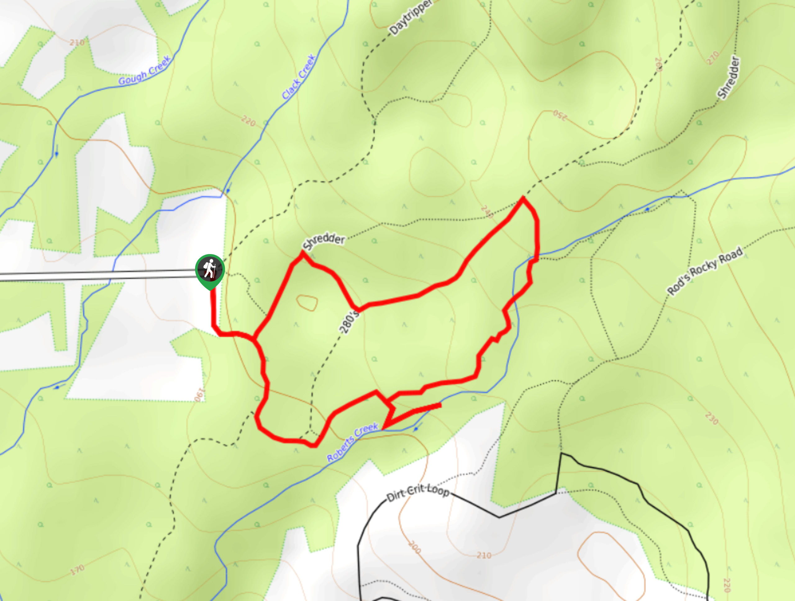
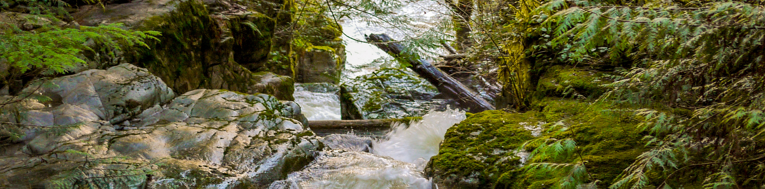
26. Roberts Creek Waterfall Loop
Difficulty
The Roberts Creek Waterfall Loop is a 1.1mi lollipop hiking route near Sechelt,… Read More
27. Pender Hill Trail
Difficulty
The Pender Hill Trail is a 1.0mi out-and-back hiking route near Sechelt, BC,… Read More
28. Kinnikinnick Park Loop
Difficulty
The Kinnikinnick Park Loop is a 1.2mi lollipop hiking route north of Sechelt,… Read More
29. McNair Lake Trail
Difficulty
The McNair Lake Trail is a 14.1mi out-and-back hiking route in Tetrahedron Provincial… Read More
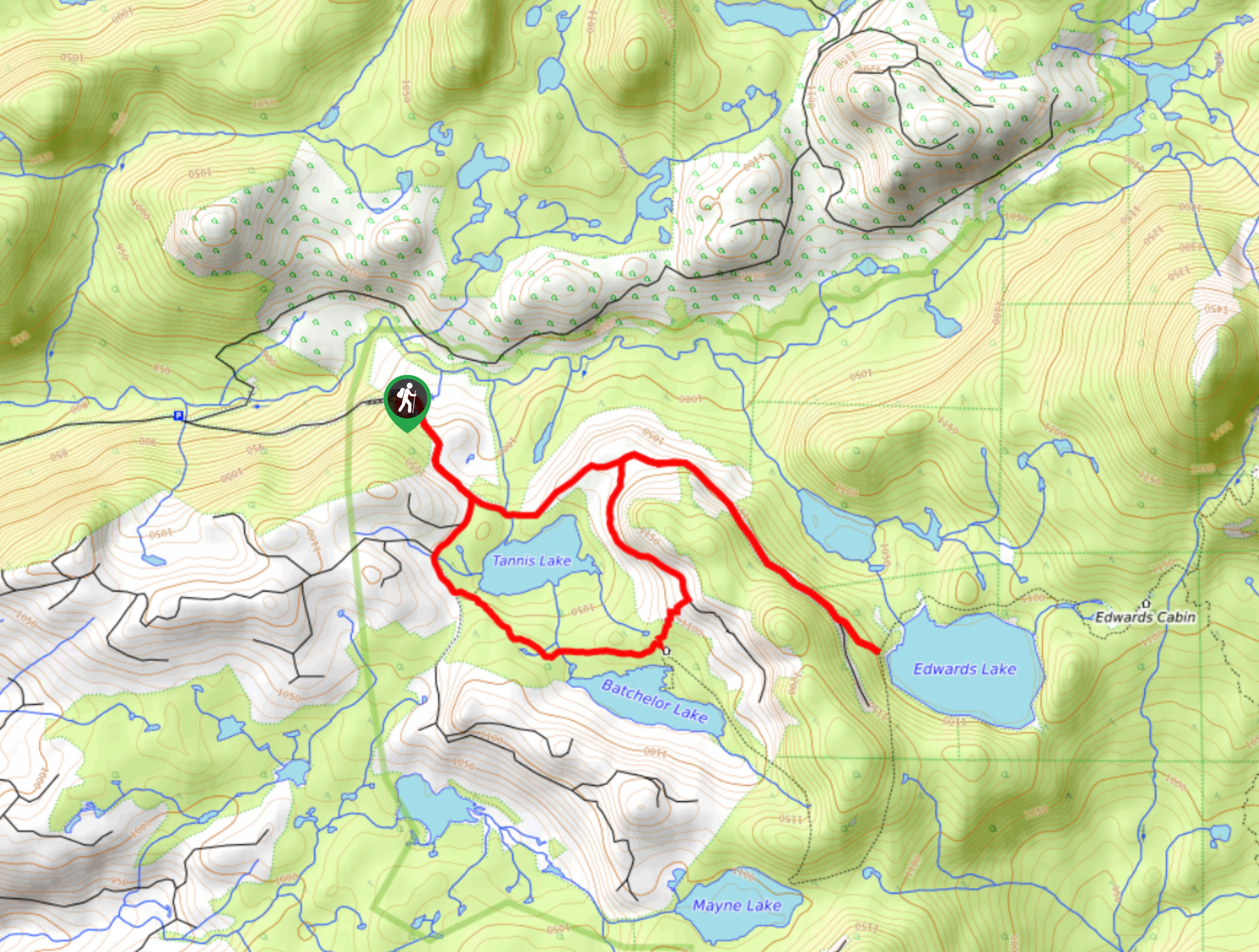
30. Edwards and Tannis Lakes Loop
Difficulty
The Edwards and Tannis Lakes Loop is an 5.0mi lollipop hiking route north… Read More
31. Dudette Loop Trail
Difficulty
The Dudette Loop Trail is an 7.0mi lollipop hiking route that is made… Read More
32. Chapman Falls Hike
Difficulty
The Chapman Falls Hike is a 4.5mi lollipop hiking route near Sechelt, BC,… Read More
33. Suicide Creek Trail
Difficulty
The Suicide Creek Trail is an 5.2mi hiking circuit near Powell River that… Read More
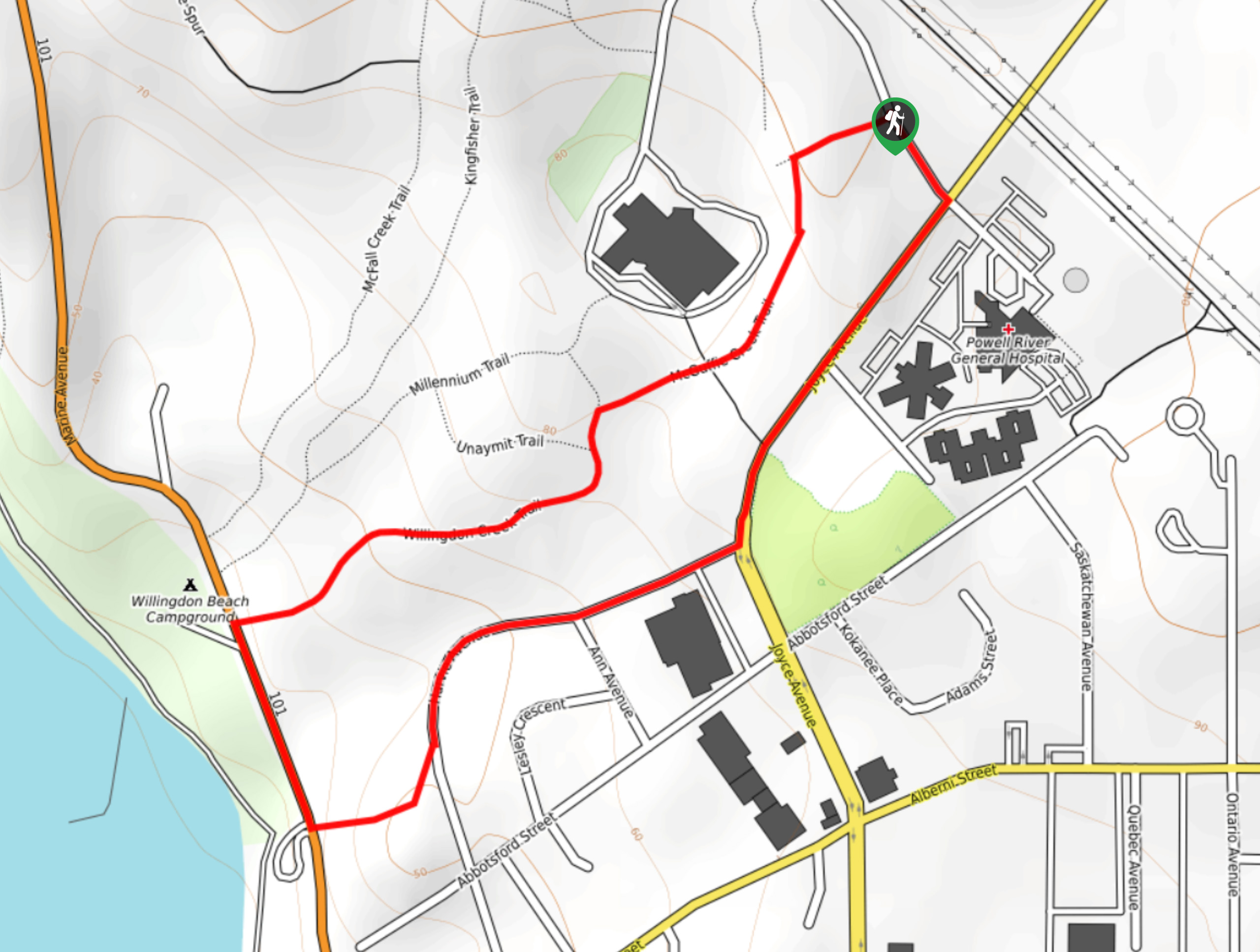
34. Willingdon Beach Trail
Difficulty
The Willingdon Beach Trail is a 2.7mi out-and-back hiking route in Powell River… Read More
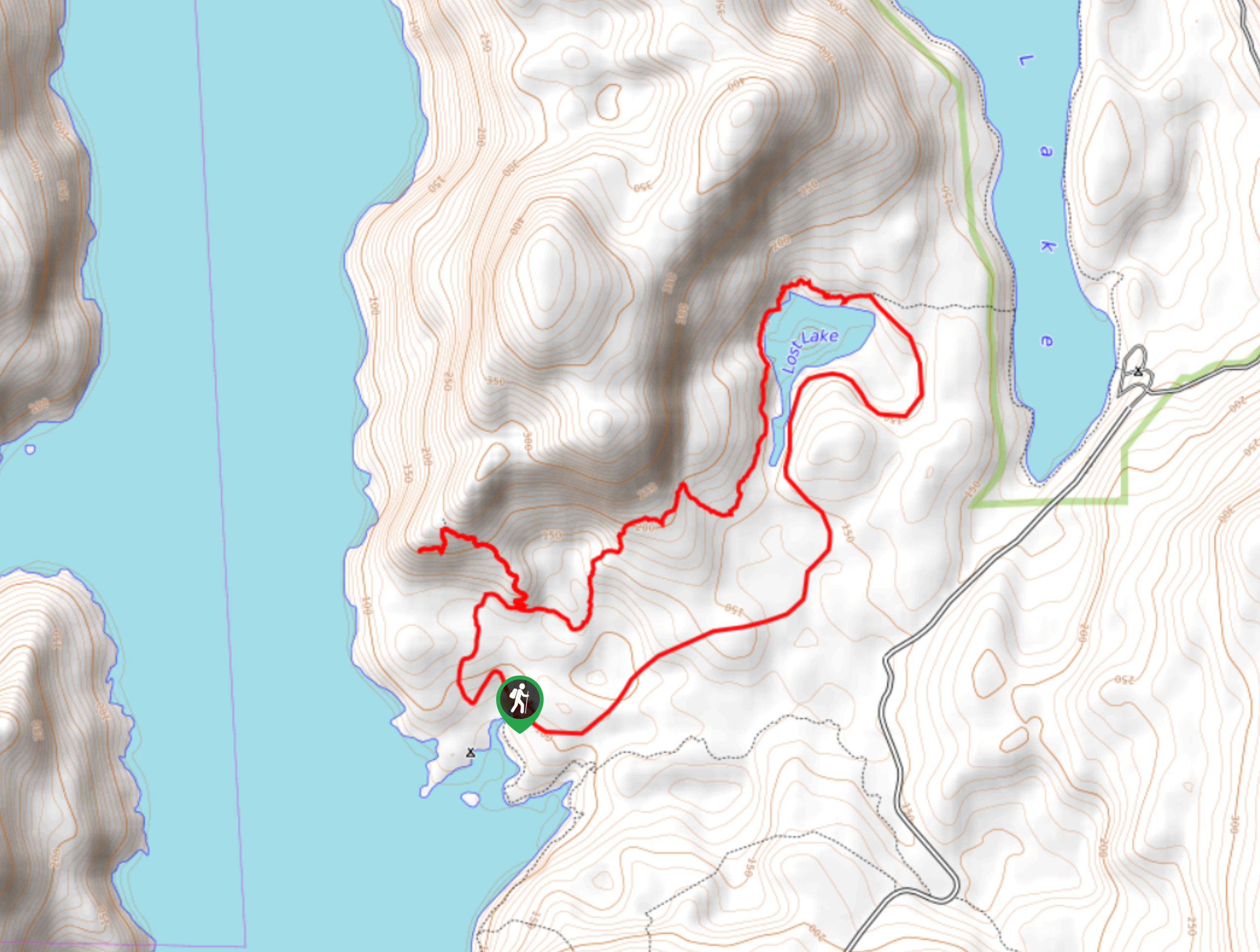
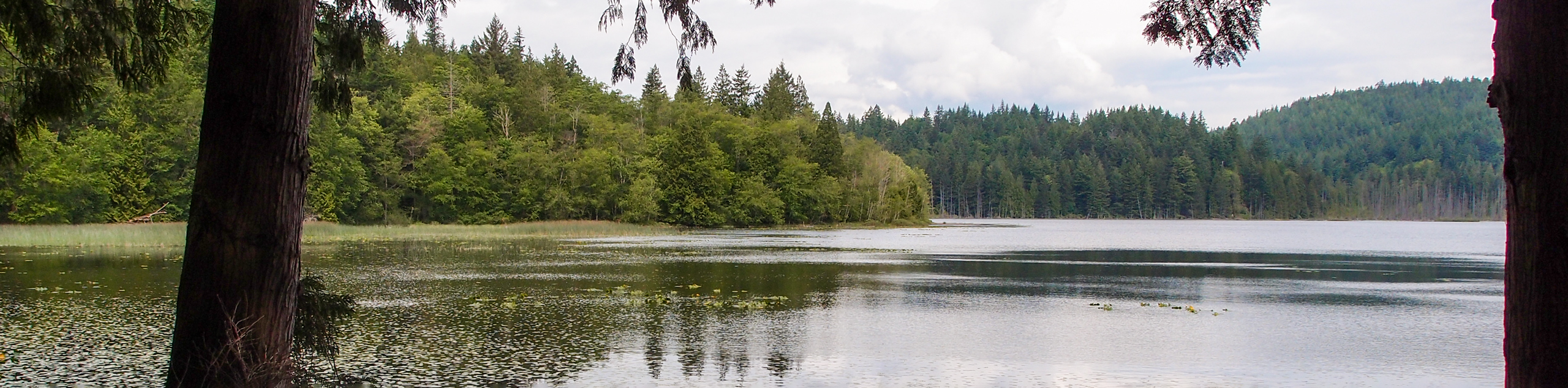
35. Haywire Bay to Lost Lake Hike
Difficulty
The hike from Haywire Bay to Lost Lake Hike follows a 6.0mi lollipop… Read More
36. Killarney Lake Hike
Difficulty
The trek around Killarney Lake follows a 4.9mi lollipop hiking route that traverses… Read More
37. Blackwater Creek Trail
Difficulty
The Blackwater Creek Trail is a 2.6mi lollipop hiking route near Powell River,… Read More
38. Suncoaster Trail
Difficulty
The Suncoaster Trail is a 3.2mi out-and-back hiking route to the northwest of… Read More
39. Keats Loop Trail
Difficulty
The Keats Loop Trail is a 2.7mi hiking circuit on Keats Island that… Read More
40. Mount Gardner SW Trail
Difficulty
The Mount Gardner SW Trail is a 3.8mi out-and-back hiking route on Bowen… Read More
41. Toquenatch Trail
Difficulty
The Toquenatch Trail is a 4.6mi out-and-back hiking route north of Sliammon, BC,… Read More
42. Halfmoon Loop Trail
Difficulty
The Halfmoon Loop is a 2.5mi lollipop hiking route near Halfmoon Bay, BC… Read More
43. Pterodactyl Loop Trail
Difficulty
The Pterodactyl Loop is a 2.4mi hiking circuit near Sechelt, BC, that winds… Read More
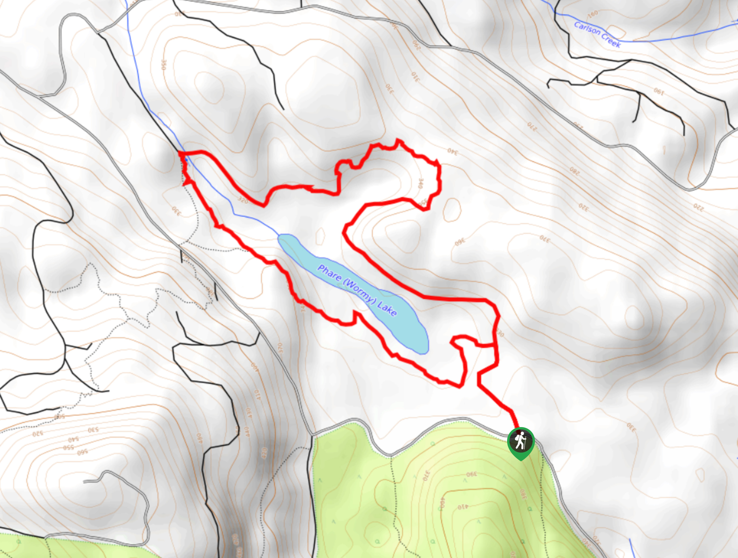
44. Phare Lake Hike
Difficulty
The trek around Phare Lake follows a 3.7mi lollipop hiking route that will… Read More
45. Easter Bluffs
Difficulty
The hike up to the Easter Bluff Viewpoint follows a 1.1mi out-and-back route… Read More
46. Mansons Landing Loop Trail
Difficulty
The Mansons Landing Loop is a 5.9mi lollipop hiking route that begins in… Read More
47. Wilde Creek Loop Trail
Difficulty
The Wilde Creek Loop is an 7.4mi lollipop hiking route near Sliammon, BC… Read More
48. Gibraltar Lookout Hike
Difficulty
The journey to the Gibraltar Lookout follows a 3.8mi out-and-back hiking route that… Read More
49. Kingfisher and McFall Creek Loop Hike
Difficulty
The Kingfisher and McFall Creek Loop is a 1.4mi lollipop hiking route that… Read More
50. Heron Trail
Difficulty
The Heron Trail is a 1.8mi lollipop hiking route in Powell River, BC… Read More
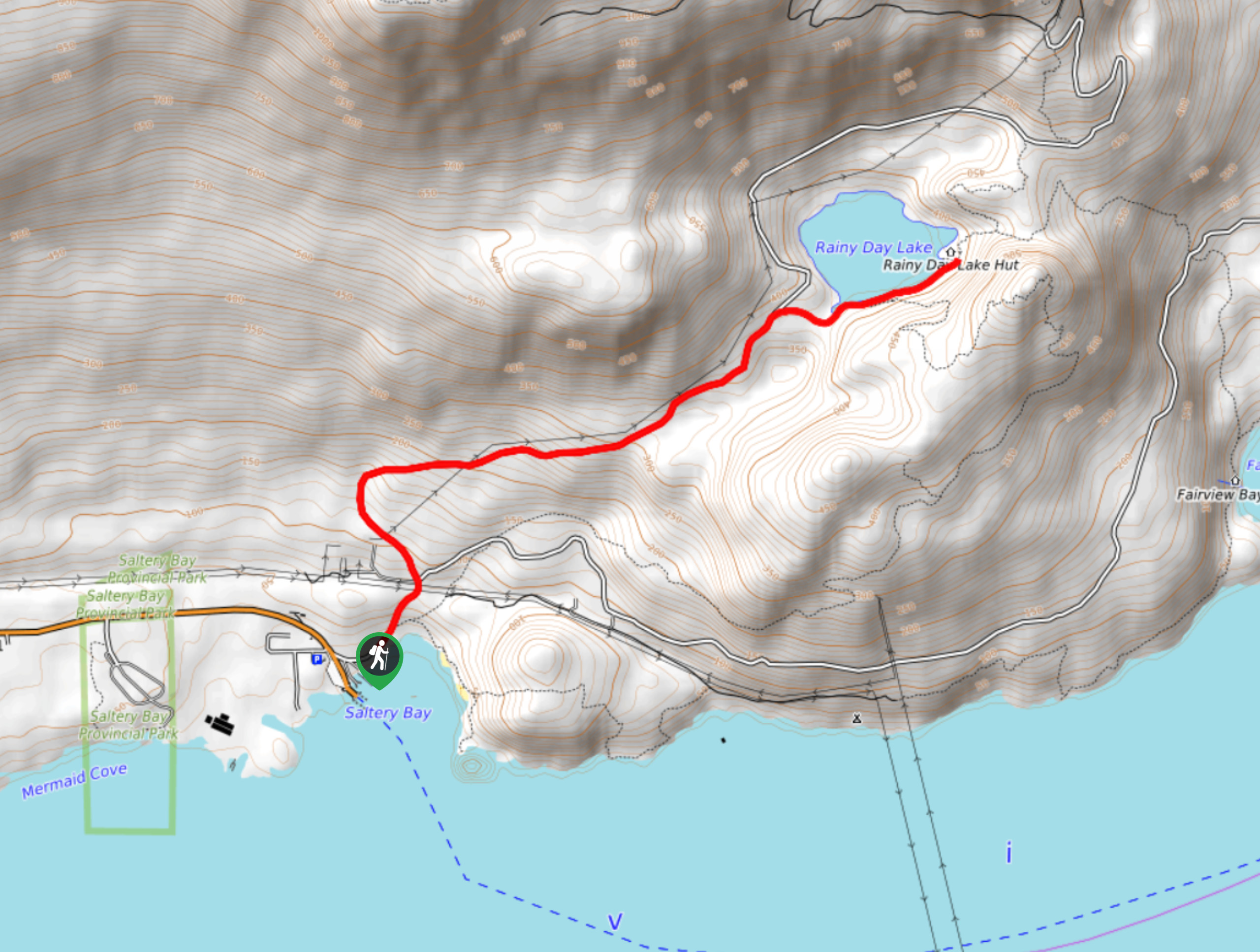
51. Rainy Day Lake Hike
Difficulty
The hike out to Rainy Day Lake follows an 5.1mi out-and-back route near… Read More
52. Saltery Bay and Rainy Day Lake Loop
Difficulty
The Saltery Bay and Rainy Day Lake Loop is an 11.4mi lollipop hiking… Read More

53. Stillwater Bluffs Trail
Difficulty
The Stillwater Bluffs Trail is a 1.9mi lollipop hiking route along the Sunshine… Read More

54. Holly Branch Loop Hike
Difficulty
The Holly Branch Loop is a 3.7mi lollipop hiking route near Powell River,… Read More

55. Malaspina Switchback Trail
Difficulty
The Malaspina Switchback Trail is a 4.3mi out-and-back hiking route in Powell River,… Read More
Are we missing your favourite hike?
Tell us! If you've got photos, a GPS track and know the hike, we'd love to share your favourite hike with the rest of the 10Adventures community.