
Langdale Falls Loop Hike
View Photos
Langdale Falls Loop Hike
Difficulty Rating:
The Langdale Falls Loop is a 4.1mi lollipop hiking route in Langdale, BC that will take you to the site of a picturesque cascading waterfall with a small pool below. Along the hike, you will cross over several creek crossings and experience an amazing temperate rainforest setting filled with moss-covered trees. The northern side of the trail is a bit overgrown, so be prepared for some light bushwhacking or to complete the hike as an out-and-back along the lower portion of the loop.
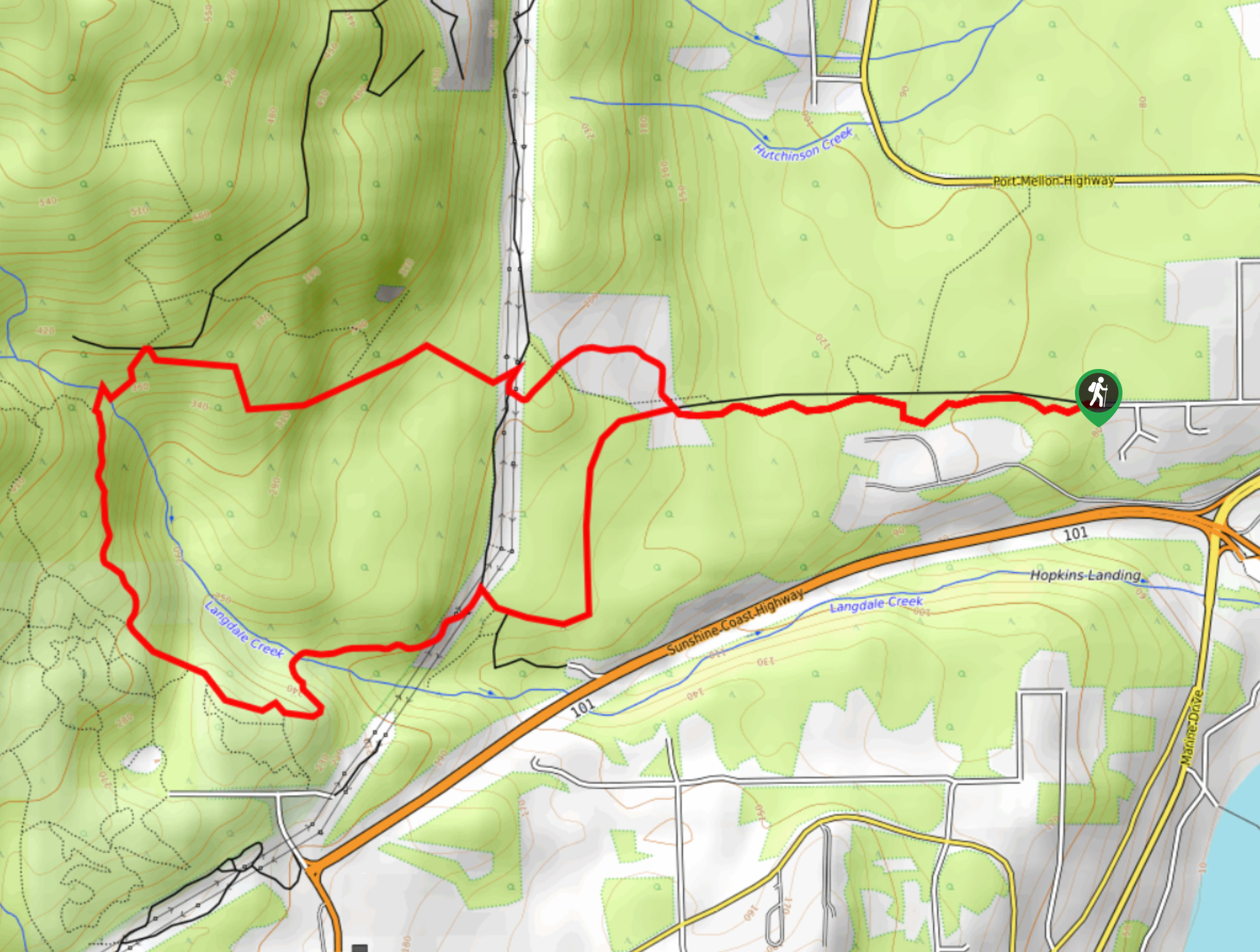
Getting there
To reach the trailhead for the Langdale Falls Loop from Gibsons, drive southeast on School Road for 2625ft and turn left onto Marine Drive. After 2.7mi, continue straight onto Port Mellon Highway for 1312ft before turning left onto Wharf Road. In 1804ft, you will find the trailhead straight ahead.

About
| When to do | April-November |
| Backcountry Campsites | No |
| Pets allowed | Yes - On Leash |
| Family friendly | Older Children only |
| Route Signage | Average |
| Crowd Levels | Moderate |
| Route Type | Lollipop |
Langdale Falls Loop Hike
Elevation Graph
Weather
Langdale Falls Hike Description
Although the Langdale Falls Loop is located just on the edge of town, sections of it have become poorly-maintained over time and will require a bit of light bushwhacking and route finding in order to stay on the correct path. Whether you view this as an opportunity for an off-the-path adventure or as more of a nuisance, this hiking route is sure to provide you with some amazing rainforest scenery along the Sunshine Coast. The trailhead sets out from the end of Wharf Road and immediately enters into the tree cover. When you reach the fork in the trail, follow the path to the right to complete the overgrown part of the loop first so that you can better enjoy the falls. Once there, enjoy the amazing views looking out onto the cascading water before continuing along the loop to the south towards the Sprockids Trail Recreation Site. After passing through this stretch of forest, you will arrive back at the initial junction in the trail, where you can head right to return to the trailhead.
Similar hikes to the Langdale Falls Loop Hike hike

Malaspina Switchback Trail
The Malaspina Switchback Trail is a 4.3mi out-and-back hiking route in Powell River, BC, that will take you…

Holly Branch Loop Hike
The Holly Branch Loop is a 3.7mi lollipop hiking route near Powell River, BC, that will take you…

Stillwater Bluffs Trail
The Stillwater Bluffs Trail is a 1.9mi lollipop hiking route along the Sunshine Coast that provides some amazing…
Comments