
Roberts Creek Waterfall Loop
View Photos
Roberts Creek Waterfall Loop
Difficulty Rating:
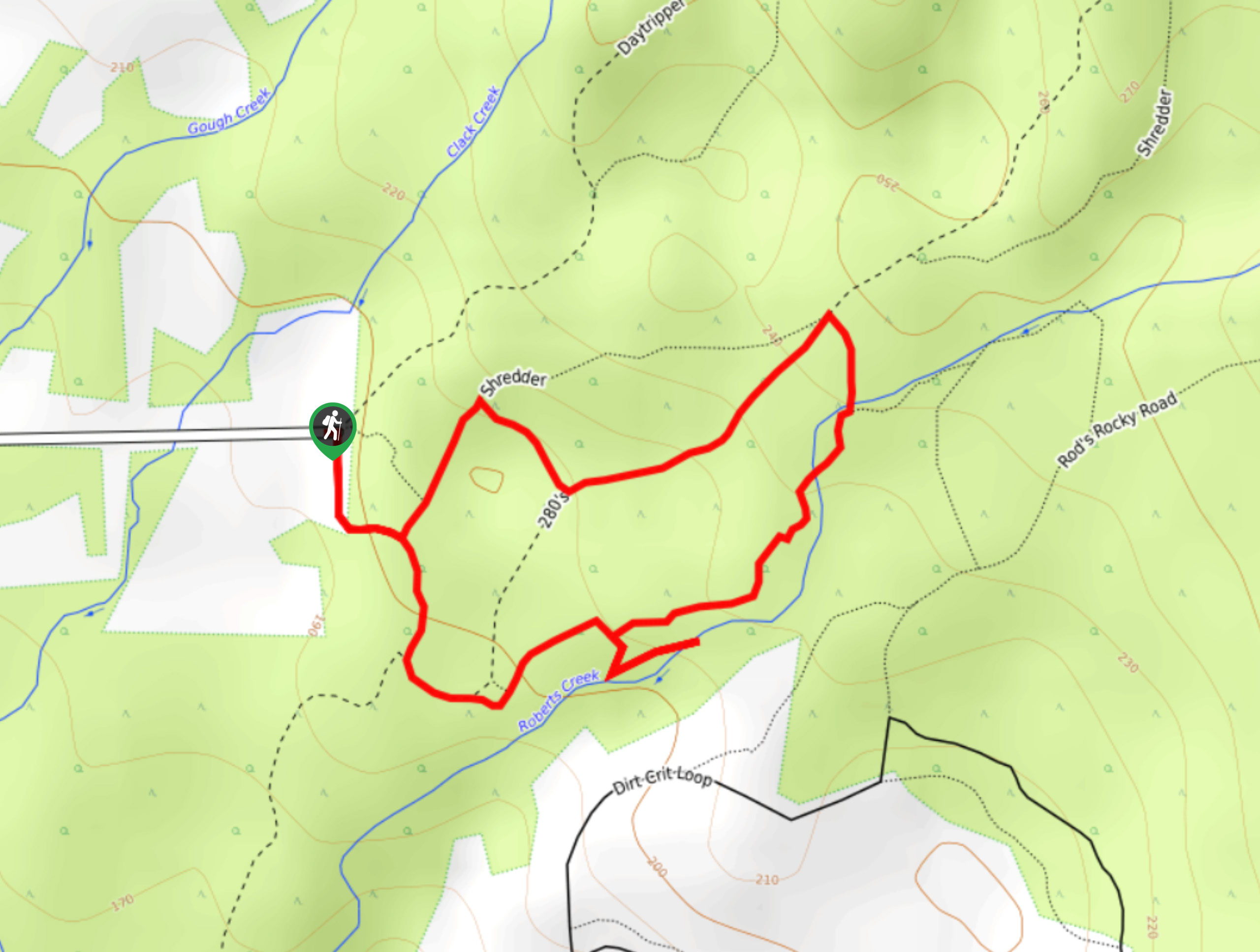
The Roberts Creek Waterfall Loop is a 1.1mi lollipop hiking route near Sechelt, BC, that will take you through the temperate rainforest to view the cascading water of the falls. Along the trail, you will be immersed in a tranquil rainforest setting, surrounded by abundant plant life and small creek crossings before arriving at the serene vantage point over the falls. Make sure to utilize a GPS or trail map when out on the trail, as there are many intersecting pathways and navigation can be difficult in places.
Getting there
To reach the trailhead for the Roberts Creek Waterfall Loop from Sechelt, head southeast on BC-101 for 5.8mi and turn left onto Lockyer Road. After 2789ft, turn left to continue along the same road for 0.6mi before turning right onto Day Road. You will reach the trailhead in 2625ft.

About
| When to do | May-October |
| Backcountry Campsites | No |
| Pets allowed | Yes - On Leash |
| Family friendly | Yes |
| Route Signage | Poor |
| Crowd Levels | Low |
| Route Type | Lollipop |
Roberts Creek Waterfall Loop
Elevation Graph
Weather
Roberts Creek Waterfall Trail Description
While it is a short hiking route, the Roberts Creek Waterfall Loop can be a bit confusing to navigate due to the dense network of trails that it is a part of. Make sure to keep an eye on your map or GPS in order to stay on the correct path. The hike sets out from the side of Day Road and enters into the forest along a path to the south. From here, you will navigate through an amazingly atmospheric stretch of West Coast temperate rainforest that is filled with moss-covered trees, plentiful amounts of ferns, wild mushrooms, and the charming waters of Roberts Creek. Eventually, you will arrive at the cascading waterfall, which you can either admire from afar or descend to the pool below for a quick dip in the cool water. After taking in the beauty of the falls, continue along the loop to return to the trailhead.
Similar hikes to the Roberts Creek Waterfall Loop hike

Malaspina Switchback Trail
The Malaspina Switchback Trail is a 4.3mi out-and-back hiking route in Powell River, BC, that will take you…

Holly Branch Loop Hike
The Holly Branch Loop is a 3.7mi lollipop hiking route near Powell River, BC, that will take you…

Stillwater Bluffs Trail
The Stillwater Bluffs Trail is a 1.9mi lollipop hiking route along the Sunshine Coast that provides some amazing…
Comments