Pender Hill Trail
View Photos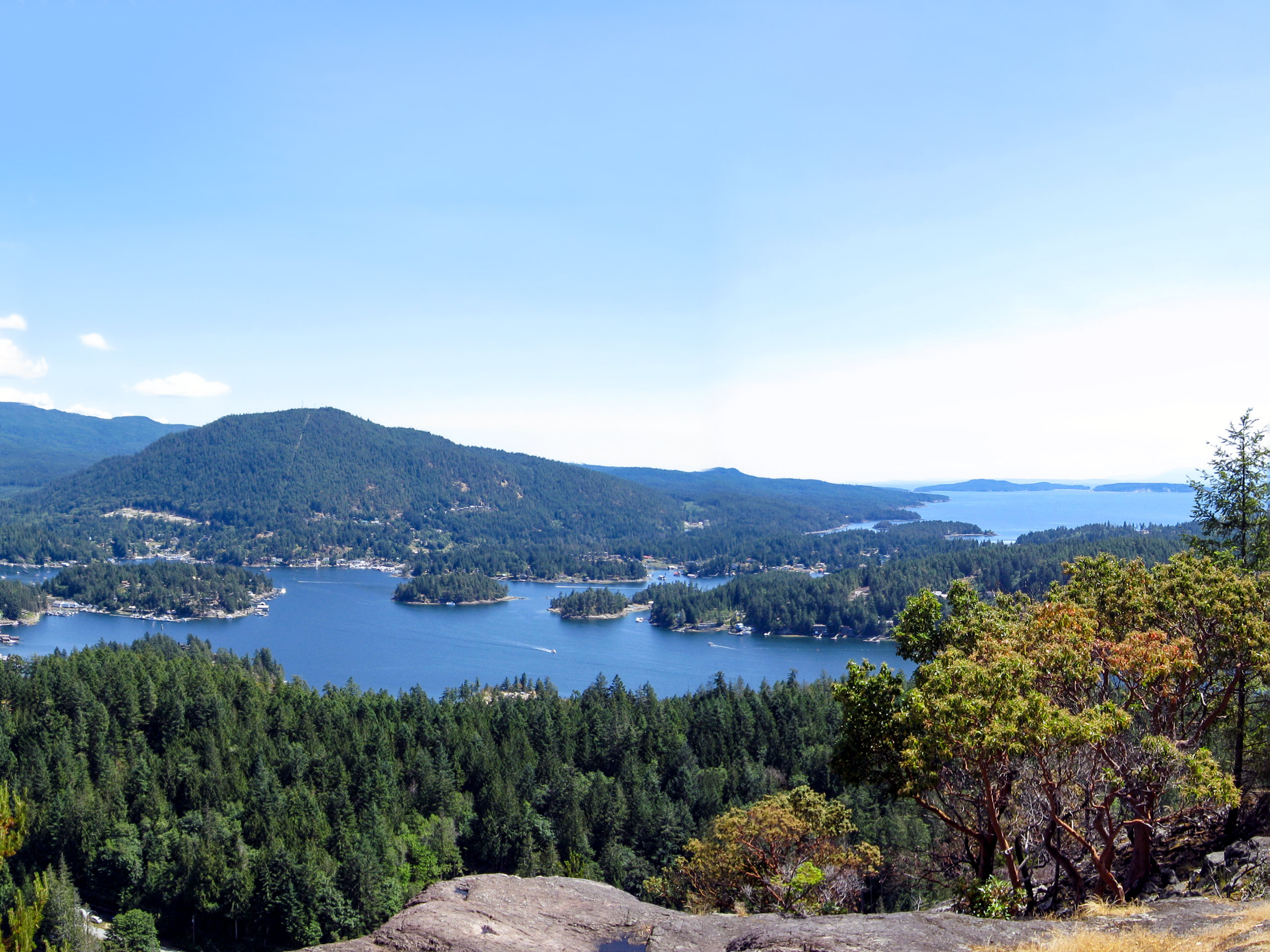
Pender Hill Trail
Difficulty Rating:
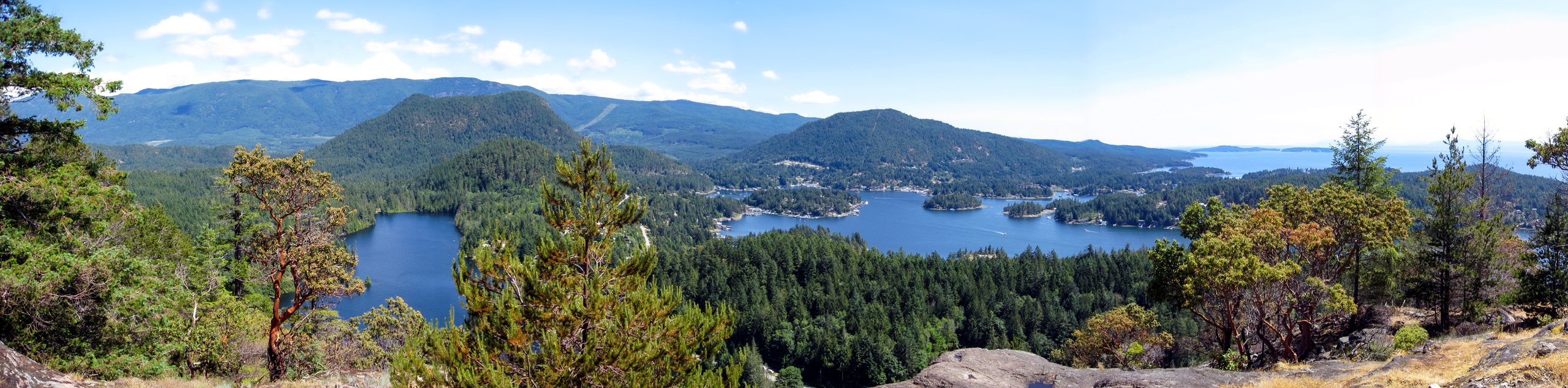
The Pender Hill Trail is a 1.0mi out-and-back hiking route near Sechelt, BC, that will take you on a forested trail up to the summit of Pender Hill. From the rocky viewpoint, you will have an amazingly scenic view overlooking the forests and rugged coastal terrain that makes up the beautiful Sunshine Coast. This is a great family-friendly hike with enough room atop the hill to spread out for a fun picnic with gorgeous views.
Getting there
To reach the trailhead for the Pender Hill Trail from Sechelt, head southwest on BC-101 for 23.1mi and turn left onto Garden Bay Road. After 3.4mi, continue onto Irvines landing Road and follow it for 1.9mi. Turn right onto Lee Road and after 1km turn right on Coastview Drive, where you will find the trailhead.

About
| When to do | Year-Round |
| Backcountry Campsites | No |
| Pets allowed | Yes - On Leash |
| Family friendly | Yes |
| Route Signage | Average |
| Crowd Levels | Low |
| Route Type | Out and back |
Pender Hill Trail
Elevation Graph
Weather
Pender Hill Trail Description
Although short, the Pender Hill Trail is a fairly steep climb up to a viewpoint that will reward hikers that make it there with amazingly scenic views along the coast. Even so, the trail is very well-maintained and can be completed by beginner hikers and families that take their time along the trail. Setting out from the trailhead, the route climbs uphill through a beautifully forested trail that will provide some protection against the sun on your uphill climb. Eventually, you will break out of the tree cover and arrive at the rocky bluff with views along the Sunshine Coast that stretch out across the Strait of Georgia to Texada Island. After enjoying the views and having a quick snack, make your way back through the forest to return to the trailhead.
Similar hikes to the Pender Hill Trail hike

Malaspina Switchback Trail
The Malaspina Switchback Trail is a 4.3mi out-and-back hiking route in Powell River, BC, that will take you…

Holly Branch Loop Hike
The Holly Branch Loop is a 3.7mi lollipop hiking route near Powell River, BC, that will take you…

Stillwater Bluffs Trail
The Stillwater Bluffs Trail is a 1.9mi lollipop hiking route along the Sunshine Coast that provides some amazing…
Comments