
Kinnikinnick Park Loop
View Photos
Kinnikinnick Park Loop
Difficulty Rating:
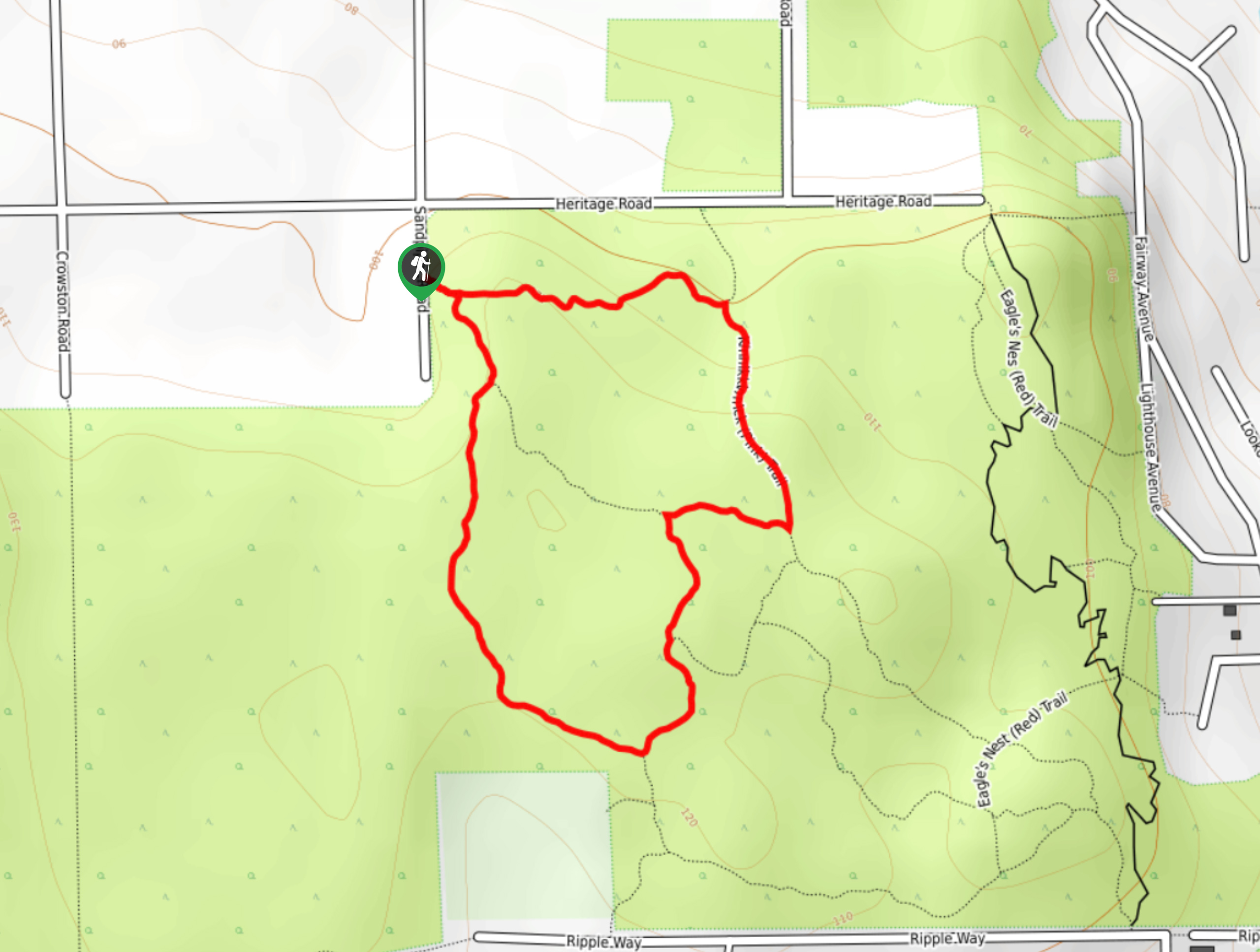
The Kinnikinnick Park Loop is a 1.2mi lollipop hiking route north of Sechelt, BC that will take you on a fun adventure through the rainforest. Made up of well-maintained trails, beautiful rainforest scenery, and a short overall distance; this hike is a perfect option for a quick excursion into the wilderness with family and friends. Make sure to bring a trail map or GPS, as there are a few intersecting routes that can make navigation tricky in certain areas.
Getting there
To reach the parking area for the Kinnikinnick Park Loop from Sechelt, head north on Trail Avenue for 1.1mi and turn right onto Reef Road, following it for 2133ft. Turn left onto Shoal Way and continue along for 886ft, before turning right onto Fairway Avenue. After 0.9mi, turn left onto Gale Avenue and follow it for 0.7mi, turning left onto Sandpiper Road. You will find the trailhead on the left in 2789ft.

About
| When to do | Year-Round |
| Backcountry Campsites | No |
| Pets allowed | Yes - On Leash |
| Family friendly | Yes |
| Route Signage | Average |
| Crowd Levels | Low |
| Route Type | Lollipop |
Kinnikinnick Park Loop
Elevation Graph
Weather
Kinnikinnick Park Trail Description
If you are looking for a beautifully scenic trek through the forest with easy terrain, then the Kinnikinnick Park Loop is exactly what you need. With almost no change in elevation, this short hike will allow you to experience the natural beauty of the pacific temperate rainforest atmosphere without any real physical exertion. Setting out from the parking area, follow the trail to the east as it enters into the thick cover of the rainforest. When you reach the fork in the trail, follow the path to the right to begin the loop portion of the hike. As you work your way along the trail, take some time to relax in the magical forest landscape that is teeming with all sorts of plant and animal life. After working around the loop you will arrive back at the initial junction, which you can follow to the right to return to the trailhead.
Similar hikes to the Kinnikinnick Park Loop hike

Malaspina Switchback Trail
The Malaspina Switchback Trail is a 4.3mi out-and-back hiking route in Powell River, BC, that will take you…

Holly Branch Loop Hike
The Holly Branch Loop is a 3.7mi lollipop hiking route near Powell River, BC, that will take you…

Stillwater Bluffs Trail
The Stillwater Bluffs Trail is a 1.9mi lollipop hiking route along the Sunshine Coast that provides some amazing…
Comments