Burnett Falls Hike
View Photos
Burnett Falls Hike
Difficulty Rating:
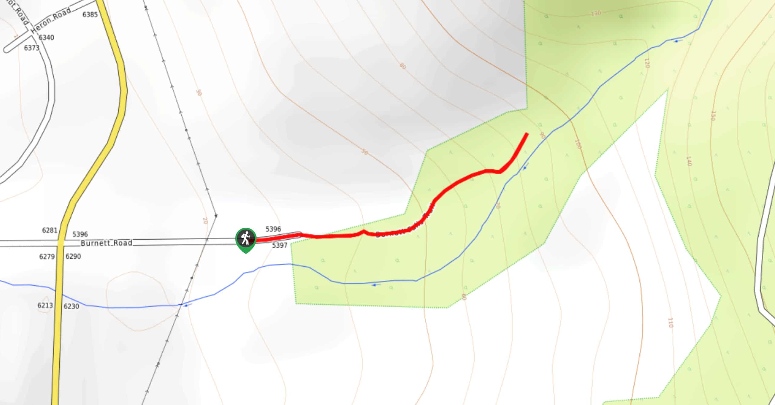
The trek to Burnett Falls follows a 0.3mi out-and-back hiking route that climbs uphill to a viewpoint overlooking the waterfall. Although it is very short, the route works up an elevation gain of 98ft through the forest, eventually providing views across the canyon and the cascading water of the falls. Make sure to time this hike for the winter or spring when the water levels are generally higher and the powerful falls will create more of a spectacle.
Getting there
To reach the trailhead for Burnett Falls, head north on Wharf Avenue for 1804ft and turn right on E Porpoise Bay Road. Continue onto Sechelt Inlet Road for 1.4mi and turn right onto Burnett Road, where you will find the trailhead in 656ft.

About
| When to do | Year-Round |
| Backcountry Campsites | No |
| Pets allowed | Yes - On Leash |
| Family friendly | Yes |
| Route Signage | Average |
| Crowd Levels | Moderate |
| Route Type | Out and back |
Burnett Falls Hike
Elevation Graph
Weather
Burnett Falls Trail Description
The Burnett Falls Trail is a quick, family-friendly hiking route in Sechelt, BC, that will expose you to a tranquil forest setting and some scenic views overlooking the canyon and a beautiful waterfall. Setting out from the trailhead, pass by the metal gate and work your way uphill toward the edge of the forest. Shortly after passing by a picnic table, follow the path into the tree cover to begin the more scenic portion of the hike. Here, the trail will begin to climb more steeply uphill until you arrive at a small bench with views overlooking the rushing water of the falls. After enjoying the serene setting and taking in the views, head back down the same route to return to the trailhead.
Similar hikes to the Burnett Falls Hike hike

Malaspina Switchback Trail
The Malaspina Switchback Trail is a 4.3mi out-and-back hiking route in Powell River, BC, that will take you…

Holly Branch Loop Hike
The Holly Branch Loop is a 3.7mi lollipop hiking route near Powell River, BC, that will take you…

Stillwater Bluffs Trail
The Stillwater Bluffs Trail is a 1.9mi lollipop hiking route along the Sunshine Coast that provides some amazing…
Comments