
Phare Lake Hike
View Photos
Phare Lake Hike
Difficulty Rating:
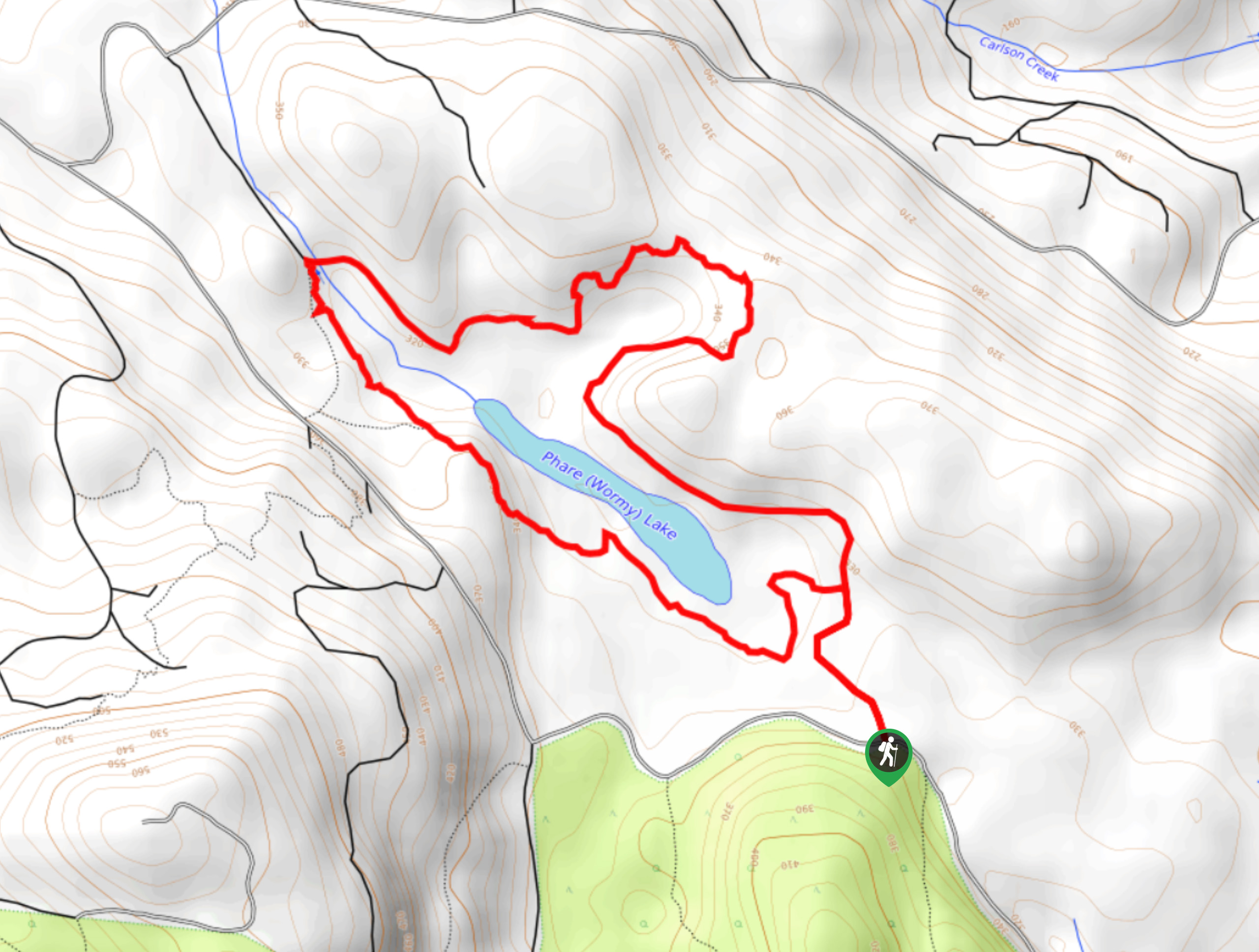
The trek around Phare Lake follows a 3.7mi lollipop hiking route that will allow you to explore the landscape surrounding this picturesque woodland lake. This hike is perfect for hikers of all skill levels due to the amazing scenery and easy to traverse forest terrain. Along the route, you will experience a beautiful temperate rainforest setting that features interpretive trail signs to learn about the different species of plant and animal life in the area.
Getting there
To reach the Phare Lake trailhead from Sechelt, drive southwest on BC-101 for 1.2mi and turn right onto Norwest Bay Road. After 1.1mi, turn right onto Mason Road and follow it for 2.7mi. At the fork, head left and continue on for 1.4mi to find the trailhead on the right.

About
| When to do | April-October |
| Backcountry Campsites | No |
| Pets allowed | Yes |
| Family friendly | Yes |
| Route Signage | Average |
| Crowd Levels | Low |
| Route Type | Lollipop |
Phare Lake Hike
Elevation Graph
Weather
Phare Lake Trail Description
The Phare Lake trail is a fantastic outdoor hiking excursion that is perfectly suited for hikers of every skill level, especially families with young kids. The trail sets out from the side of the road and heads north before breaking off to the right on a trail through the forest that loops around the lake. Follow the path as it winds between large, moss-covered trees and interpretive signs about the various plant species and types of amphibians that can be found around the lake. Reaching the northern tip of the lake, the trail will continue a bit further before crossing over a creek and working along the eastern shore. Enjoy the scenic views across the calm waters of the lake, as you hike the return part of the loop back to the trailhead.
Similar hikes to the Phare Lake Hike hike

Malaspina Switchback Trail
The Malaspina Switchback Trail is a 4.3mi out-and-back hiking route in Powell River, BC, that will take you…

Holly Branch Loop Hike
The Holly Branch Loop is a 3.7mi lollipop hiking route near Powell River, BC, that will take you…

Stillwater Bluffs Trail
The Stillwater Bluffs Trail is a 1.9mi lollipop hiking route along the Sunshine Coast that provides some amazing…
Comments