Easter Bluffs
View Photos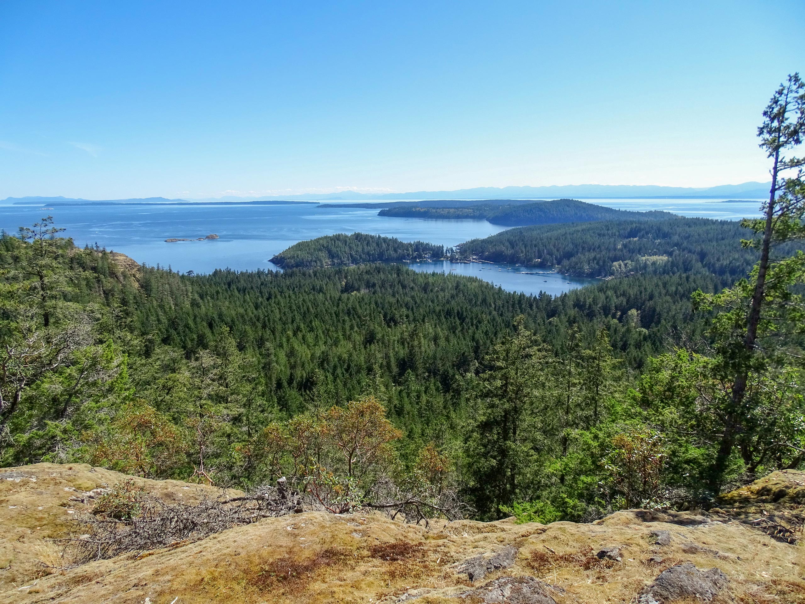
Easter Bluffs
Difficulty Rating:
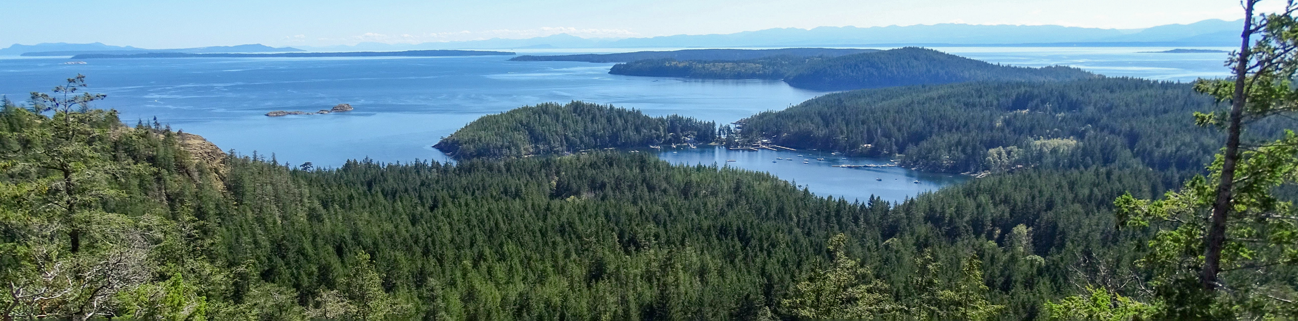
The hike up to the Easter Bluff Viewpoint follows a 1.1mi out-and-back route that leads you uphill for some amazing views overlooking Cortes Bay. From the viewpoint, you can watch boats come in and out of the cove, while you sit and enjoy a nice picnic lunch along the Sunshine Coast. While the trail is fairly short and easy, there are some steep sections with rocks that will make travel difficult for families with strollers and there are also some drop offs at the top, so be sure to keep an eye on children when up near the viewing area.
Getting there
To reach the Easter Bluffs trailhead from Squirrel Cove, drive east along Squirrel Cove Road for 2.5mi and continue straight onto Seaford Road. After 1.0mi, make a slight left onto COrtes Bay Road and you will find the trailhead on the left in 1903ft.

About
| When to do | Year-Round |
| Backcountry Campsites | No |
| Pets allowed | Yes |
| Family friendly | Yes |
| Route Signage | Average |
| Crowd Levels | Low |
| Route Type | Out and back |
Easter Bluffs
Elevation Graph
Weather
Easter Bluffs Trail Description
While it may be short on distance and difficulty, the Easter Bluffs trail is big on views. The trail sets out from the side of the road and immediately enters into the forest to the east. From here, it climbs uphill through the dense tree cover on a quick route up to the viewpoint. After making your way up the 101m of elevation gain that is crammed into the short hike, you will be greeted with an amazing view that looks out over the calm waters of Cortes Bay below and stretches out across the blue expanse of the Georgia Strait. After taking in the amazing views, head back down the same route to return to the trailhead.
Similar hikes to the Easter Bluffs hike

Malaspina Switchback Trail
The Malaspina Switchback Trail is a 4.3mi out-and-back hiking route in Powell River, BC, that will take you…

Holly Branch Loop Hike
The Holly Branch Loop is a 3.7mi lollipop hiking route near Powell River, BC, that will take you…

Stillwater Bluffs Trail
The Stillwater Bluffs Trail is a 1.9mi lollipop hiking route along the Sunshine Coast that provides some amazing…
Comments