
Blackwater Creek Trail
View Photos
Blackwater Creek Trail
Difficulty Rating:
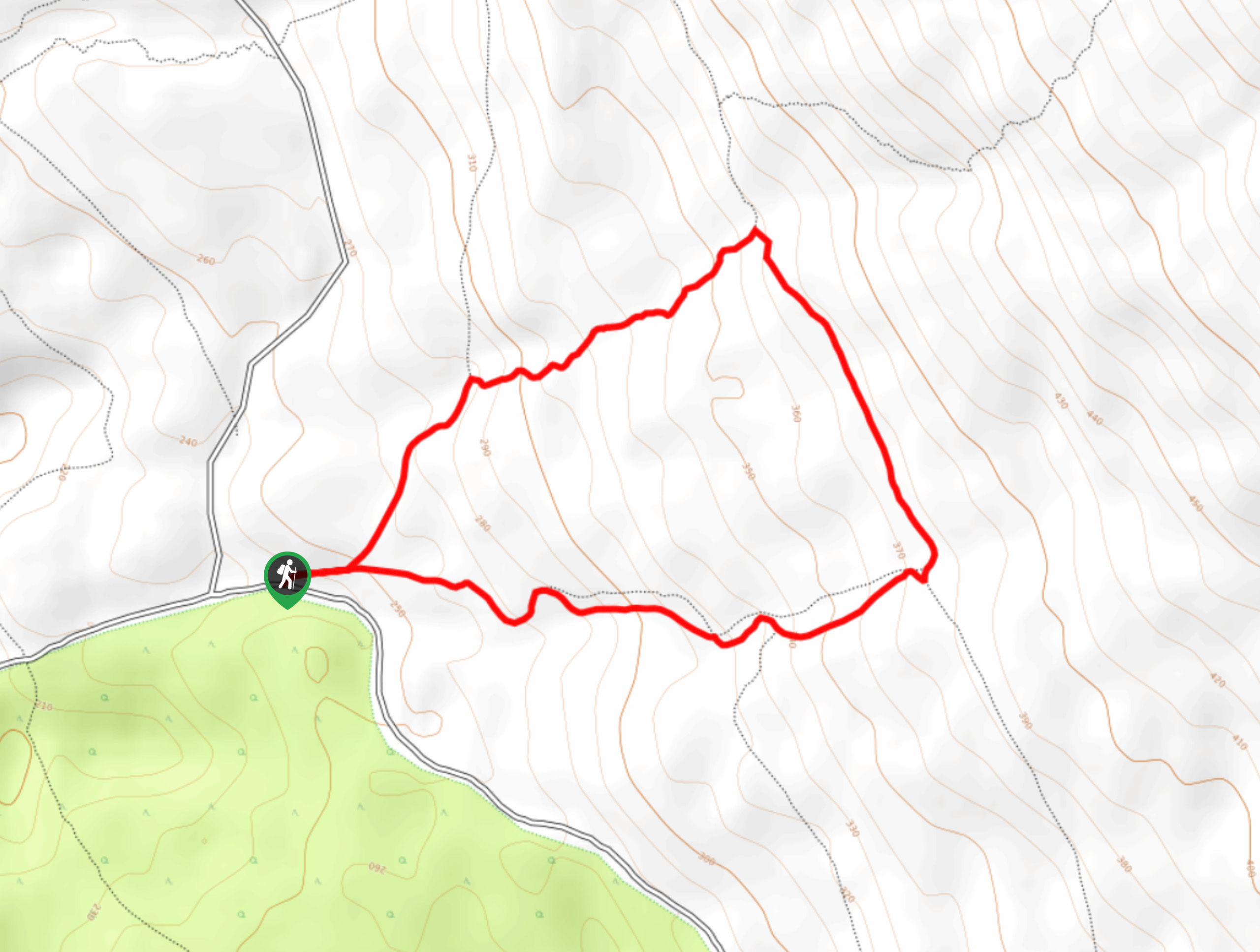
The Blackwater Creek Trail is a 2.6mi lollipop hiking route near Powell River, BC, that winds through a beautifully scenic forest setting. Along the trail, you will experience a relaxing forest atmosphere as you hike through a West Coast temperate rainforest that is packed full of plant life, small waterfalls, and creek crossings. With a small elevation gain and well-maintained trails, this scenic hiking route is suitable for hikers of almost every skill level.
Getting there
To access the Blackwater Creek Trail from Powell River, make your way north for 1.5mi on Manson Ave and turn right onto Cassiar St. After 984ft, turn left onto Yukon Ave and follow it for 0.6mi, before turning right on Haslam St. Turn right onto Haslam Lake Rd after 2297ft and continue on it for 0.8mi. Turn right and stay on the road for 3.0mi, where you will make a left turn onto Duck Lake Brach 1/Larson Landing Rd. After 1.8mi, you will find the trailhead on the left.

About
| When to do | April-October |
| Backcountry Campsites | No |
| Pets allowed | Yes |
| Family friendly | Yes |
| Route Signage | Average |
| Crowd Levels | Low |
| Route Type | Lollipop |
Blackwater Creek Trail
Elevation Graph
Weather
Blackwater Creek Trail Description
Hiking along the Blackwater Creek Trail is a fantastic way to spend the day outdoors if you find yourself in the Powell River area, due to the easy-to-navigate terrain and spectacular scenery. The trail sets out from the side of the road and immediately enters into the forest, where you will feel a sudden wave of relaxation wash over you. As you hike past the moss-covered trees, you will cross over small streams that run along the forest floor and eventually arrive at the cascading water of Kelly Falls. Continue along the trail and turn left at the junction to work your way around the eastern side of the loop. Head left again to chart a course back through the forest to return to the trailhead where you began.
Similar hikes to the Blackwater Creek Trail hike

Malaspina Switchback Trail
The Malaspina Switchback Trail is a 4.3mi out-and-back hiking route in Powell River, BC, that will take you…

Holly Branch Loop Hike
The Holly Branch Loop is a 3.7mi lollipop hiking route near Powell River, BC, that will take you…

Stillwater Bluffs Trail
The Stillwater Bluffs Trail is a 1.9mi lollipop hiking route along the Sunshine Coast that provides some amazing…
Comments