
Suncoaster Trail
View Photos
Suncoaster Trail
Difficulty Rating:
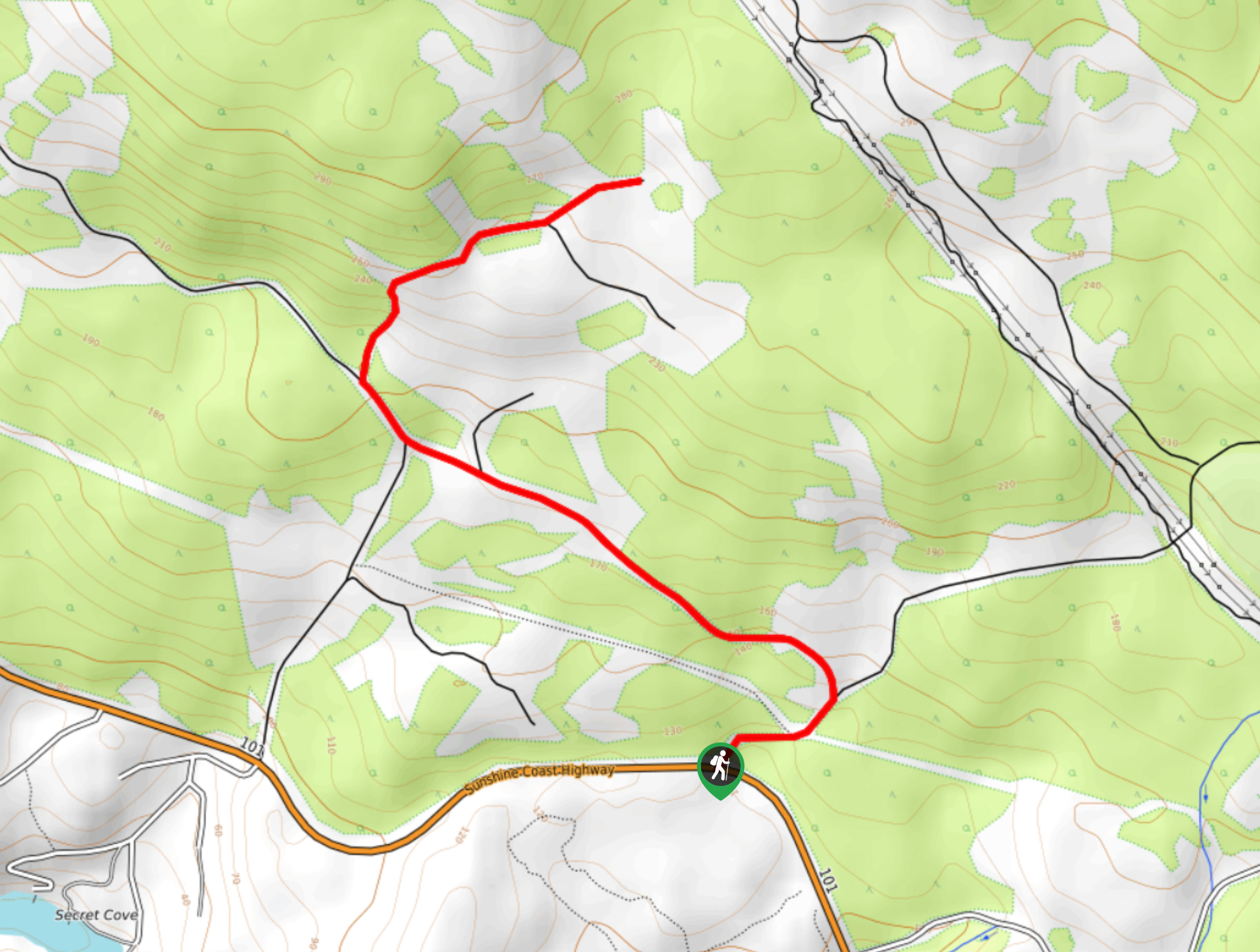
The Suncoaster Trail is a 3.2mi out-and-back hiking route to the northwest of Sechelt, BC, that will take you through an amazing stretch of forest along the Sunshine Coast. Made up of easy-to-navigate trails and favourable terrain, this hike is perfectly suited for hikers of almost any skill level. For those looking to explore more trails in the area, try pairing this hike with a weekend of camping at the Homesite Creek Campground that is right near the trailhead.
Getting there
To reach the parking area for the Suncoaster Trail from Sechelt, head southwest on BC-101 for 10.8mi and you will find the trailhead on the right.

About
| When to do | Year-Round |
| Backcountry Campsites | Homesite Creek Campground |
| Pets allowed | Yes - On Leash |
| Family friendly | Yes |
| Route Signage | Average |
| Crowd Levels | Low |
| Route Type | Out and back |
Suncoaster Trail
Elevation Graph
Weather
Suncoaster Trail Description
The Suncoaster Trail is a great half-day hike along the Sunshine Coast due to its pleasant trails and beautiful forest scenery. While the hike lacks dramatic views of mountain peaks or rugged coastlines, it makes up for with a relaxing forest atmosphere that will wash all of your worries away and allow you to disconnect from the outside world. Setting out from the campground, follow the trail to the northeast, making sure to take the path to the left when you reach the fork in the trail. From here, you will hike through an amazing stretch of forest and climb uphill along a gradual incline to a viewpoint of the surrounding forests. After reaching the end of the trail, make your way back down the same route to return to the trailhead below.
Similar hikes to the Suncoaster Trail hike

Malaspina Switchback Trail
The Malaspina Switchback Trail is a 4.3mi out-and-back hiking route in Powell River, BC, that will take you…

Holly Branch Loop Hike
The Holly Branch Loop is a 3.7mi lollipop hiking route near Powell River, BC, that will take you…

Stillwater Bluffs Trail
The Stillwater Bluffs Trail is a 1.9mi lollipop hiking route along the Sunshine Coast that provides some amazing…
Comments