
Keats Loop Trail
View Photos
Keats Loop Trail
Difficulty Rating:
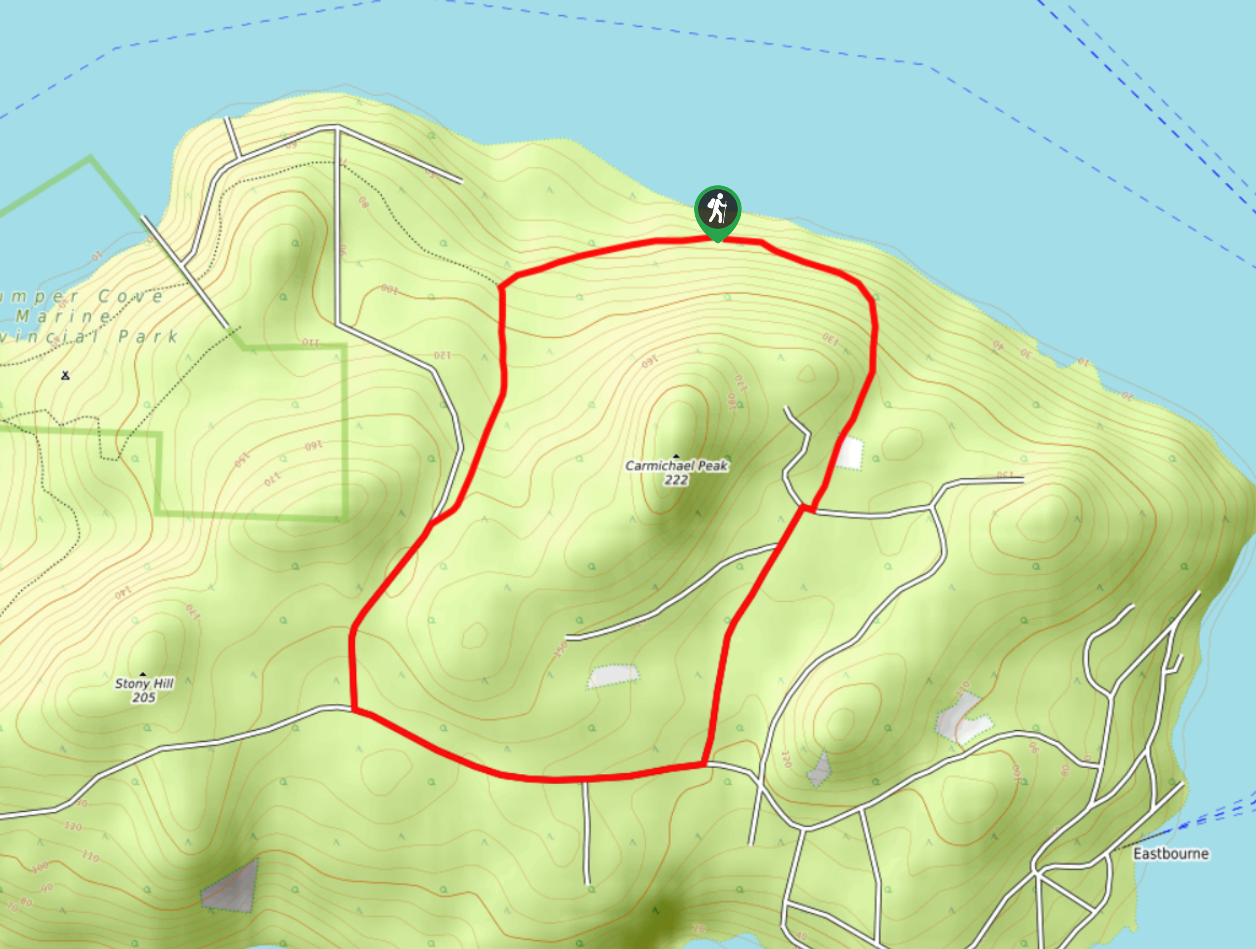
The Keats Loop Trail is a 2.7mi hiking circuit on Keats Island that will take you through an amazingly scenic stretch of Pacific temperate rainforest that is brimming with various plant and animal life species. With a short overall distance, a small amount of elevation gain, and well-maintained trails, this trail is perfectly suited for hikers of all skill levels. Portions of this hike will come very close to the private property of some local residents, so make sure to treat the area with the utmost respect when out on the trail.
Getting there
To reach the Keats Loop Trail from the Keats Landing Ferry Terminal, head southwest on Keats Road for 1.2mi and turn left onto Skyline Road, following it for 1312ft. Turn right and continue on for 0.6mi to find the trailhead on the right.

About
| When to do | March-October |
| Backcountry Campsites | No |
| Pets allowed | Yes - On Leash |
| Family friendly | Yes |
| Route Signage | Average |
| Crowd Levels | Moderate |
| Route Type | Circuit |
Keats Loop Trail
Elevation Graph
Weather
Keats Loop Trail Description
The Keats Loop Trail may be a short hiking route, but it is the perfect way to explore the diversity and natural beauty of the temperate rainforests that can be found on Keats Island. The route sets out from the trailhead and immediately enters into the dense, moss-covered expanse of the temperate rainforest. As you work your way along the trail, you will feel a sensation of relaxation as you meander along the well-maintained pathways that cut through the thick brush of the forest floor. The route will eventually meet up with the road, which you will need to follow in order to work your way around the south side of Carmichael Peak before entering back into the thick tree cover. Along the trail, you will pass by a plentiful amount of small ferns that stand in direct contrast to the vast frames of the cedar trees towering above. As you hike along the north side of the trail loop, you will eventually arrive back at the trailhead where you began your hike.
Similar hikes to the Keats Loop Trail hike

Malaspina Switchback Trail
The Malaspina Switchback Trail is a 4.3mi out-and-back hiking route in Powell River, BC, that will take you…

Holly Branch Loop Hike
The Holly Branch Loop is a 3.7mi lollipop hiking route near Powell River, BC, that will take you…

Stillwater Bluffs Trail
The Stillwater Bluffs Trail is a 1.9mi lollipop hiking route along the Sunshine Coast that provides some amazing…
Comments