Cliff Gilker Park Loop
View Photos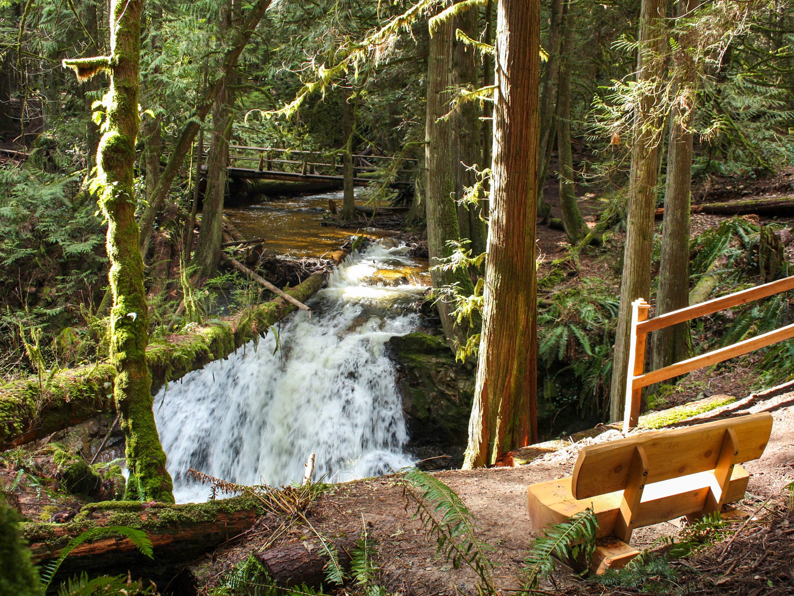
Cliff Gilker Park Loop
Difficulty Rating:
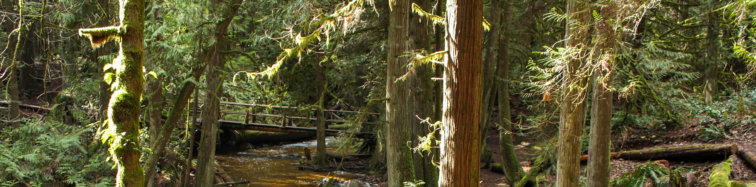
The Cliff Gilker Park Loop is a 1.3mi lollipop hiking route near Sechelt, BC, that is part of a dense network of trails through the forest. Along the hike, you will experience an amazing West Coast temperate rainforest setting, make your way over scenic bridge crossings, and visit a charming waterfall. Due to the easy terrain and well-maintained park trails, this route is perfectly suitable for hikers of all skill levels; however, you should make sure to bring a trail map or GPS to avoid straying from the main path on one of the intersecting trails.
Getting there
To reach the Cliff Gilker Park Loop trailhead from Sechelt, drive southeast on BC-101 for 6.7mi and turn left. From here, you will find the trailhead on the right in 427ft.

About
| When to do | Year-Round |
| Backcountry Campsites | No |
| Pets allowed | Yes - On Leash |
| Family friendly | Yes |
| Route Signage | Average |
| Crowd Levels | Moderate |
| Route Type | Lollipop |
Cliff Gilker Park Loop
Elevation Graph
Weather
Cliff Gilker Park Trail Description
Hiking the Cliff Gilker Park Loop is the perfect family-friendly adventure in the Sechelt area, due to the easy nature of the terrain and the amazingly scenic rainforest setting. The trail sets out from the side of the road and cuts through the forest to the east to meet up with the main path. Follow this to the right to begin a loop that will take you through the dense forest of the park. Shortly after beginning your journey, you will cross over the flowing waters of Clack Creek before turning more to the north on a route running parallel to Roberts Creek. Reaching the northernmost part of the trail, your direction will turn to the southwest as you cross over a beautiful bridge spanning Clack Creek. From here, continue south along the creek, crossing over it two more times and passing by a cascading waterfall before returning to the trailhead where you began your hike.
Similar hikes to the Cliff Gilker Park Loop hike

Malaspina Switchback Trail
The Malaspina Switchback Trail is a 4.3mi out-and-back hiking route in Powell River, BC, that will take you…

Holly Branch Loop Hike
The Holly Branch Loop is a 3.7mi lollipop hiking route near Powell River, BC, that will take you…

Stillwater Bluffs Trail
The Stillwater Bluffs Trail is a 1.9mi lollipop hiking route along the Sunshine Coast that provides some amazing…
Comments