Mount Gardner Hikers Trail
View Photos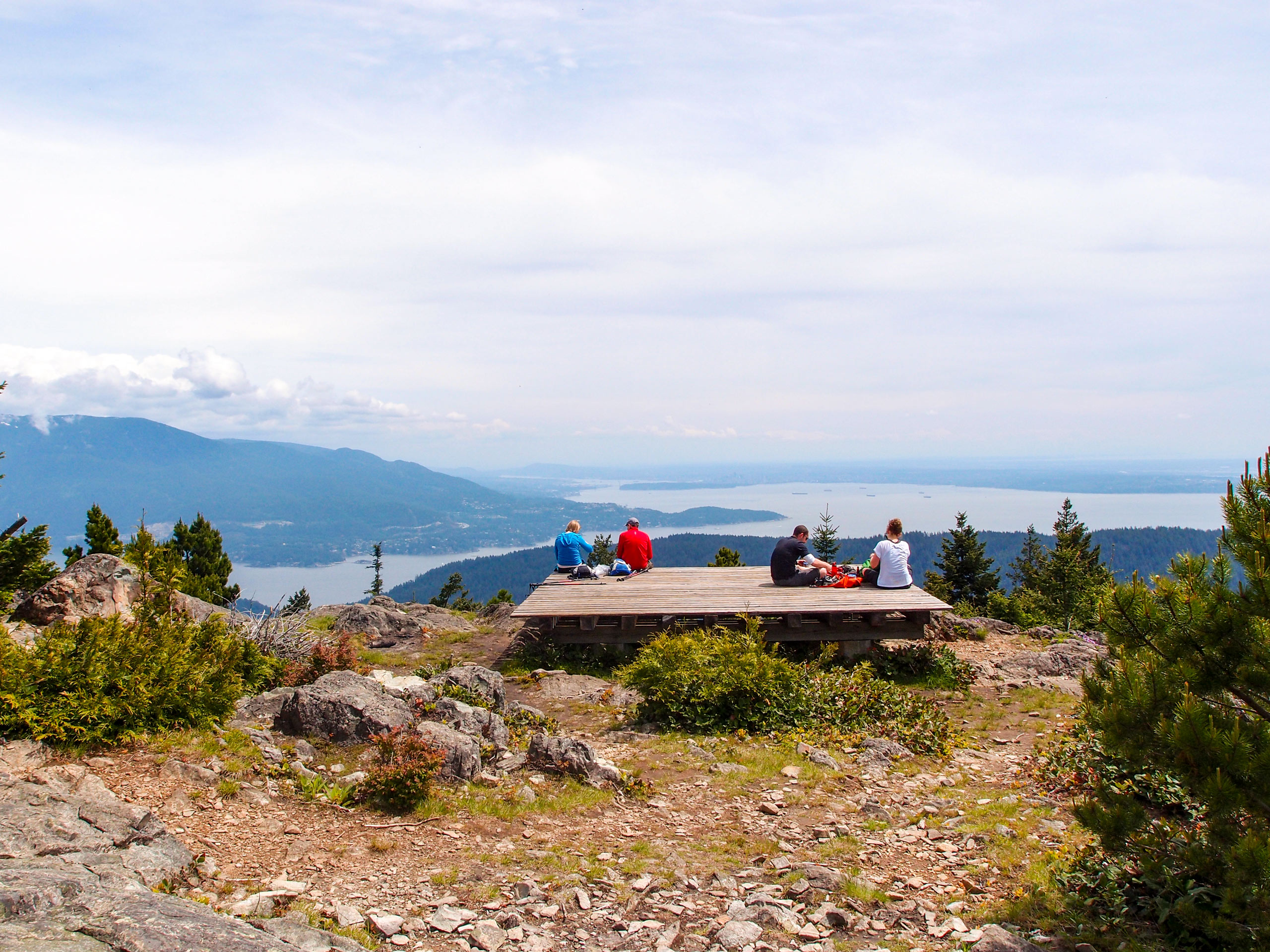
Mount Gardner Hikers Trail
Difficulty Rating:
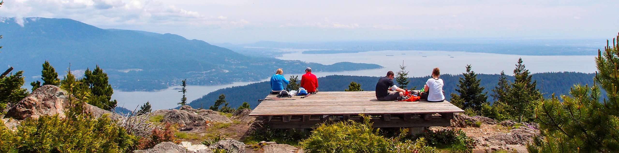
The Mount Gardner Hikers Trail is a 4.8mi out-and-back hiking route on Bowen Island that offers an alternate route to reach the viewpoint at the summit. Although it is a bit more steep and challenging, once you reach the top, you will have the same amazing views looking out across the water to mainland British Columbia. Make sure to bring a trail map/GPS, as there are intersecting trails that can make navigation on the mountain a bit tricky at times.
Getting there
To reach the Mount Gardner Hikers Trail from the Snug Cove Ferry Terminal, head west along Bowen Island Trunk Road for 2461ft and make a right turn onto Mount Gardner Road. From here, continue for 1.4mi to get to the trailhead.

About
| When to do | Year-Round |
| Backcountry Campsites | No |
| Pets allowed | Yes |
| Family friendly | Older Children only |
| Route Signage | Average |
| Crowd Levels | Moderate |
| Route Type | Out and back |
Mount Gardner Hikers Trail
Elevation Graph
Weather
Mount Gardner Hikers Trail Description
Trekking up the Mount Gardner Hikers Trail is a great way to explore an alternate route to the summit and gain a different perspective of the mountain and Bowen Island in general. The route sets out from the trailhead and splits off to the right on a path away from the main trail. The initial stretch of this route climbs steeply uphill along an old logging road and consists of loose gravel and larger rocks, so make sure to watch your footing. Eventually, the path transitions to a dirt trail and passes through an amazing stretch of old-growth forest on the way up to the summit viewing platform. Once there, you will have a commanding view that sweeps west across the Strait of Georgia to Vancouver Island and east towards mainland BC and the city of Vancouver. After taking in the views, head back along the trail to return to the starting point.
Similar hikes to the Mount Gardner Hikers Trail hike

Malaspina Switchback Trail
The Malaspina Switchback Trail is a 4.3mi out-and-back hiking route in Powell River, BC, that will take you…

Holly Branch Loop Hike
The Holly Branch Loop is a 3.7mi lollipop hiking route near Powell River, BC, that will take you…

Stillwater Bluffs Trail
The Stillwater Bluffs Trail is a 1.9mi lollipop hiking route along the Sunshine Coast that provides some amazing…
Comments