
Triangle Lake Trail
View Photos
Triangle Lake Trail
Difficulty Rating:
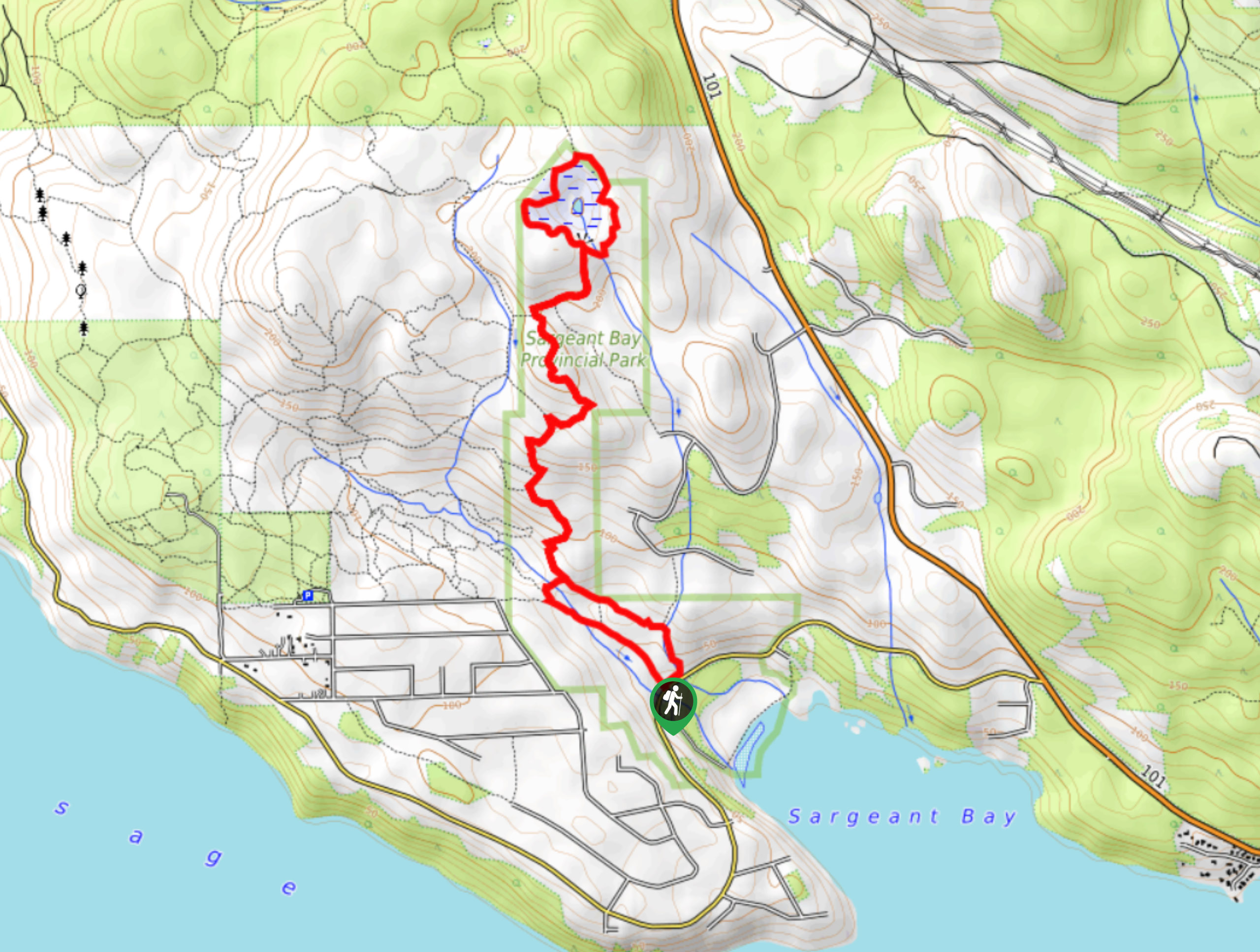
The Triangle Lake Trail is an 5.3mi hiking circuit in Sargeant Bay Provincial Park, BC that will take you through a magnificent stretch of West Coast temperate rainforest to the edges of a small lake. With easy to navigate trails, small elevation gains, and interesting forest terrain; this route is perfect for hikers of most skill levels, including families. Make plenty of noise along the trail and remember to bring bear spray, as bears are often spotted in the vicinity around the trail.
Getting there
To reach the parking area for the Triangle Lake Trail from Sechelt, head south on BC-101 for 4.5mi and turn left onto Redrooffs Road. Continue on for 1.2mi, where you will find the trailhead on the right.

About
| When to do | Year-Round |
| Backcountry Campsites | No |
| Pets allowed | Yes - On Leash |
| Family friendly | Yes |
| Route Signage | Average |
| Crowd Levels | Moderate |
| Route Type | Circuit |
Triangle Lake Trail
Elevation Graph
Weather
Triangle Lake Trail Description
Hiking the Triangle Lake Trail is a fantastic family-friendly activity that will allow you to get some exercise and take in the natural beauty of the rainforest landscape along the Sunshine Coast. The trail sets out from the side of the road and enters into the forest in a northbound direction. There won’t be any stunning mountain or coastal views along this hike; however, you will be able to experience the magical atmosphere of the moss-covered rainforest, as you make your way toward the shores of Triangle Lake. Once there, follow the trail that loops around the edge of the water and enjoy the views, before making your way back along the trail to return to the trailhead.
Similar hikes to the Triangle Lake Trail hike

Malaspina Switchback Trail
The Malaspina Switchback Trail is a 4.3mi out-and-back hiking route in Powell River, BC, that will take you…

Holly Branch Loop Hike
The Holly Branch Loop is a 3.7mi lollipop hiking route near Powell River, BC, that will take you…

Stillwater Bluffs Trail
The Stillwater Bluffs Trail is a 1.9mi lollipop hiking route along the Sunshine Coast that provides some amazing…
Comments