
Toquenatch Trail
View Photos
Toquenatch Trail
Difficulty Rating:
The Toquenatch Trail is a 4.6mi out-and-back hiking route north of Sliammon, BC, that will allow you to experience the calm, relaxing nature and beauty of the temperate rainforests along the Sunshine Coast. As a section of the much longer Sunshine Coast Trail, this route is used for multiple purposes, although hiking, mountain biking, and trail running are the most popular. With a fairly minimal elevation gain, this trail is well-suited for casual hikers looking to simply meander along some wonderful forest paths.
Getting there
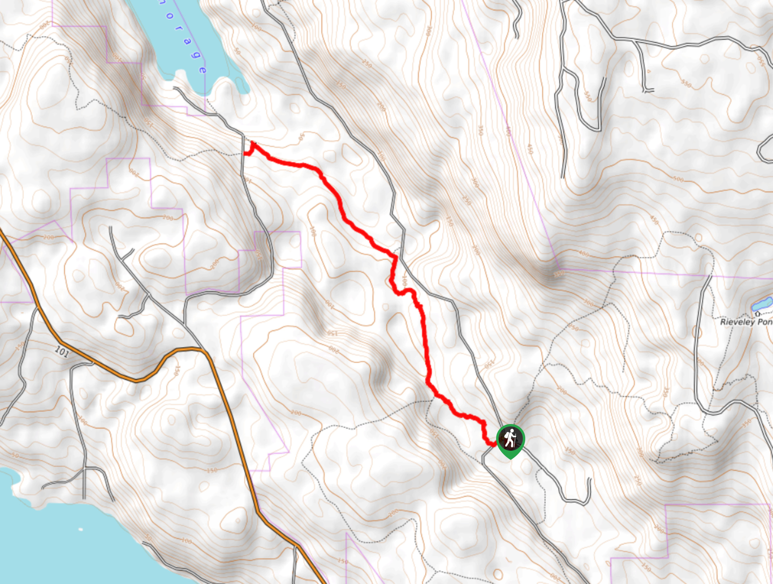
To reach the parking area for the Toquenatch Trail from Sliammon, head west on BC-101 for 2.4mi and turn right onto Southview Road. After 2.1mi, you will find the trailhead on the left.

About
| When to do | April-September |
| Backcountry Campsites | No |
| Pets allowed | Yes |
| Family friendly | Yes |
| Route Signage | Average |
| Crowd Levels | Moderate |
| Route Type | Out and back |
Toquenatch Trail
Elevation Graph
Weather
Toquenatch Trail Description
Hiking along the Toquenatch Trail is a great way to leave the outside world behind and focus on reconnecting with nature for a few hours. Although the trail doesn’t have any spectacular viewpoints, it does feature an amazing forest setting that you will find yourself fully immersed in. Setting out from the trailhead, the route immediately enters into the dense rainforest in a northwestern direction. After roughly 2789ft, you will find yourself skirting along the edge of a more recently cleared stretch of forest before entering back into the thick brush on the way to the northernmost point of the trail. Along the route you will pass by an abundance of small plantlife and even a few mammoth trees as well. When the trail meets up with Plummer Creek Road, turn around and make your way back to the trailhead along the same route that you just hiked to gain an alternate perspective on the forest.
Similar hikes to the Toquenatch Trail hike

Malaspina Switchback Trail
The Malaspina Switchback Trail is a 4.3mi out-and-back hiking route in Powell River, BC, that will take you…

Holly Branch Loop Hike
The Holly Branch Loop is a 3.7mi lollipop hiking route near Powell River, BC, that will take you…

Stillwater Bluffs Trail
The Stillwater Bluffs Trail is a 1.9mi lollipop hiking route along the Sunshine Coast that provides some amazing…
Comments