
Little Sliammon Lake Hike
View Photos
Little Sliammon Lake Hike
Difficulty Rating:
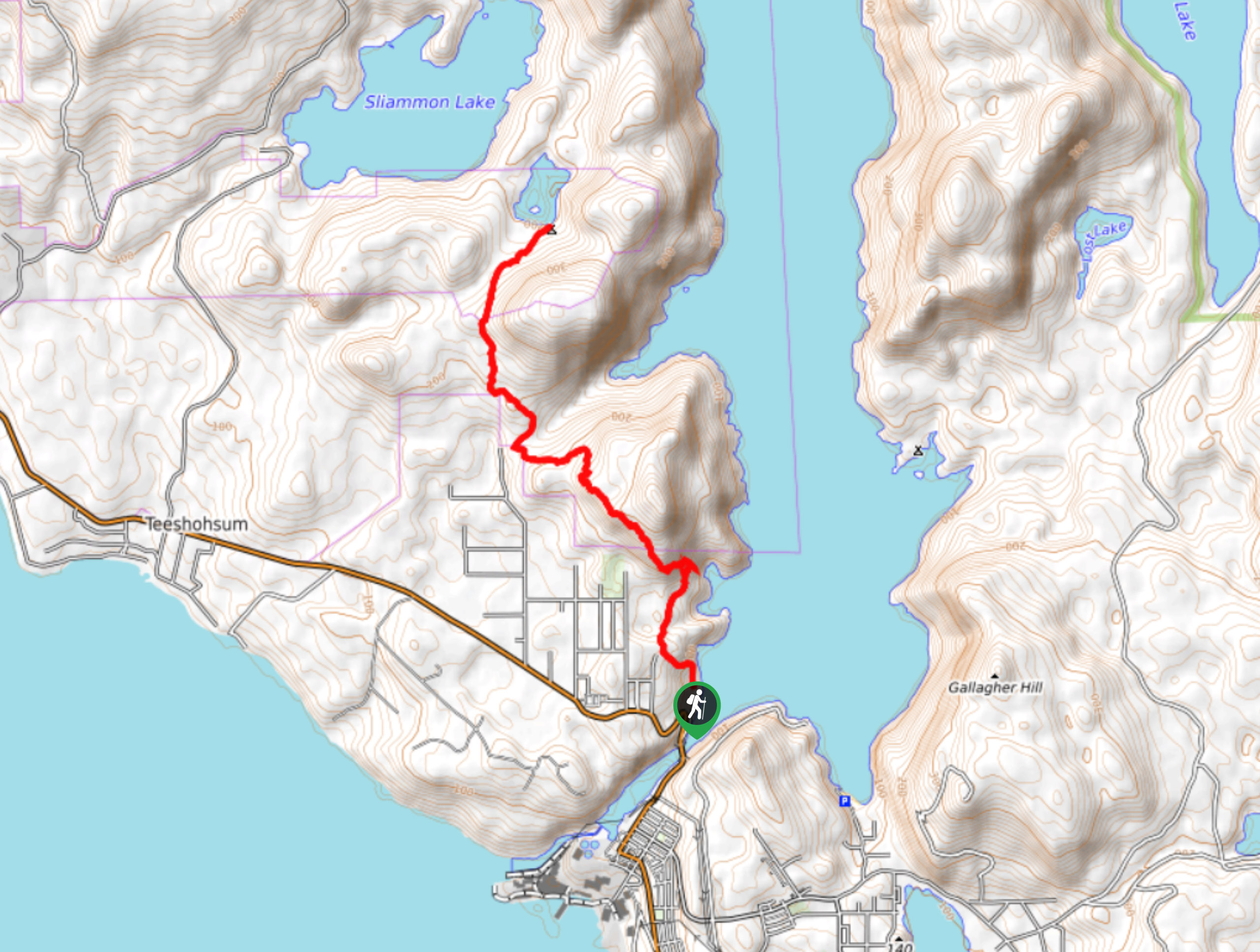
The trek to Little Sliammon Lake is an 7.4mi out-and-back hiking route that will take you from the Marina in Powell River up to the forested shores of Little Sliammon Lake. Along the trail, you will gain and lose elevation, as you traverse Scout mountain and work through the forest to the lake. This is a great hiking route for both casual and experienced hikers alike.
Getting there
To reach the parking area for the Little Sliammon Lake trail from Powell River, head north on Marine Avenue for 3.7mi and turn right onto Powell Place. After 1148ft, you will arrive at the parking area.

About
| When to do | April-September |
| Backcountry Campsites | Little Sliammon Lake Campground |
| Pets allowed | Yes - On Leash |
| Family friendly | Older Children only |
| Route Signage | Average |
| Crowd Levels | Moderate |
| Route Type | Out and back |
Little Sliammon Lake Hike
Elevation Graph
Weather
Little Sliammon Lake Trail Description
Hiking the Little Sliammon Lake Trail is a fun outdoor activity in the Powell River area that will allow you to experience the natural beauty of the surrounding landscape. The trail sets out from the marina in Powell River and heads north through the forest, traversing the lower slopes of Scout Mountain for some nice views overlooking the city. From there, you will continue through the dense forest cover and pass through a small meadow on the approach to the lake. Once you reach the heavily wooded shores of the lake, you can spend some time exploring the area and relaxing in the amazing lakeside atmosphere before heading back along the same route to return to the trailhead.
Similar hikes to the Little Sliammon Lake Hike hike

Malaspina Switchback Trail
The Malaspina Switchback Trail is a 4.3mi out-and-back hiking route in Powell River, BC, that will take you…

Holly Branch Loop Hike
The Holly Branch Loop is a 3.7mi lollipop hiking route near Powell River, BC, that will take you…

Stillwater Bluffs Trail
The Stillwater Bluffs Trail is a 1.9mi lollipop hiking route along the Sunshine Coast that provides some amazing…
Comments