
Appleton Creek Trail
View Photos
Appleton Creek Trail
Difficulty Rating:
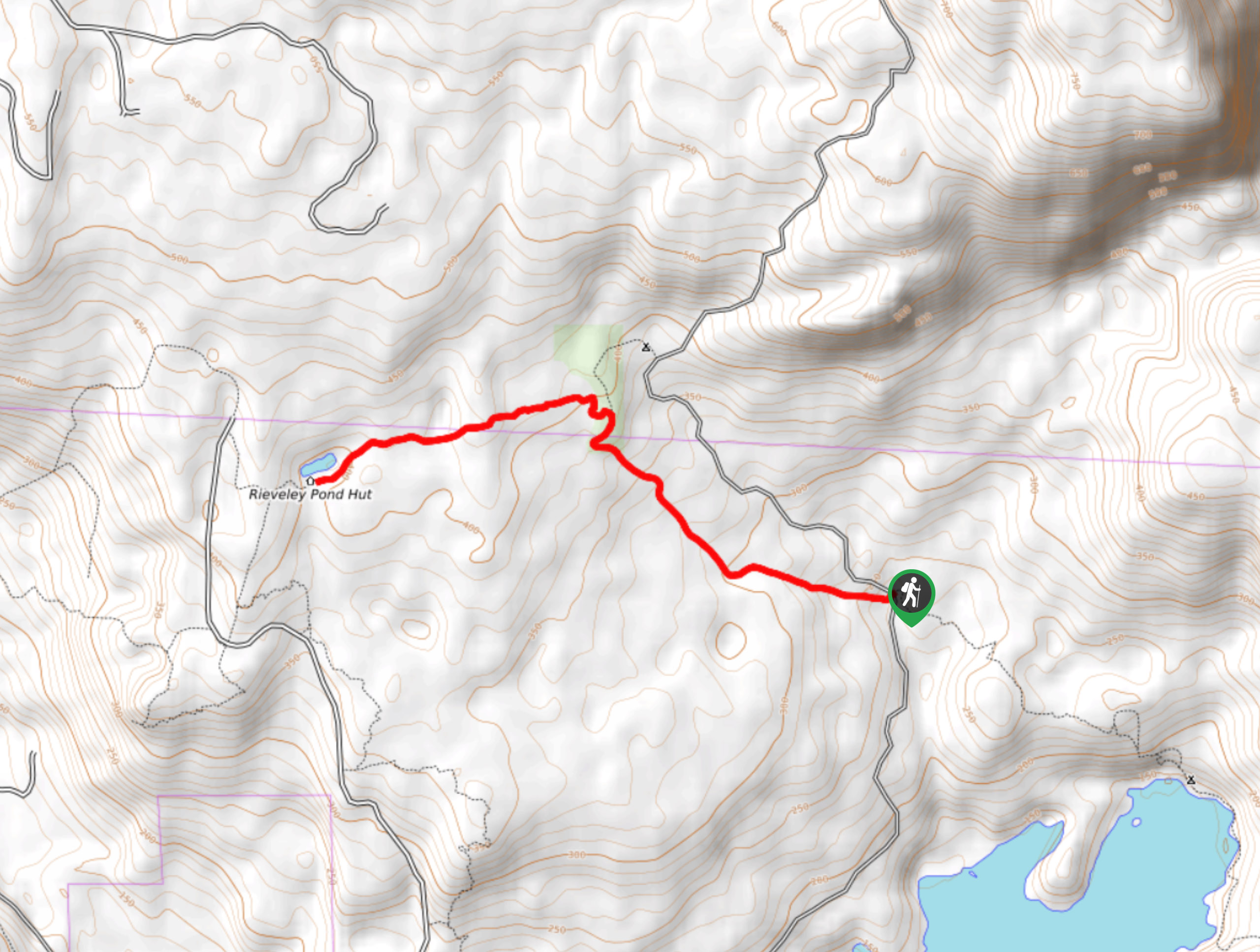
The Appleton Creek Trail is a 4.9mi out-and-back hiking route north of Powell River that follows a portion of the Sunshine Coast Trail from the trailhead on Tomkinson Road to the edge of Rieveley’s Pond. Along the trail, you will hike through a beautiful forest atmosphere, pass by a small cascading waterfall, and experience the tranquil shores of the small lake. If you are looking to spend a few nights in the area, try booking a spot in the charming Rieveley Pond Hut.
Getting there
To reach the Appleton Creek Trail from Powell River, drive north along Marine Avenue for 8.2mi and turn right on Wilde Road. Continue on for 0.7mi and make a right on Tomkinson Road. After 2.9mi, you will find the trailhead on the left.

About
| When to do | April-October |
| Backcountry Campsites | No |
| Pets allowed | No |
| Family friendly | Yes |
| Route Signage | Average |
| Crowd Levels | Moderate |
| Route Type | Out and back |
Appleton Creek Trail
Elevation Graph
Weather
Appleton Creek Trail Description
Hiking the Appleton Creek Trail is a great family-friendly adventure that will allow you to experience the natural beauty of the backcountry areas along the Sunshine Coast. The trail sets out from the side of Tomkinson Road and immediately heads into a heavily forested area. Enjoy the relaxing atmosphere of the Pacific Temperate Rainforest, as you cross over streams and pass by countless ferns that blanket the lush forest floor. After passing by a small and charming waterfall, you will arrive at the calm waters of Rieverley’s Pond. Take some time to enjoy this quaint area in the forest before heading back along the same route to return to the trailhead.
Similar hikes to the Appleton Creek Trail hike

Malaspina Switchback Trail
The Malaspina Switchback Trail is a 4.3mi out-and-back hiking route in Powell River, BC, that will take you…

Holly Branch Loop Hike
The Holly Branch Loop is a 3.7mi lollipop hiking route near Powell River, BC, that will take you…

Stillwater Bluffs Trail
The Stillwater Bluffs Trail is a 1.9mi lollipop hiking route along the Sunshine Coast that provides some amazing…
Comments