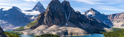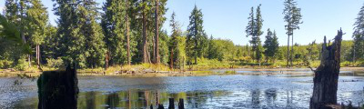
hikes in East Kootenays
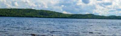
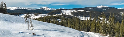
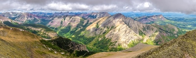
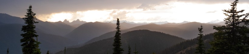
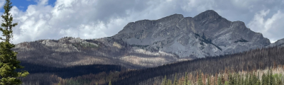
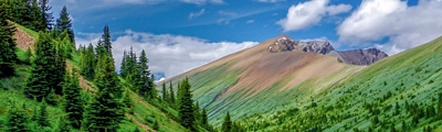
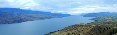
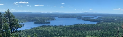
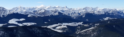
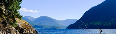
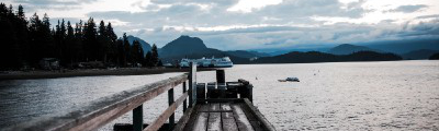
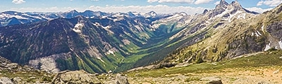
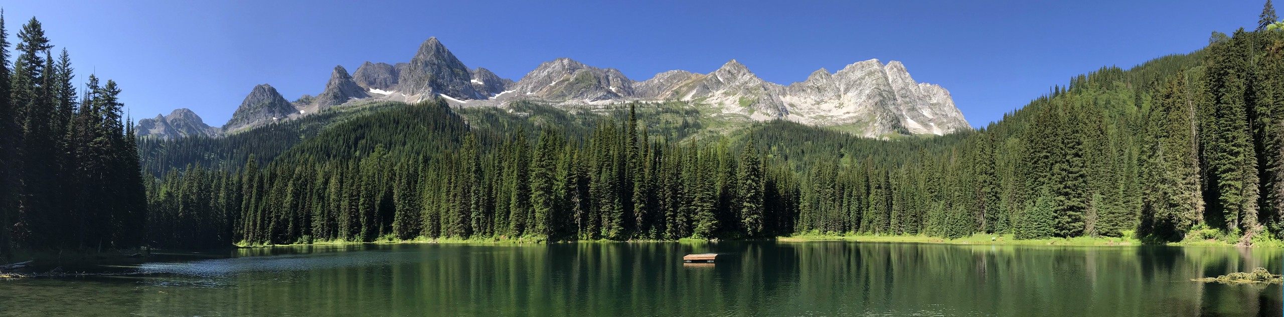
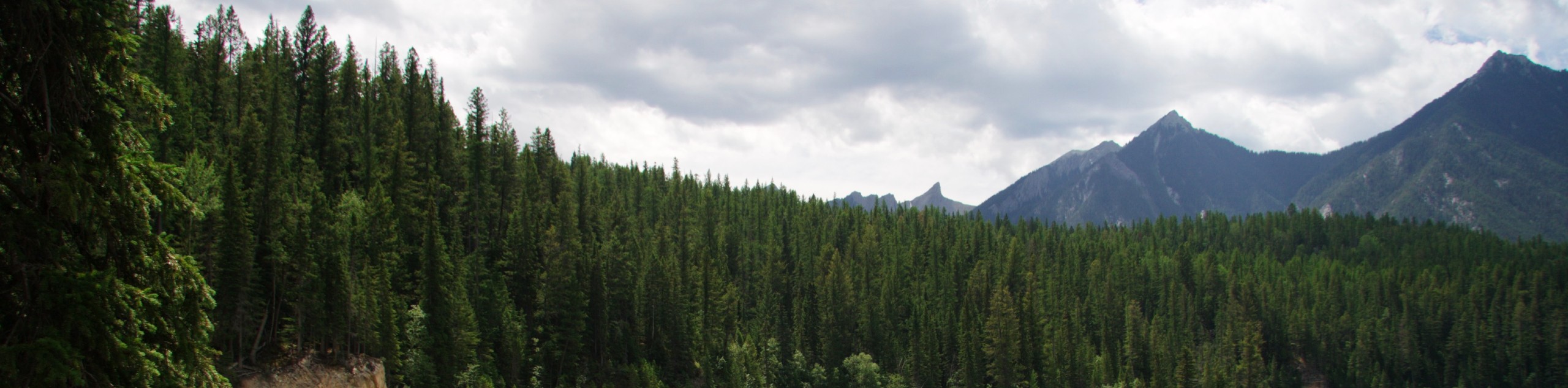
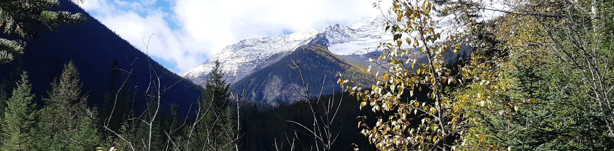
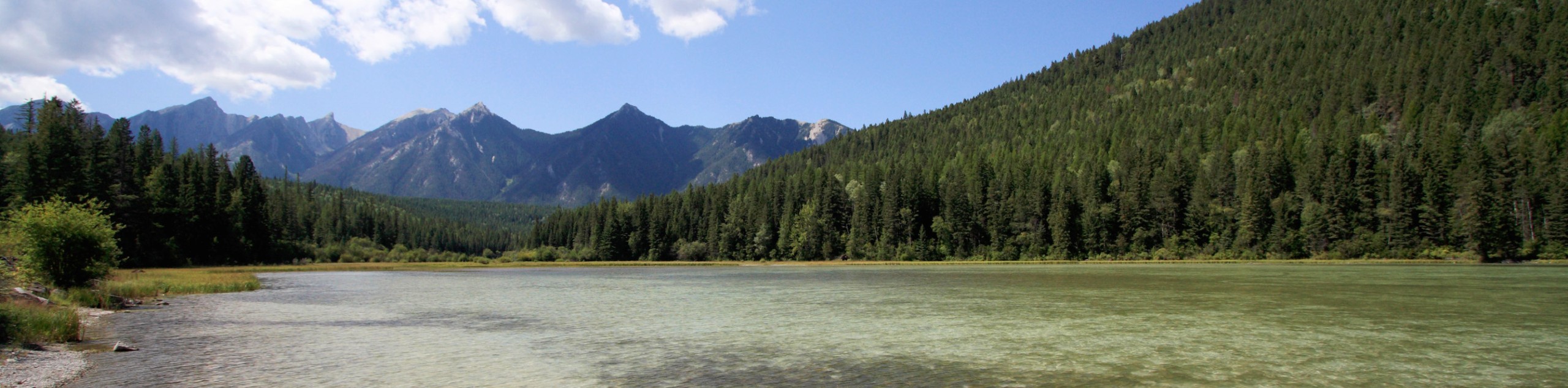
Nestled in the southeast corner of British Columbia, the East Kootenays are a vast region that is characterized by rugged mountain ranges, lush river valleys, and beautifully scenic meadows. Dominated by the Rocky Mountain Trench, and flanked by both the Purcell and Rocky mountain ranges, this is a dramatic landscape that offers a wealth of opportunities for exploring the wilderness.
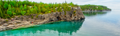
Located within relatively close proximity to a number of popular national, provincial, and regional parks; it is little wonder why the East Kootenays are such a great gateway for exploring this rugged corner of BC. Towns like Fernie, Cranbrook, Invermere, and Kimberley all provide easy access to great accommodations and countless outdoor activities, ensuring that your next trip to the East Kootenays will be an action-packed and memorable experience.
The 10 Greatest Hikes in the East Kootenays
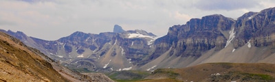
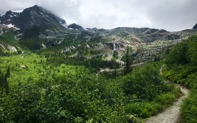
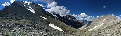
While the terrain of the East Kootenays may seem a bit rough and daunting, the region as a whole offers a great selection of hiking trails that are suitable for all ages and skill levels. Whether you are looking to hike along the banks of the powerful Kootenay River, trek through the rugged mountains of Top of the World Provincial Park, or take a leisurely stroll to one of the relaxing hot springs in Whiteswan Lake Provincial Park, you will be sure to find countless trails that will perfectly suit your next adventure. If you aren’t sure where to get started, check out this list of some great East Kootenay hikes that we’ve put together below:
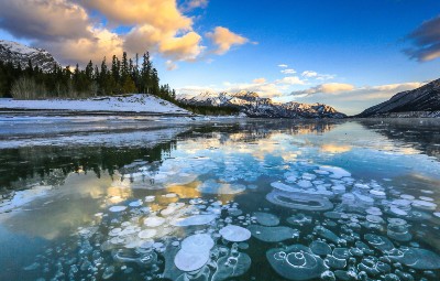
- Lussier Hot Springs: This quick and easy trail isn’t really much of a hike, but it will take you to a relaxing set of hot springs along the Lussier River. Arrive early to beat the crowds and walk the short distance along the path to access the restorative waters of the thermal pools set in a picturesque woodland setting.
- Ram Creek Hot Springs: This adventure to a different hot spring is longer and will require a bit more of an effort in the hiking department; however, the stunning views of nearby mountains makes for the perfect setting when you slip into the thermal pools to relax after a long hike.
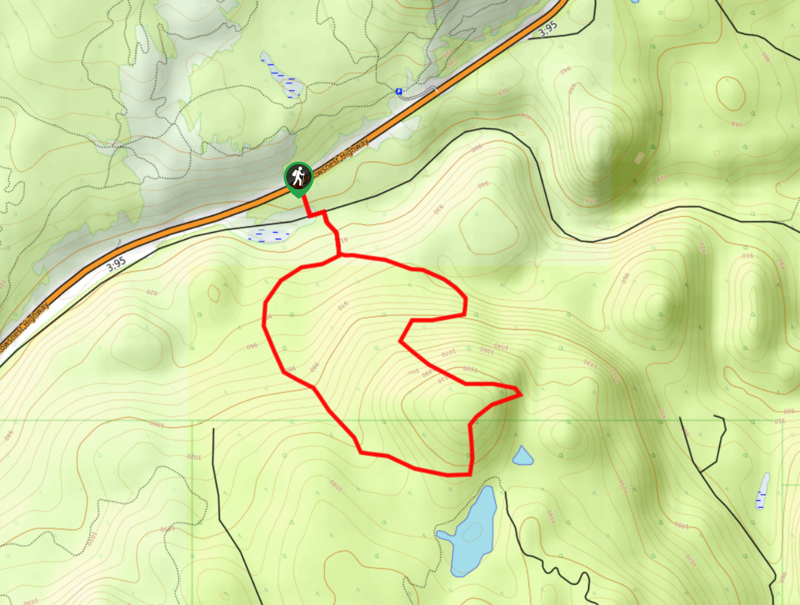
- Bee Line Trail: This quick hike in Cranbrook will take you through a charming forest to an awesome vantage point overlooking the town and nearby Rocky Mountains. The easy to navigate nature of the trail and favourable terrain make this great for a family adventure.
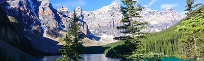
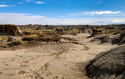
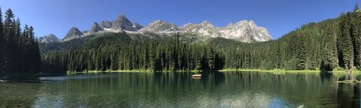
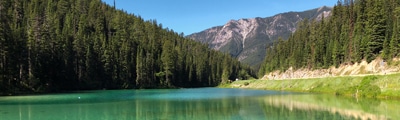
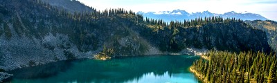
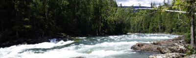
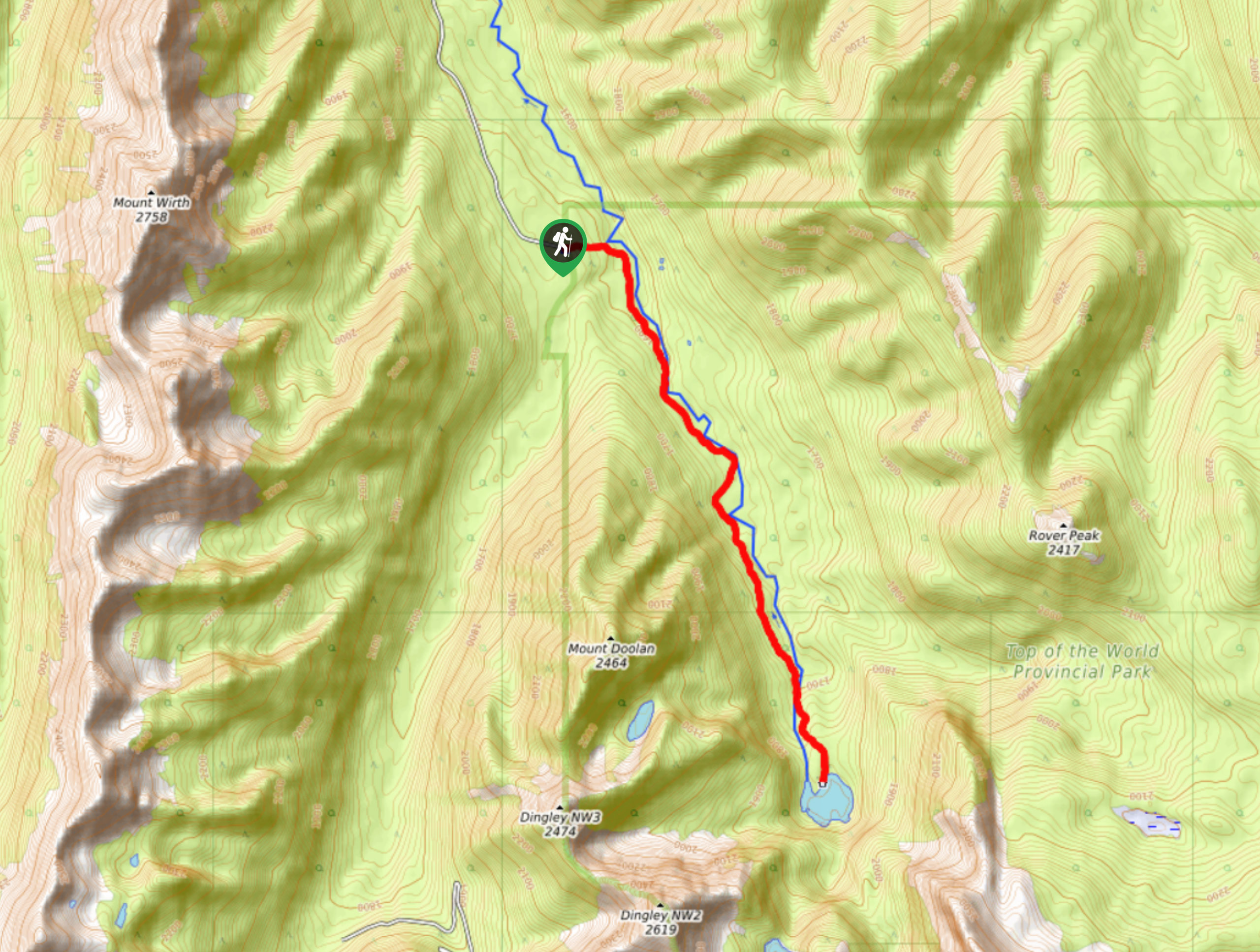
- Fish Lake: The hike to Fish Lake is an amazing adventure that will allow you to take in the natural beauty of Top of the World Provincial Park. After hiking through the forest along the Lussier River, you will end up at the quiet shores of Fish Lake that are surrounded by rugged mountain peaks.
- Dewar Creek Hot Springs: This lengthy out-and-back journey will take you through the rugged backcountry of the Purcell Mountains to reach a beautiful setting with hot springs. The trail might be a bit on the overgrown side, but the amazing views and relaxing thermal pools at the end are more than enough of a reward.
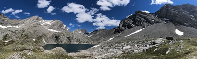
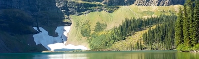
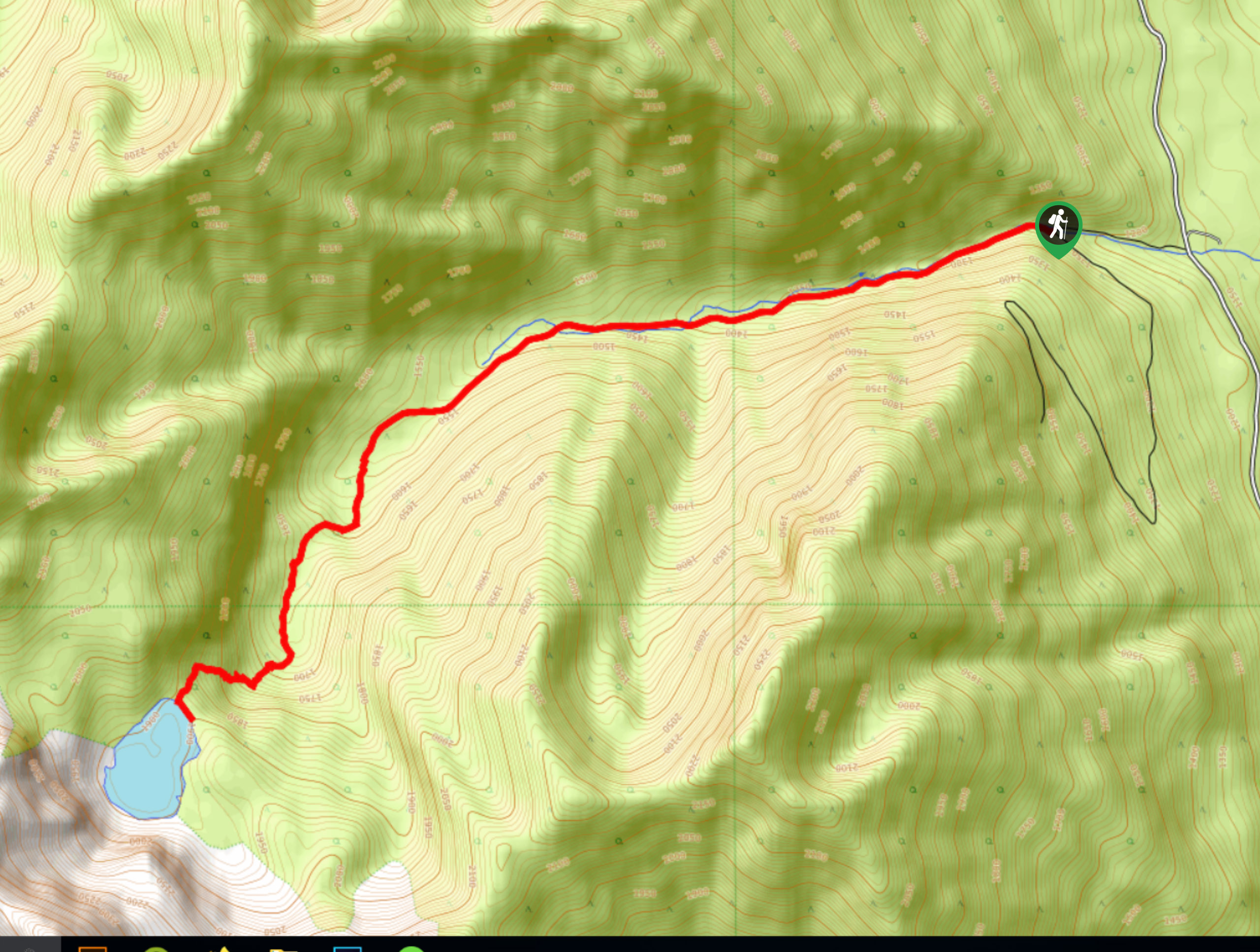
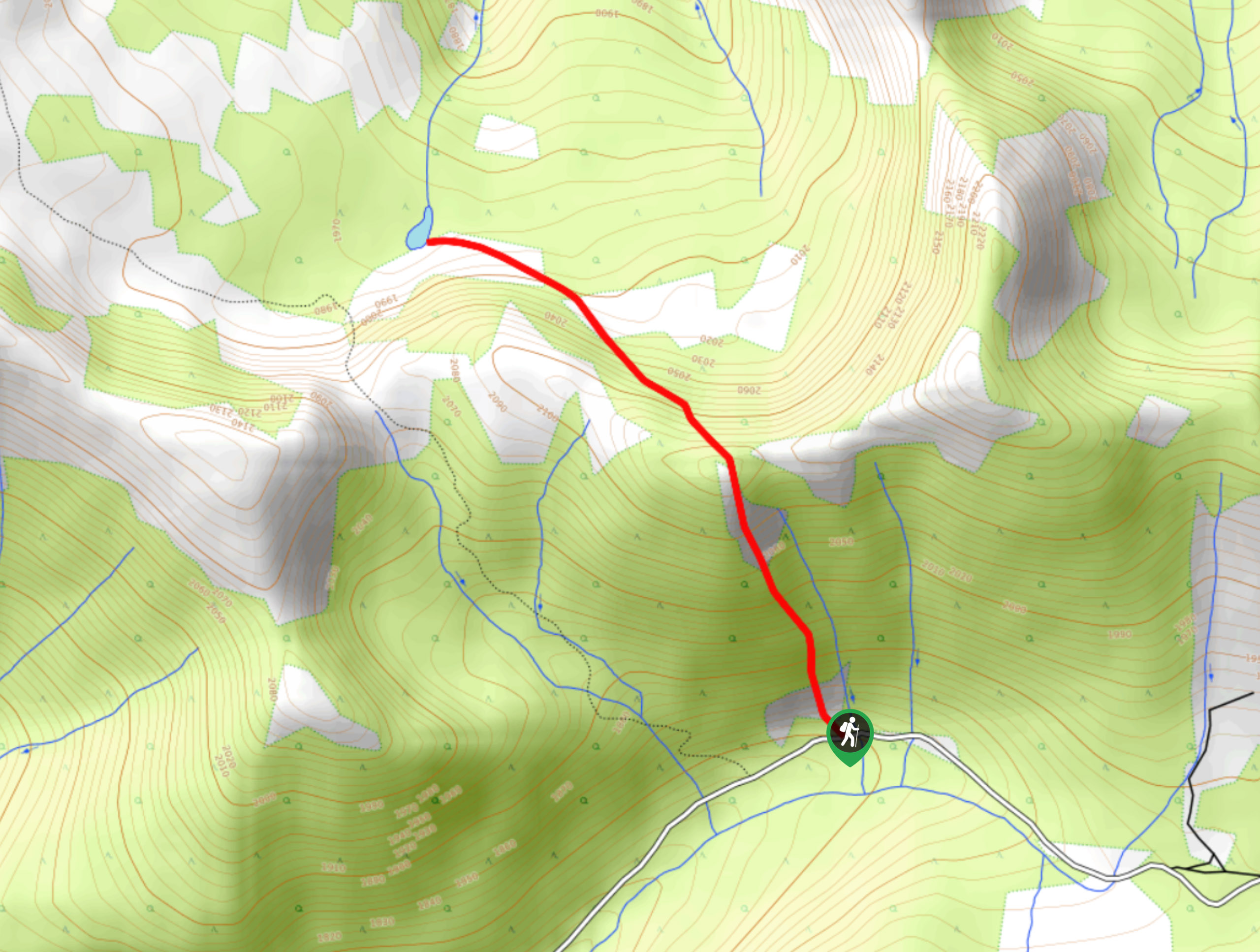
- Lake of the Hanging Glacier: Hiking this trail is a technical adventure that will lead you uphill through challenging terrain to reach a stunning glacial lake with gorgeous views of nearby mountain peaks. You will need a 4x4 vehicle to access this route.
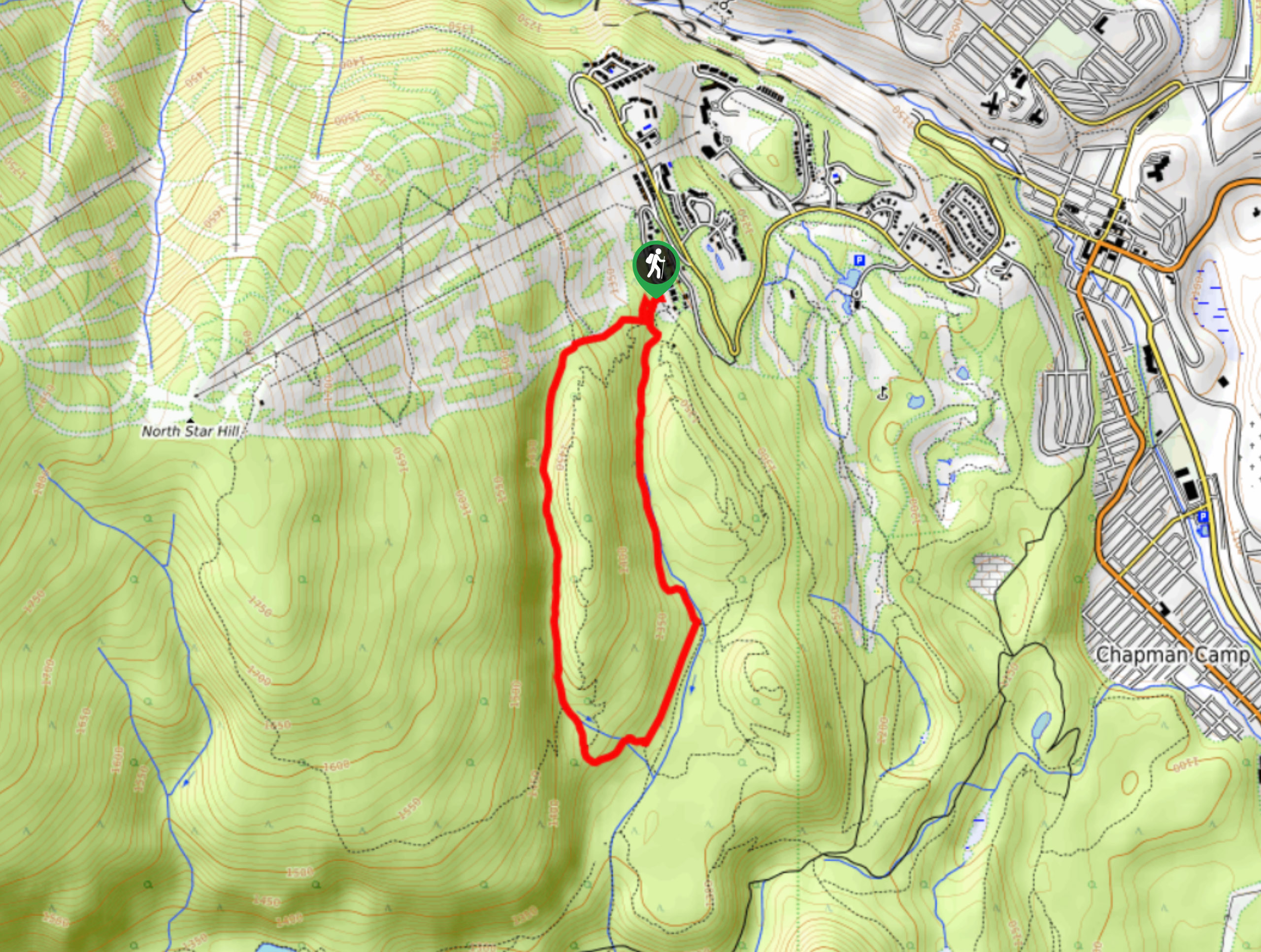
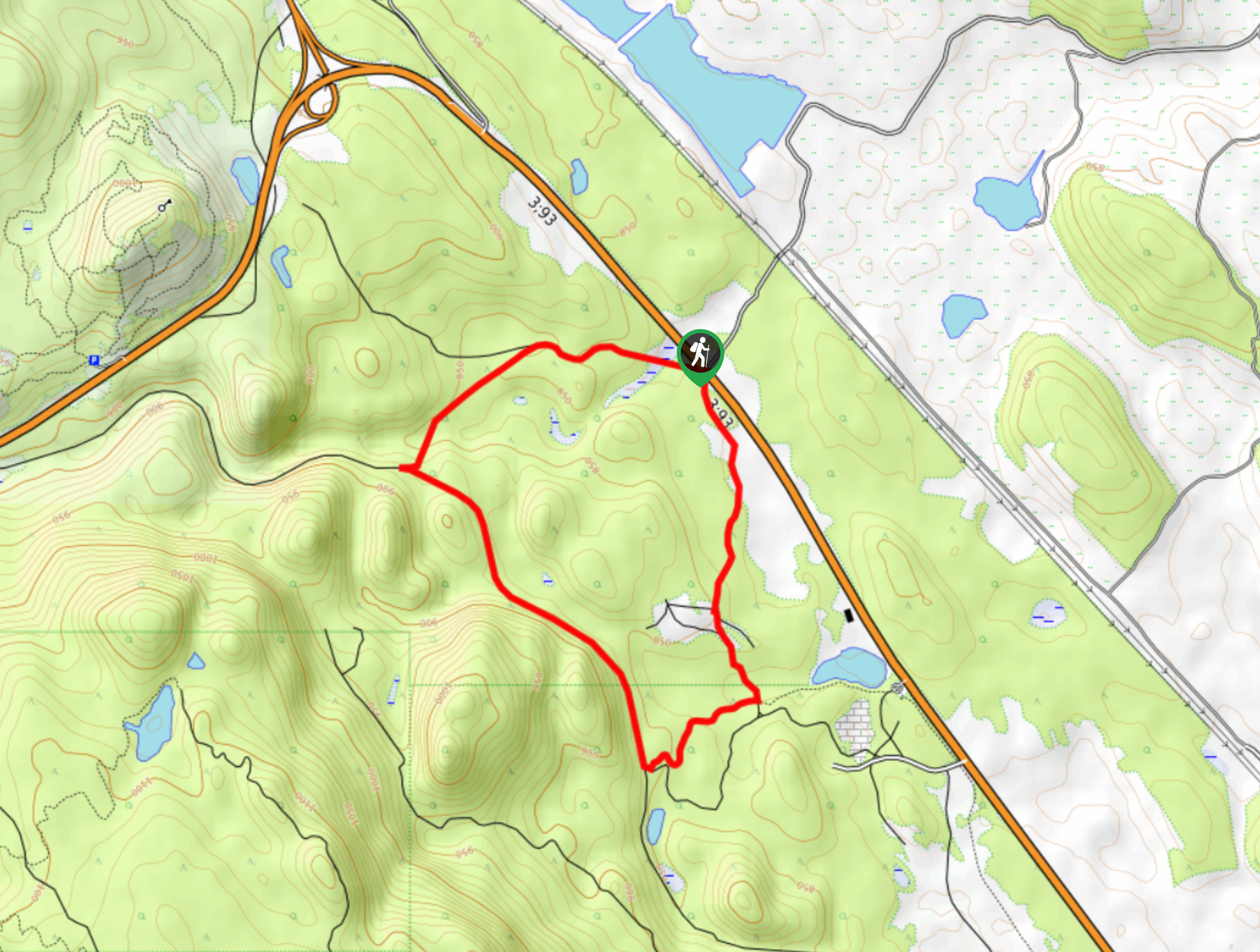
- Moe's Canyon Loop: This quick hiking route near Kimberley is a bit overgrown, but the charming forest setting and rocky terrain of the surrounding area make for a fun day out on a network of trails that can be enjoyed by all.
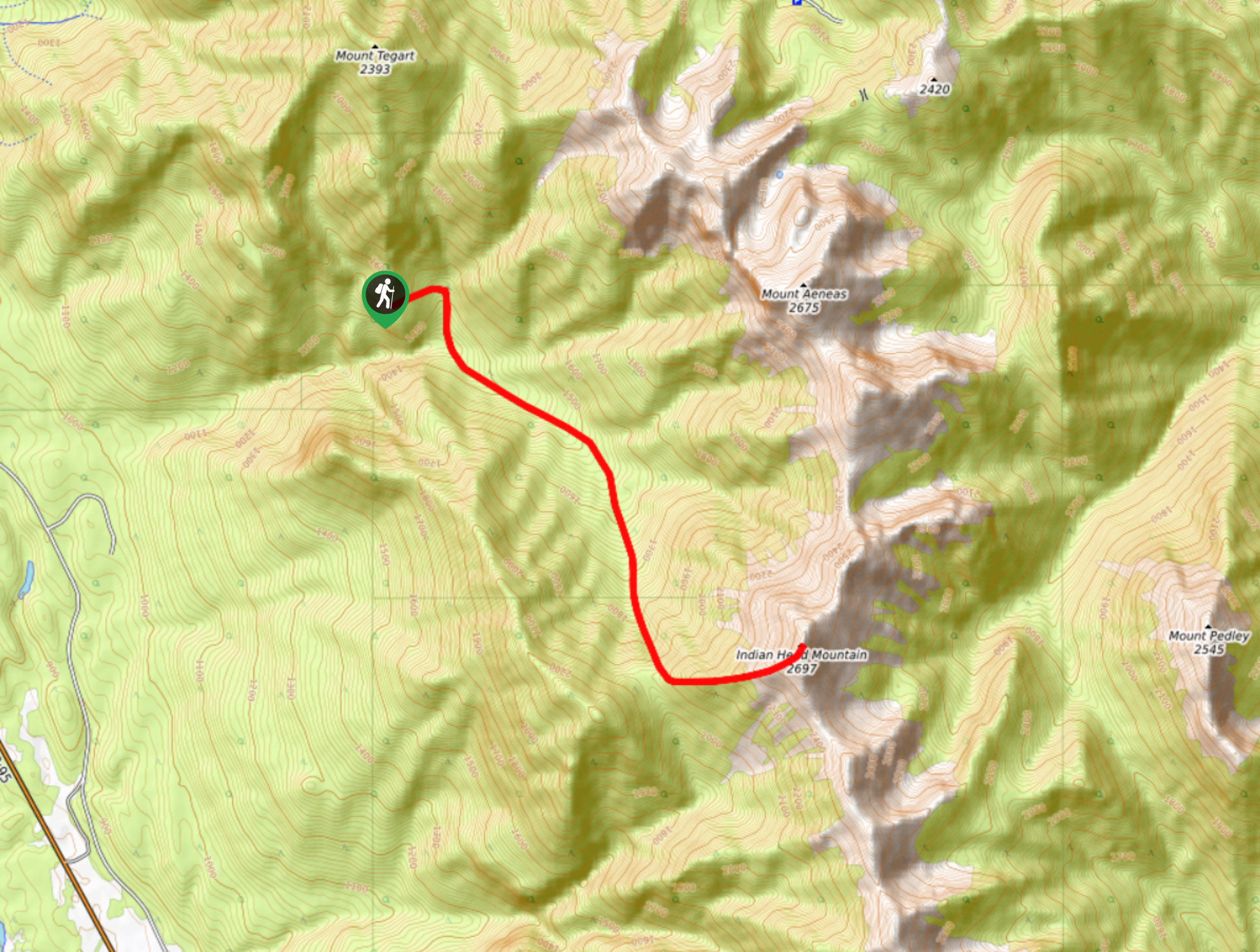
- Mount Stevens and Teepee Mountain: Although this relentless trail east of Wasa will see you work your way uphill through some gruelling terrain, the views of the surrounding alpine landscape will be an ample reward for your efforts. This is another route that is set in the backcountry, making a 4x4 vehicle necessary to reach the trailhead.
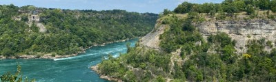
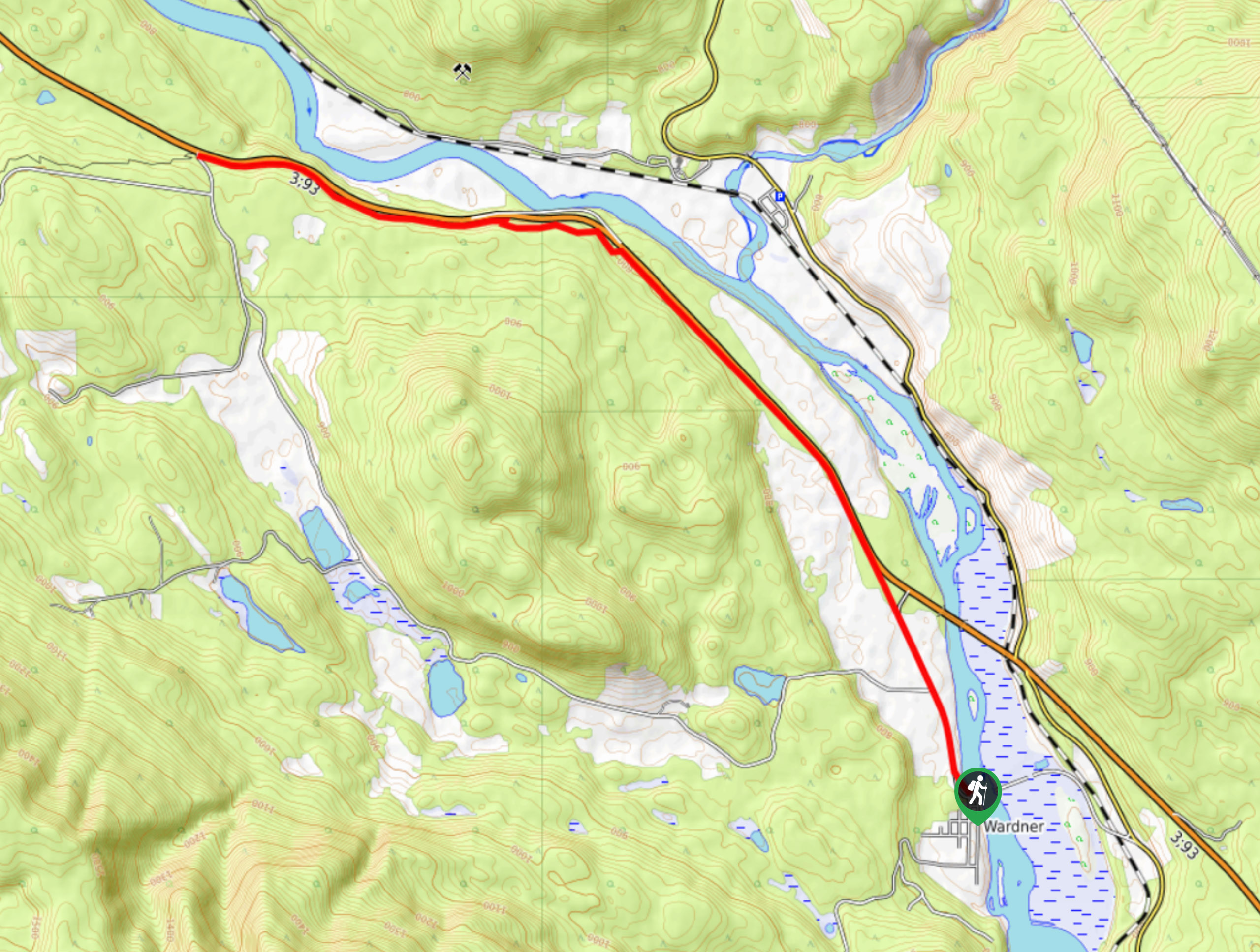
- Chief Isadore Trail: Running parallel to the winding banks of the Kootenay River, the Chief Isadore trail is a fantastic hiking route that will provide breathtaking views of the mountains across the valley. This is a one-way adventure, so be sure to plan a pick up ahead of time.
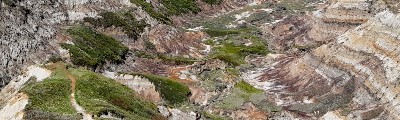
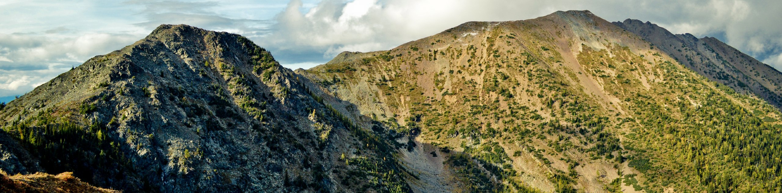
- Chisel Peak: This 8.6mi out-and-back is a rugged climb through some rocky terrain that will take you up to the summit of the peak. Here, you will experience amazingly scenic views overlooking nearby mountains and the Columbia Valley.
When is the Best Time to Hike in East Kootenays?
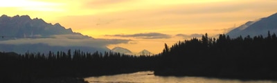
As with most areas in and around the Canadian Rockies, the best time to hike in the East Kootenays is during the summer months. During the early June to end of September window, most of the higher-elevation trails in the region will be free of snow and the hot conditions will be sure to keep trail conditions safe and dry. This also means that the hiking routes will be busiest at this time, so if you don’t mind taking a chance on the weather, you could always aim for the late spring/early fall. At these times, temperatures will be a bit cooler and weather will be more of a factor; however, the opportunities for viewing wildlife and other natural phenomena like waterfalls will bring a whole other level of excitement to your hiking adventure.
Other Outdoor Activities in the East Kootenays
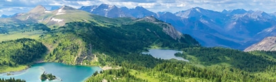
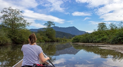
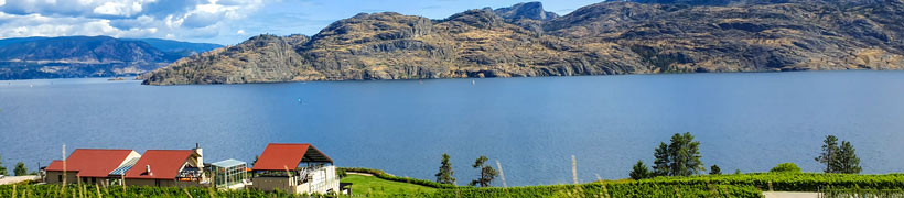
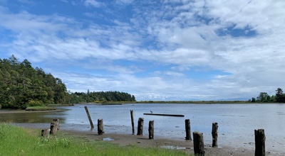
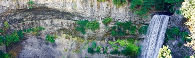
The East Kootenay region covers a massive area in southeastern BC and as a result there will be no shortage of amazing outdoor activities that you can take part in. Summer here will provide access to countless hiking and mountain bike trails, canoe/kayak excursions, mountaineering treks, and fishing expeditions. If you are more interested in winter sports, you will no doubt be happy with the amazing selection of ski slopes, snowshoeing trails, and ice climbing opportunities on offer here. No matter the season, you will always be able to relax after a long day of exploring in the East Kootenays with a soak in one of the region’s many hot springs.
Frequently Asked Questions About the East Kootenays
What is considered the East Kootenays?
The East Kootenay region in southeastern British Columbia is generally accepted to include the valley of the Kootenay and Columbia Rivers, stretching from Golden to the Canada-United States border. On its east and west sides, the region is flanked by the Rocky and Purcell mountain ranges respectively.
What are the Kootenay Mountains?
The Kootenay Rockies aren’t a single range of mountains in themselves, rather, they are comprised of the Rocky, Purcell, Selkirk, and Monashee mountain ranges.
Find other amazing hiking regions in British Columbia
- Whistler
- Kootenay National Park
- Glacier National Park
- Mount Revelstoke National Park
- Yoho National Park
- Strathcona Provincial Park
The best hikes in East Kootenays
01. Lussier Hot Springs
Difficulty
The trail to the Lussier Hot Springs is a short 0.3mi hiking route… Read More

02. Ram Creek Hot Springs
Difficulty
Hiking to the Ram Creek Hot Springs will take you on an 6.9mi… Read More
03. Bee Line Trail
Difficulty
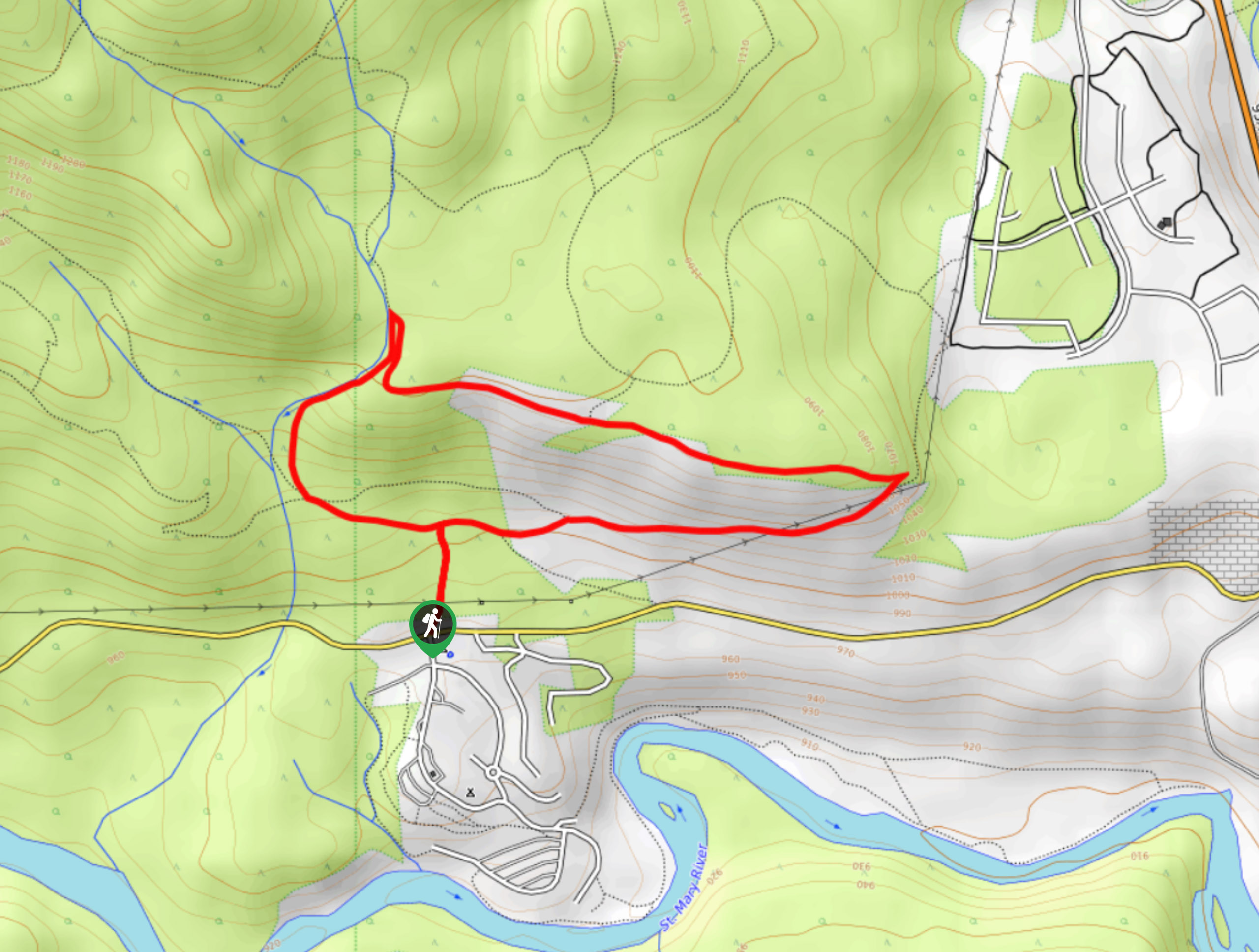
The Bee Line Trail is a 2.8mi lollipop hiking route in Cranbrook, BC,… Read More
04. Fish Lake
Difficulty
The trek to Fish Lake follows a 7.8mi out-and-back hiking route that will… Read More
05. Dewar Creek Hot Springs
Difficulty
The trek to the Dewar Creek Hot Springs follows a 11.9mi out-and-back hiking… Read More
06. Lake of the Hanging Glacier
Difficulty
The trail leading to the Lake of the Hanging Glacier is a 9.9mi… Read More
07. Moe’s Canyon Loop
Difficulty
Moe’s Canyon Loop is a 2.9mi lollipop hiking route just west of Kimberley… Read More

08. Mount Stevens and Teepee Mountain
Difficulty
The trek to Mount Stevens and Teepee Mountain is a steep 8.4mi out-and-back… Read More
09. Chief Isadore Trail
Difficulty
The Chief Isadore Trail is a 6.4mi point-to-point hiking route that will take… Read More
10. Chisel Peak
Difficulty
Chisel Peak is a 8.6mi out-and-back hiking route near Invermere, BC, that will… Read More
Yes, there are more than 10
East Kootenays is so beautiful that we can not give you only 10 hikes. So here is a list of bonus hikes in East Kootenays that you should take a look at as well
11. Mary’s Lunch Room
Difficulty
The Mary’s Lunch Room trail is an 7.1mi hiking circuit just outside of… Read More
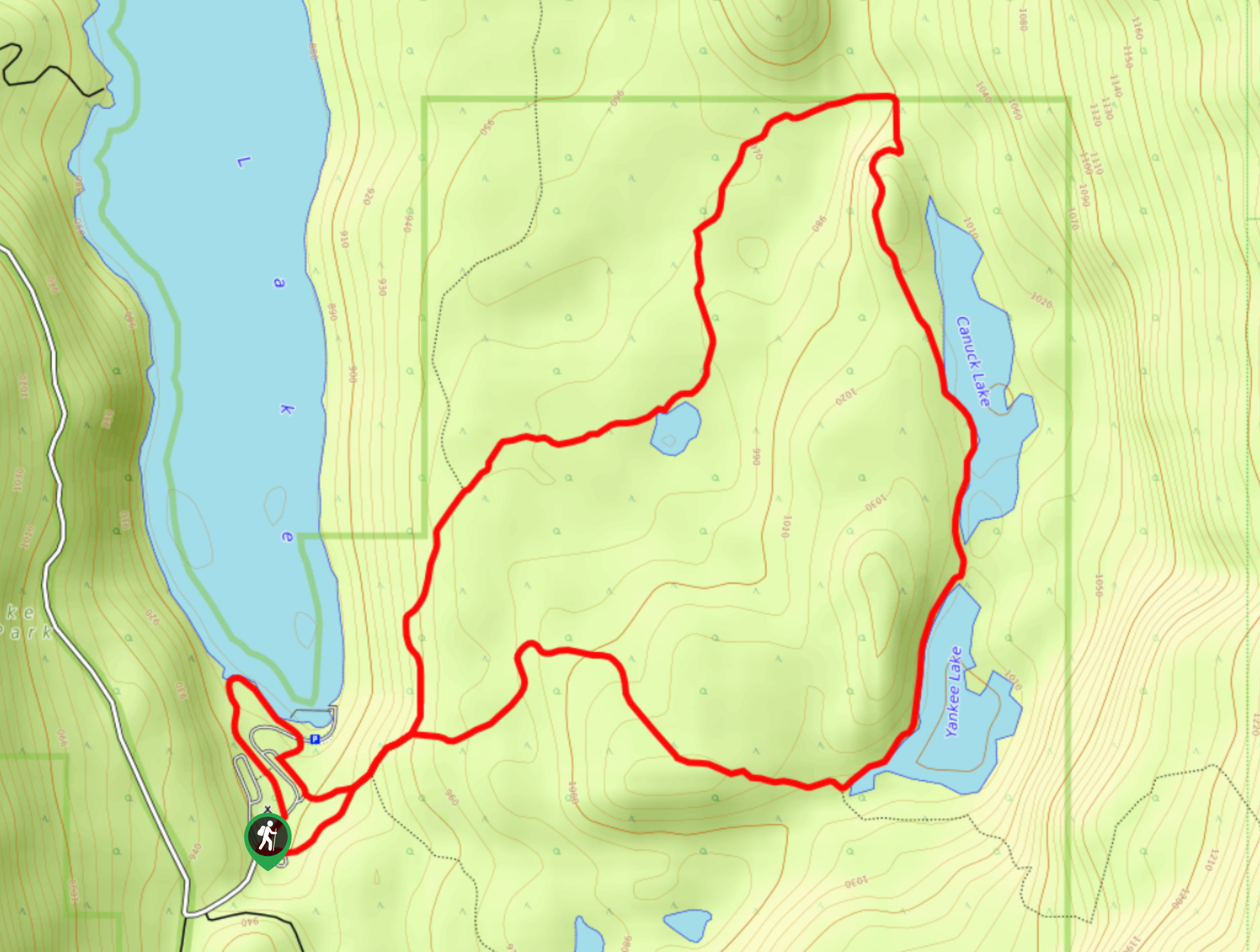
12. Premier Lake to Canuck Lake Loop
Difficulty
Hiking the Premier Lake to Canuck Lake Loop is a great experience that takes you… Read More
13. Lakit Lookout
Difficulty
The Lakit Lookout trail is a 2.1mi out-and-back hiking route near Fort Steele,… Read More
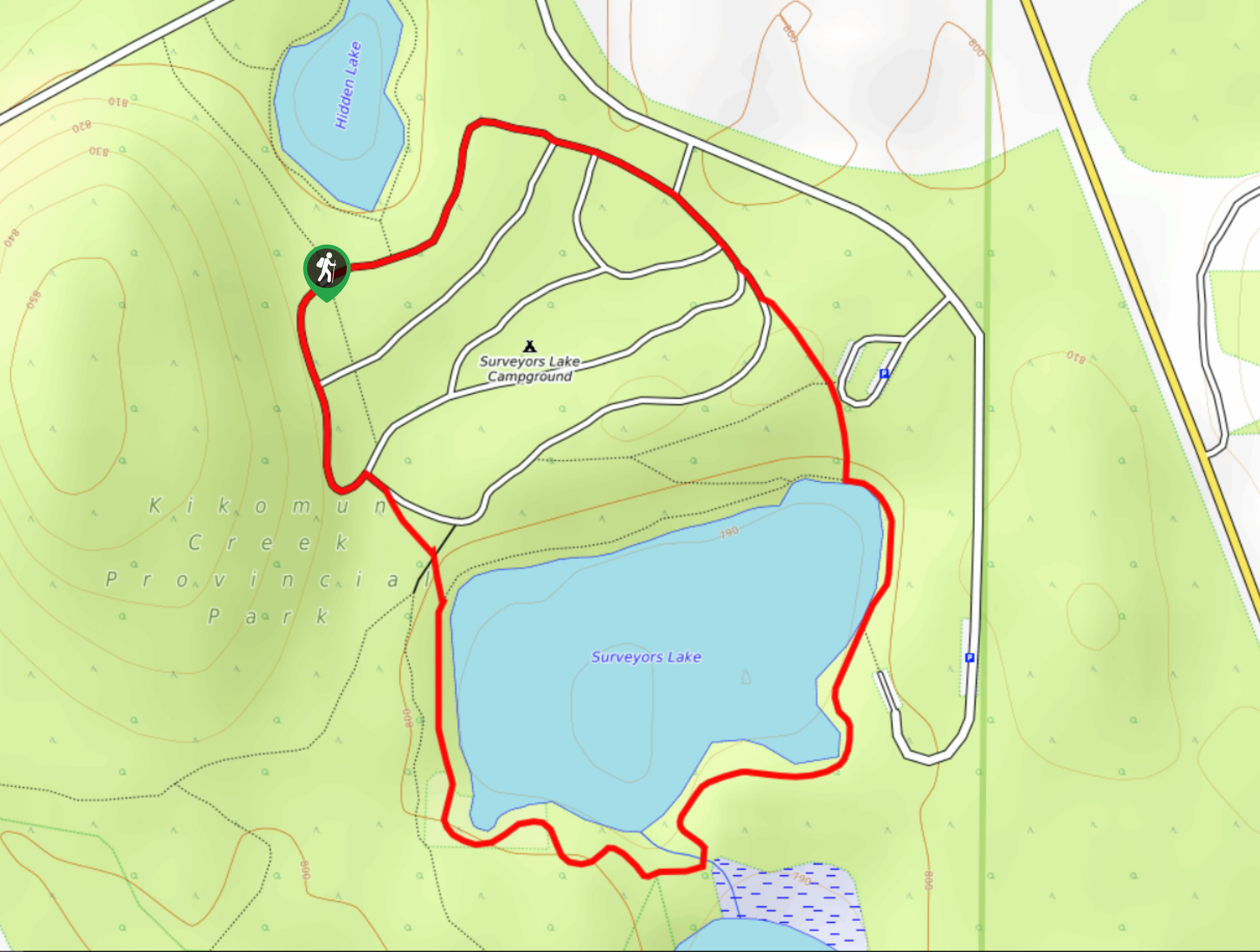
14. Surveyors Lake Loop
Difficulty
The Surveyors Lake Loop is a 1.7mi circuit hiking route in Kikomun Creek… Read More
15. Jimmy Russel to Sunflower Hill Loop
Difficulty
The Jimmy Russel to Sunflower Hill Loop is a 2.4mi lollipop hiking route… Read More
16. Jimmy Russel to Hoodoo View Loop
Difficulty
The Jimmy Russel to Hoodoo View Loop is an awesome 2.4mi lollipop trail… Read More
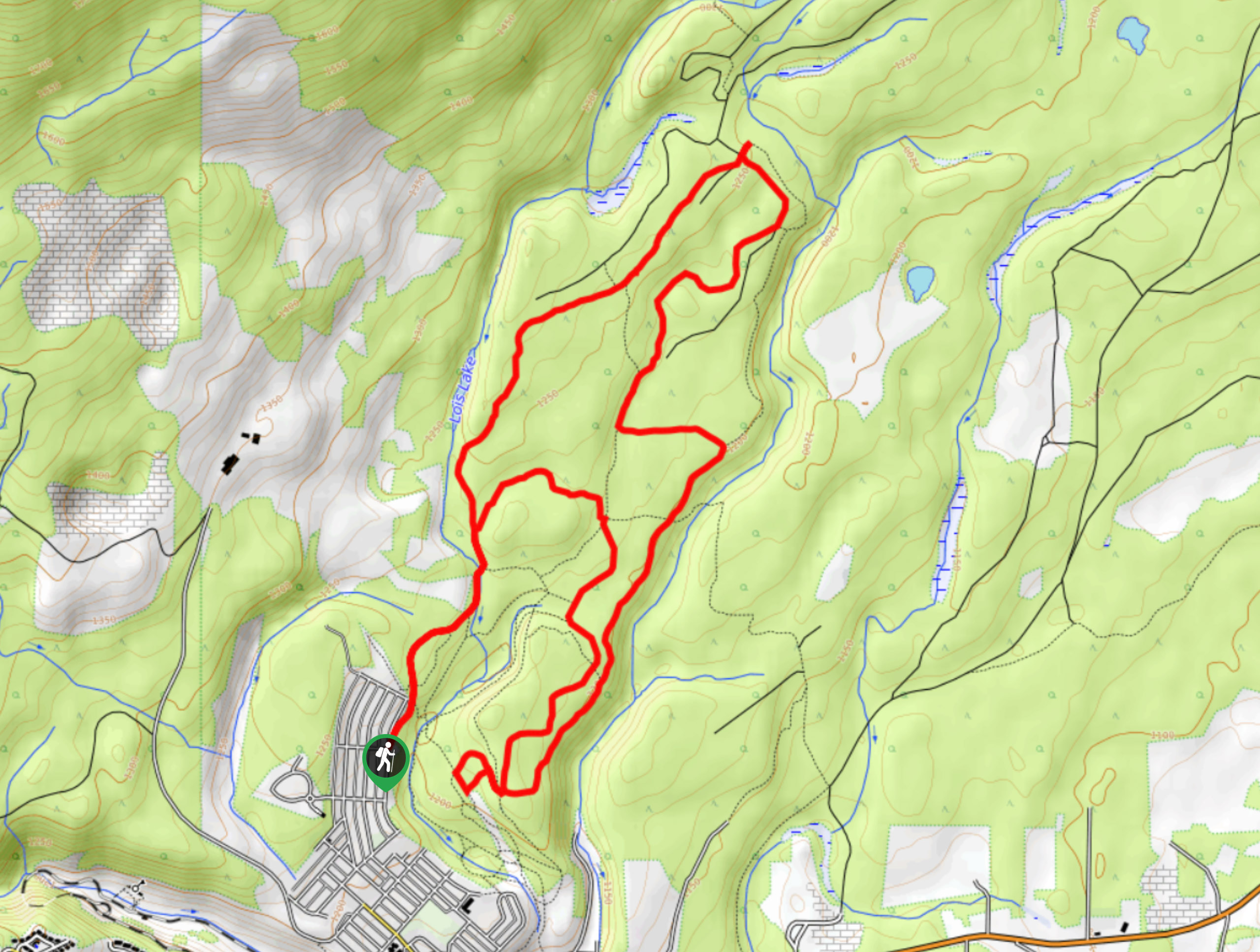
17. Lois Creek Trail
Difficulty
The Lois Creek Trail is a 7.9mi hiking circuit on the northeastern edge… Read More
18. Apache Loop
Difficulty
The Apache Loop is a 4.0mi lollipop hiking route in Kimberley, BC that… Read More
19. Round the Mountain Trail
Difficulty
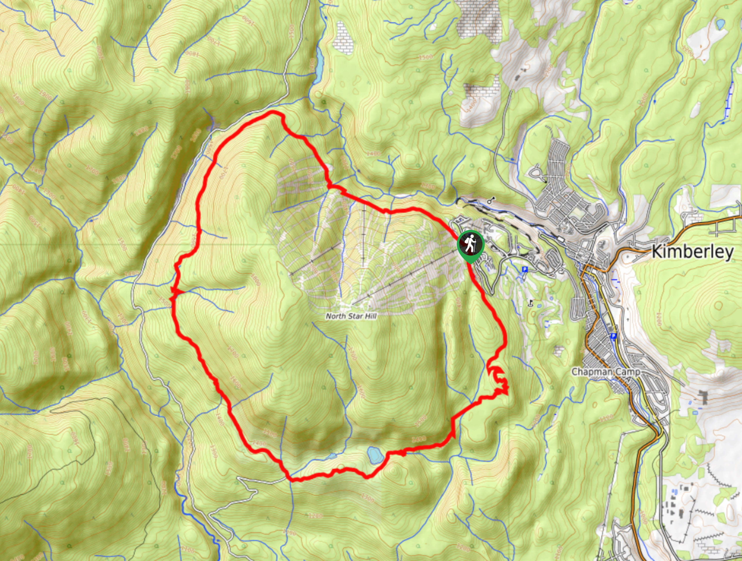
The Round the Mountain Trail is a 12.1mi lollipop hiking route that will… Read More
20. Musser’s Plateau Loop
Difficulty
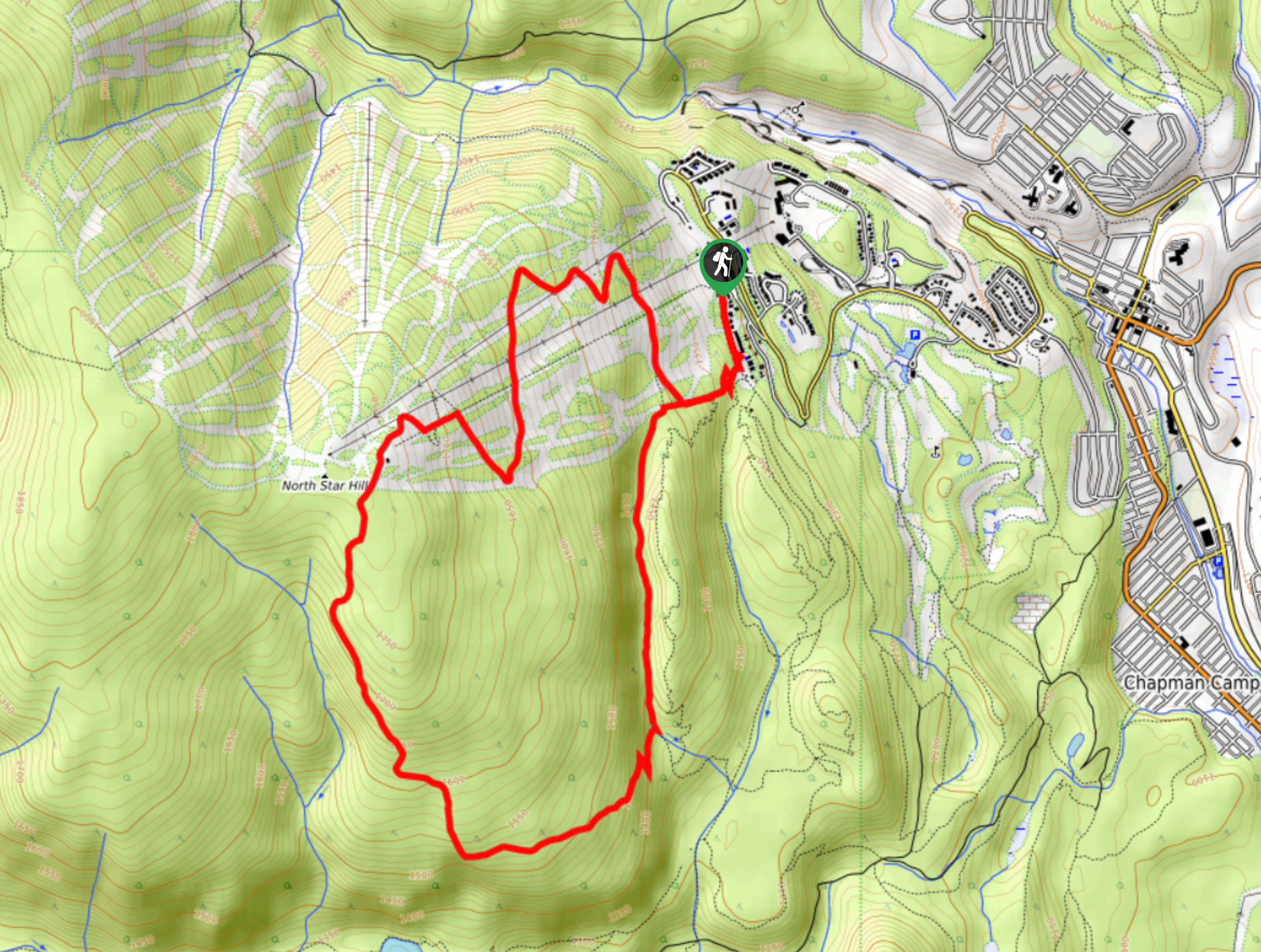
Musser’s Plateau Loop is a 6.2mi lollipop hiking route in Kimberley, BC, that… Read More
21. Magic Line Trail
Difficulty
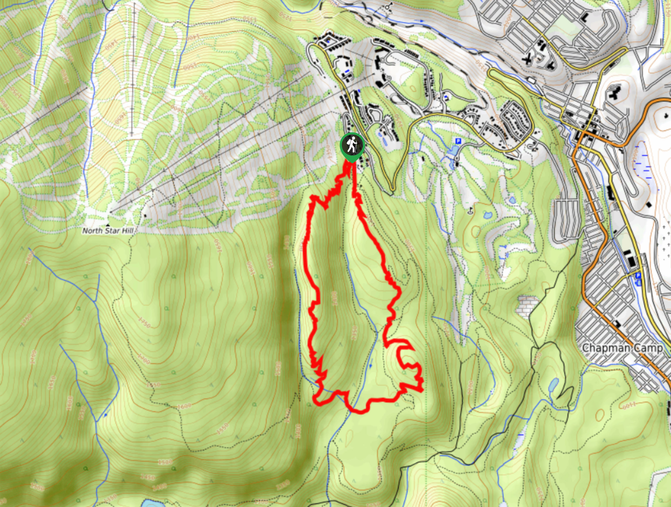
The Magic Line Trail is a 4.5mi lollipop hiking route in Kimberley, BC,… Read More
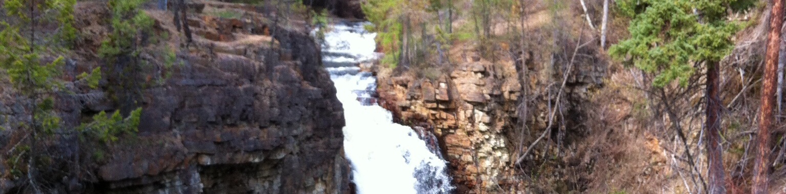
22. Findlay Falls Trail
Difficulty
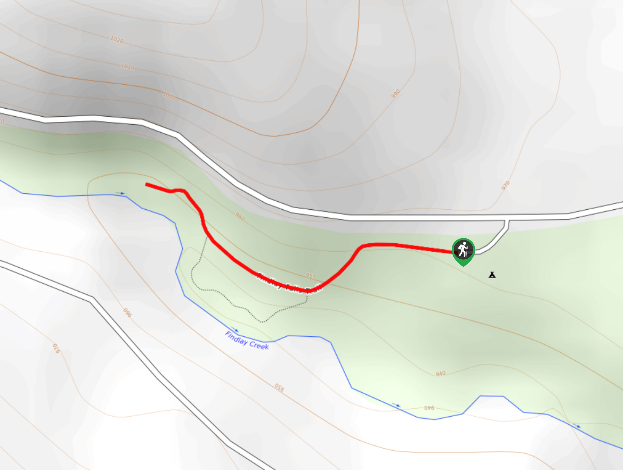
The Findlay Falls Trail is a 0.6mi out-and-back hiking route near Canal Flats… Read More
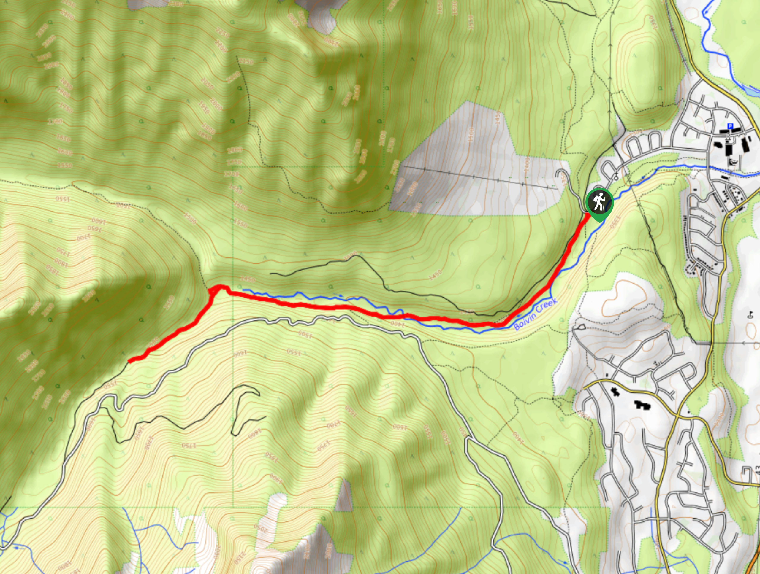
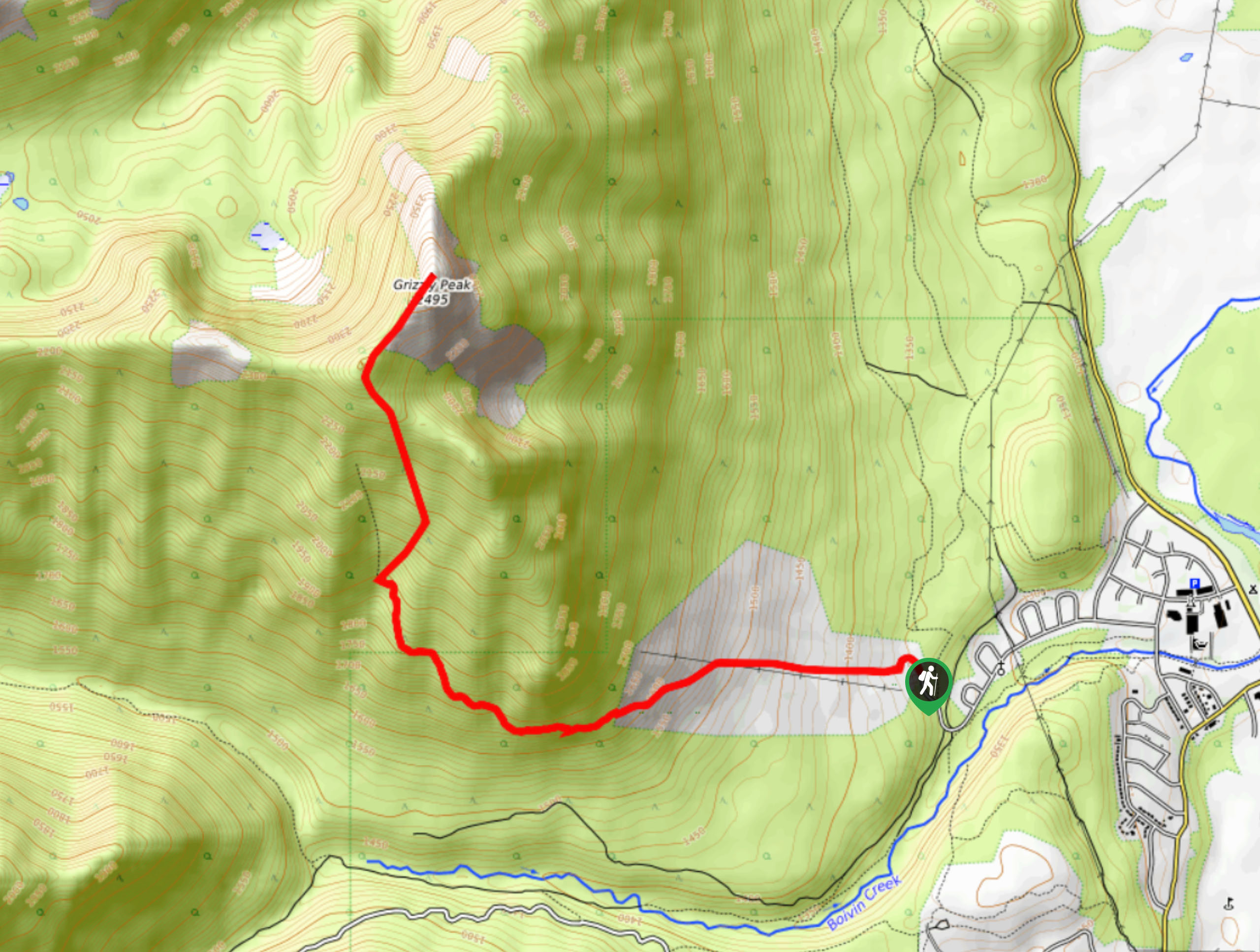
23. Boivin Creek Trail
Difficulty
The Boivin Creek Trail is an 5.3mi out-and-back hiking route in Elkford that… Read More

24. Spirit Trail Loop
Difficulty
The Spirit Trail Loop is a 10.1mi hiking circuit in the East Side… Read More
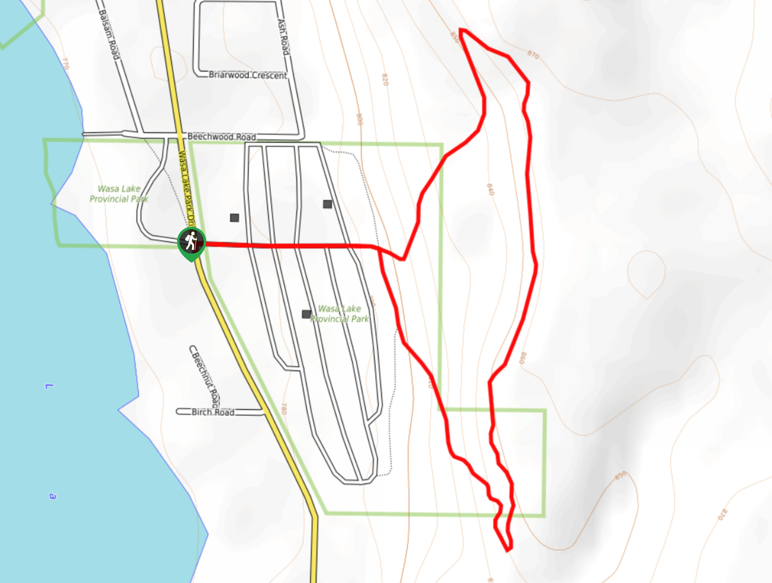
25. Wasa Lake Campground Loop
Difficulty
The Wasa Lake Campground Loop is a 1.8mi lollipop hiking route in Wasa,… Read More
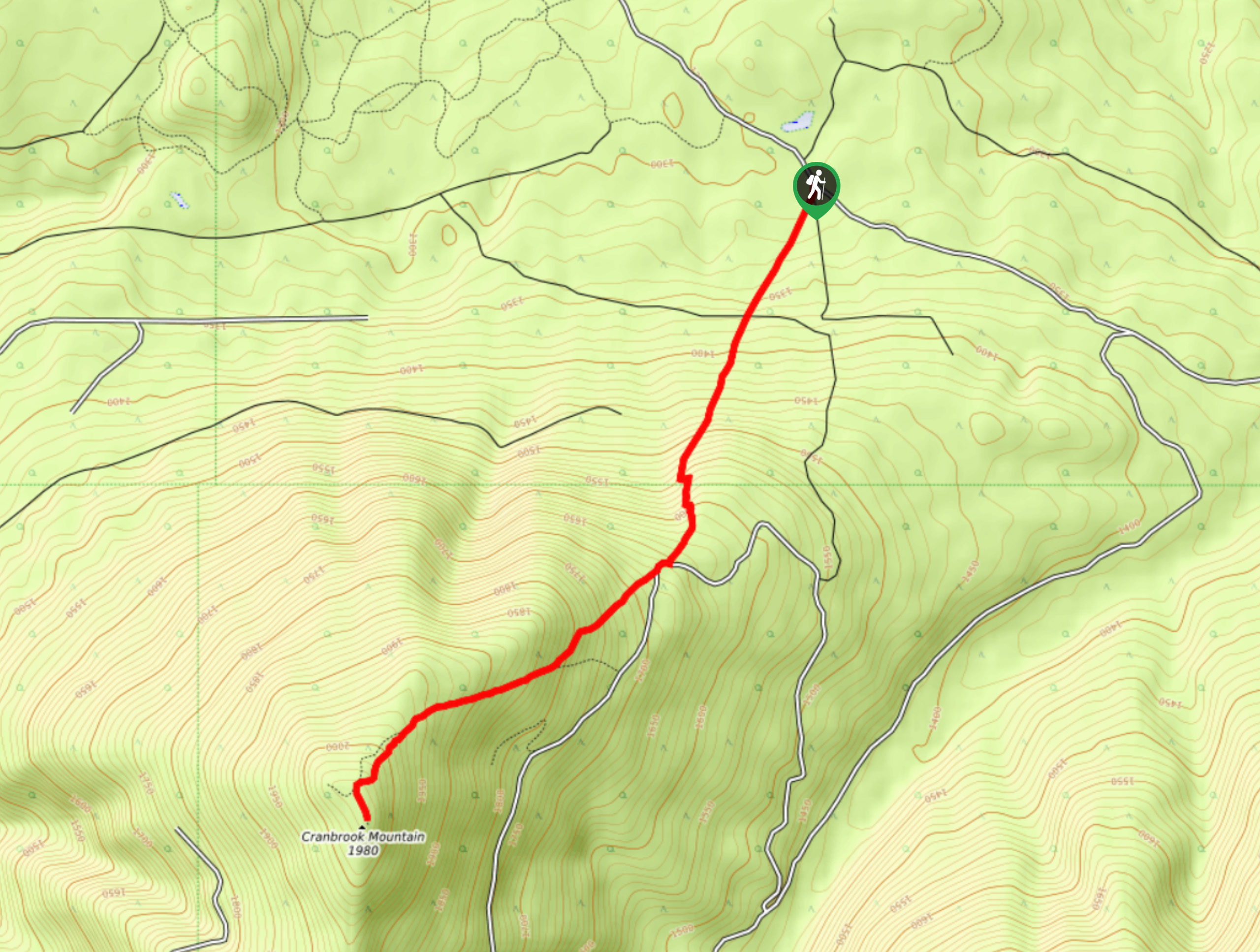
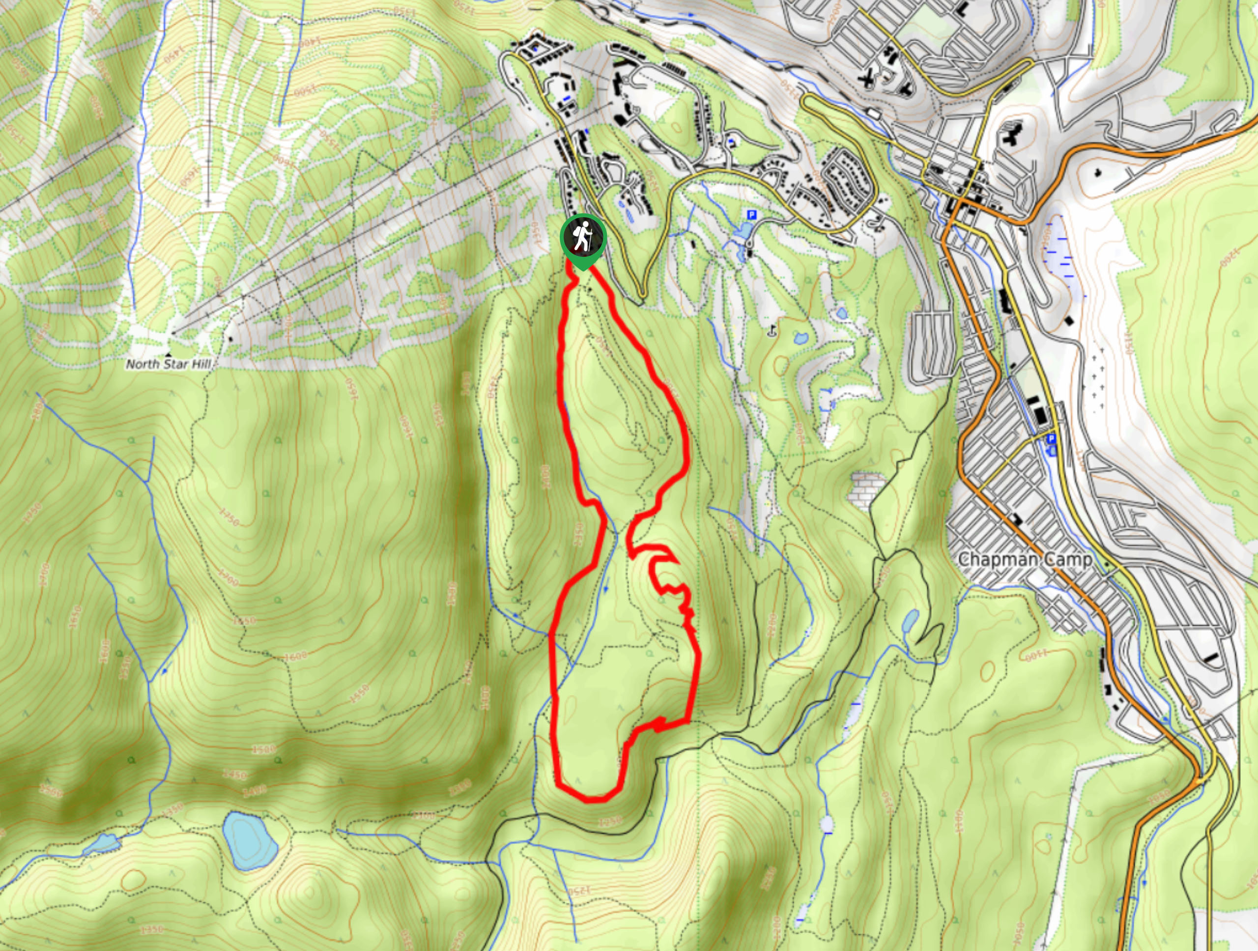
26. Cranbrook Mountain Trail
Difficulty
The Cranbrook Mountain Trail is an 5.5mi out-and-back hiking route near Cranbrook, BC,… Read More
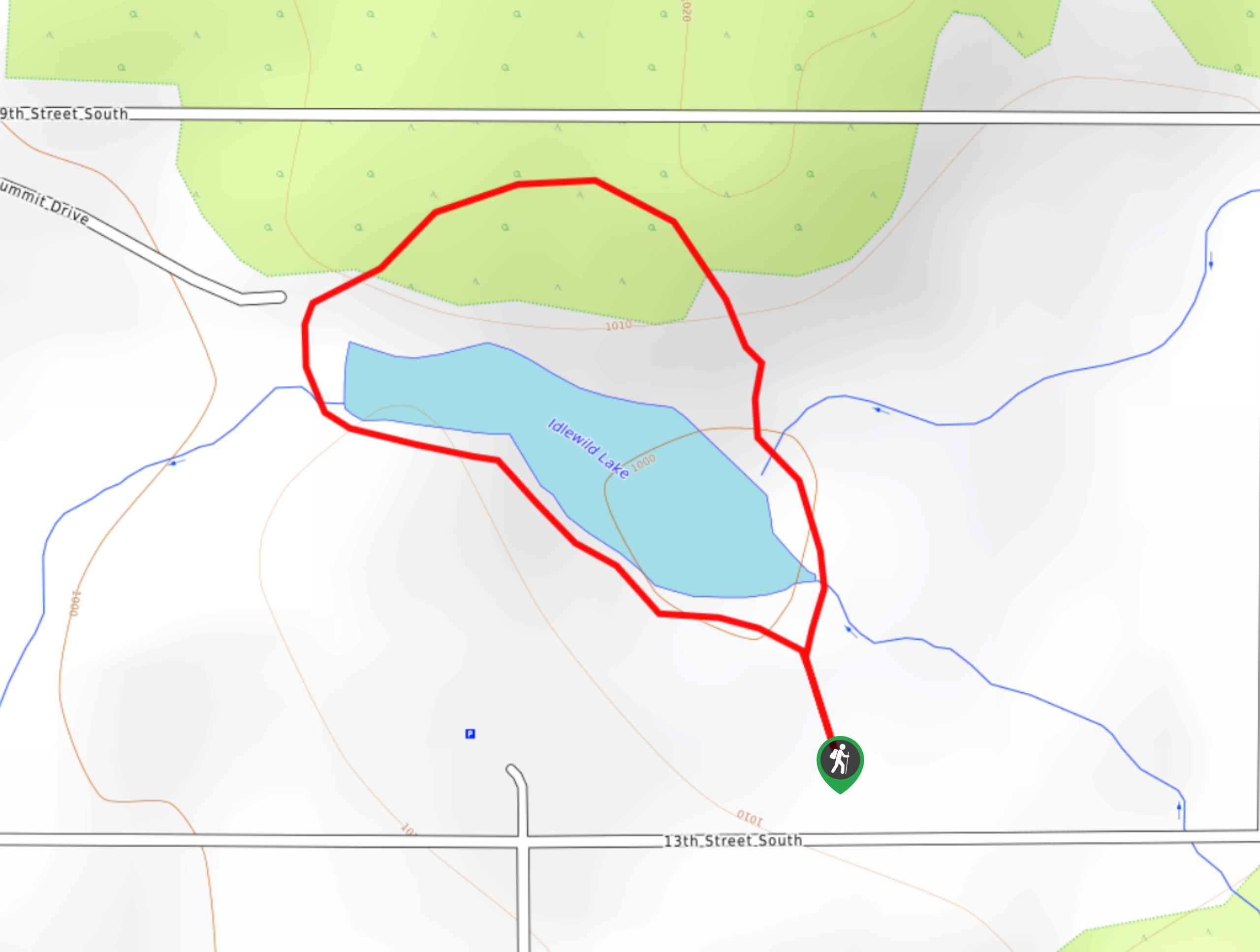
27. Idlewild Lake Loop
Difficulty
The Idlewild Lake Loop is a 0.7mi lollipop hiking route in Cranbrook, BC… Read More
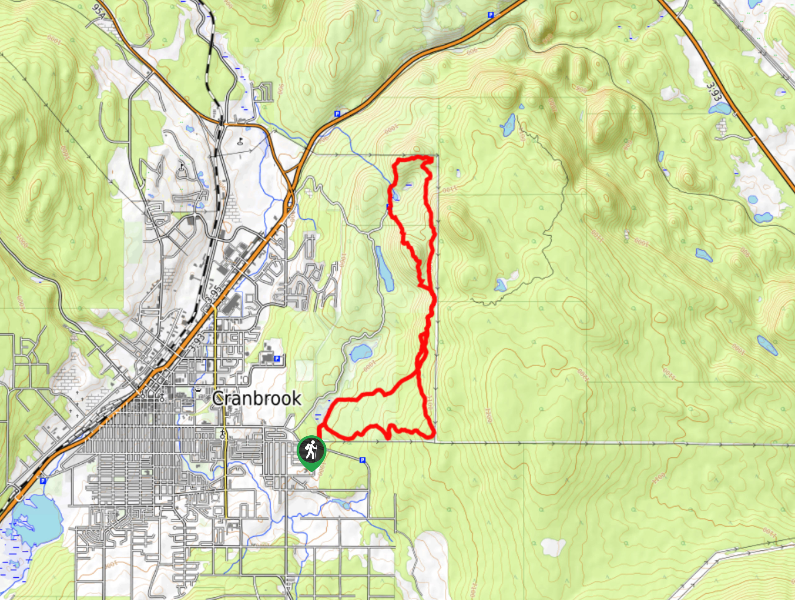
28. Cranbrook Roller Coaster
Difficulty
The Cranbrook Roller Coaster is a 9.0mi lollipop hiking route that traverses the… Read More
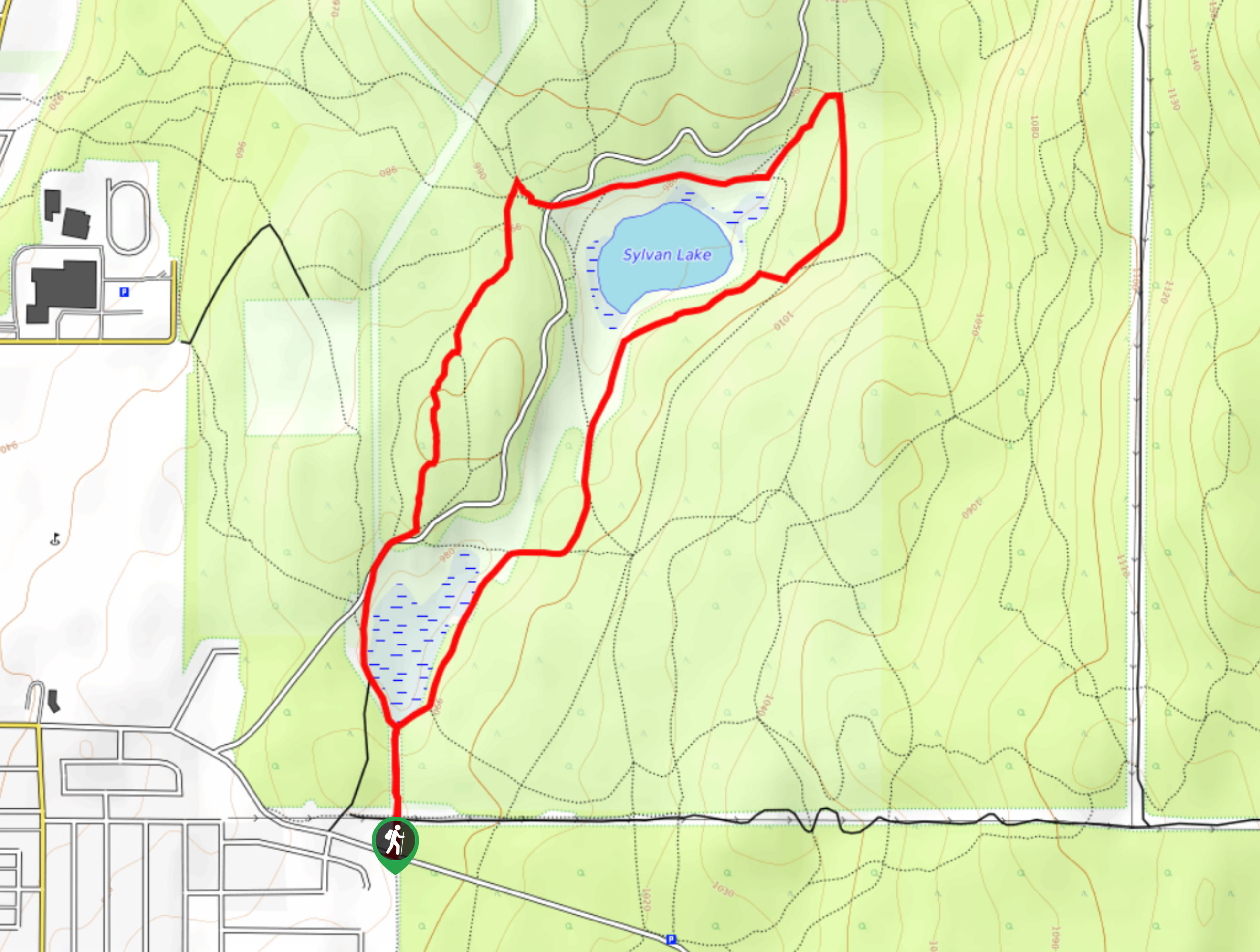
29. Sylvan Trail Loop
Difficulty
The Sylvan Trail Loop is a 3.0mi lollipop hiking route in Cranbrook, BC,… Read More
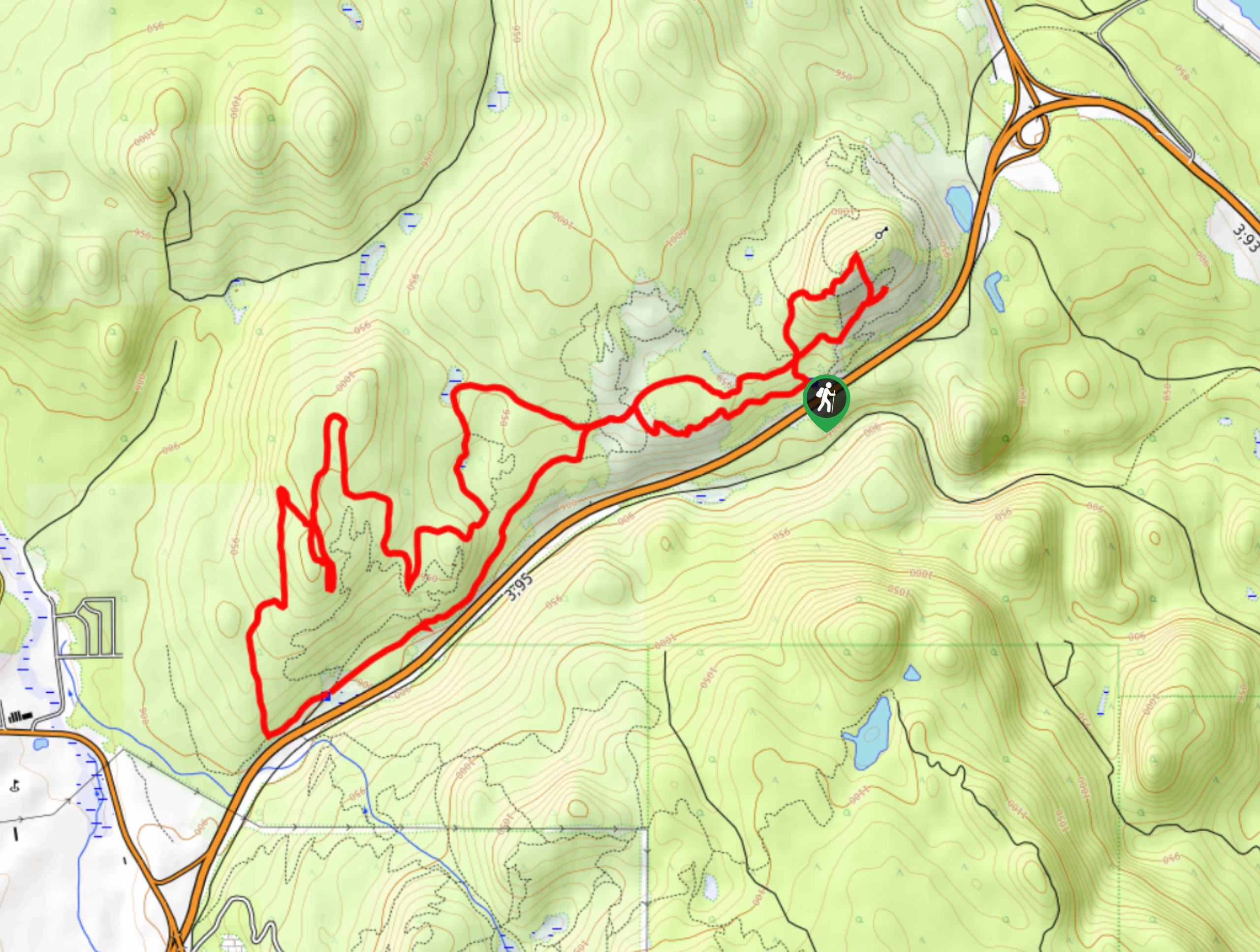
30. Chewbacca Rocka to Eager Hills Lookout
Difficulty
The Chewbacca Rocka to Eager Hills Lookout is a fantastic hiking circuit in Cranbrook, BC,… Read More
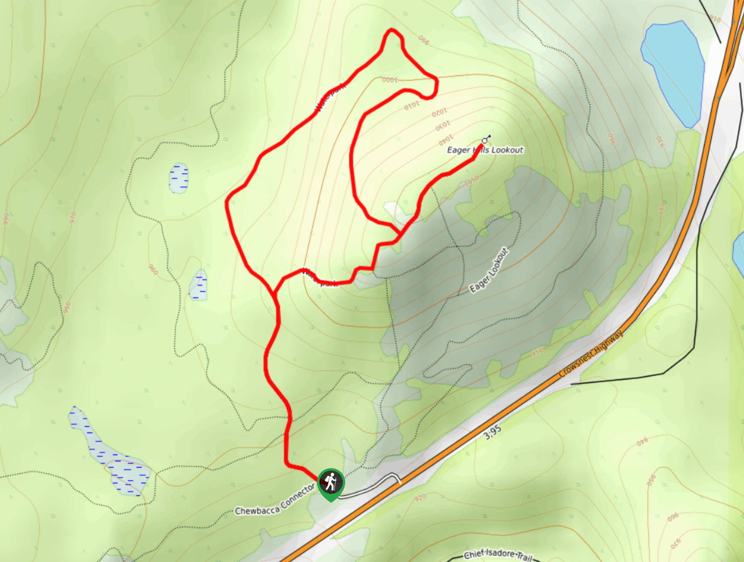
31. Eager Hill via Waterpark Trail
Difficulty
The Eager Hill via Waterpark Trail is a scenic lollipop hiking route that winds 2.1mi Read More
32. Isadore Canyon Loop
Difficulty
The Isadore Canyon Loop is a 3.6mi hiking circuit to the east of… Read More
33. Moyie Falls
Difficulty
Making the trek to Moyie Falls will see hikers utilize a 1.4mi out-and-back… Read More
34. Silver Springs Trail
Difficulty
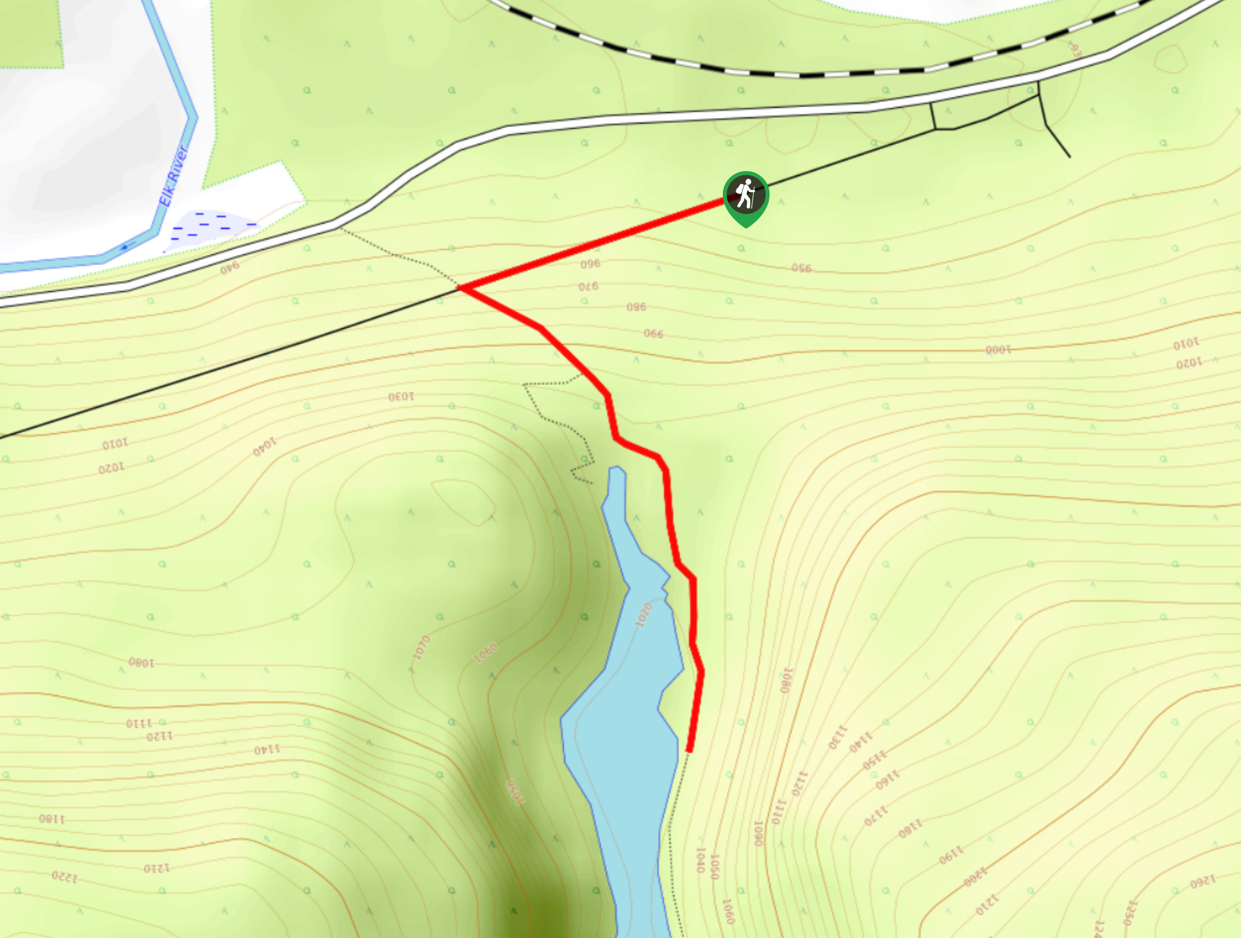
The Silver Springs trail is a 1.1mi out-and-back hiking route near Elko, BC,… Read More
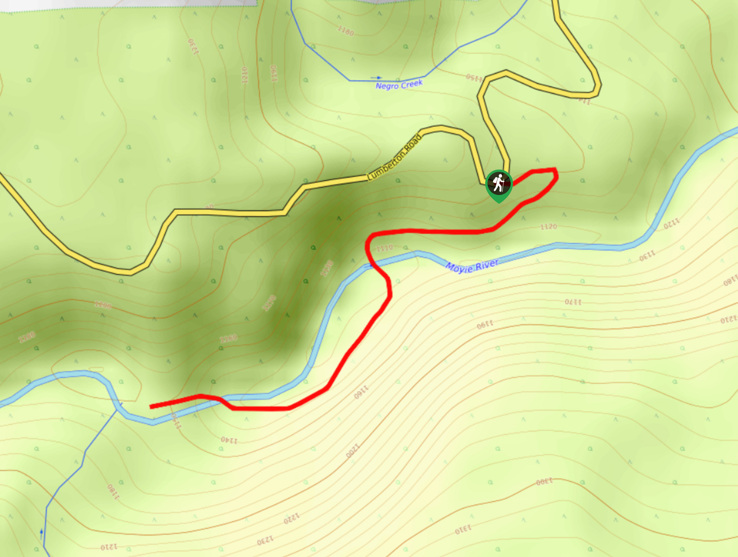
35. Silver Creek Cliffs
Difficulty
The trek to the Silver Creek Cliffs is an 5.5mi out-and-back hiking route… Read More
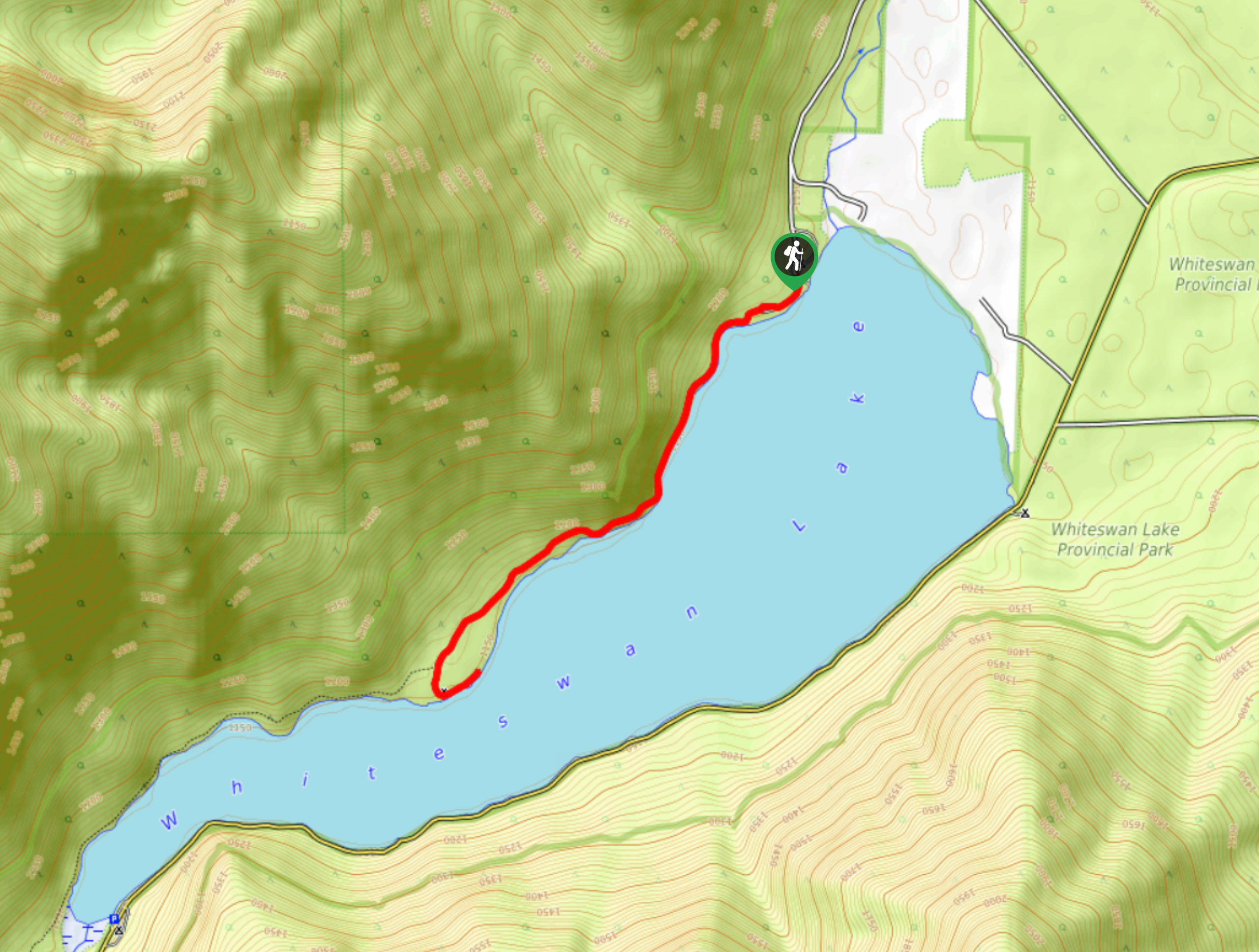
36. Whiteswan North Shore Trail Loop
Difficulty
The Whiteswan North Shore Trail Loop is a long but amazingly scenic hiking circuit that… Read More
37. Cave Creek Campground via North Shore Trail
Difficulty
The Cave Creek Campground via North Shore Trail is a 1.8mi point-to-point hiking… Read More
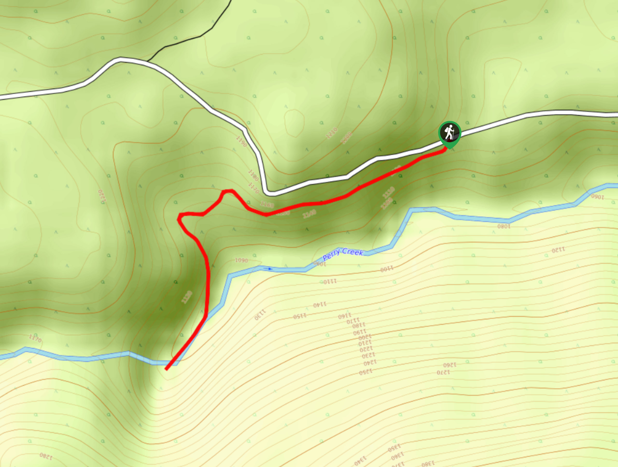
38. Perry Creek Trail
Difficulty
The Perry Creek Trail is a 1.5mi out-and-back hiking route near Cranbrook, BC,… Read More
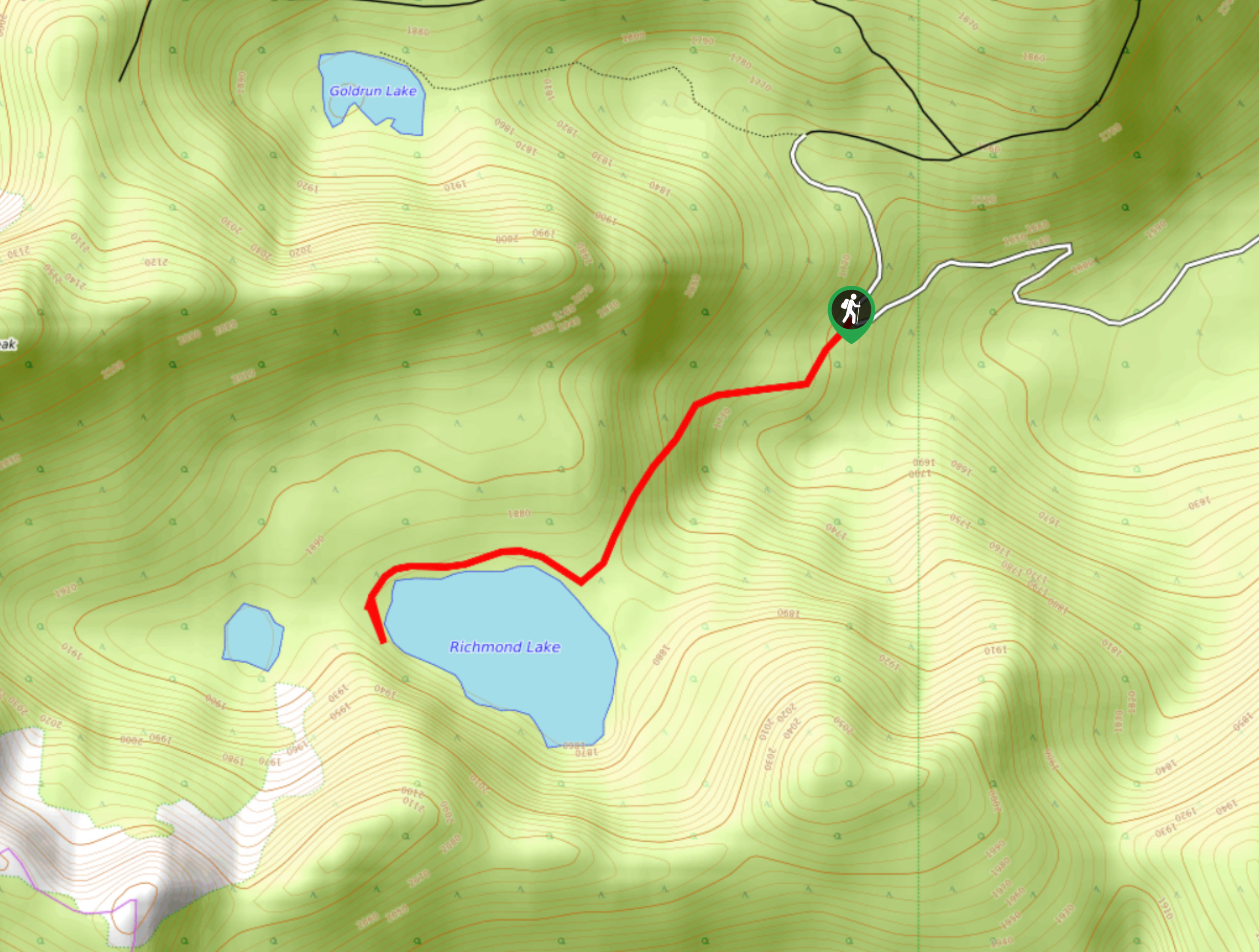
39. Richmond Lake Trail
Difficulty
The Richmond Lake Trail is a 1.9mi out-and-back hiking route near Cranbrook, BC,… Read More
40. Ptarmigan Lake Trail
Difficulty
The Ptarmigan Lake Trail is an 7.1mi out-and-back hiking route near Whiteswan Lake… Read More
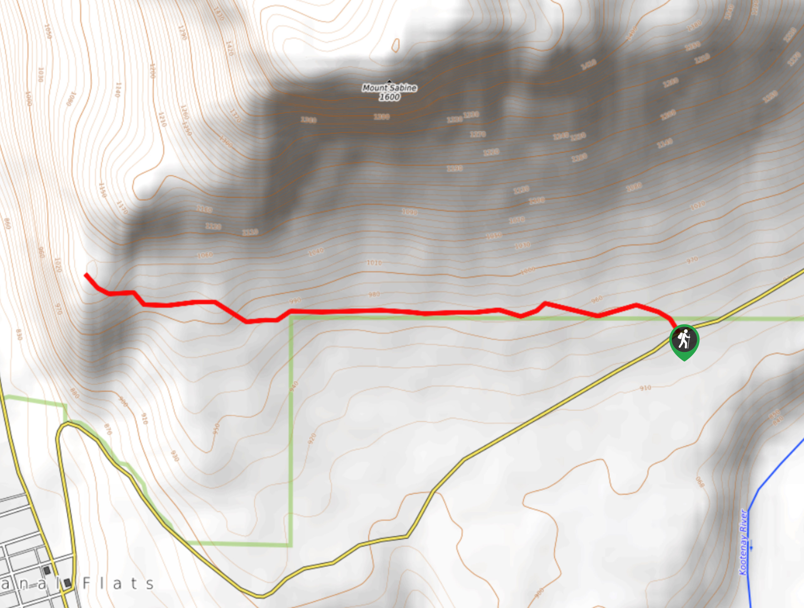
41. Mount Sabine Lookout Trail
Difficulty
The Mount Sabine Lookout Trail is a 3.1mi out-and-back hiking route in Canal… Read More
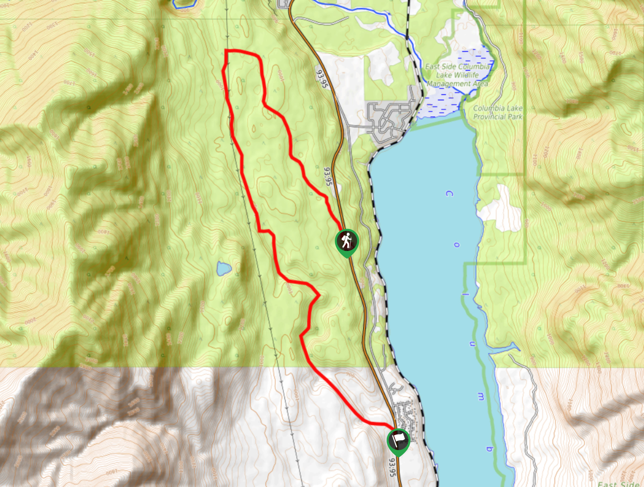
42. Columbia Lake Lookout
Difficulty
The Columbia Lake Lookout is a 8.5mi point-to-point hiking route northwest of Canal… Read More
43. Baldy Lake Trail
Difficulty
The Baldy Lake Trail is a 6.1mi out-and-back hiking route in British Columbia… Read More
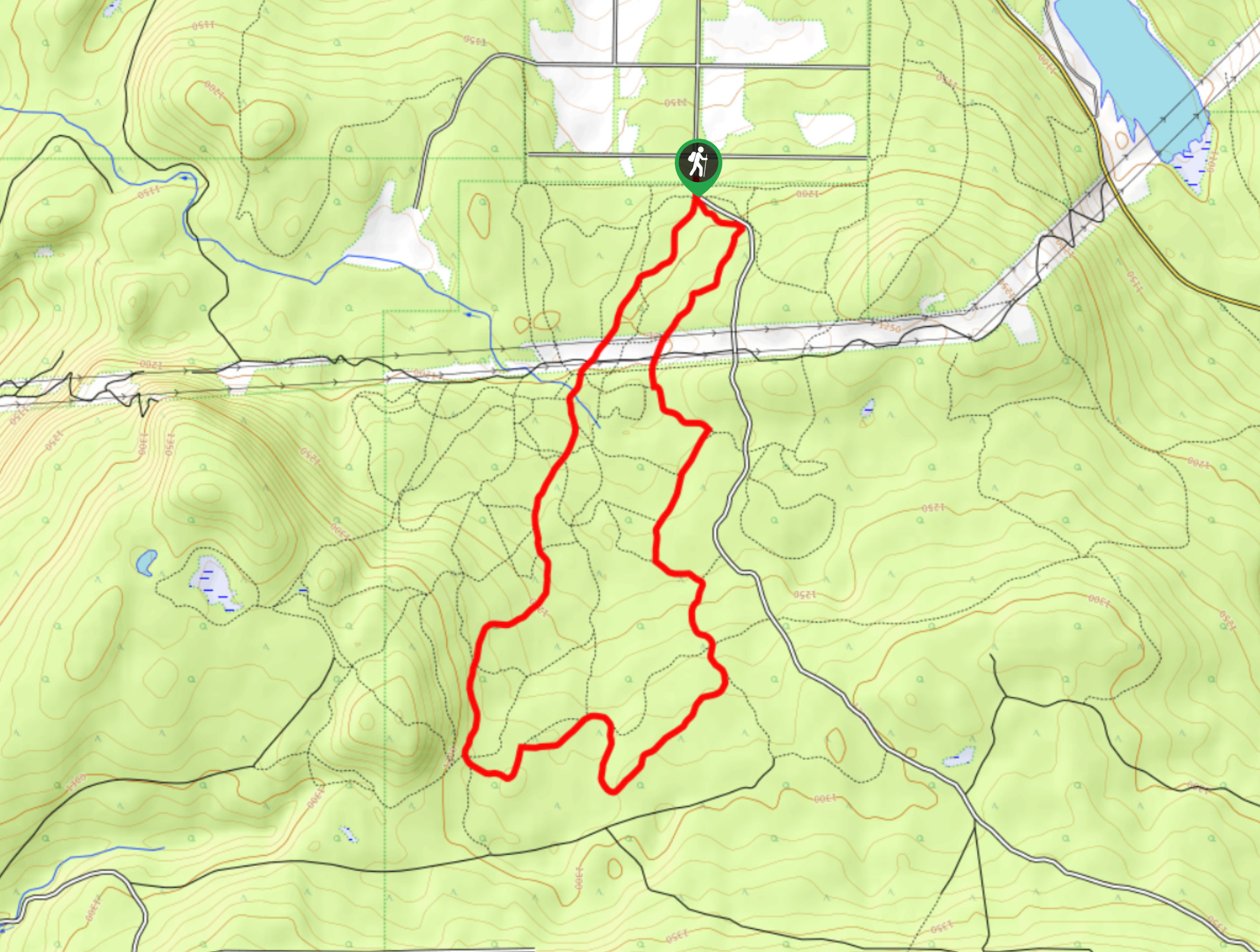
44. Moose Creek Loop
Difficulty
The Moose Creek Loop is an 8.9km lollipop hiking route through the forests south of… Read More
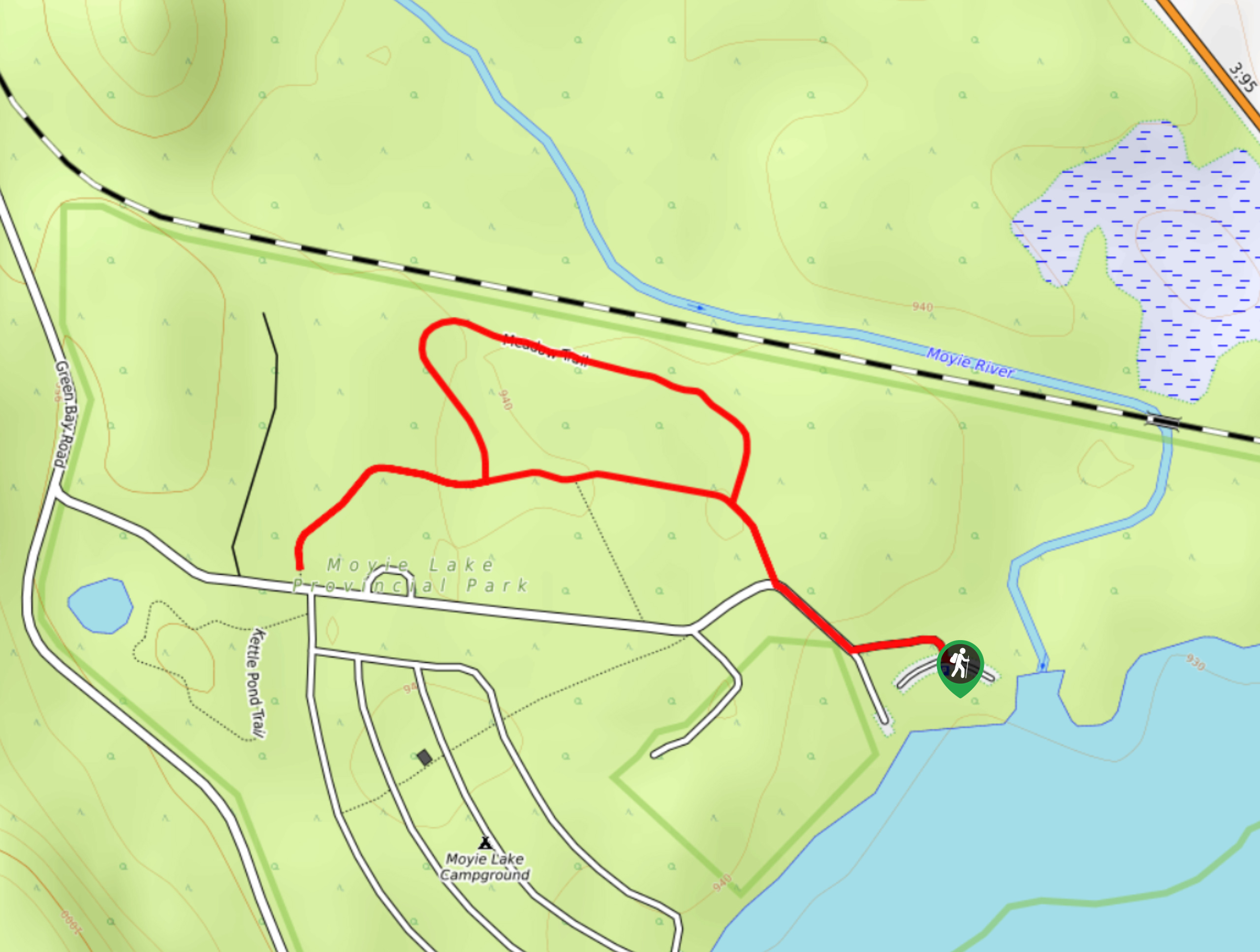
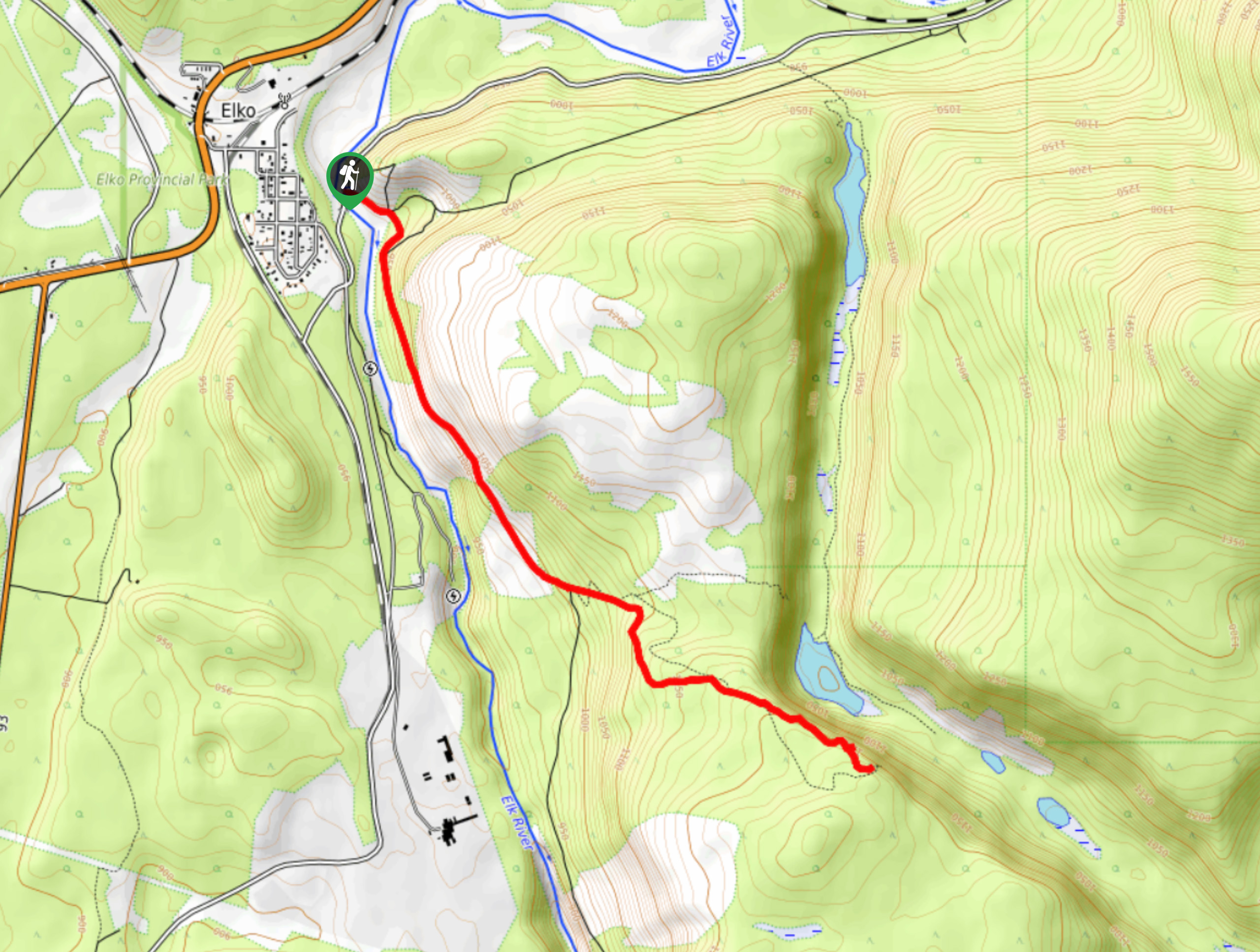
45. Moyie Lake Area Trail
Difficulty
The Moyie Lake Area trail is a 1.4mi lollipop hiking route south of… Read More
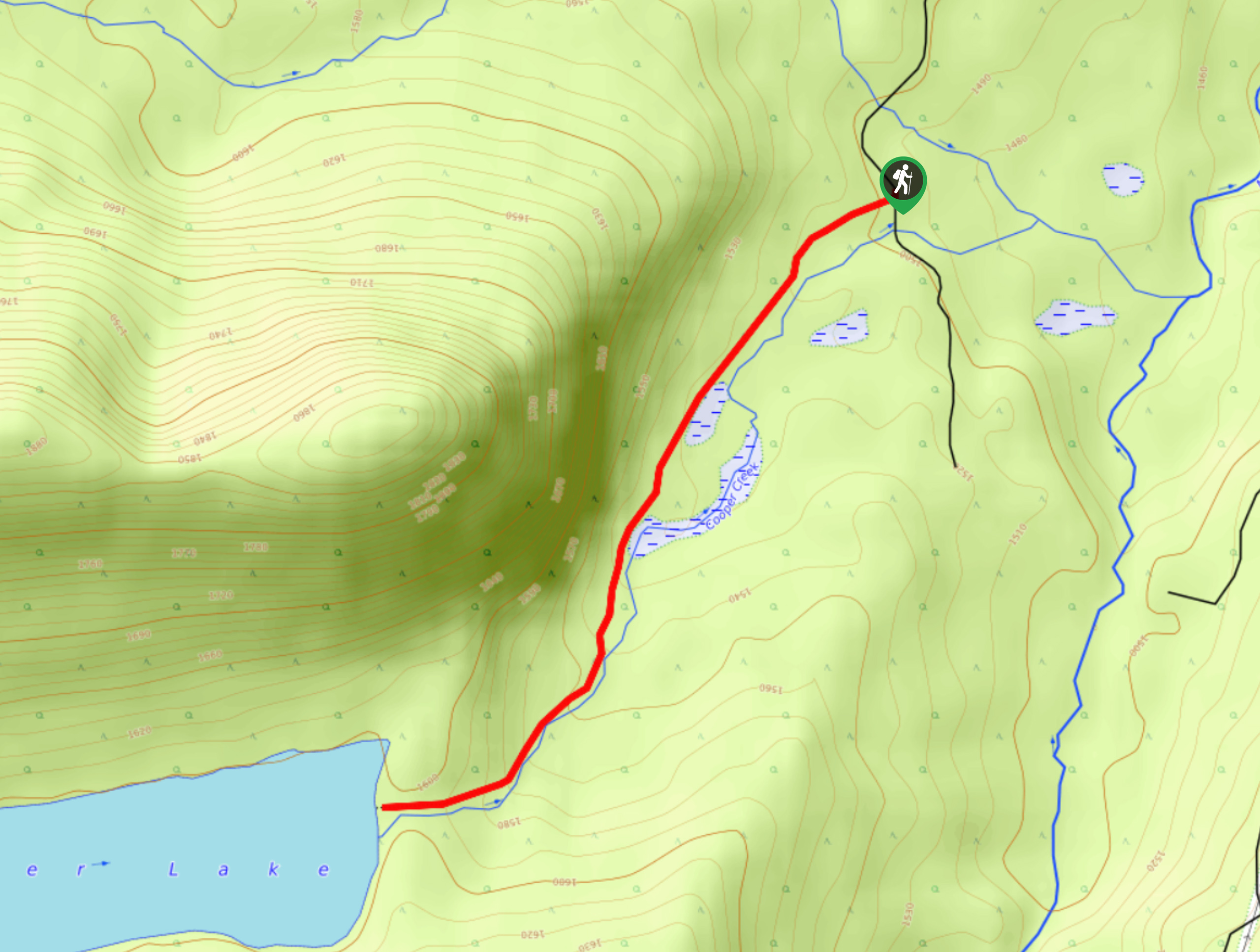
46. Cooper Lake Trail
Difficulty
The Cooper Lake Trail is a 2.5mi out-and-back hiking route near Cranbrook, BC,… Read More
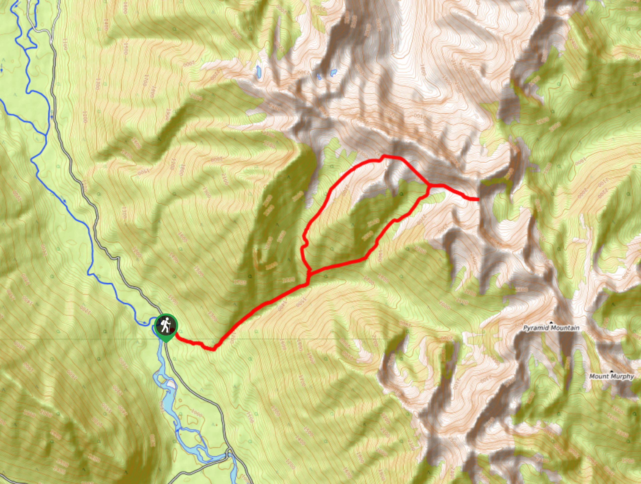
47. Pyramid Creek Loop
Difficulty
The Pyramid Creek Loop is a challenging 12.2mi lollipop hiking route west of… Read More
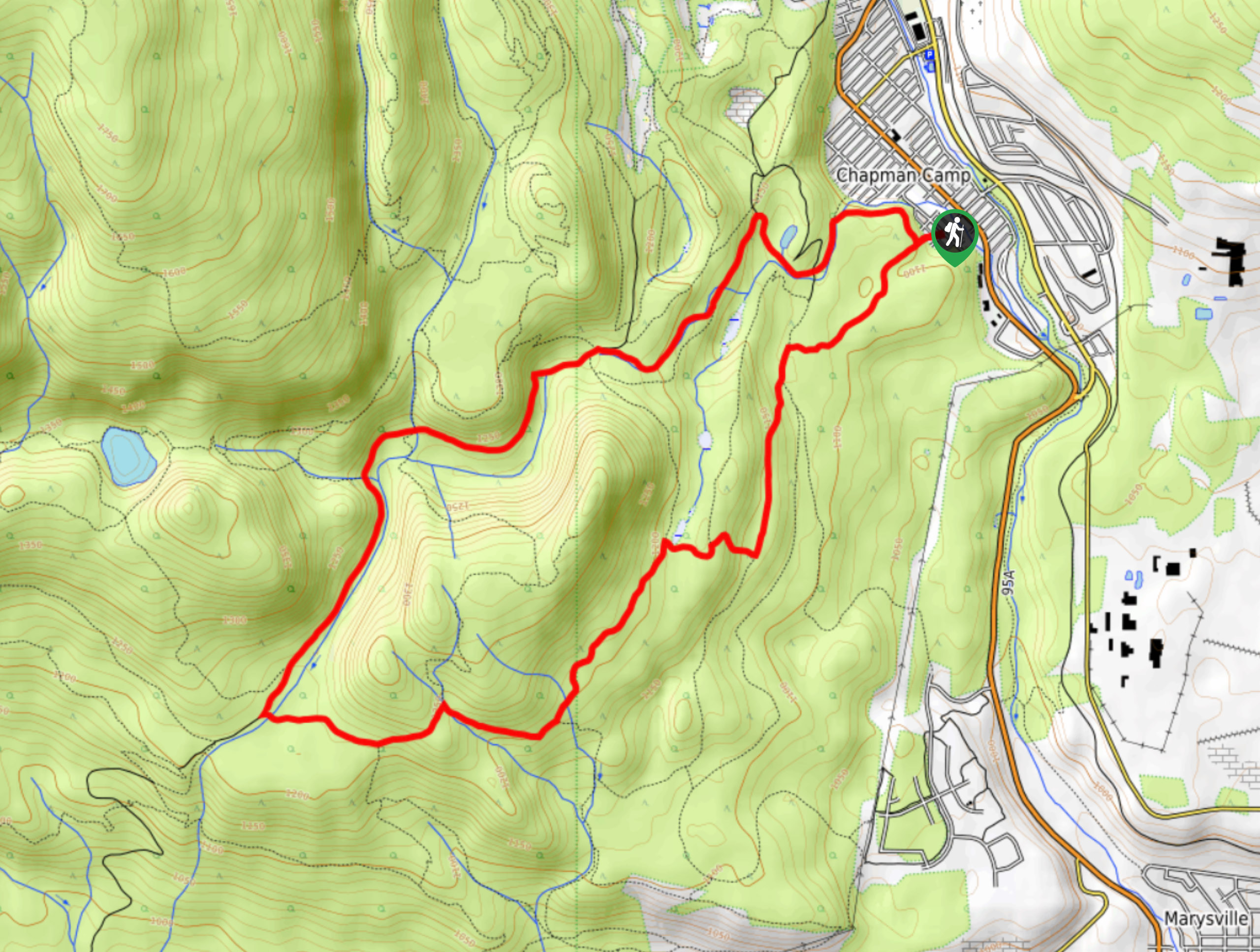
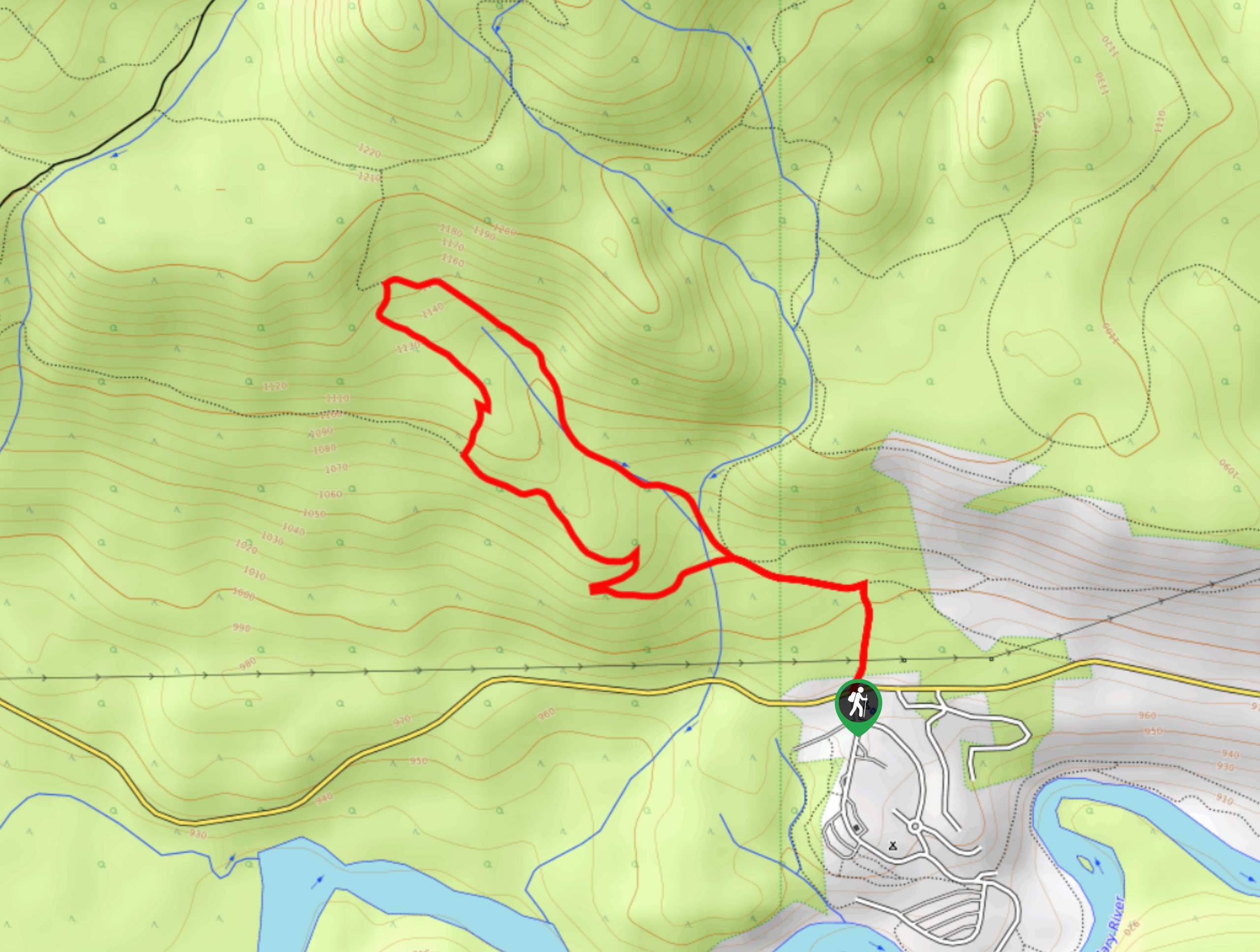
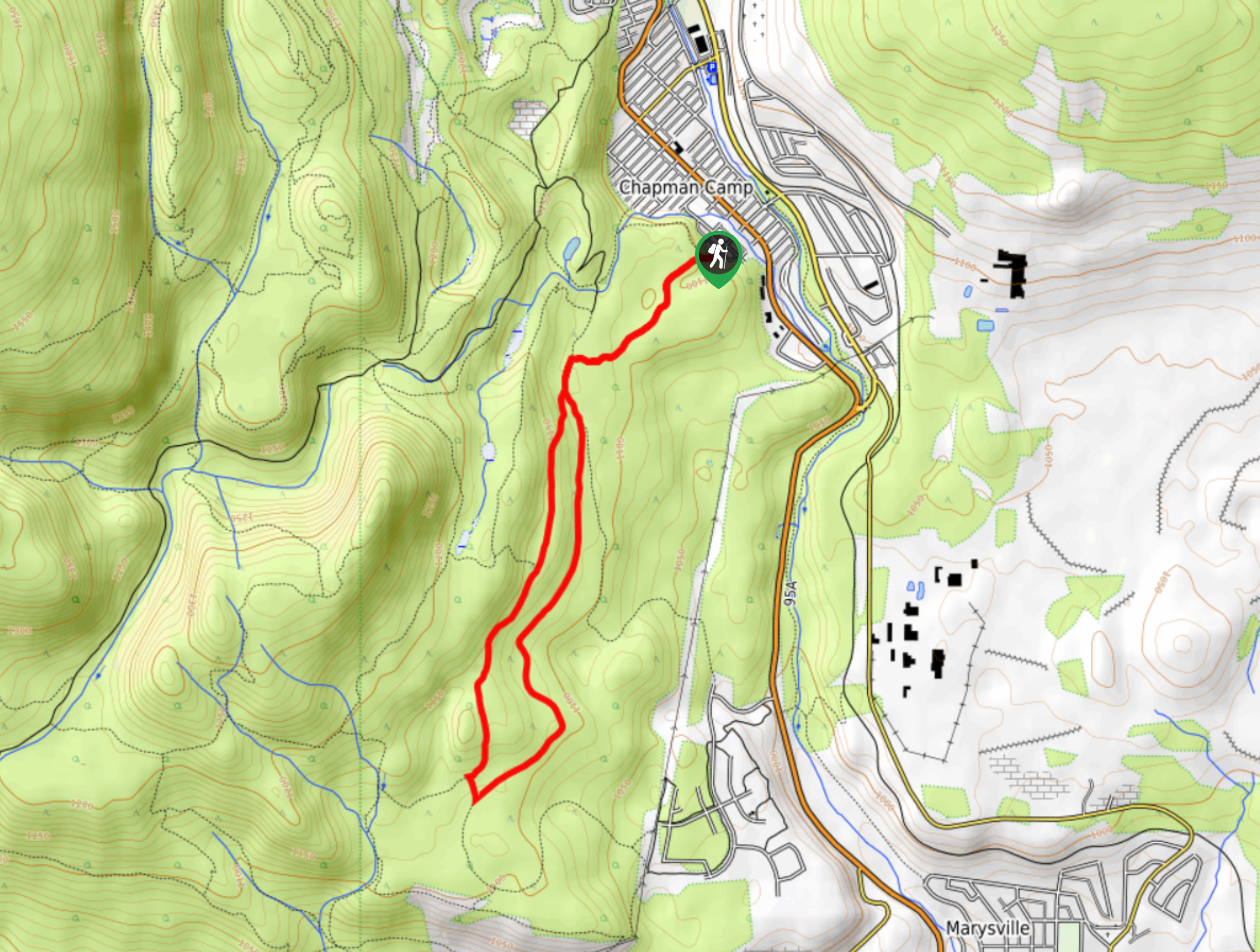
48. Marysville Falls
Difficulty
Marysville Falls is a short 0.3mi out-and-back hiking route in Marysville, BC that… Read More
49. Kimberley Nordic Centre Trail
Difficulty
The Kimberley Nordic Centre Trail is an 5.2mi hiking circuit in Kimberley, BC,… Read More
50. Mount Wapiti
Difficulty
The Mount Wapiti Trail is a challenging 6.0mi out-and-back hiking route in Elkford,… Read More
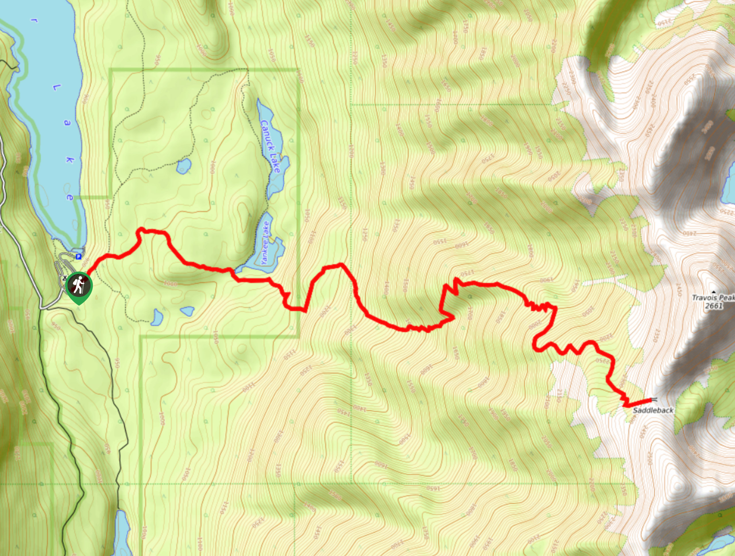
51. Saddleback Ridge Trail
Difficulty
The Saddleback Ridge Trail is a 9.6mi out-and-back hiking route in Premier Lake… Read More
Are we missing your favourite hike?
Tell us! If you've got photos, a GPS track and know the hike, we'd love to share your favourite hike with the rest of the 10Adventures community.