
Moose Creek Loop
View Photos
Moose Creek Loop
Difficulty Rating:
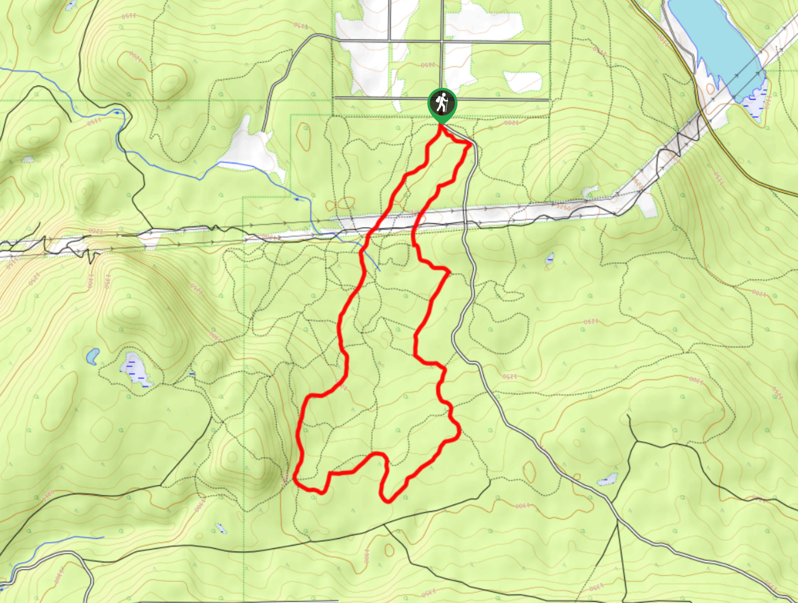
The Moose Creek Loop is an 8.9km lollipop hiking route through the forests south of Cranbrook that features easily traversable terrain and a wonderful forest atmosphere. Located within the South Star Recreation Area, this trail features a small gain in elevation and is suitable for hikers of most skill levels. Make sure to bring a trail map or GPS, as there are a lot of intersecting trails along the route and it can be easy to take off on the wrong course.
Getting there
To get to the Moose Creek Loop trailhead from Cranbrook, head south on Victoria Ave for 0.7mi and turn left onto 13th Street S. After 689ft, make a right onto 24th Avenue S and continue on for 2789ft. Turn left on 21st Street S and after 1640ft, make a slight right on Gold Creek Road. After 1.0mi, turn right on 38th Avenue S and follow it to the end to arrive at the parking area.

About
| When to do | April-October |
| Backcountry Campsites | No |
| Pets allowed | Yes - On Leash |
| Family friendly | Older Children only |
| Route Signage | Average |
| Crowd Levels | Moderate |
| Route Type | Lollipop |
Moose Creek Loop
Elevation Graph
Weather
Moose Creek Loop Description
The Moose Creek Loop is actually a mash-up of several trails within the recreation area that create a fun adventure loop through the scenic woodland terrain. Setting out from the parking area, the trail heads south and is immediately met with a fork. Follow the path to the left, as you will be returning on the opposite path. Follow along the Wapiti Way trail as it winds through the light forest cover before crossing over a powerline clearing. Pick the trail back up on the other side of the clearing as it enters into a more densely packed forest. Take some time to relax as you hike through the peaceful forest setting and enjoy the picturesque woodland scenery. Reaching the southernmost point of the hike along the Moose Creek Trail, the route will turn back to the north and follow along the Easy Street trail as it meanders through the forest and back to the trailhead.
Similar hikes to the Moose Creek Loop hike

Spirit Trail Loop
The Spirit Trail Loop is a 10.1mi hiking circuit in the East Side Columbia Lake Wildlife Management Area,…

Mount Stevens and Teepee Mountain
The trek to Mount Stevens and Teepee Mountain is a steep 8.4mi out-and-back hiking route east of Wasa,…

Ram Creek Hot Springs
Hiking to the Ram Creek Hot Springs will take you on an 6.9mi out-and-back trail that runs along…
Comments