
Baldy Lake Trail
View Photos
Baldy Lake Trail
Difficulty Rating:
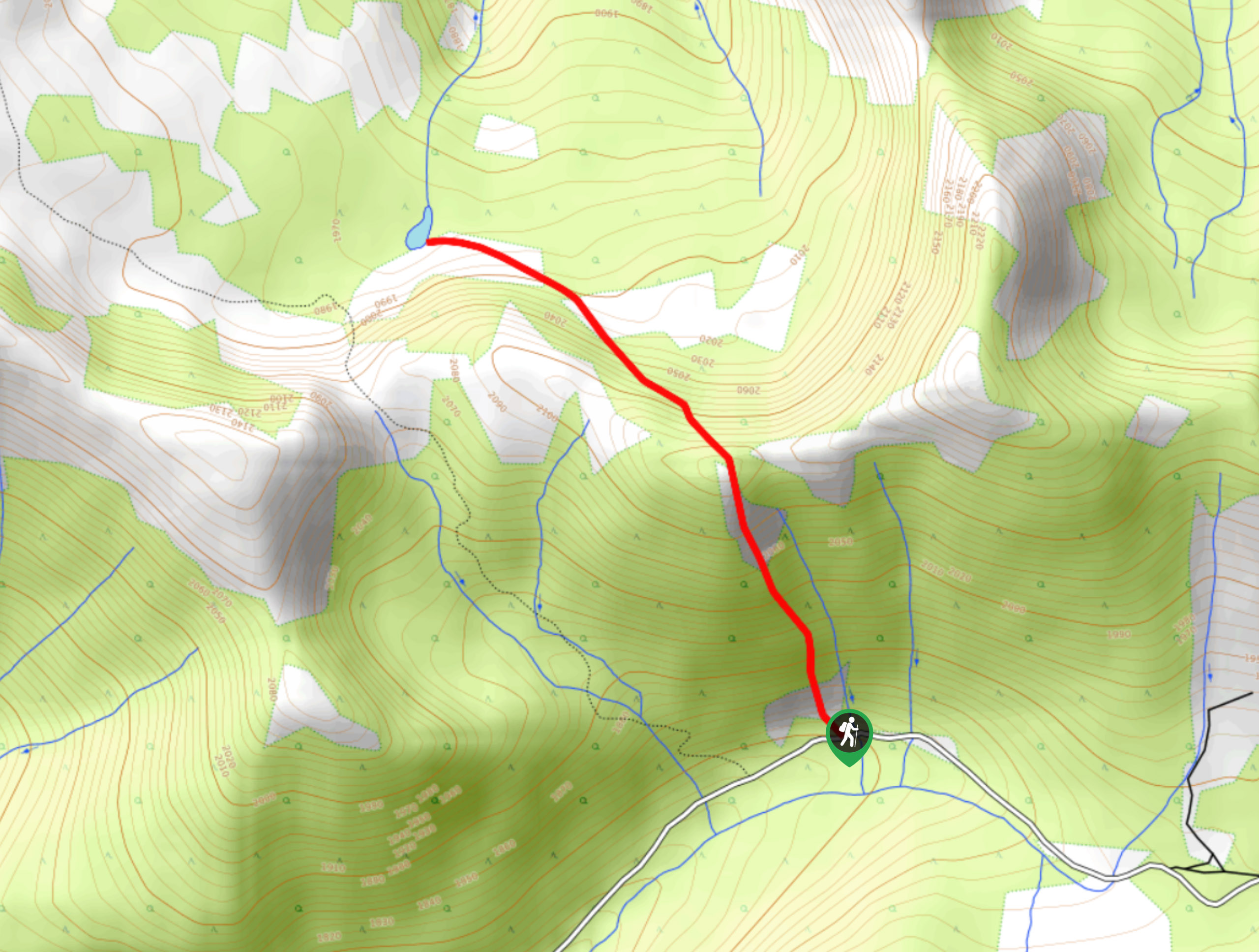
The Baldy Lake Trail is a 6.1mi out-and-back hiking route in British Columbia near the Canada-United States border that will take you uphill through the forest to the tranquil waters of a small subalpine lake. Along the route, you will hike through picturesque meadows, serene forests, and exposed trails with mountain views before you arrive at the lake. As with most backcountry hikes in BC, make sure to bring bear spray and create noise while out on the trail in order to avoid any potentially dangerous encounters with bears or mountain lions.
Getting there
To get to the Baldy Lake trailhead from Elko, drive south on BC-93 for 20.4mi and turn left onto Connor Road. In 1640ft, make a sharp right to stay on the road and continue on for 68.5mi, where you will find parking on the left.

About
| When to do | May-October |
| Backcountry Campsites | No |
| Pets allowed | Yes |
| Family friendly | Older Children only |
| Route Signage | Average |
| Crowd Levels | Low |
| Route Type | Out and back |
Baldy Lake Trail
Elevation Graph
Weather
Baldy Lake Trail Description
Hiking the Baldy Lake Trail is a great way to get out and experience the natural beauty of southern British Columbia, while getting some exercise hiking along the undulating terrain of this mountainous region. The trail sets out from the side of the road and works to the northwest through the forest before ascending and descending a series of small ridges. As you work your way through the meadows and forests along the route, you will have some beautiful views of the surrounding mountains. Eventually, you will break out of the dense forest cover and arrive at the scenic shores of Baldy Lake, with Mount Mahaney standing directly behind to the northwest. Take some time to explore the area while basking in the amazing views of the rugged landscape before heading back along the same route to return to the trailhead.
Similar hikes to the Baldy Lake Trail hike

Spirit Trail Loop
The Spirit Trail Loop is a 10.1mi hiking circuit in the East Side Columbia Lake Wildlife Management Area,…

Mount Stevens and Teepee Mountain
The trek to Mount Stevens and Teepee Mountain is a steep 8.4mi out-and-back hiking route east of Wasa,…

Ram Creek Hot Springs
Hiking to the Ram Creek Hot Springs will take you on an 6.9mi out-and-back trail that runs along…
Comments