
Pyramid Creek Loop
View Photos
Pyramid Creek Loop
Difficulty Rating:
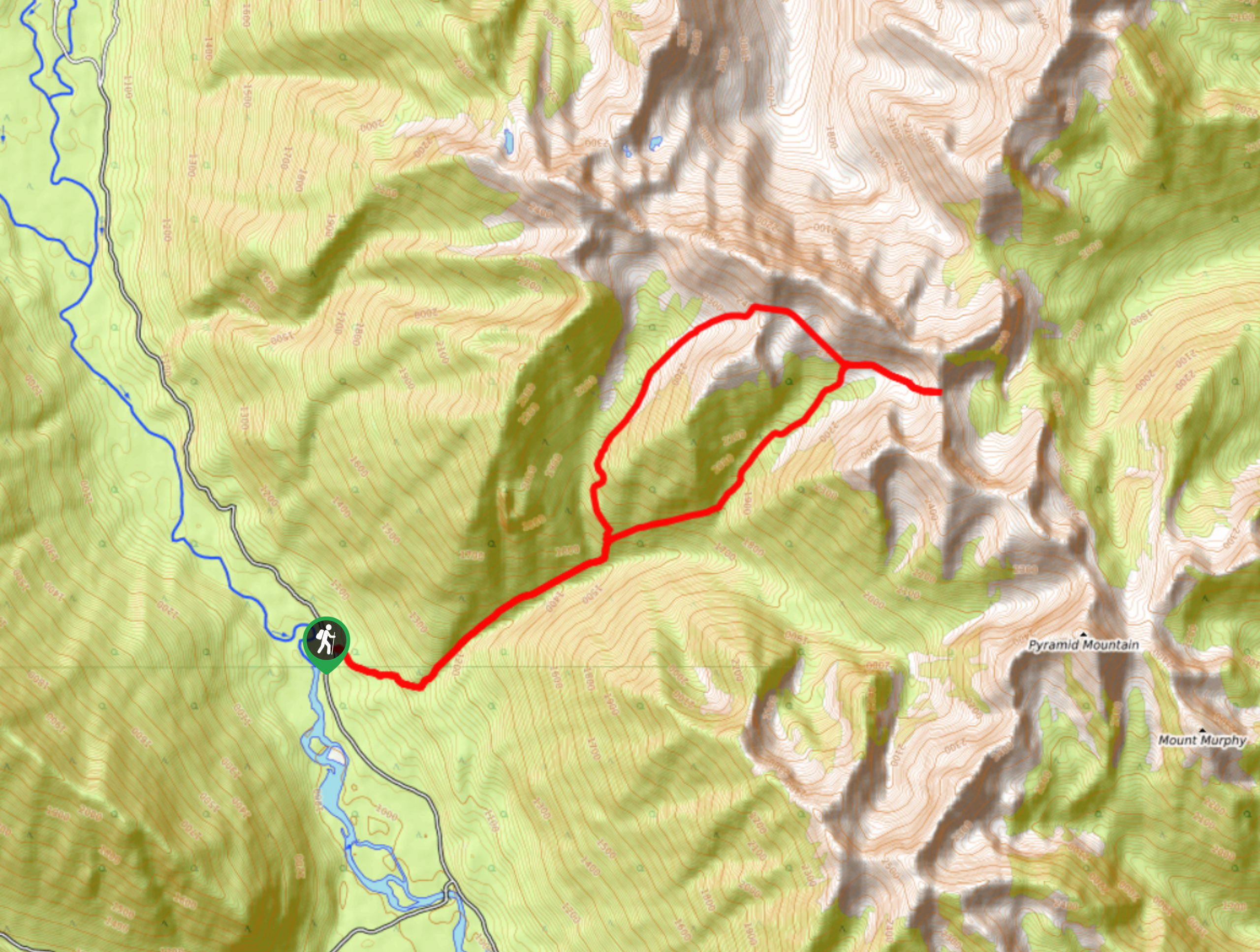
The Pyramid Creek Loop is a challenging 12.2mi lollipop hiking route west of Kimberley, BC, that will take you into the subalpine terrain for some spectacular views of the surrounding mountain peaks. From the top of the ridge, you will have a sightline that reaches across the valley and town of Kimberley below. With a large amount of elevation gain and technical terrain, this route is best left for more experienced hikers.
Getting there
To access the Pyramid Creek Loop trailhead from Kimberley, drive southeast on BC-95A for 2.2mi and turn right onto St Mary's Lake Road. Continue on for 20.2mi, where you will find the trailhead on the right.

About
| When to do | May-October |
| Backcountry Campsites | No |
| Pets allowed | Yes |
| Family friendly | No |
| Route Signage | Average |
| Crowd Levels | Low |
| Route Type | Lollipop |
Pyramid Creek Loop
Elevation Graph
Weather
Pyramid Creek Trail Description
Although the name makes it sound like a nice creekside hiking loop, the Pyramid Creek Loop is a tough full-day climb through rugged terrain that is more suited for experienced hikers. With 5335ft of elevation gain along the route, this challenging hike will more than likely leave exhausted by the day’s end. The trail sets out from the side of the road and heads through the forest to the northeast. Almost immediately, the trail will begin to climb steeply uphill as you work your way through the forested valley towards the loop portion of the hike. When you reach a fork in the trail, follow the path to the right to begin the loop in a counterclockwise direction. Here, you will need to climb uphill and traverse a few scree slopes on the way to the high point of the trail.
Once you reach the top of the ridge, you will have an amazing sightline that stretches across the Kootenay River Valley and includes all of the surrounding mountains. After taking in the views, head down the trail and follow the path to the right of the fork to make a different descent down the ridge alongside a larger scree slope. Once you reach the bottom, you will meet back up with the main trail and can follow it back alongside Pyramid Creek to the trailhead.
Similar hikes to the Pyramid Creek Loop hike

Spirit Trail Loop
The Spirit Trail Loop is a 10.1mi hiking circuit in the East Side Columbia Lake Wildlife Management Area,…

Mount Stevens and Teepee Mountain
The trek to Mount Stevens and Teepee Mountain is a steep 8.4mi out-and-back hiking route east of Wasa,…

Ram Creek Hot Springs
Hiking to the Ram Creek Hot Springs will take you on an 6.9mi out-and-back trail that runs along…
Comments