
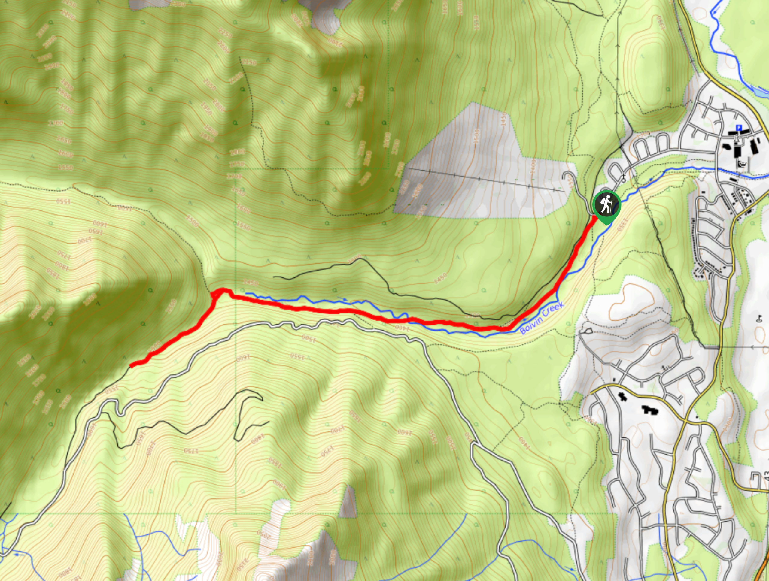
Boivin Creek Trail
View Photos
Boivin Creek Trail
Difficulty Rating:
The Boivin Creek Trail is an 5.3mi out-and-back hiking route in Elkford that follows a cross-country skiing route through the woods to explore the natural beauty to the west of the town. The route is made up largely of old logging roads, making it an accessible route that is easy to navigate. If you are looking for a longer journey, try exploring some of the different trails that branch off from the main route.
Getting there
To get to the Boivin Creek trailhead from the District of Elkford Municipal Office, drive west on Natal Road for 0.7mi to find the trailhead on the left.

About
| When to do | July-October |
| Backcountry Campsites | No |
| Pets allowed | Yes |
| Family friendly | Older Children only |
| Route Signage | Average |
| Crowd Levels | Moderate |
| Route Type | Out and back |
Boivin Creek Trail
Elevation Graph
Weather
Boivin Creek Trail Description
Hiking along the Boivin Creek Trail is a great way to experience the skiing trails around Elkford, even when there isn’t any snow on the ground. The trail sets out from the Elkford Nordic Ski Clubs and heads southwest through the dense forests that populate the area around the creek. Along the route, you will make use of several bridge crossings and old, well-worn roads that make traversing the terrain a breeze. Eventually, you will reach the Boivin Hut, a warming cabin used by skiers in the winters. Take the path to the left here and follow it towards the rugged Profile Mountain. When you break out of the forest, turn back and make your way to the trailhead where you began your journey.
Similar hikes to the Boivin Creek Trail hike

Spirit Trail Loop
The Spirit Trail Loop is a 10.1mi hiking circuit in the East Side Columbia Lake Wildlife Management Area,…

Mount Stevens and Teepee Mountain
The trek to Mount Stevens and Teepee Mountain is a steep 8.4mi out-and-back hiking route east of Wasa,…

Ram Creek Hot Springs
Hiking to the Ram Creek Hot Springs will take you on an 6.9mi out-and-back trail that runs along…
Comments