
Findlay Falls Trail
View Photos
Findlay Falls Trail
Difficulty Rating:
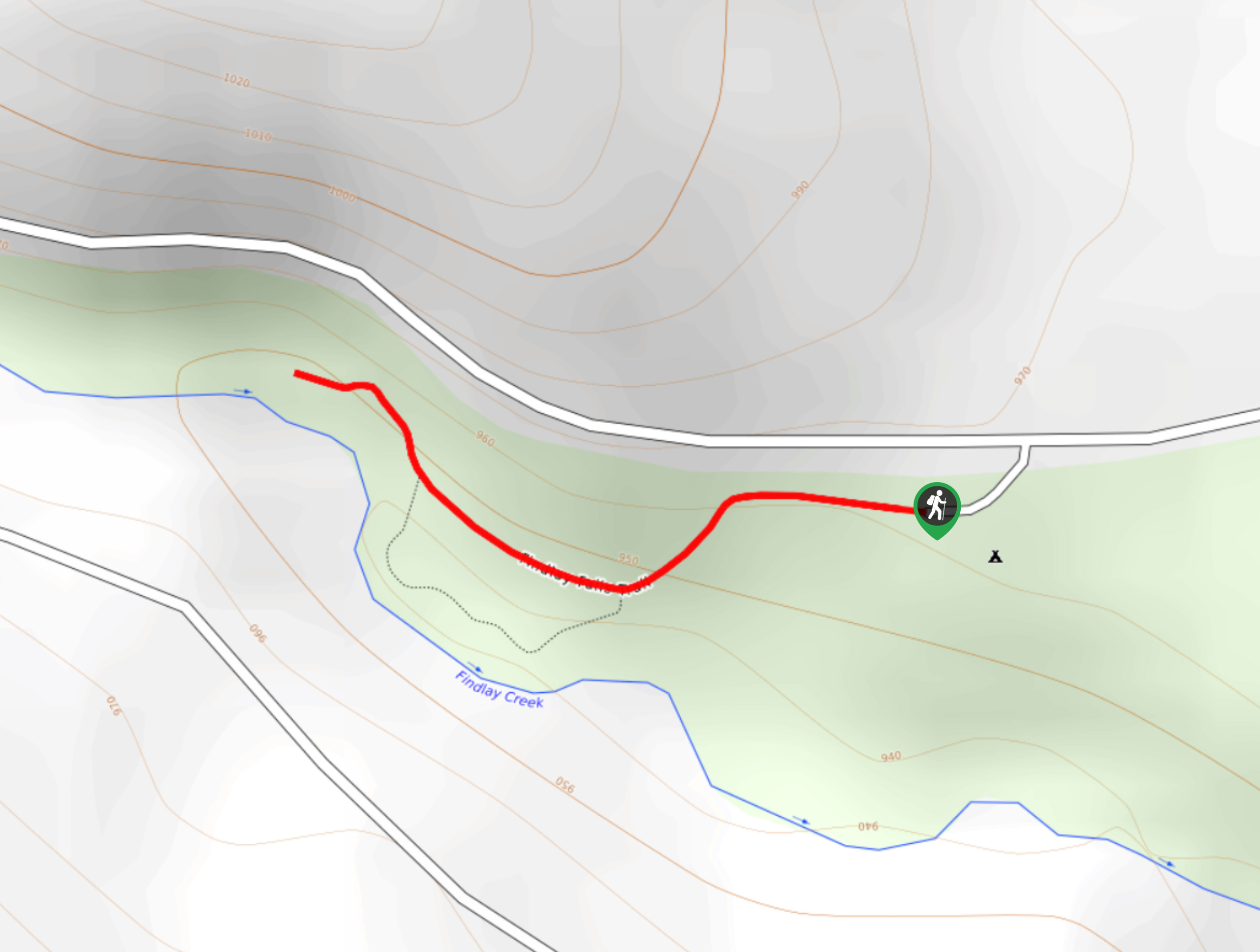
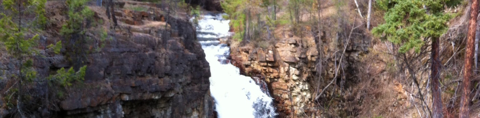
The Findlay Falls Trail is a 0.6mi out-and-back hiking route near Canal Flats that will take you through the forest to reach a viewpoint overlooking the rocky and rugged waterfall. Along the trail, you will experience a peaceful forest setting and hike alongside the rushing waters of Findlay Creek, making for a fun day of sightseeing. Try timing this hike for the spring when water levels are higher and the falls seem to almost burst from the torrent rushing downstream.
Getting there
To reach the Findlay Falls trailhead from Canal Flats, drive northwest on BC-95 for 1.6mi and turn left onto Findlay Creek Road. Continue on for 2.9mi and turn left to enter the parking area at the recreation site.

About
| When to do | April-November |
| Backcountry Campsites | Findlay Falls Recreation Site |
| Pets allowed | Yes - On Leash |
| Family friendly | Yes |
| Route Signage | Average |
| Crowd Levels | Low |
| Route Type | Out and back |
Findlay Falls Trail
Elevation Graph
Weather
Findlay Falls Trail Description
Although it may be short, the Findlay Falls Trail is an amazing hike that will take you to a spectacular viewpoint overlooking the rugged and powerful falls. With relatively well-maintained pathways, a short overall distance, and fairly flat terrain, this hike is easily accessible for almost every hiker. The trail sets out from the recreation site and heads through the tree cover to the west. Along the trail, you will be able to hear the sound of rushing water as you work parallel to the creek and inch your way closer to the falls. Eventually, you will arrive at a viewpoint overlooking the azure-blue water as it crashes and flows over the large rock formation. After taking in the sights of the powerful falls, head back along the trail to return to your vehicle at the recreation site.
Similar hikes to the Findlay Falls Trail hike
Marysville Falls
Marysville Falls is a short 0.3mi out-and-back hiking route in Marysville, BC that offers a pleasant stroll along…
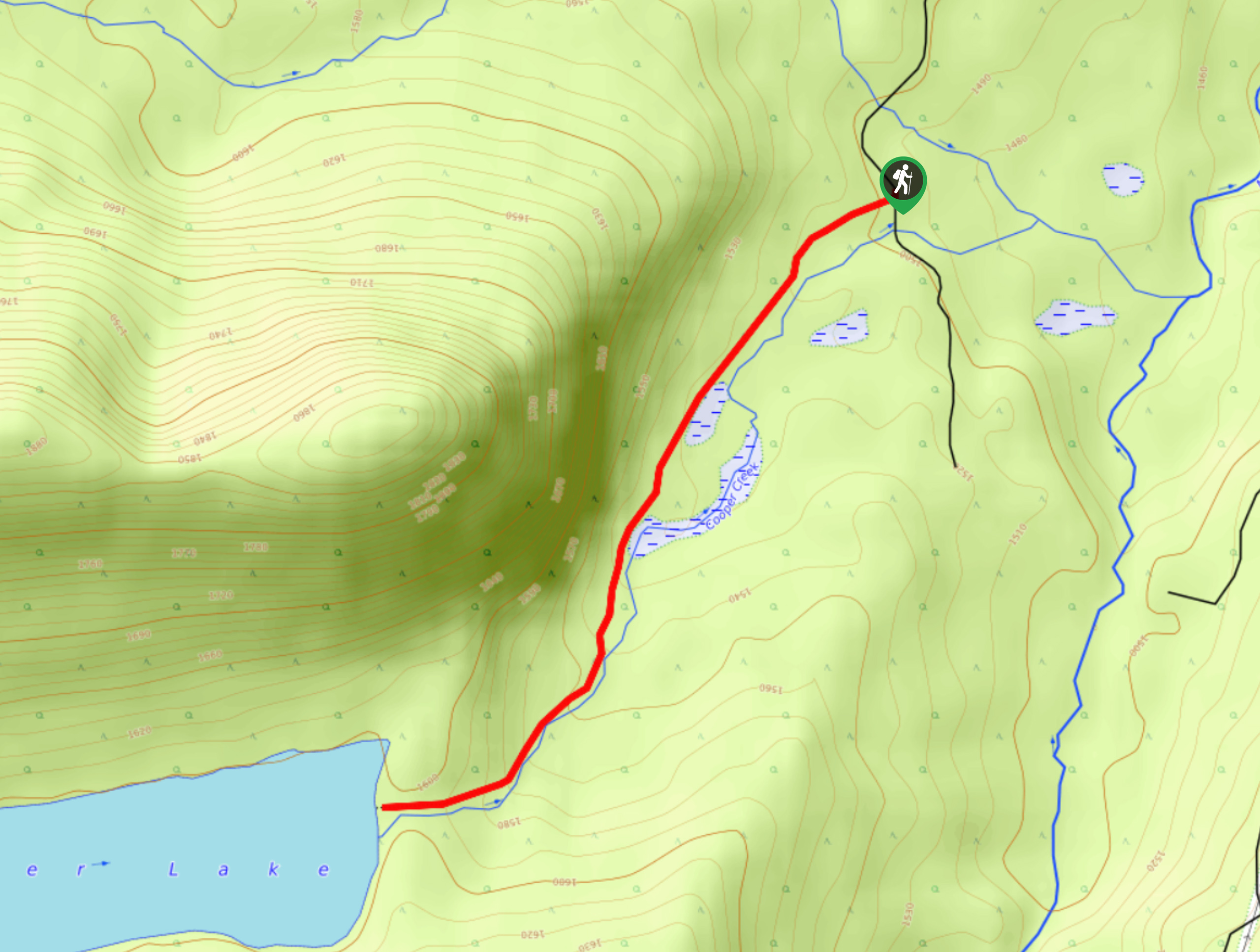
Cooper Lake Trail
The Cooper Lake Trail is a 2.5mi out-and-back hiking route near Cranbrook, BC, that follows closely along an…
Moyie Lake Area Trail
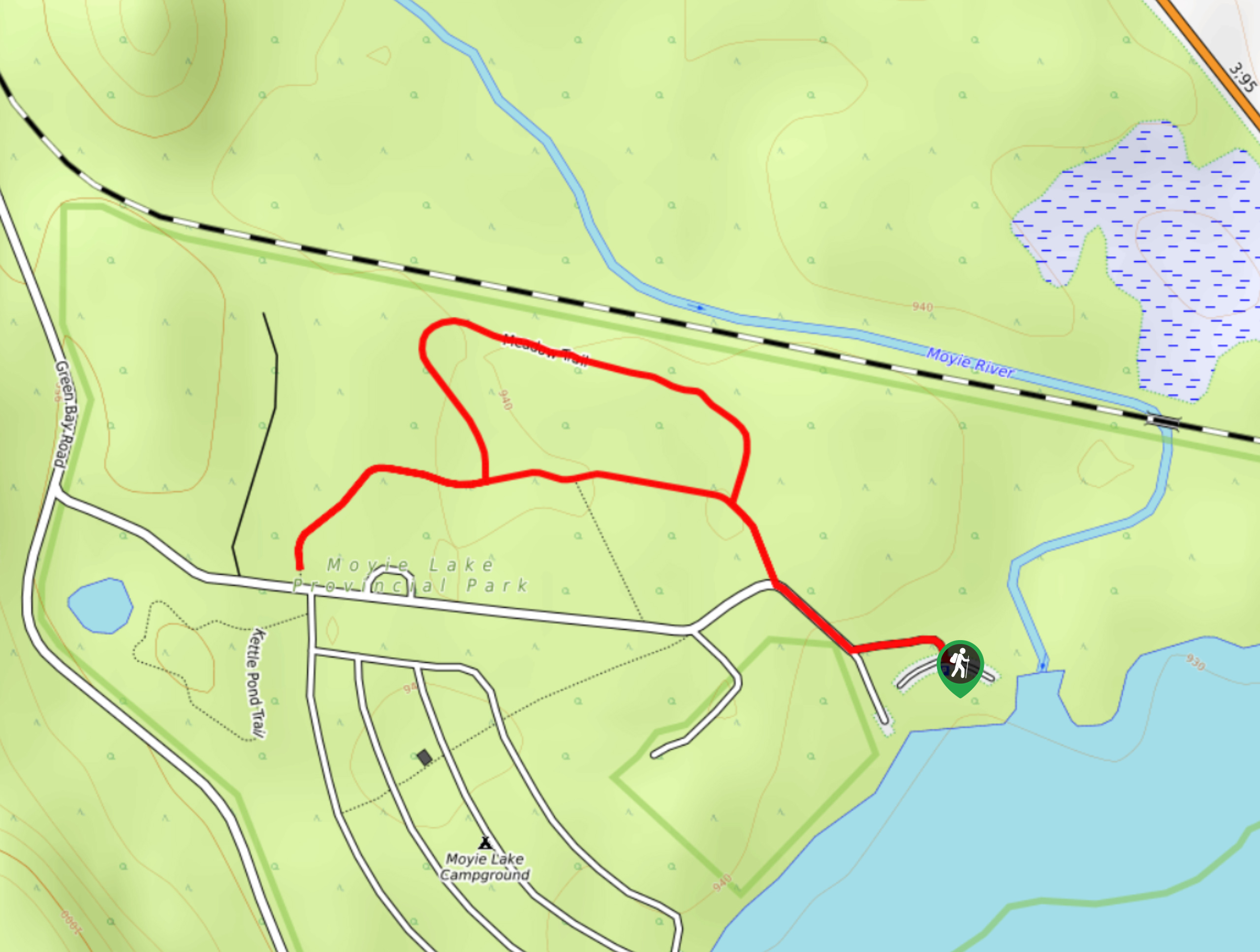
The Moyie Lake Area trail is a 1.4mi lollipop hiking route south of Cranbrook that takes you on…
Comments