
Silver Creek Cliffs
View Photos
Silver Creek Cliffs
Difficulty Rating:
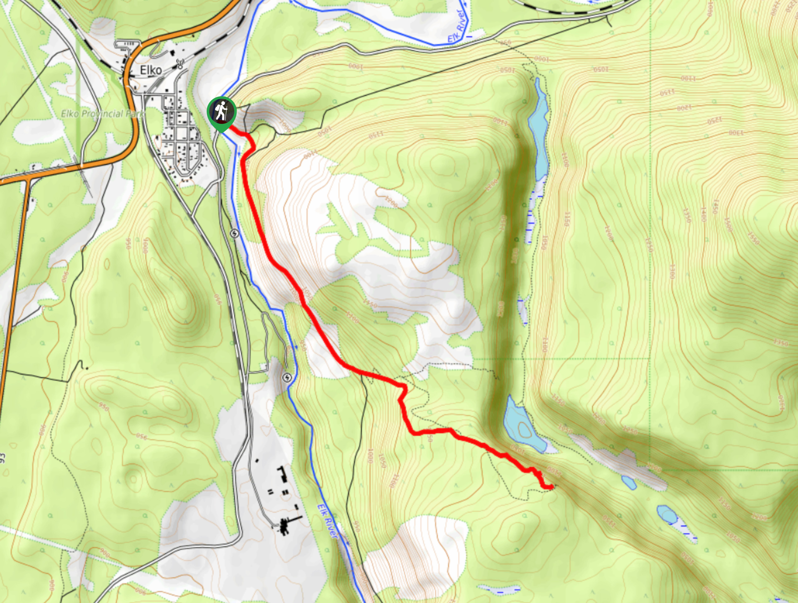
The trek to the Silver Creek Cliffs is an 5.5mi out-and-back hiking route that will take you up to the edge of the cliffs with amazing views looking out over the Silver Spring Lakes and Mount Broadwood in the backdrop. The trail has a moderate incline, but the terrain is relatively easy to traverse, making this a great family hike with spectacular views. Ensure to wear proper hiking footwear, as there are some loose gravel/rocks on the trail that can be tough on the ankles.
Getting there
To reach the trailhead for the Silver Creek Cliffs from Elko, drive southeast on Cascade Street for 984ft and turn left onto River FSR. Continue on for 1476ft, where you will find the trailhead on the right.

About
| When to do | May-November |
| Backcountry Campsites | No |
| Pets allowed | Yes - On Leash |
| Family friendly | Yes |
| Route Signage | Average |
| Crowd Levels | Moderate |
| Route Type | Out and back |
Silver Creek Cliffs
Elevation Graph
Weather
Silver Creek Cliffs Trail Description
If you are short on time and can only afford to complete one hike in the Elko area, then the trek to the Silver Creek Cliffs should be number one on your list. The trail climbs uphill through a mix of light forest and exposed terrain until you arrive at the scenic viewpoint overlooking the canyon. From here, hikers will have a great sightline down to the pristine waters of the Silver Spring Lakes, as well as a number of prominent mountain peaks in the backdrop that include Mount Broadwood, Windfall, and Overfold mountains to the east. This trail is an exciting adventure that produces some absolutely stunning views for the moderate amount of effort involved in completing it.
Similar hikes to the Silver Creek Cliffs hike

Spirit Trail Loop
The Spirit Trail Loop is a 10.1mi hiking circuit in the East Side Columbia Lake Wildlife Management Area,…

Mount Stevens and Teepee Mountain
The trek to Mount Stevens and Teepee Mountain is a steep 8.4mi out-and-back hiking route east of Wasa,…

Ram Creek Hot Springs
Hiking to the Ram Creek Hot Springs will take you on an 6.9mi out-and-back trail that runs along…
Comments