
Kimberley Nordic Centre Trail
View Photos
Kimberley Nordic Centre Trail
Difficulty Rating:
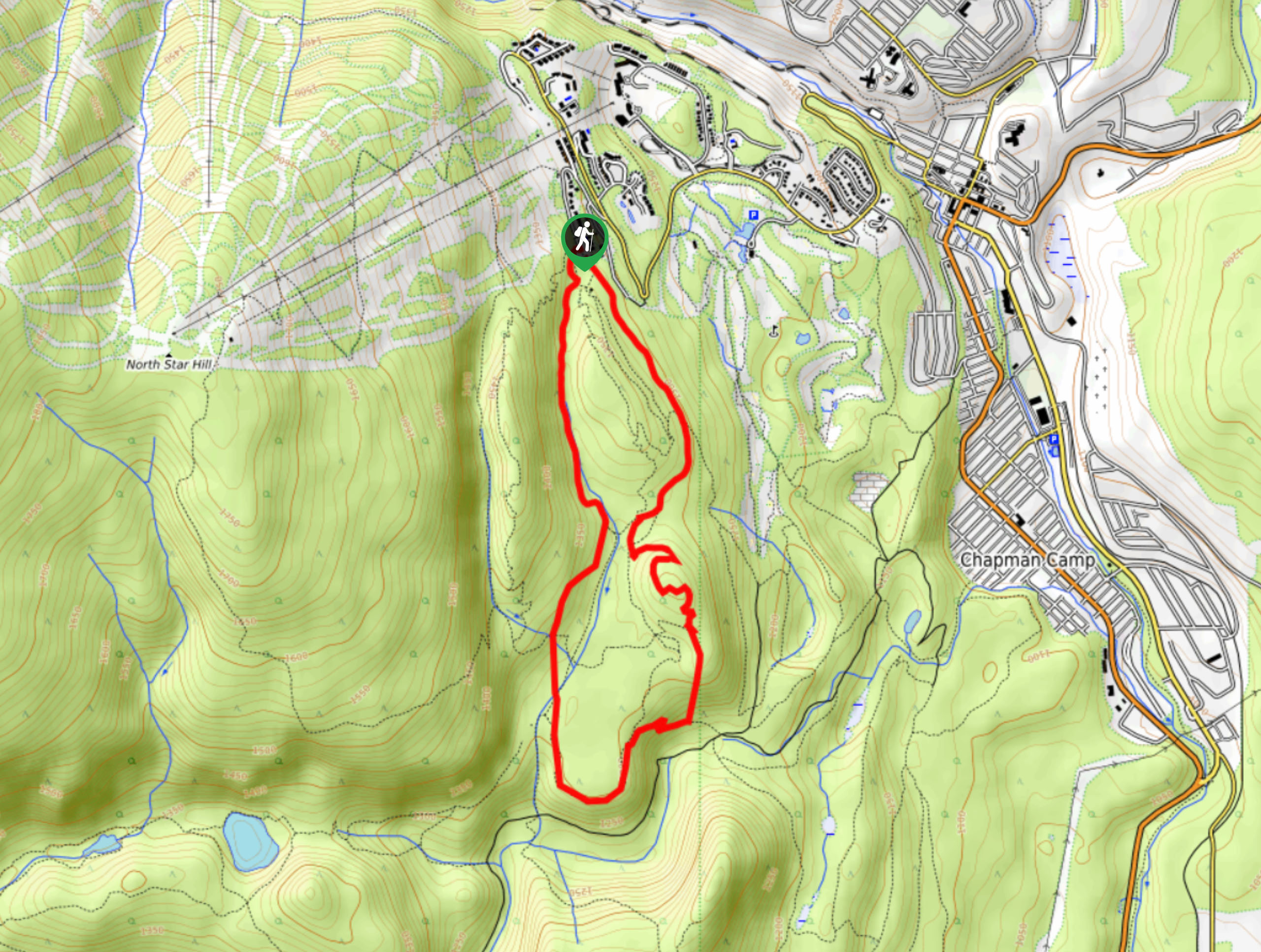
The Kimberley Nordic Centre Trail is an 5.2mi hiking circuit in Kimberley, BC, that will take you through a fun stretch of rolling forest terrain to several vantage points with views overlooking the valley. While the overall elevation gain is pretty small, the route is made up of numerous climbs and drops that keep the hike interesting throughout. This trail is an option for catching some quick exercise and taking in the beautiful views of the landscape surrounding the city.
Getting there
To access the Kimberley Nordic Centre Trail from Kimberley, head to the northeast along BC-95A and make a left onto Burdett St. In 951ft, you will reach Norton Ave. Turn right and follow it for another 2953ft. Make a left turn on Gerry Sorensen Way and continue for 1.2mi, making a left onto North Star Dr. You will arrive at the trailhead in 1969ft.

About
| When to do | Year-Round |
| Backcountry Campsites | No |
| Pets allowed | Yes |
| Family friendly | Yes |
| Route Signage | Average |
| Crowd Levels | Moderate |
| Route Type | Circuit |
Kimberley Nordic Centre Trail
Elevation Graph
Weather
Kimberley Nordic Centre Trail Description
Hiking the Kimberley Nordic Centre Trail is fairly straightforward; however, you should still make sure to bring a trail map or GPS, as there are a number of intersecting trails that can make navigation tricky at times. Setting out from the trailhead, follow the path to the south as it leads through the dense forest next to the golf course. The trail will eventually climb uphill towards Ikers Landing, a vantage point with nice views of the valley and the Rocky Mountain in behind. Continue to the southwest along a more exposed section of trail, before crossing over a creek and turning back to the north on the return leg of the hike. Along this last stretch, you will pass through a mix of meadow and trees, before arriving back at the trailhead where you began.
Similar hikes to the Kimberley Nordic Centre Trail hike

Spirit Trail Loop
The Spirit Trail Loop is a 10.1mi hiking circuit in the East Side Columbia Lake Wildlife Management Area,…

Mount Stevens and Teepee Mountain
The trek to Mount Stevens and Teepee Mountain is a steep 8.4mi out-and-back hiking route east of Wasa,…

Ram Creek Hot Springs
Hiking to the Ram Creek Hot Springs will take you on an 6.9mi out-and-back trail that runs along…
Comments