
Mount Wapiti
View Photos
Mount Wapiti
Difficulty Rating:
The Mount Wapiti Trail is a challenging 6.0mi out-and-back hiking route in Elkford, BC that will take you up to the summit of the most visible peak from the town. Along the trail, you will climb uphill along the ski hill before working your way onto the ridge and pushing up the rocky summit for some breathtaking views of the surrounding Rocky Mountains. There are two distinct peaks on Mount Wapiti; however, the taller north peak is the true summit and will allow you to get the best views possible of the surrounding landscape.
Getting there
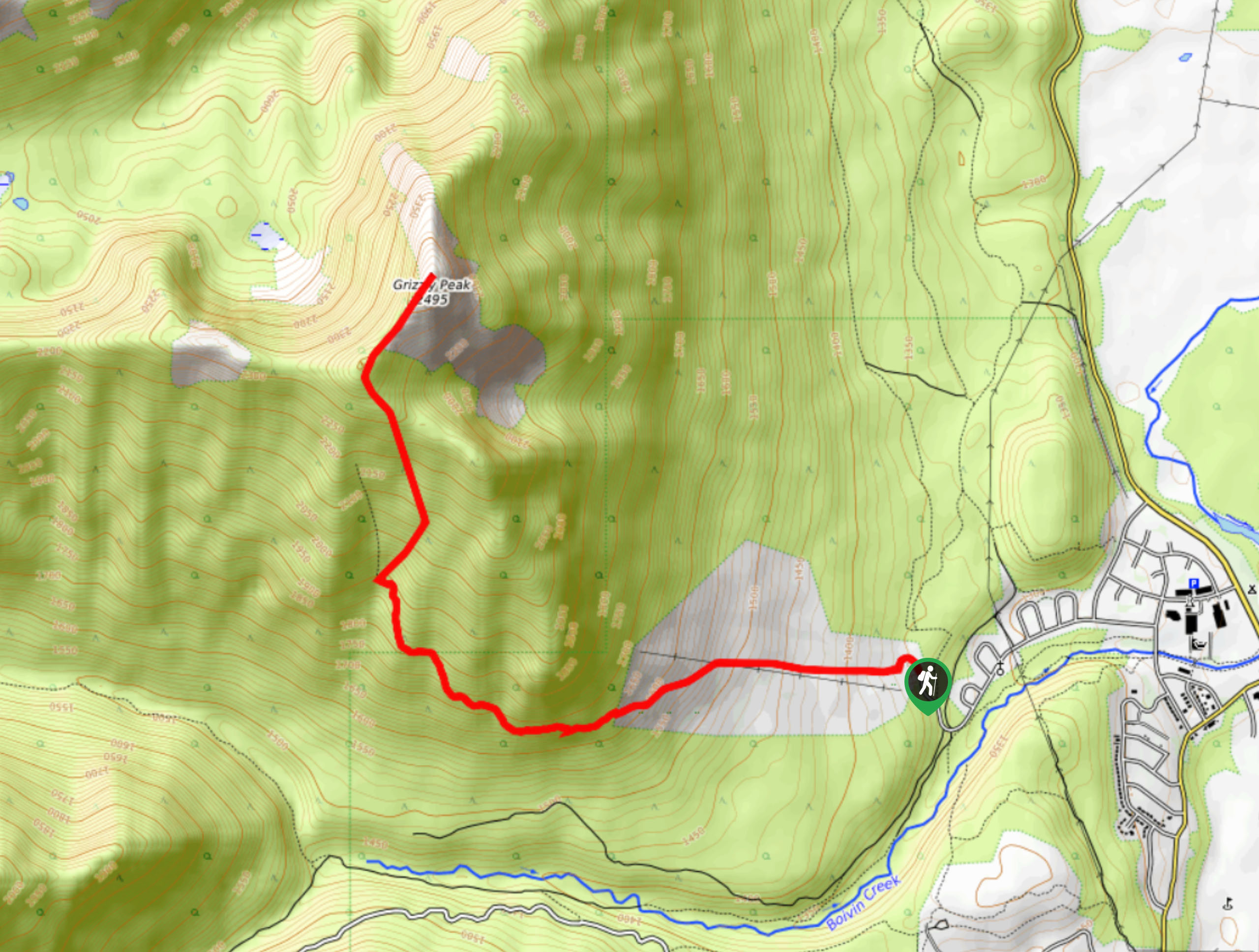
To access the Mount Wapiti trailhead from the Elkford Municipal Office, head west along Natal Road for 0.9mi, where you will find the trailhead.

About
| When to do | May-September |
| Backcountry Campsites | No |
| Pets allowed | No |
| Family friendly | No |
| Route Signage | Average |
| Crowd Levels | Low |
| Route Type | Out and back |
Mount Wapiti
Elevation Graph
Weather
Mount Wapiti Trail Description
The hike up Mount Wapiti may only be an intermediate trek in terms of overall distance but the large elevation gain and technical terrain leading to the summit make this a challenging route that is sure to leave you exhausted by the end. Setting out from the trailhead, follow the route west as it climbs uphill along the ski runs, before working through the dense cover of the forest and up onto the ridge. From here, hikers will need to traverse the ridgeline to reach the two peaks of Mount Wapiti.
Enjoy the amazing views of the surrounding mountains with the town of Elkford below, as you traverse the first summit and move on to the taller north peak of the mountain. This stretch is a bit more technical, featuring a steep climb up a field of loose shale. Once you push your way up to the summit, you will be greeted with a spectacular panoramic view that includes the surrounding Rocky Mountains, as wella s the Columbia Valley and Purcell Mountains to the west. After breathing in the crisp mountain air, head back down along the same route to return to the trailhead.
Similar hikes to the Mount Wapiti hike

Spirit Trail Loop
The Spirit Trail Loop is a 10.1mi hiking circuit in the East Side Columbia Lake Wildlife Management Area,…

Mount Stevens and Teepee Mountain
The trek to Mount Stevens and Teepee Mountain is a steep 8.4mi out-and-back hiking route east of Wasa,…

Ram Creek Hot Springs
Hiking to the Ram Creek Hot Springs will take you on an 6.9mi out-and-back trail that runs along…
Comments