
Saddleback Ridge Trail
View Photos
Saddleback Ridge Trail
Difficulty Rating:
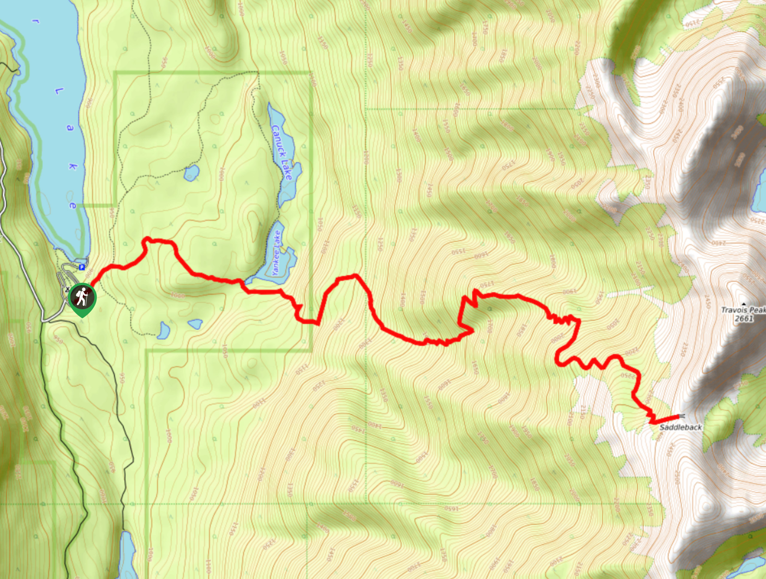
The Saddleback Ridge Trail is a 9.6mi out-and-back hiking route in Premier Lake Provincial Park that will take hikers on a steep uphill climb through the forest to reach the ridge. From the top of the trail, you will experience some breathtaking views that stretch out across the valley and look down on the blue waters of Premier Lake below. Make sure to bring bear spray, travel in groups, and make lots of noise along the trail, as bears are frequently spotted in the area.
Getting there
To get to the Saddleback Ridge Trail from Skookumchuck, drive north on Sheep Creek Road for 2461ft and make a slight right on Premier Lake Road. Follow this for 4.3mi and turn right onto N Lussier River Road. After 1.0mi, make a slight right on Wasa Sheep Creek Road, followed by a slight left turn to continue on the same road for another 0.6mi. Turn right on Premier Ridge Road and follow it for 1.6mi. Make a left turn, followed by an immediate left to reach the trailhead at Premier Lake Provincial Park Campground.

About
| When to do | May-October |
| Backcountry Campsites | Premier Lake Provincial Park Campground |
| Pets allowed | No |
| Family friendly | No |
| Route Signage | Average |
| Crowd Levels | Low |
| Route Type | Out and back |
Saddleback Ridge Trail
Elevation Graph
Weather
Saddleback Ridge Trail Description
Hiking up the Saddleback Ridge Trail is definitely a challenging trek due to the steep nature of the route and the fact that sections of it are overgrown. With over 5249ft of elevation gain along the trail, you will most certainly be feeling this hike in your legs over the following days. Setting out from the Premier Lake Provincial Park Campground, the trail heads east through the dense forest cover towards the rugged mountain peaks of the Rockies. The trail is a bit overgrown and you won’t have many great views until roughly the 4.3mi mark, so keep pushing your way uphill towards the ridge. Eventually you will have some pretty amazing views that sweep across the valley with Premier Lake nestled on the valley floor. Continue hiking up to the top of the ridge as the trail gets steep. Once you reach the top, you will have an even greater view out to the Purcell Mountains to the west. After taking in the views, carefully head back down the trail to return to the campground.
Similar hikes to the Saddleback Ridge Trail hike

Spirit Trail Loop
The Spirit Trail Loop is a 10.1mi hiking circuit in the East Side Columbia Lake Wildlife Management Area,…

Mount Stevens and Teepee Mountain
The trek to Mount Stevens and Teepee Mountain is a steep 8.4mi out-and-back hiking route east of Wasa,…

Ram Creek Hot Springs
Hiking to the Ram Creek Hot Springs will take you on an 6.9mi out-and-back trail that runs along…
Comments